


Tropical Cyclone Band MA.W to TO.W - Hazard Services
Tropical Cyclone Band MA.W to TO.W
Purpose:
This jobsheet will guide forecasters how to use Hazard Services to copy Special Marine Warnings (MA.W) to a Tornado Warning (TO.W) for landfalling waterspouts in a tropical cyclone rainband.Tasks:
AT-A-GLANCE:
-
Who? This jobsheet is relevant for coastal sites that are issuing Special Marine Warnings (MA.W) for a tropical cyclone band who also need to issue Tornado Warnings (TO.W) for landfalling waterspouts.
-
What? Tropical cyclones rainbands may pose multiple hazards, one being landfalling waterspouts. In warning of both the offshore and onshore waterspout/tornado hazards, forecasters should issue a MA.W for marine and TO.W for the land affected areas. Hazard Services ability to copy event metadata between MA.W when creating a TO.W can be a powerful tool in such situations.
-
Considerations. While the copy to new event option is helpful in more expedient hazard creation, there are some things to be aware of. The fields that are copied over are the storm motion/bearing, storm track, and report sources/details. Most other fields will need to be adjusted after copying over the hazard metadata.
-
Required Coastal Extensions. The coastal geometries used in AWIPS and Hazard Services may present challenges or situations where invalid geometries prevent hazard product issuance. Coastal extension zones help reduce the likelihood that problem coastal geometries interfere with Hazard Services performance. Coastal WFOs should have coastal extension area localizations already with WarnGen. These localizations will need to be transferred to the Hazard Services localizations by a Hazard Services focal point using this jobsheet.
Follow the steps below for more detailed guidance.
-
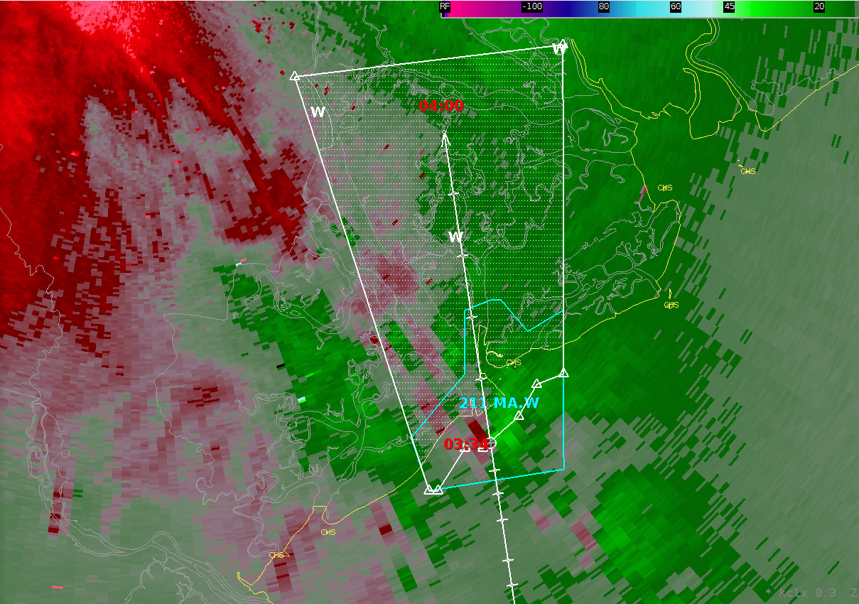
This exercise will use the Hazard Services Storm Track Tool in the D2D Perspective. We will use this tool to first create a MA.W that is tracking an area in a tropical cyclone rainband with a possible waterspout. Click on the Hazard Services short-fused storm track icon, the icon with the red tornado and H.

-
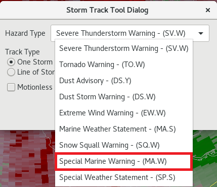
In the Storm Track Tool Dialog Hazard Type drop down menu select the Special Marine Warning – (MA.W).
-
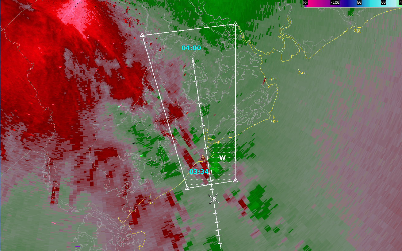
Drag the storm track dot to the location within the rainband that has a waterspout threat. This situation will be for a landfalling waterspout, so the threat should cross the coastal extension zone into the CWA.
-
Modify the track. The speed and direction metadata are important in generating the copied tornado warning hazard event track polygon. Modify the polygon to your liking.
-
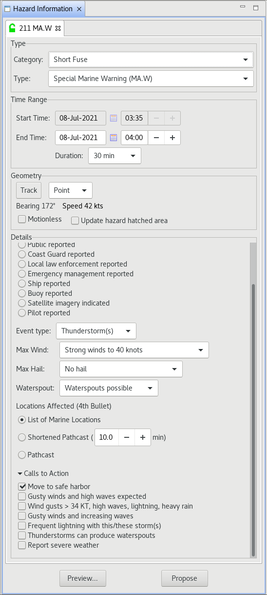
In the HID fill out the details. Select the hazard source, winds indicative of the maximum 3-second wind gusts within the band, and whether waterspouts are possible or observed. Choose appropriate Calls to Action (CTAs) for the selected hazards. Also note that the default duration of the MA.W is 30 minutes, the same as a TO.W.
-
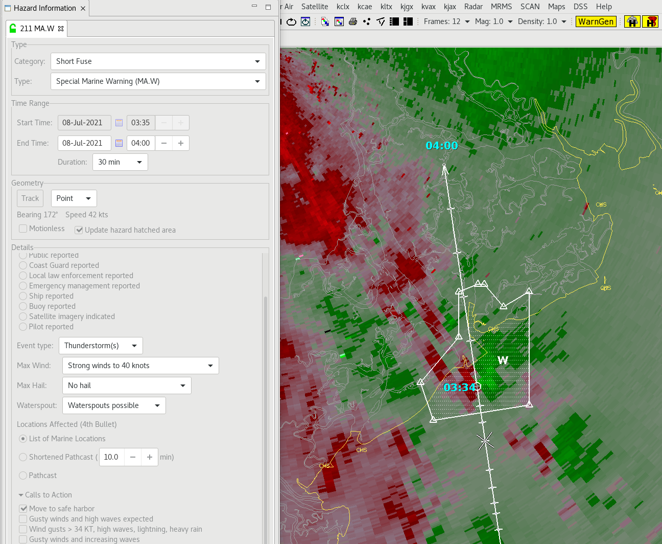
Select the Update hazard hatched area to preview the simplified hazard polygon and adjust this to your liking.
-
Select preview, adjust any text if needed before clicking on Issue to issue the MA.W.

-
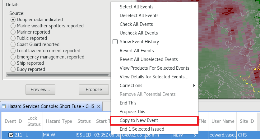
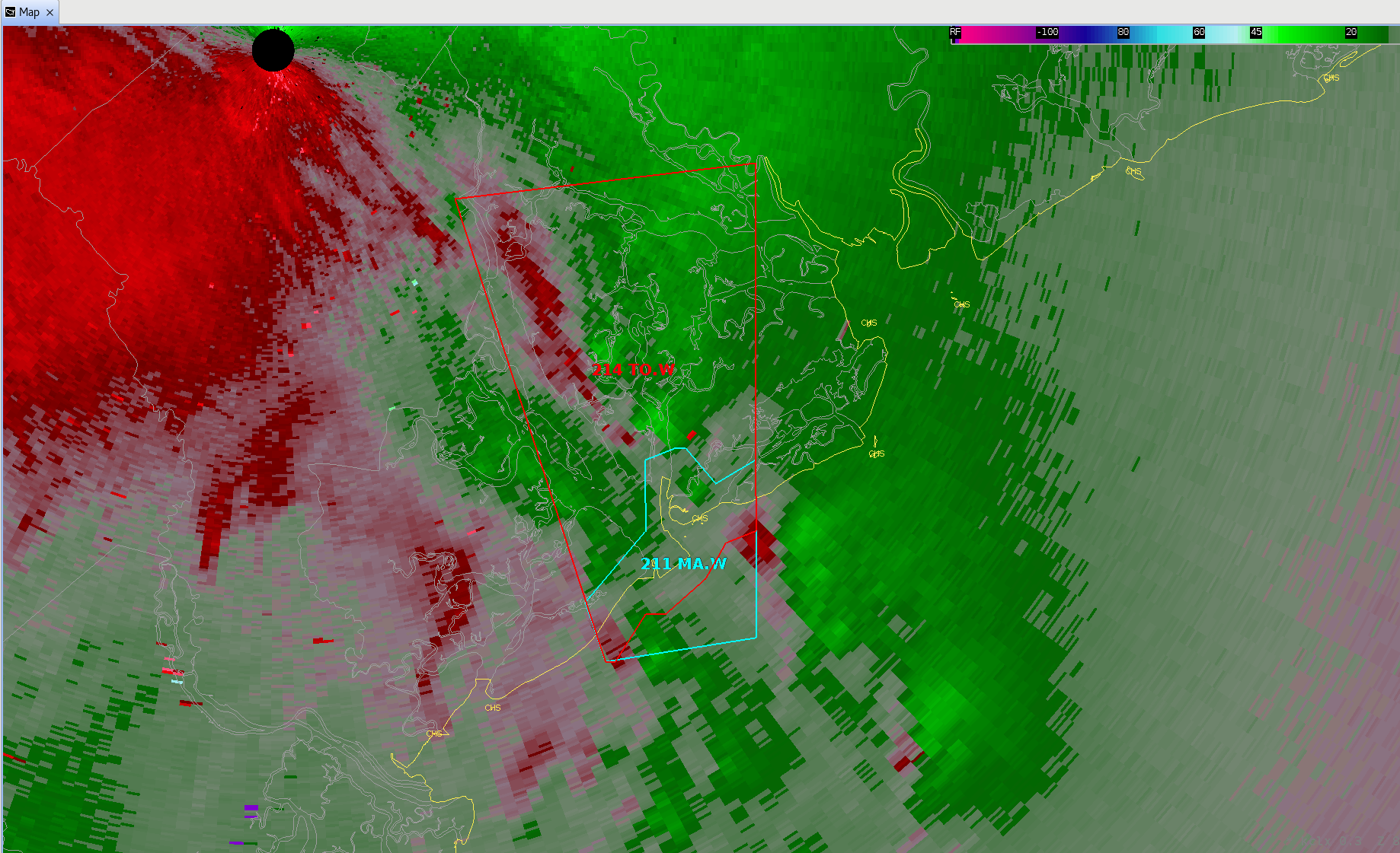
In your console the status of the MA.W hazard should change to ISSUED after issuing the warning. Left click to highlight this hazard in the console and right click to bring up an options menu. From the menu select Copy to New Event to start the process of creating a TO.W from the just issued MA.W.
-
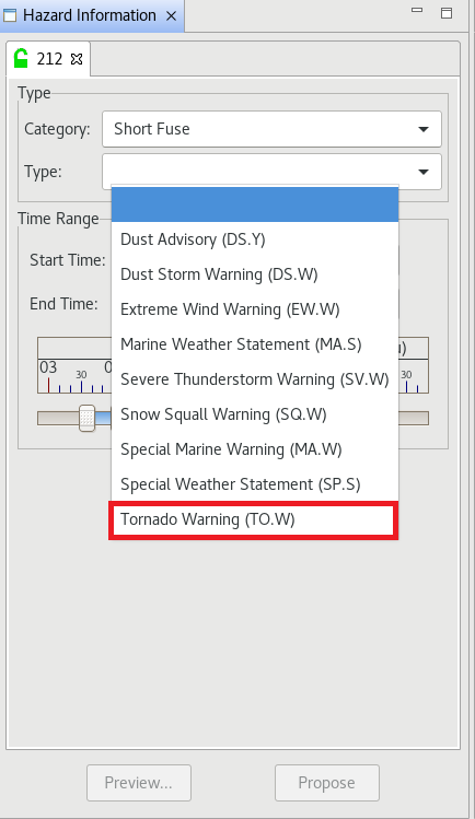
The HID should appear with the Short Fuse category. Select Tornado Warning (TO.W) from the Type dropdown menu.
-
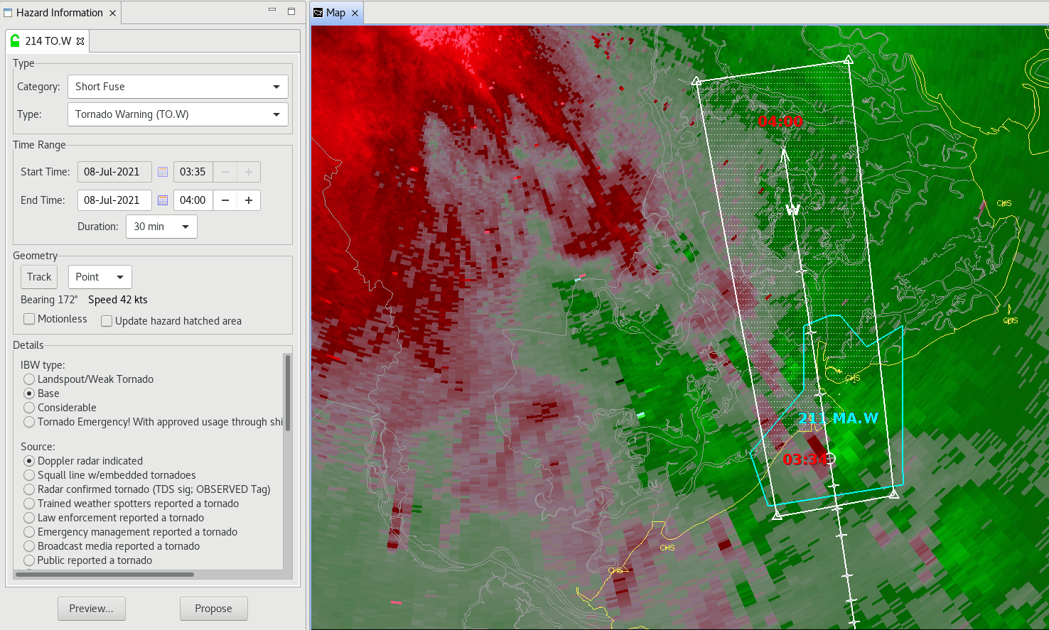
The HID then should populate with metadata from the issued MA.W. Click Track under the Geometry section to use the track from the MA.W to create a default warning polygon. If you had not modified the MA.W prior to issuing the warning the polygon should appear upon first selecting the type without first selecting Track.
-
Modify the TO.W polygon to match the edges of the MA.W polygon.

-
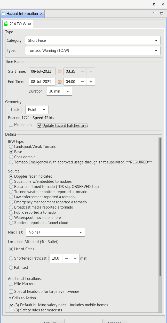
Edit the Details section of your TO.W and click Update hazard hatched area.
-
Click Preview, review the text of the product, then click Issue to issue the Tornado Warning.
-
You should now have a MA.W and TO.W that overlap at the coastal marine extension zone and are near seamless in polygon area coverage.
-
You are done with this jobsheet!