


Proposing and Collaborating Hazards at CWA borders - Hazard Services
Proposing and Collaborating Short-Fused Hazards at CWA Borders
Purpose:
This jobsheet will guide forecasters how to use Hazard Services to propose short-fused hazard events with neighboring WFOs along shared CWA borders.Tasks:
AT-A-GLANCE:
-
What? Hazard Services (V4) allows forecasters to collaborate more seamlessly with neighboring WFOs when issuing hazard events along shared CWA borders. The metadata of a proposed or issued hazard event can be used to issue or draft products for events that span across the border of multiple CWAs.
-
Why? In the collaborative spirit of Hazard Services, Version 4 allows WFOs the ability to more easily take the metadata of a proposed or issued hazard event from neighboring WFOs to generate products in their own CWA. This is particularly useful to rapidly and seamlessly join warning polygons when a storm moves from one CWA to another. When a hazard and forecasted path impacts the area bordering multiple CWAs, an office should take the initiative of drafting a proposed hazard event in Hazard Services. A line of communication should be in place between offices to coordinate expected hazards, timing, locations, and severity of hazards.
-
Required Visible ShortFuse Site IDs. It is important to have Hazard Services configured to show other site’s short fuse hazards. This may be done by clicking the Setup icon->Manage Settings->Edit/Filter. A list of Site IDs should be displayed in the menu popup, these are the sites whose hazards will display in CAVE. If the site you wish to collaborate with is not visible in the Site IDs, you will need to use the Add Site button at the bottom of the menu to add the site. Clicking Save will override the Site options visible in Hazard Services.
Follow the steps below for more detailed guidance.
-
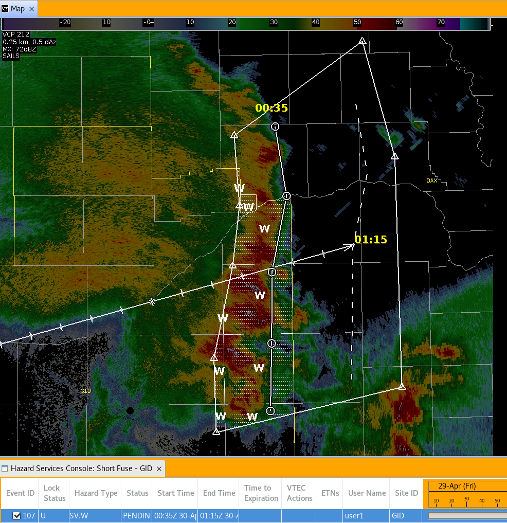
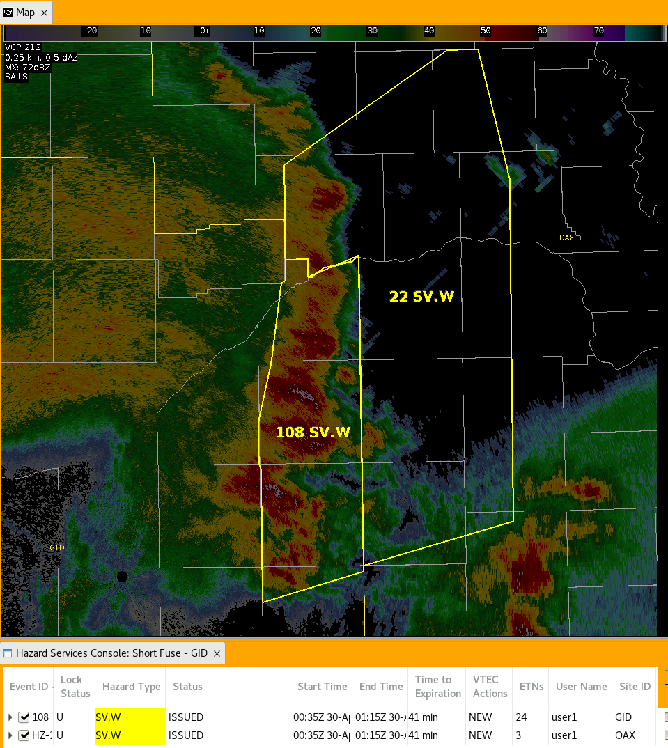
A hazard needs to be either proposed or issued for other WFOs to see the event populate D2D and the Hazard Service Console. With one CAVE instance, draft a pending SV.W that spans across a CWA boundary. We will show an example using the Hazard Services Storm Track Tool with a line of storms, however tracking a single storm follows the same process.
-
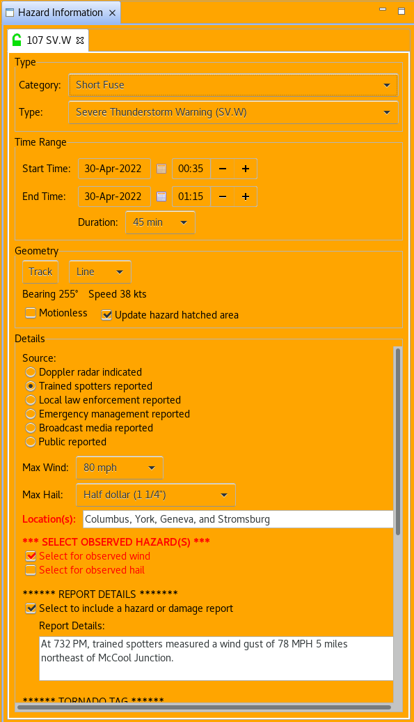
To demonstrate the utility of metadata in the proposal/collaboration process, we will fill out the details section with locations, report details, and select a destructive tag for this event.
Source: Trained spotters reported
Max Wind: 80 mph
Max Hail: Half dollar (1 1/4”)
Location(s): Columbus, York, Geneva, and Stromsburg
Select for observed wind
Report Details:
“At 732 PM, trained spotters measured a wind gust of 78 MPH 5 miles northeast of McCool Junction.”
-
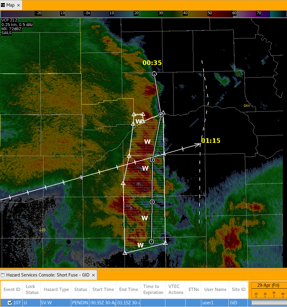
Clicking propose allows the hazard event to be viewable to any office that has your localization configured to display. Clicking propose or Update hazard hatched area also simplifies and snaps the polygon to counties/parishes valid within your localization’s CWA.
-
Open another instance of CAVE with the localization of the office that will act as the collaborator. It is possible to use service backup mode to perform the same collaboration steps, however, for this jobsheet, using two separate CAVE localization instances is recommended.
-
The proposed hazard is visible to the neighboring WFO along with the associated metadata.
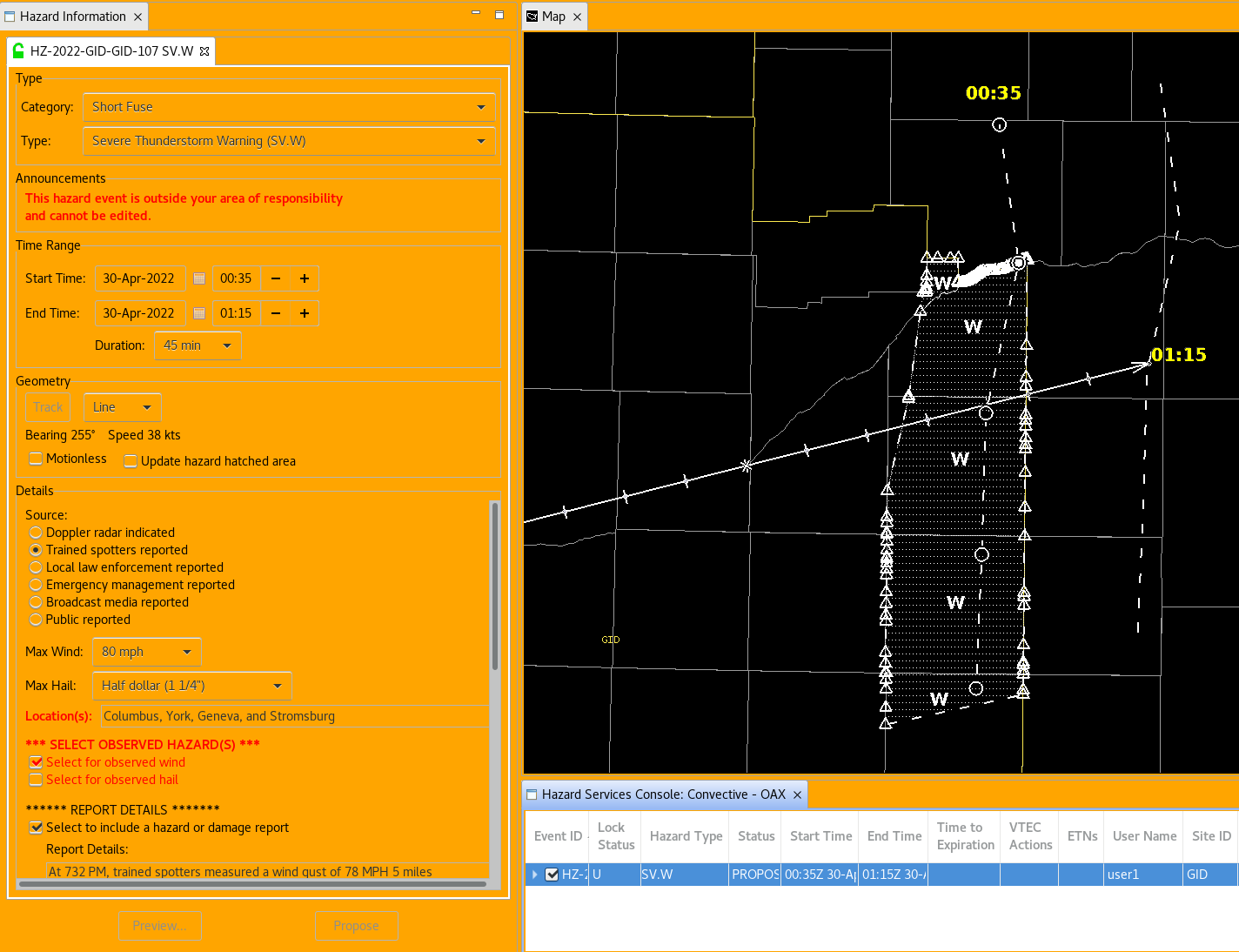
-
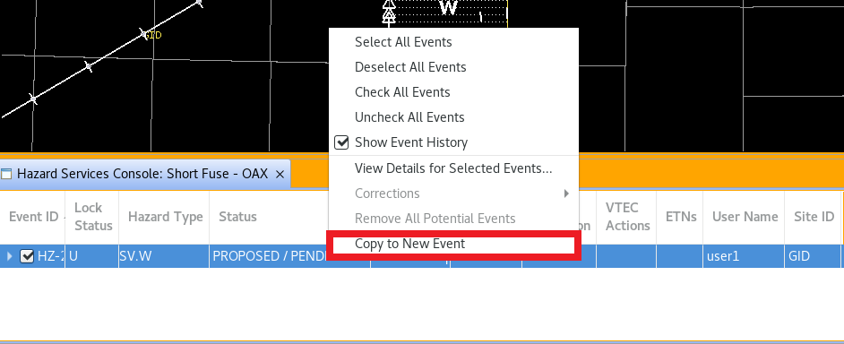
The portion of the hazard outside the CWA is not editable. However, to draft a polygon using the metadata of the proposed hazard, right click the highlighted event in the console and select Copy to New Event.
-
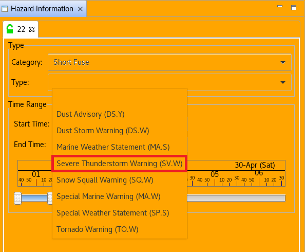
Select the event type that matches the proposed hazard that was just copied. In this case select Severe Thunderstorm Warning (SV.W).
-
The HID will populate with the metadata of the proposed event. You may modify the details of the hazard within your CWA, but communication of these changes is strongly encouraged to ensure consistent messaging of hazards and expected impacts.

-
If the proposed event’s polygon was modified from the default track generated polygon, there will be no polygon that shows when selecting SV.W. Select Track to generate a polygon using the metadata of the proposed event in your portion of the CWA and modify this default polygon.
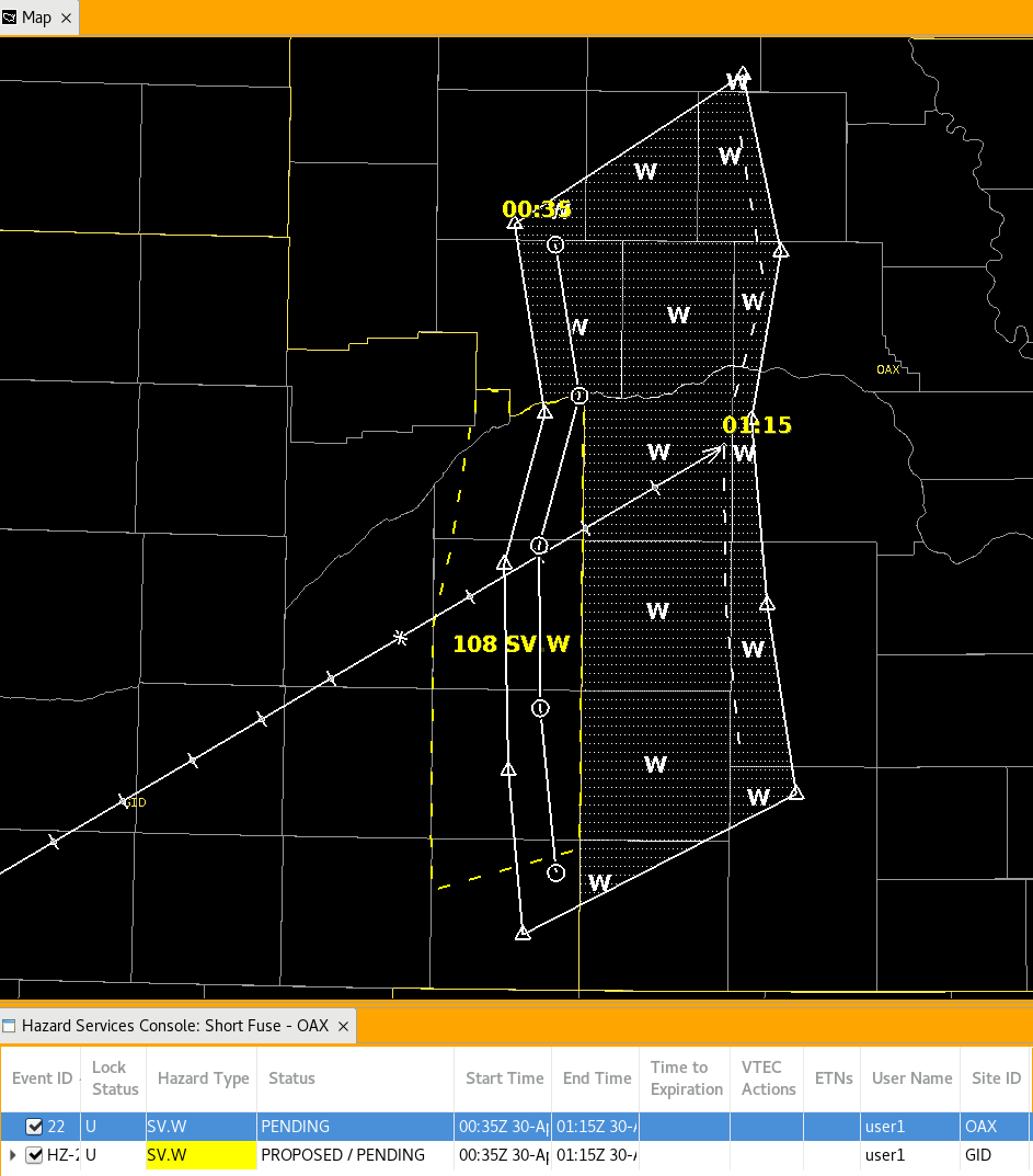
A good practice is matching your polygon to the extent of the proposed polygon at the edge of the CWA.
-
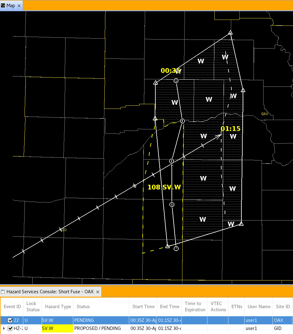
Once you are satisfied with the polygon and it matches the proposed warning polygon, click on Update hazard hatched area and click propose. At this step there are two proposed polygons for a hazard that cross the boundary of two CWAs. Both events should be visible to each WFO. If both WFOs agree on the proposals you may click preview, review the product, and issue the warning.
-
WFOs should continue to coordinate updates to warnings, utilizing the propose feature in Hazard Services, to ensure the messaging is consistent until the hazard has fully moved away from the CWA border.
-
You are done with this jobsheet!