Purpose:
This jobsheet will configure the inclusion area for short-fused hazards. The inclusion* tags specified in the WarnGen geospatialConfig_*.xml files must be propagated to Hazard Services HazardTypes.py.
Tasks:
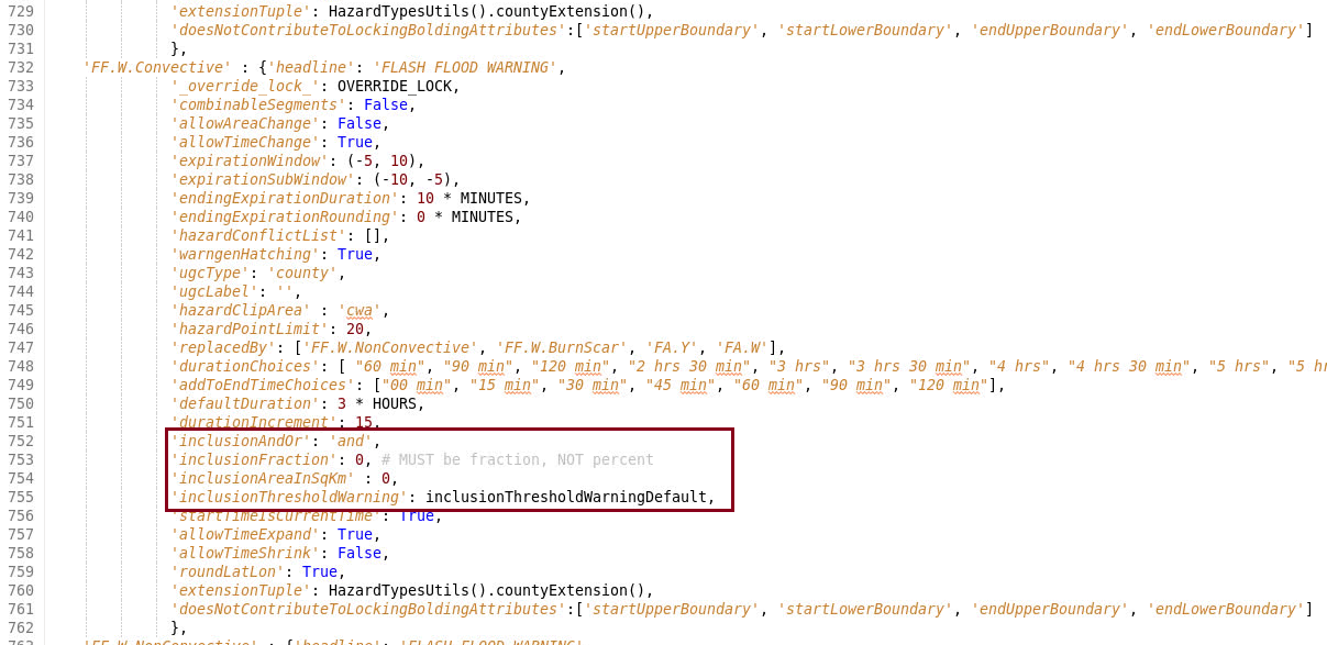
- In the Localization Perspective, navigate to the base HazardTypes.py in Hazard Services -> Hazard Types -> HazardTypes.py -> BASE. Double click on BASE and inspect the inline documentation on the available tags, notably the inclusion* tags.
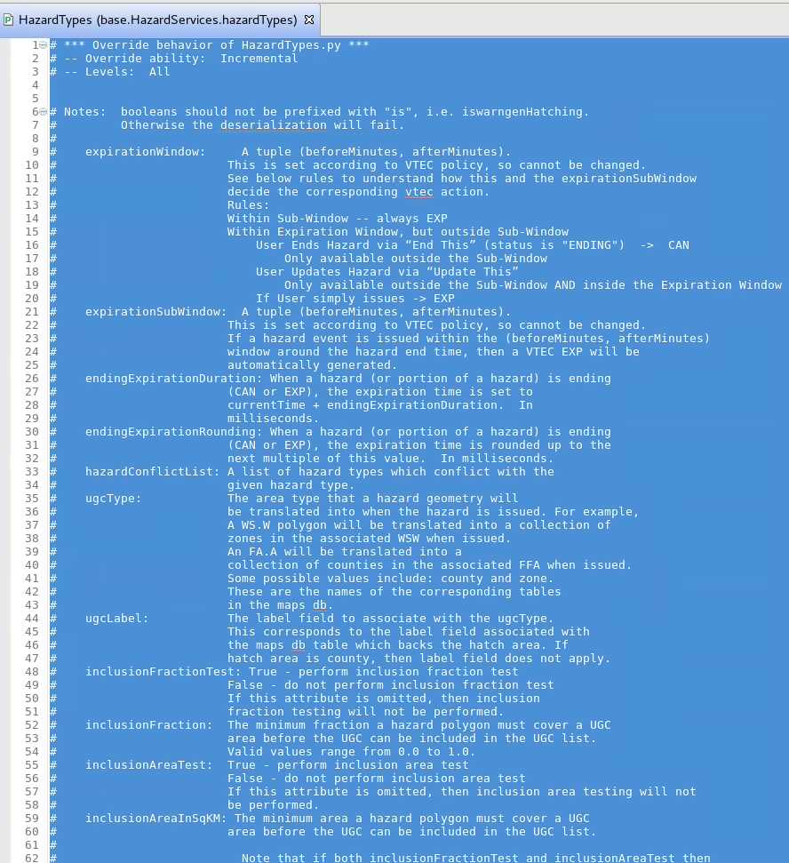
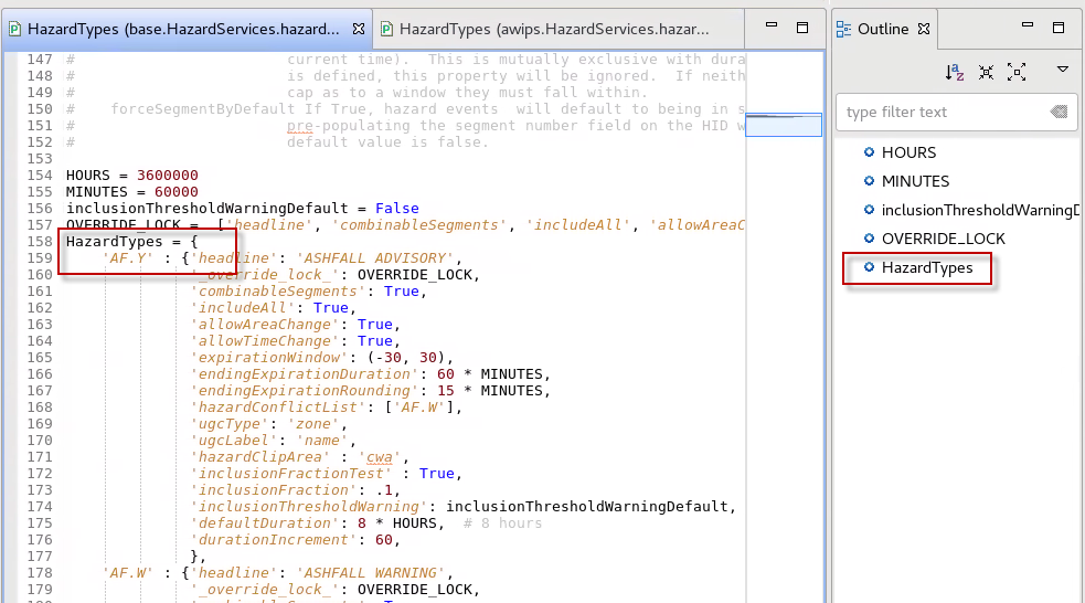
- Scroll down past the documentation in HazardTypes.py and identify the general structure of the dictionaries, methods, and classes. Notice the Outline in the upper right indicates HazardTypes.py consists of a single HazardTypes dictionary. Scrolling through the file reveals nested dictionaries for each hazard type (e.g. AF.Y), so the namespace in your overrides is going to require specifying the HazardTypes dictionary and the hazard-specific dictionary you will be overriding.
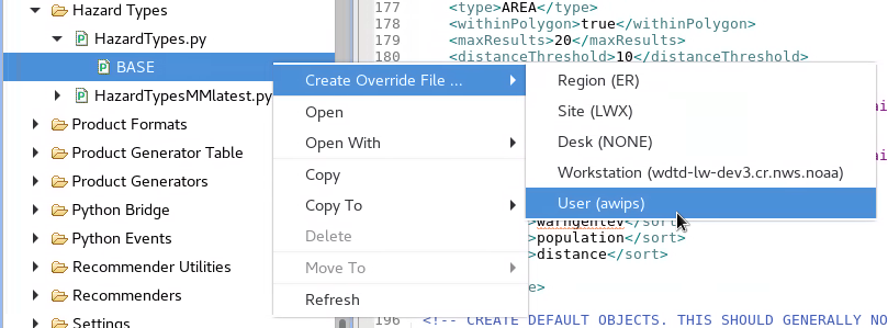
- If you do not have a USER override file for HazardTypes.py then right click on BASE -> Create Override File ... and select User.

- In the Localization Perspective, navigate to your site's WarnGen's geospatialConfig_COUNTY.xml file under D2D -> WarnGen -> geospatialConfig_COUNTY.xml -> SITE and double click on SITE to load.
Under the geospatialConfig_COUNTY.xml's <areaSource variable="areas"> tag identify your <inclusionPercent>, <inclusionAndOr>, and <inclusionArea> tags.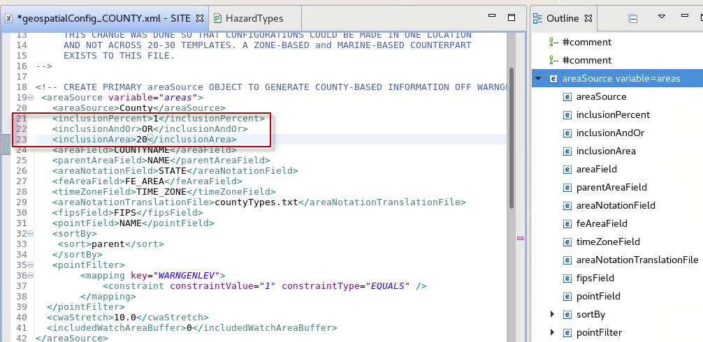
- Find the FF.W.Convective dictionary in the base HazardTypes.py to identify the inclusion* tags. Notice the default value for inclusionFraction is 0% and inclusionAreaInSqKm is 0 square km in flash flood warnings.
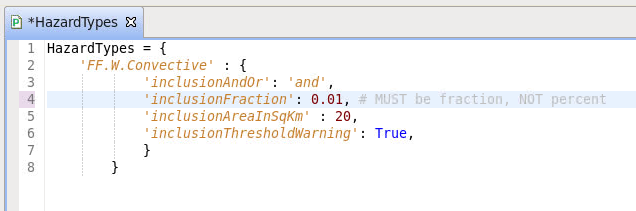
- Set up the namespace for the HazardTypes dictionary and FF.W.Convective sub-dictionary (see image below). Start with the HazardTypes dictionary and then embed the indented FF.W.Convective dictionary (note step 2). Then copy the inclusion* tags from the base file and paste inside the user file, taking care to adjust indentation properly. Change the inclusionThresholdWarning to True to receive more informative AlertViz troubleshooting messages. Configure the tags with the values from your geospatialConfig.xml noting that the inline documentation mentions that the inclusion fraction is between 0 and 1 which is different than the integer percentage in the geospatialConfig file.
- Hit Ctrl+S to save the file. If this is the first time setting up the user override, you will need to click OK, close the Merge tab, and click Yes twice to merge the changes in. Note the settings immediately take effect and do not require restarting Hazard Services.
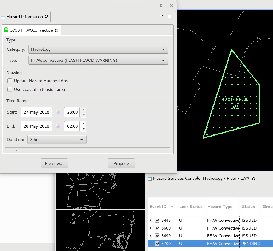
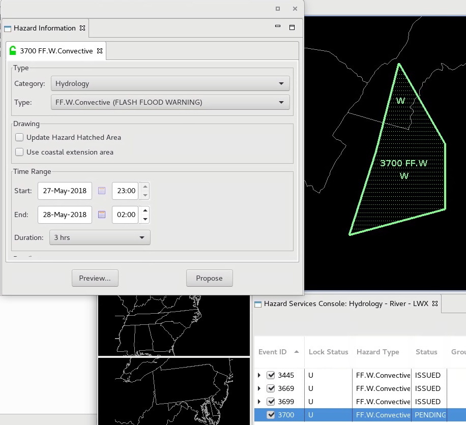
- Open the D2D perspective and test clipping a county in an FF.W.Convective flash flood warning to ensure your thresholds are being met. You can drag a vertex to clip and county and change the area to trigger the inclusion thresholds.
- Note: When you implement 'inclusionAndOr' as "and', this is the same as the "AND" operator in WarnGen where both criterion are required to be met in order to hatch a county and include it in a warning. Using the "or" value allows either one of the criteria to be met in order for the county to be hatched in the warning.
- Repeat this for every hazard type you need to override.


 rgba(220, 220, 220, 0.5); top: -15px; left: 0px; display: block;)