Storm Surge - MDL

Guidance Products and External Links
| Guidance Products | External Links | ||
|---|---|---|---|
|
|
|
|
|
|
|
|
|
|


Storm Surge Model DATA
| Name | P-Surge v3.1 | P-ETSS v1.4 | ETSS v1.4 | STOFS v2.3.3 |
| NOMADS - HTTP | HERE | HERE | HERE | HERE |
| NCEP - FTP | ftp ftp.ncep.noaa.gov /pub/data/nccf/com/ psurge/prod | ftp ftp.ncep.noaa.gov /pub/data/nccf/com/ petss/prod | ftp ftp.ncep.noaa.gov /pub/data/nccf/com/ petss/prod | ftp ftp.ncep.noaa.gov /pub/data/nccf/com/ stofs/prod |
| NDGD | Discontinued Sep 2020 | Discontinued Sep 2025 | Discontinued Sep 2025 | |
| Organization | MDL | MDL | MDL | CSDL |
| Implementation Date | May 20, 2025 | Aug 15, 2023 | Aug 15, 2023 | Jul 27, 2021 |
| Surge Model | SLOSH - Parametric | SLOSH- Gridded | SLOSH - Gridded | ADCIRC / SCHISM |
| Wind Model | Parametric |
GEFS: 31 member, 3hr, 27.5km GEPS: 21 member, 3hr, 55km, only on 00Z, and 12Z |
GFS (1hr, 13km) | GFS |
| Time Range | 102-hr forecast, on demand | 102-hr forecast, 4x a day | 102-hr forecast, 4x a day | 180-hr forecast, 4x a day |
OFFICIAL FORECASTS
STORM SURGE GUIDANCE
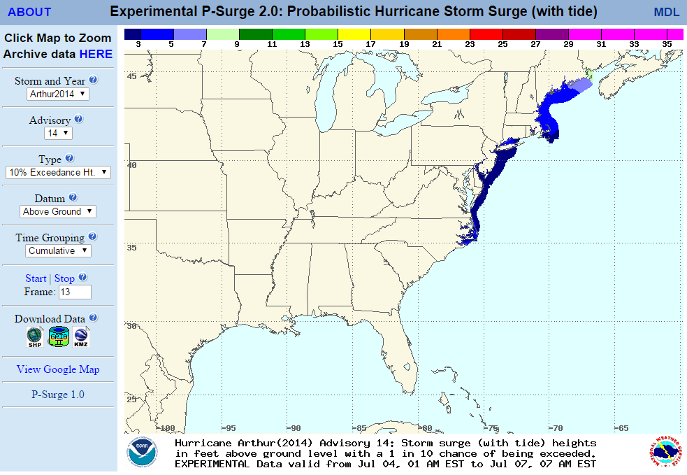
- P-Surge CONUS | Puerto Rico
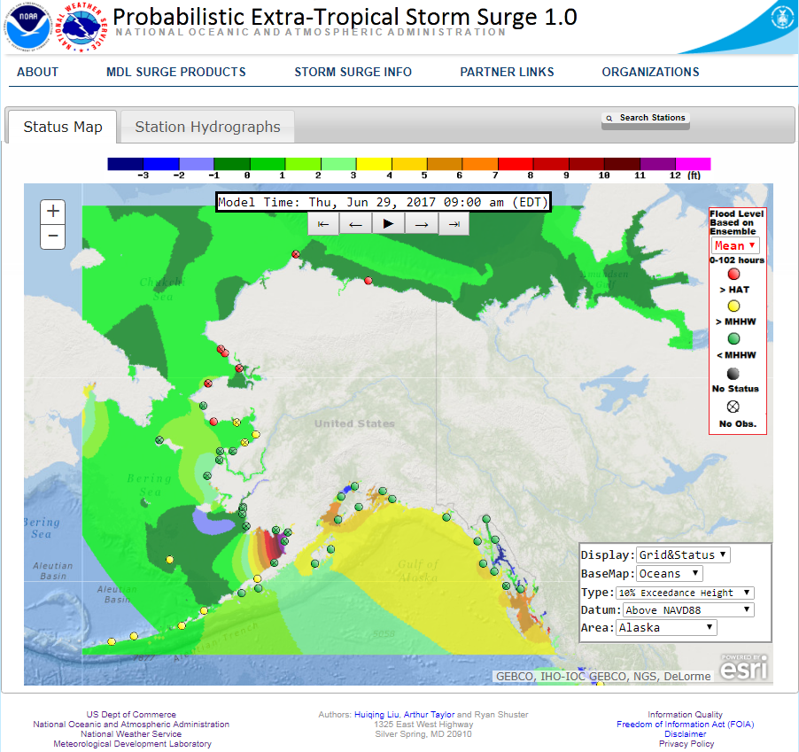
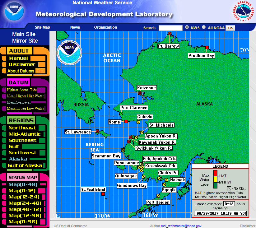
- P-ETSS
- ET-Surge New (2.0) | Original (1.0)
- STOFS
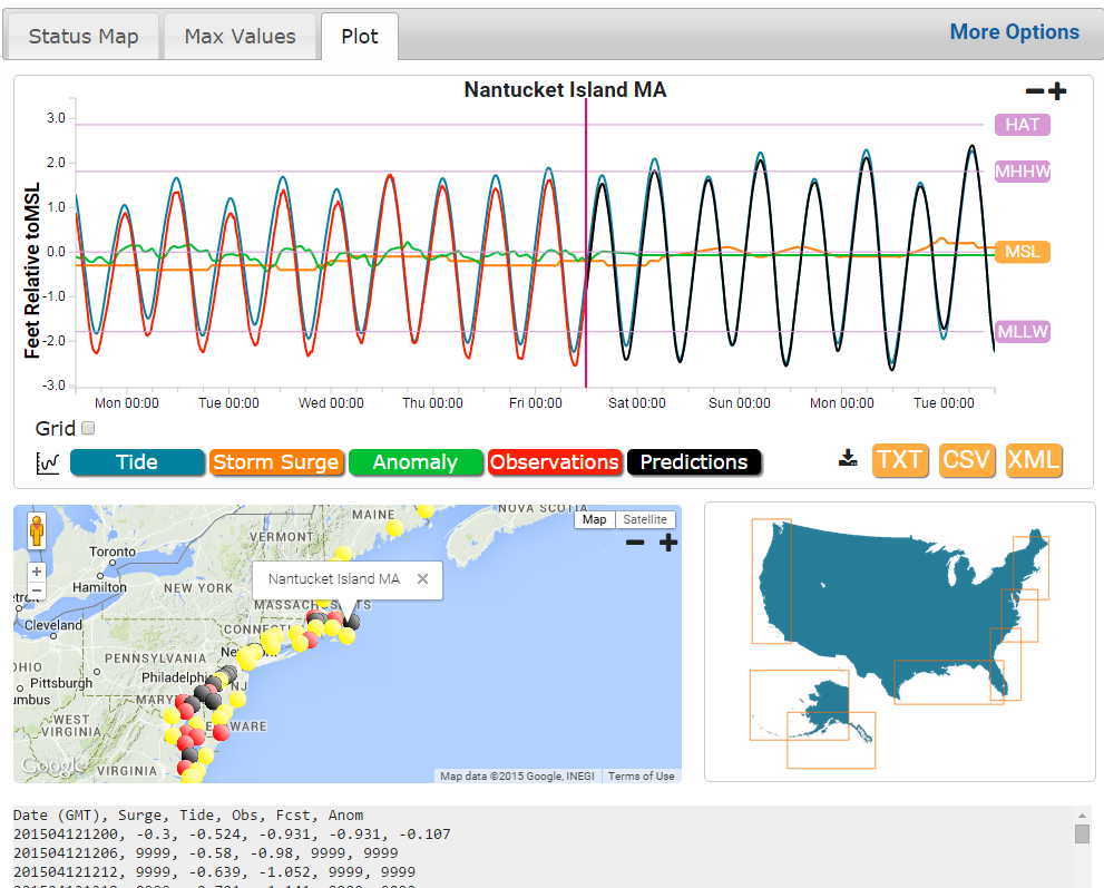
WATER OBSERVATIONS
WIND GUIDANCE
HURRICANE TRACKS
CONTACT
-
For more information about MDL's Storm Surge, please contact: Arthur.Taylor@noaa.gov