NDFD DeGRIB Data Loc - MDL
Where can I get the National Digital Forecast Database (NDFD)
You can use either:
- https://tgftp.nws.noaa.gov/SL.us008001/
- ftp://tgftp.nws.noaa.gov/SL.us008001/
Then you need to determine two things. First what sector your data is in, and then the status of your data ("experimental" or "operational"). To determine the status of each element given a sector, see: https://www.weather.gov/media/mdl/NDFD_element_status_May19.pdf (pdf)
If you determine it is operational, then add ST.opnl/ to your URL. If it is experimental, add ST.expr/ to your URL.
Next you need to determine the NDFD Sector that you want your data for. The table in the following section may help you determine which sector to use by looking at the geographic extents. After you have determined the sector and added that portion to the URL, you should have something like:
- For the experimental NDFD CONUS sector
- https://tgftp.nws.noaa.gov/SL.us008001/ST.expr/DF.gr2/DC.ndfd/AR.conus/
- ftp://tgftp.nws.noaa.gov/SL.us008001/ST.expr/DF.gr2/DC.ndfd/AR.conus/
- For the operational NDFD CONUS sector
- https://tgftp.nws.noaa.gov/SL.us008001/ST.opnl/DF.gr2/DC.ndfd/AR.conus/
- ftp://tgftp.nws.noaa.gov/SL.us008001/ST.opnl/DF.gr2/DC.ndfd/AR.conus/
What are NDFD sectors?
For dissemination, the National Digital Forecast Database (NDFD) broke the CONUS (Continental Unitied States) into several geographic sub-sectors. The reason for this, was to allow users to download just the data they were interested in. NDFD did not sub-divide the OCONUS sectors (sectors outside the CONUS), so for the OCONUS sectors you have to download the entire grid.
To determine the geographic area of each sub-sector or OCONUS sector, you can either look at the Picture in the following table, or try a flash application.
If you can not find an appropriate NDFD sub-sector, the NWS is also providing an experimental web service to allow users to get a customed defined (limited to a maximum of 15 degrees by 15 degress) sub-sector of the CONUS in GRIB2.
CONUS (Continental United States) Areas
| Sector | URL to add (Opnl link) | URL to add (Expr link) | Picture |
|---|---|---|---|
| Full CONUS | DF.gr2/DC.ndfd/AR.conus/ | DF.gr2/DC.ndfd/AR.conus/ | Picture |
| Pacific North West | DF.gr2/DC.ndfd/AR.pacnwest/ | Picture | |
| Pacific South West | DF.gr2/DC.ndfd/AR.pacswest/ | Picture | |
| Northern Rockies | DF.gr2/DC.ndfd/AR.nrockies/ | Picture | |
| Central Rockies | DF.gr2/DC.ndfd/AR.crrocks/ | Picture | |
| Southern Rockies | DF.gr2/DC.ndfd/AR.srockies/ | Picture | |
| Northern Plains | DF.gr2/DC.ndfd/AR.nplains/ | Picture | |
| Central Plains | DF.gr2/DC.ndfd/AR.crplains/ | Picture | |
| Southern Plains | DF.gr2/DC.ndfd/AR.splains/ | Picture | |
| Upper Mississippi Valley | DF.gr2/DC.ndfd/AR.umissvly/ | Picture | |
| Central Mississippi Valley | DF.gr2/DC.ndfd/AR.crmissvy/ | Picture | |
| Southern Mississippi Valley | DF.gr2/DC.ndfd/AR.smissvly/ | Picture | |
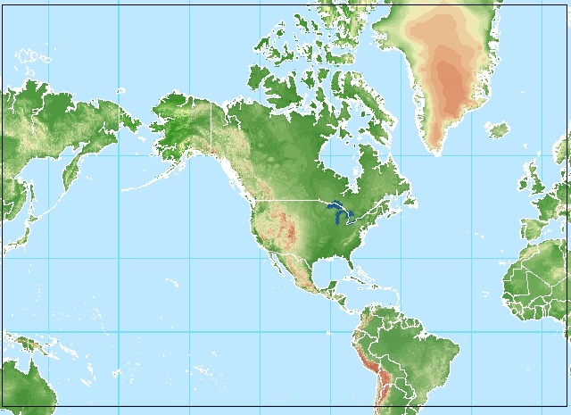
| Central Great Lakes | DF.gr2/DC.ndfd/AR.crgrlake/ | Picture | |
| Eastern Great Lakes | DF.gr2/DC.ndfd/AR.ergrlake/ | Picture | |
| North East | DF.gr2/DC.ndfd/AR.neast/ | Picture | |
| South East | DF.gr2/DC.ndfd/AR.seast/ | Picture | |
| Mid Atlantic | DF.gr2/DC.ndfd/AR.midatlan/ | Picture |
OCONUS (Outside CONUS) Areas
| Sector | URL to add (Opnl link) | URL to add (Expr link) | Picture |
|---|---|---|---|
| Puerto Rico | DF.gr2/DC.ndfd/AR.puertori/ | Picture | |
| Hawaii | DF.gr2/DC.ndfd/AR.hawaii/ | Picture | |
| Guam | DF.gr2/DC.ndfd/AR.guam/ | Picture | |
| Alaska | DF.gr2/DC.ndfd/AR.alaska/ | DF.gr2/DC.ndfd/AR.alaska/ | Picture |
Hemispheric Areas
| Sector | URL to add (Opnl link) | URL to add (Expr link) | Picture |
|---|---|---|---|
| Northern Hemispheric | DF.gr2/DC.ndfd/AR.nhemi/ | Picture | |
| Northern Pacific Ocean | DF.gr2/DC.ndfd/AR.npacocn/ | Picture | |
| Oceanic | DF.gr2/DC.ndfd/AR.oceanic/ | Picture |
Where can I get the National Digital Guidance Database (NDGD)?
You can use either:
- https://tgftp.nws.noaa.gov/SL.us008001/
- ftp://tgftp.nws.noaa.gov/SL.us008001/
Then based on the status of your data you will want to go into ST.expr or ST.opnl. As of 5/8/2018, the following table reflects the status of the NDGD.
| Guidance Type | Status | Remainder of URL |
|---|---|---|
| Air Quality | ST.opnl/ | DF.gr2/DC.ndgd/GT.aq/AR.conus/ |
| Gridded MOS(GFS) | ST.opnl/ | DF.gr2/DC.ndgd/GT.mosgfs/AR.conus/ |
| Ensemble Kernel Density MOS(EKDMOS) | ST.expr/ | DF.gr2/DC.ndgd/GT.mosekd/AR.conus |
| DNG GFS | ST.opnl// | F.gr2/DC.ndgd/GT.dnggfs/AR.conus |
| Real Time Mesoscale Analysis(RTMA) | ST.opnl/ | DF.gr2/DC.ndgd/GT.rtma/AR.conus/ |
| Probabilistic Storm Surge | ST.opnl/, ST.expr/ | DF.gr2/DC.ndgd/GT.slosh/AR.conus/, (opnl) DF.gr2/DC.ndgd/GT.slosh/AR.conus/ (expr) |
| GLMP(Gridded Localized Aviation MOS Program) | ST.opnl/ | DF.gr2/DC.ndgd/GT.glmp/AR.conus/ |
Abbreviations:
- POP## = Probability of Precipitation in a ## hour period
- PTS## = Probability of Thunder Storms in a ## hour period