


II. Instructions: Ensuring Satellite Products Ingest and Display - Total Operational Weather Readiness - Satellites (TOWR-S)
II. Instructions: Ensuring Satellite Products Ingest and Display in CAVE
Below are some procedures for checking some of the new Version 22 features. Having restarted edex, launch a CAVE session.
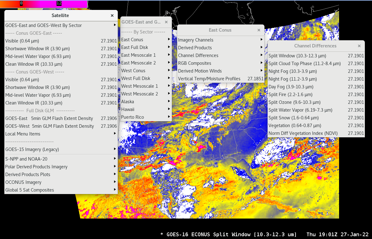
1. Select the "Satellite" menu button. menus should appear as shown in the figure below. If your Satellite menu appears abbreviated compared to this figure (for example, it includes no Conus GOES-East/West Visible, IR, WV buttons, and or No Full Disk GLM), check this pdf link or this pptx link for more information and procedures for making all items appear under Satellite.
Select a GOES Channel Difference. The Sector (e.g. ECONUS) should show up in the legend like shown here:
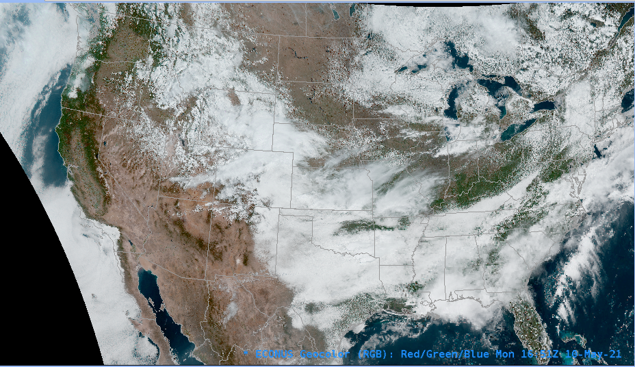
2. Full resolution Geocolor RGBs are being evaluated for every sector except Hawaii (6km for the Full Disk). For APP beta eval sites only: Select Satellite->GOES-East and GOES-West By Sector->East Conus->RGB Composites->CIRA Geocolor (and/or select other sectors. Note that the RGB will not populate the Hawaii sector). Here is an example:
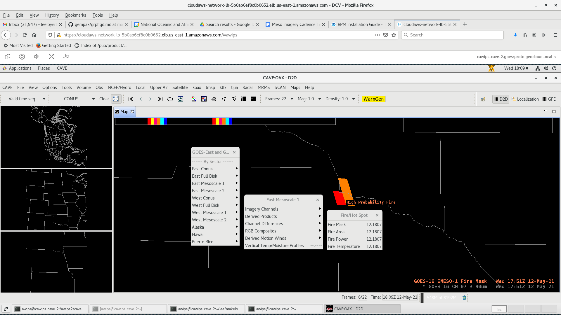
3. GOES Mesoscale Sector Fire products update at 1-minute cadence. This feature is in both v21 and v22. A Fire Mask field is now included (for all Sectors). Select Satellite->GOES-East and GOES-West By Sector->Derived Products->Fire/Hot Spot-> to see the products. Sample the Fire Mask to get additional information on the pixels (e.g. High Possibility Fire, Cloudy Fire, Processed Fire). Here is an example of the Fire Mask sampled with "High Probability" shown in orange:
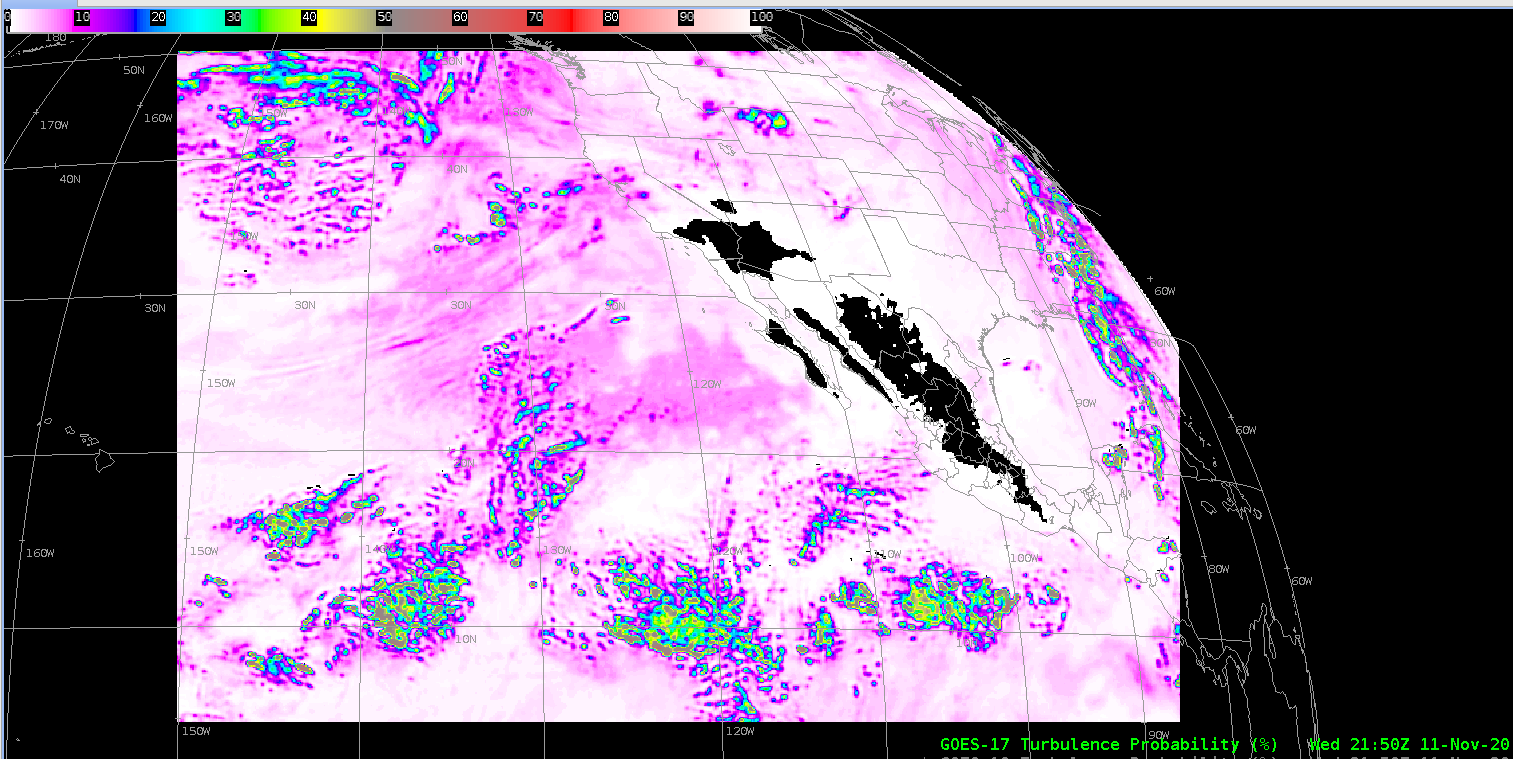
4. To confirm the CONUS or PACUS Turbulence product configuration (retained in Versions 20-22), select Satellite->GOES-East and GOES-West By Sector-> East Conus (or West Conus)->Derived Products->Turbulence Probability (UWSSEC), as shown in the example below for West Conus (note, these are tiled products which arrive every 10 minutes, shown here on the GOES-West geostationary map scale):
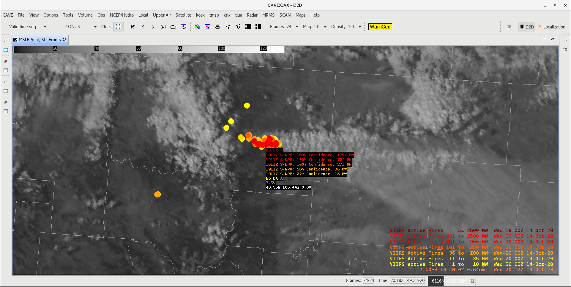
5. To confirm the VIIRS Fires product configuration (retained Versions 20-22), select Satellite-> S-NPP and NOAA-20->Derived Products->S-NPP/NOAA-20 VIIRS Active Fires (LDM), resulting in plots like the example below.
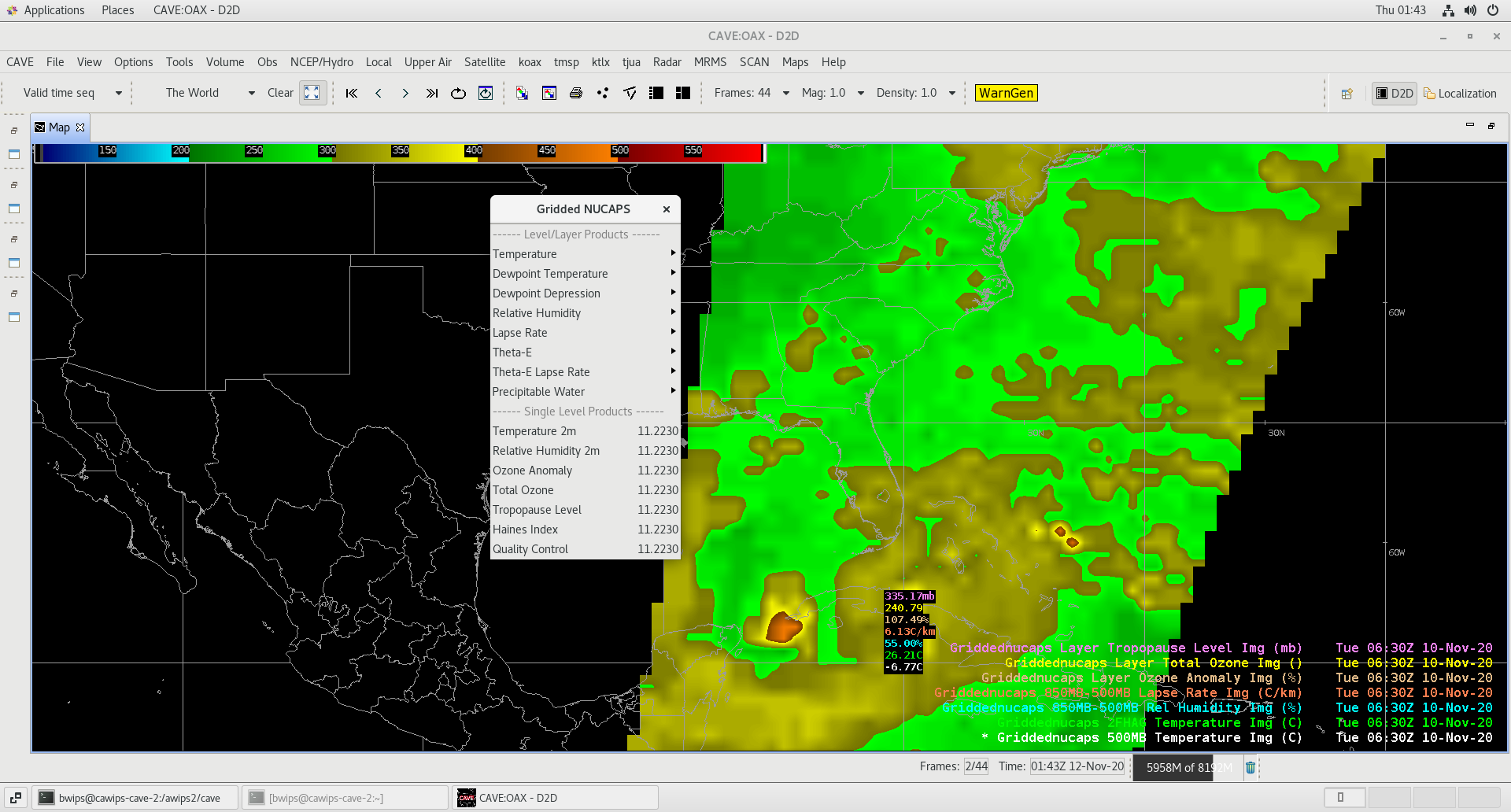
6. Improvements to the Gridded NUCAPS displays (since Version 20). These can be found under Satellite->S-NPP and NOAA-20-> Gridded NUCAPS. Below shows an example:
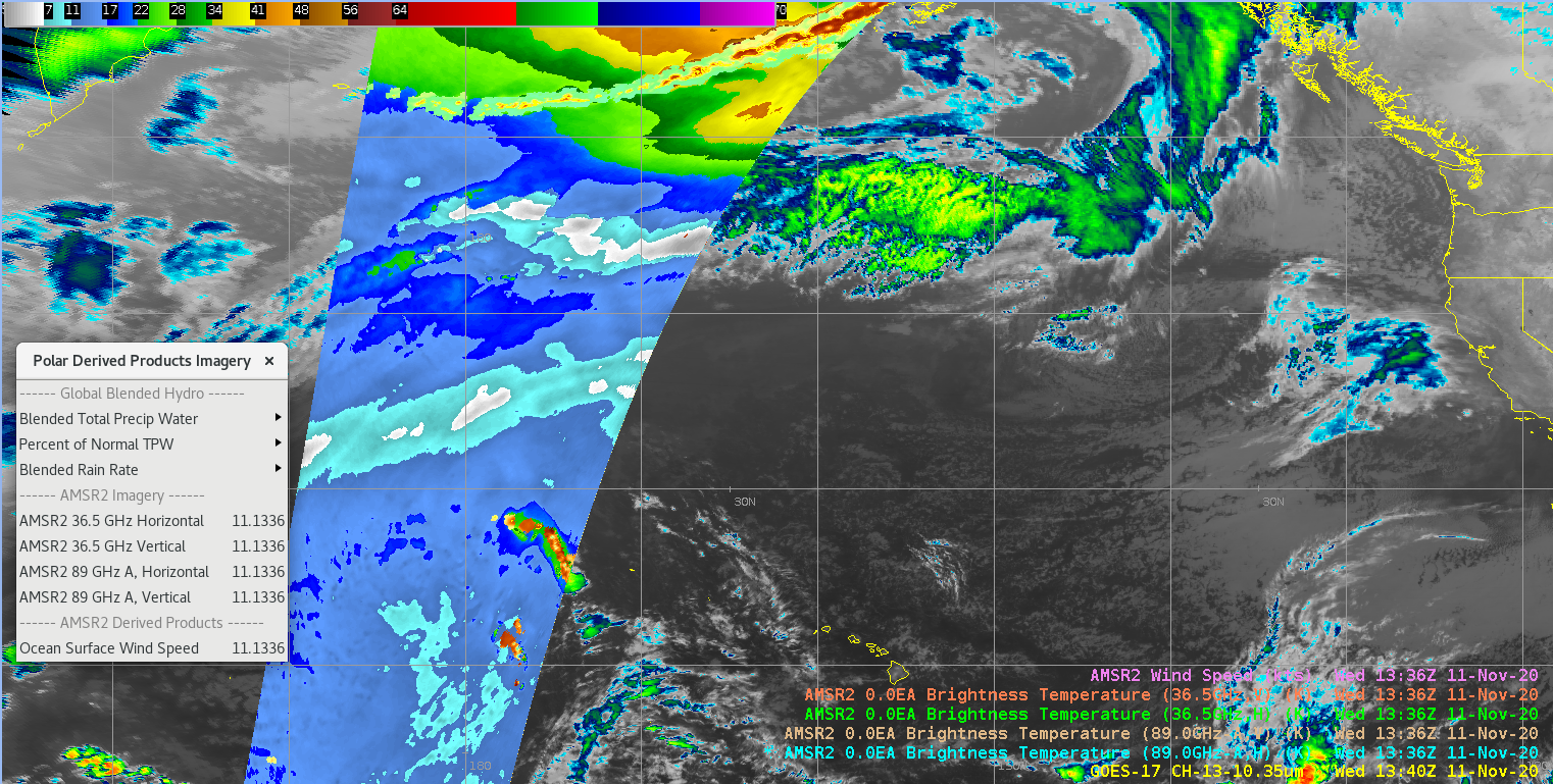
7. GCOM-AMSR2 Microwave Polar Orbiter products have been retained from Ver 20. These products will be available through data delivery in the near future. Below is an example for the AMSR2 Ocean Surface Wind Speed and Imagery. Once a site subscribes to these products via Data Delivery, they will populate under Satellite->Polar Derived Products Imagery:
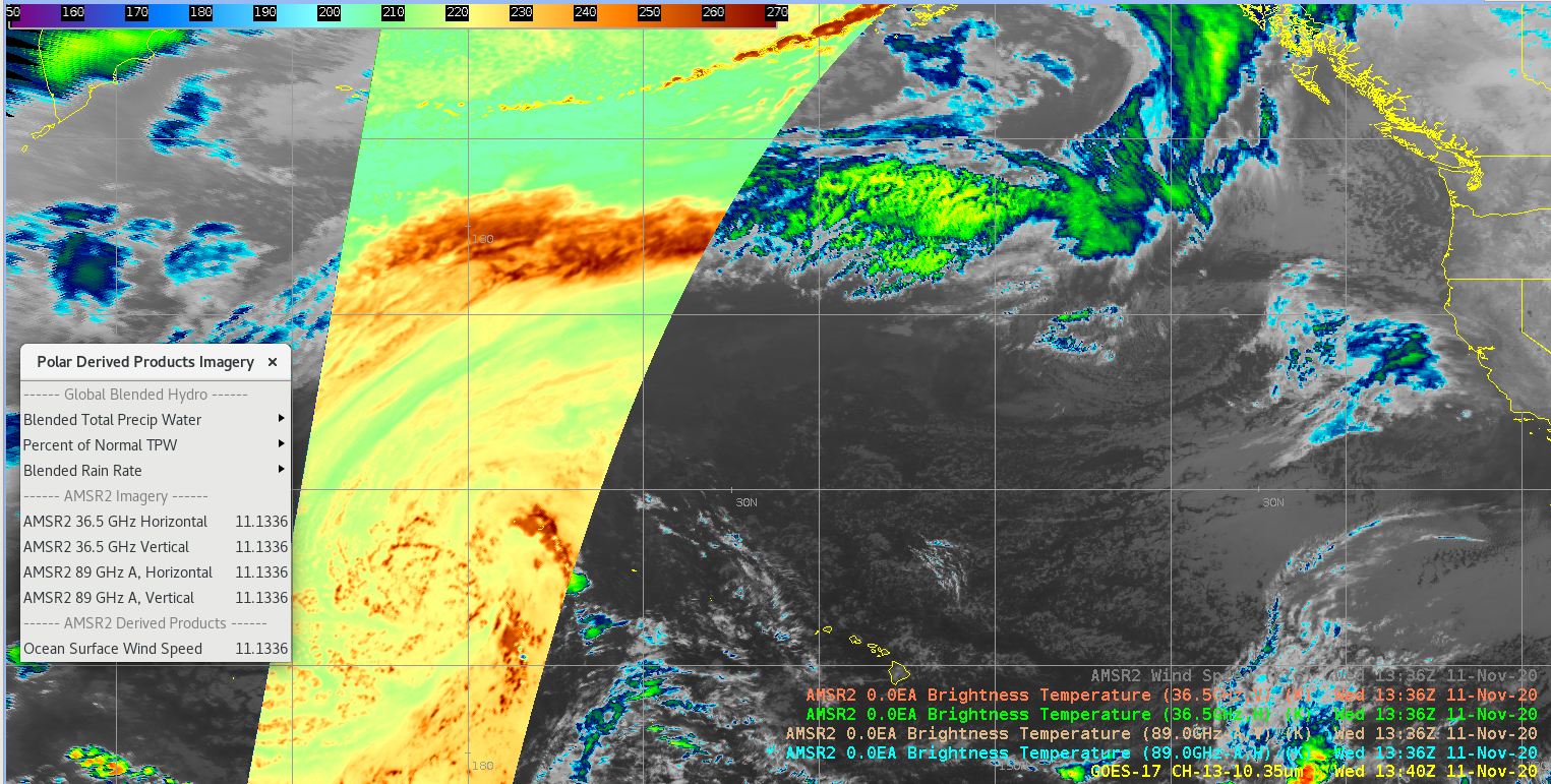
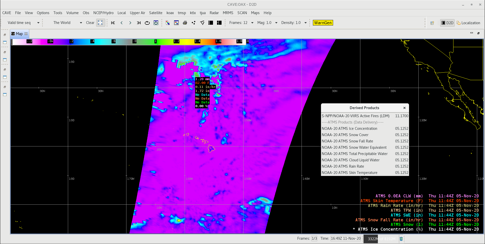
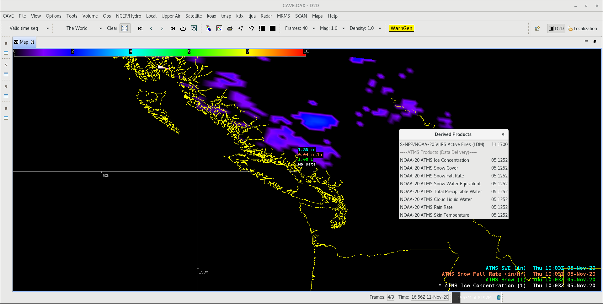
8. NOAA-20 ATMS polar products added to the Satellite menu have also been retained since Ver 20. These products will be available through data delivery in the near future. Below are two examples. Once a site subscribes to these products via Data Delivery, they will populate under Satellite-> S-NPP and NOAA-20->Derived Products->ATMS Products:
That's it. You are now configured with the latest Version 22 TOWR-S satellite product configurations. Each release, the map scales for the geostationary (e.g. world view) projections (e.g. for GOES-E and GOES-W views) are packaged, but not made active, in the TOWR-S RPMs. Follow the steps in the link on this page to "V. Instructions to Activate the Geostationary Scales..", for them to be selectable from the CAVE pull-down. In addition, GLM troubleshooting information is also included in Section III "Known Issues", which you can access using the navigation site menu on this page.
NOTE: If your AWIPS system re-localizes or changes its site name, you will need to de-install and re-install the TOWR-S RPM by repeating the above steps (save any site modifications to these files that were made after the install).