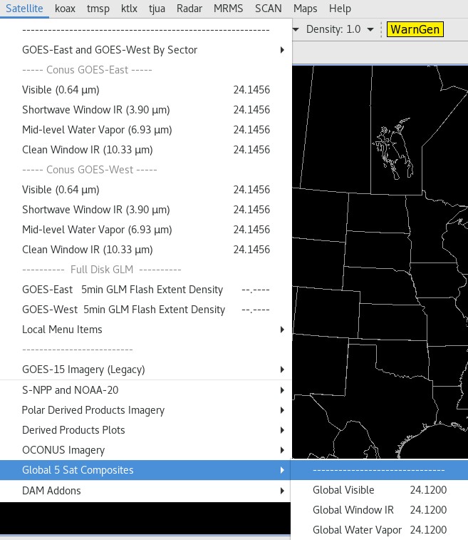
Global Mosaic of Geostationary Satellite Imagery - Total Operational Weather Readiness - Satellites (TOWR-S)
Global Mosaic of Geostationary Satellite Imagery (GMGSI)
About
The Global Mosaic of Geostationary Satellite Imagery (GMGSI) is a set of products derived from GOES-West, GOES-East, Himawari-9, Meteosat-9, and Meteosat-11. It provides near-global coverage for Visible, Water Vapor, and Longwave Infrared data. One full global image for each of the 3 composite types is produced every 3 hours. GMGSI improved upon and replaced the GINI Global Multi-Satellite Geostationary Satellite Imagery Composite products on December 10, 2020.
Limitations
Latitudinal Coverage: Valid data is produced from 71N to 71S.
Cadence: PDA subscriptions receive hourly updates, while the SBN transmits new composites every 3 hours.


AWIPS
Location: Satellite → Global 5 Sat Composites → Choose Global Visible/Window IR/Water Vapor
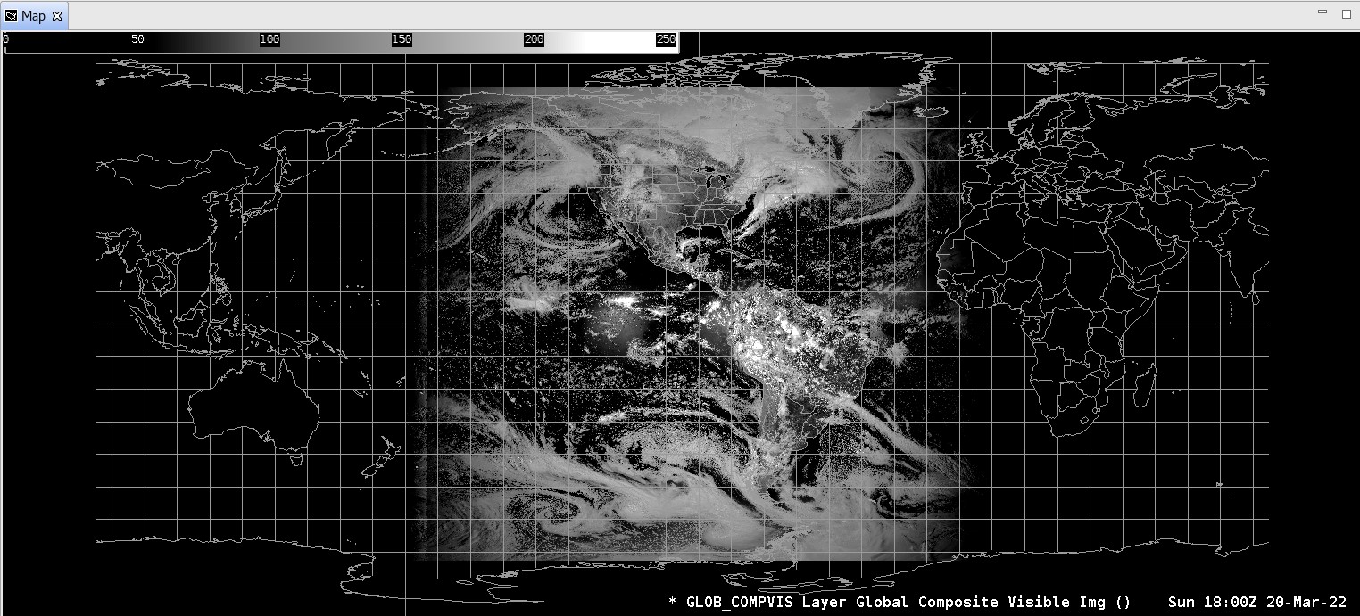
Color Maps: Visible: Sat/VIS/ZA (Vis Default)
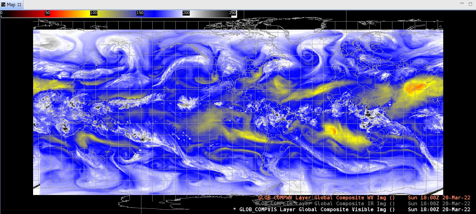
Water Vapor: Sat/WV/CIMSS_WV
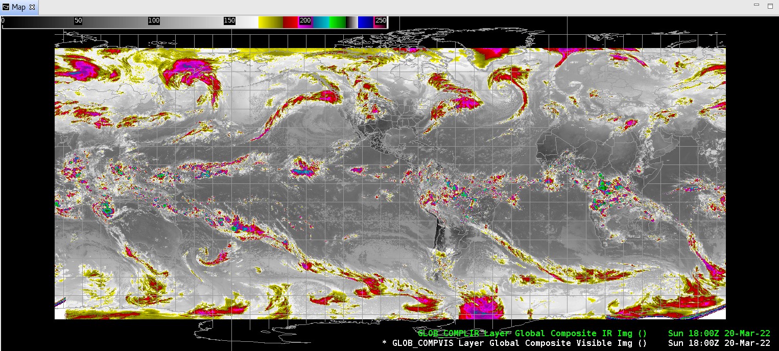
Longwave IR: Sat/IR/CIRA (IR Default)
Sampling: N/A
Quality Flags: None
Technique: The Visible composite band is ~0.6 microns, which may be used to view cloud cover, ice, and snow cover. The Water Vapor band is ~6.7 microns, which shows the amount of water vapor contained in the mid to upper levels of the troposphere. The Longwave/Window IR band is ~12.0 microns, which shows cloud cover and surface temperature.
AWIPS Technical Details
Sector | Global |
Refresh Rate | 3hr over SBN (1hr PDA) |
Size |
Visible 6.5MB/hr 19.5MB/file Water Vapor 4.6MB/hr 13.8MB/file Longwave IR 7.2MB/hr 21.6MB/file |
Resolution | 8km horizontal |
Data Source | NESDIS via PDA |
Projection | None (lon/lat grid) |
Storage Location | /data_store/goes-r |
WMO Header |
Visible TICF02 KNES Water Vapor TICF08 KNES Longwave IR TICF14 KNES |
Product Short Name |
Visible GMGSI_VIS_NetCDF Water Vapor GMGSI_WV_NetCDF Longwave IR GMGSI_LW_NetCDF |
Data Path | SBN |
AWIPS Configuration | TOWR-S RPM v22 |
AWIPS Plugin | netcdfGrid |
Edex Purge Rule | 3 versions (3 days) |
This page was last updated on February 27, 2024