GOES Cloud Top Temperature - Total Operational Weather Readiness - Satellites (TOWR-S)
GOES Cloud Top Temperature
About
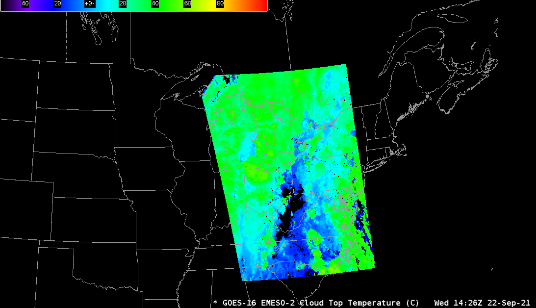
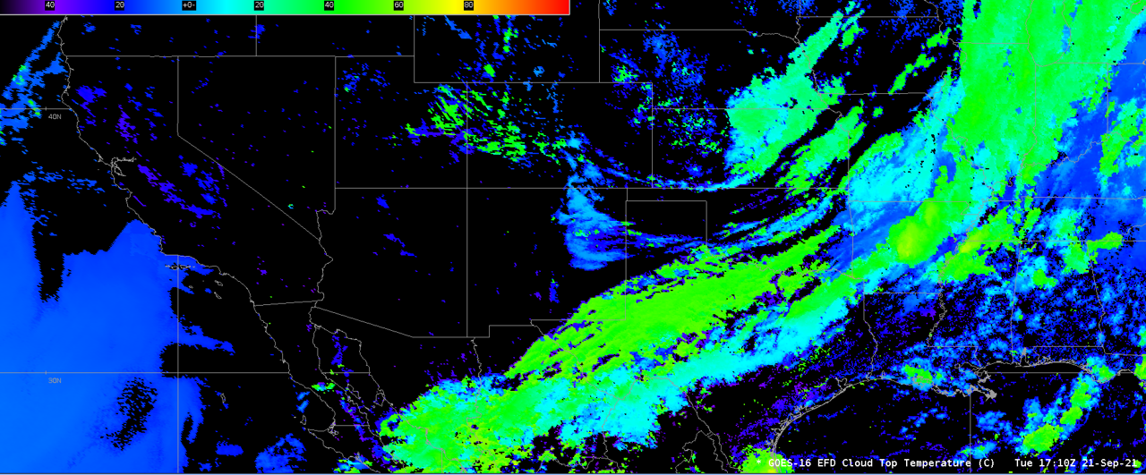
The GOES-R Cloud Top Temperature product uses GOES-R bands 11.2 um (CH 14), 12.3 um (CH 15), and 13.3 um (CH 16) to derive an estimate of the cloud top temperature. It relies on infrared observations to avoid discontinuities associated with the transition from day to night. Cloud Top Temperature can help to identify rapid cooling of convective clouds or to verify differences in convective and stratiform clouds. It can also be useful when trying to determine if clouds are present at low levels.
Limitations
Accuracy: Accurate within 3°C.
Emissivity Sensitivity: Infrared observations are impacted not only by the height of the cloud, but also its emissivity and how the emissivity varies with wavelength - a behavior that is tied to cloud microphysics. In addition, the emissions from the surface and the atmosphere can also be major contributors to the observed signal.
Cloud Structure: Clouds often exhibit complex vertical structures that violate the assumptions that go into producing the product.
AWIPS
Location: GOES-East and GOES-West By Sector → Full Disk or Mesoscale → Derived Products → Cloud Top Temperature
Color Maps: GOES-R/GOESR-L2/VTRSB (baseline). Units are degrees Celsius. Dark colors imply colder clouds whereas light colors imply warmer clouds.
Sampling: °C
Quality Flags: A “good quality” flag mask is used to retain pixels that meet good quality thresholds.
Technique: This product can be used in conjunction with visible 0.64um satellite imagery (if available) and also 10.33 um satellite imagery. Because of the increased cadence of these imagery channels, cloud vertical growth can be assessed using the imagery, then compared to the Cloud Top Temperature product to see how much cooling has occurred. The GLM Lightning Detection product can also be used, as the amount of lightning will likely increase as the cloud top temperature decreases. Comparisons can also be made to the GOES-R Cloud Top Height Product, such as how quickly is the height increasing compared to the temperature of the cloud cooling.


AWIPS Technical Details
Sector | Full Disk & Mesoscale |
Refresh Rate | Full Disk: 10 min; Meso: 1 min |
Size | ~210 MB/hr |
Resolution | 2 km at nadir |
Data Source | PDA |
Projection | GOES-R Fixed Grid |
Storage Location | /data_store/goes-r/ |
WMO Header | GOES-East: IXTI99 KNES; GOES-West: IXTI89 KNES |
Product Short Name | OR_ABI-L2-ACHT[F|M1|M2| |
Data Path | SBN EXP |
AWIPS Configuration | Baseline |
AWIPS Plugin | goes-r |
Edex Purge Rule | 1 day baseline |
Use Cases & More
More information can be retrieved from the Quick Guide, GOES-R, and STAR.
Point of Contact: Andrew Heidinger
This page was last updated on March 26, 2024.