GOES Cryosphere Products

About 

The cryosphere exists at all latitudes, plays a significant role in climate studies, and is critical for accurate weather forecasts. It has profound socio-economic value due to its role in water resources and its impact on transportation, fisheries, hunting, herding, and agriculture. Snow and ice cover are among the key Earth’s surface characteristics influencing radiation budget, energy exchange between the land surface or ocean and the atmosphere, and water balance. Information on the spatial extent and distribution of snow and ice cover presents an important input to numerical weather prediction (NWP), hydrological and climate models.

Sea and lake ice influence the surface radiation budget and energy and moisture exchange between the atmosphere and the underlying water. It is one of the key factors to consider in the atmospheric circulation, numerical weather forecasting, and climate models. Ice cover is also important for planning commercial transport. Ice cover and concentration are among the most important indices in studying climate change. Accurate retrievals of ice cover and concentration are of high importance both to the scientific communities and to the general public.

As of June 5, 2023, three ice and snow data products from the GOES-R constellation will be available over the Satellite Broadcast Network (SBN). These include:

  • Ice Concentration & Extent (including Ice Surface Temperature)
  • Ice Age & Thickness
  • Fractional Snow Cover

For the purposes of this guide, these will be referred to as IC&E, IA&T, and FSC.

Limitations

Higher Latitude Coverage: IC&E and IA&T are accurate up to 67 degrees Local Zenith Angle (LZA). FSC is accurate up to 55 degrees LZA and (as a daytime-only product) up to 67 degrees Solar Zenith Angle (SZA). The quality of the products degrade as the angles increase, significantly so past these thresholds. The approximate LZAs for each GOES satellite can be seen here.

Daytime Only: FSC is only available during daylight hours. Due to this, and the limited spatial coverage, FSC is significantly limited in winter months at high latitudes.

Cloud Cover: Data is only available for cloud-free pixels.

AWIPS 

Location: GOES-East and GOES-West By Sector → Full Disk → Derived Products → Snow Cover OR Cryosphere (Ice) → Choose Product

Color Maps: 

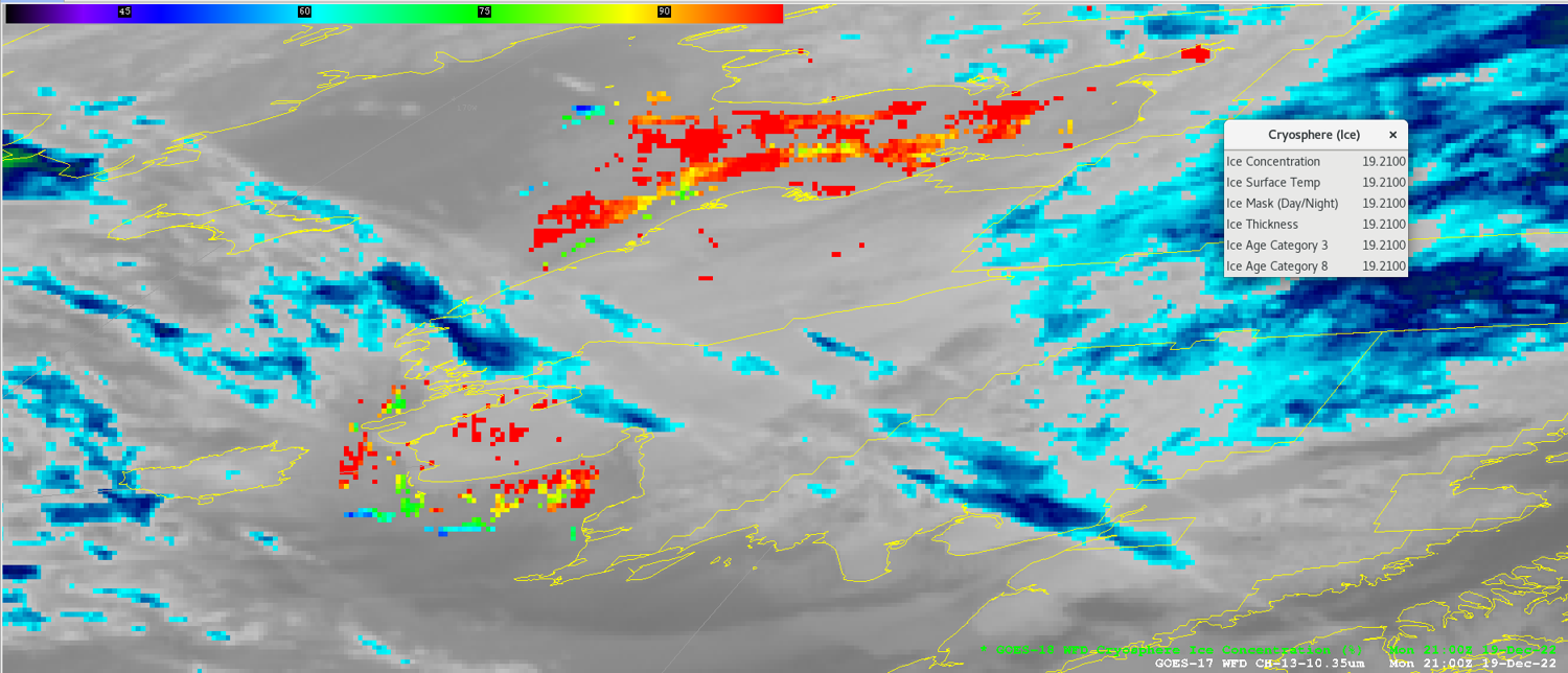
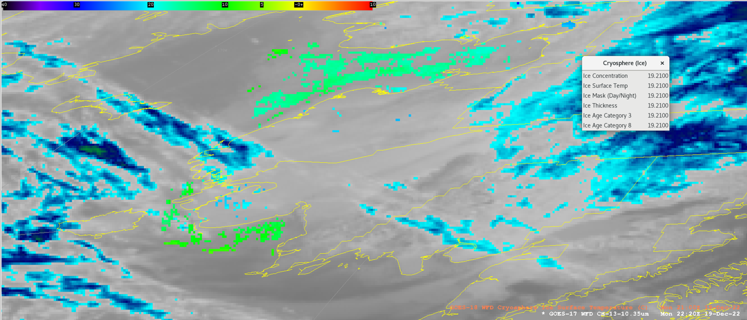
Ice Concentration, Surface Temperature: GOES-R/GOESR-L2/VTRSB
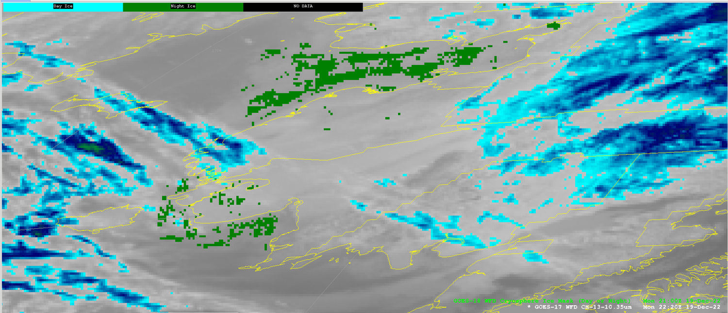
Ice Mask: GOES-R/GOESR-L2/IceMask_DayNight
Ice Thickness: GOES-R/GOESR-L2/VTRSB
3 Category: GOES-R/GOESR-L2/IceAge3
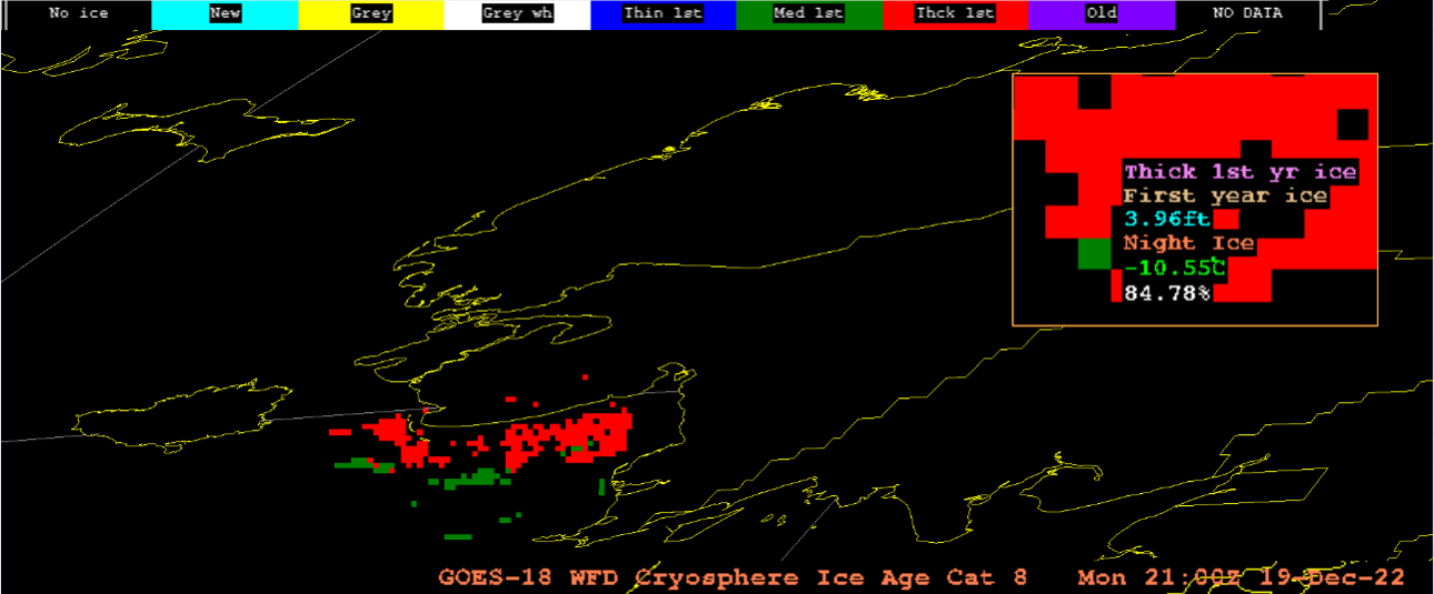
8 Category: GOES-R/GOESR-L2/IceAge8
FSC: GOES-R/GOESR-L2/FSC

Sampling:

IC&E: Ice Concentration in % 0-100
Ice Surface Temperature in Kelvin 100-275
Ice Mask as Day Ice or Night Ice
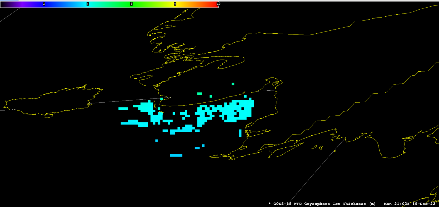
IA&T: Thickness in meters 0-3
3 category as Ice Free, First Year Ice, Older Ice
8 category as Ice Free, New Ice, Gray Ice, Gray White Ice, Thin First Year Ice, Medium First Year Ice, Thick First Year Ice, Old Ice
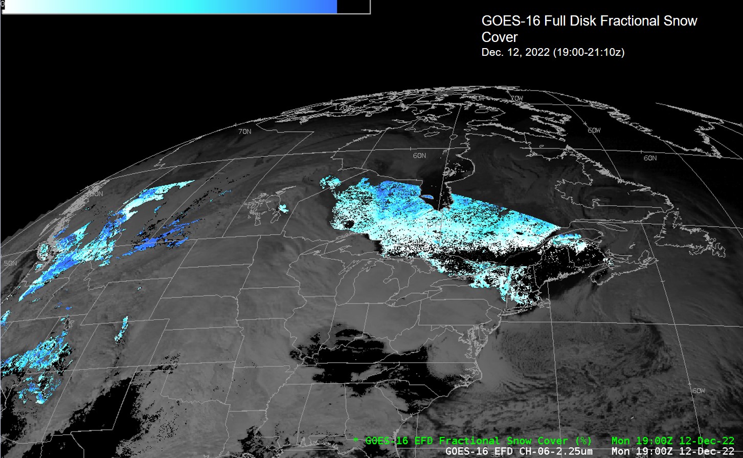
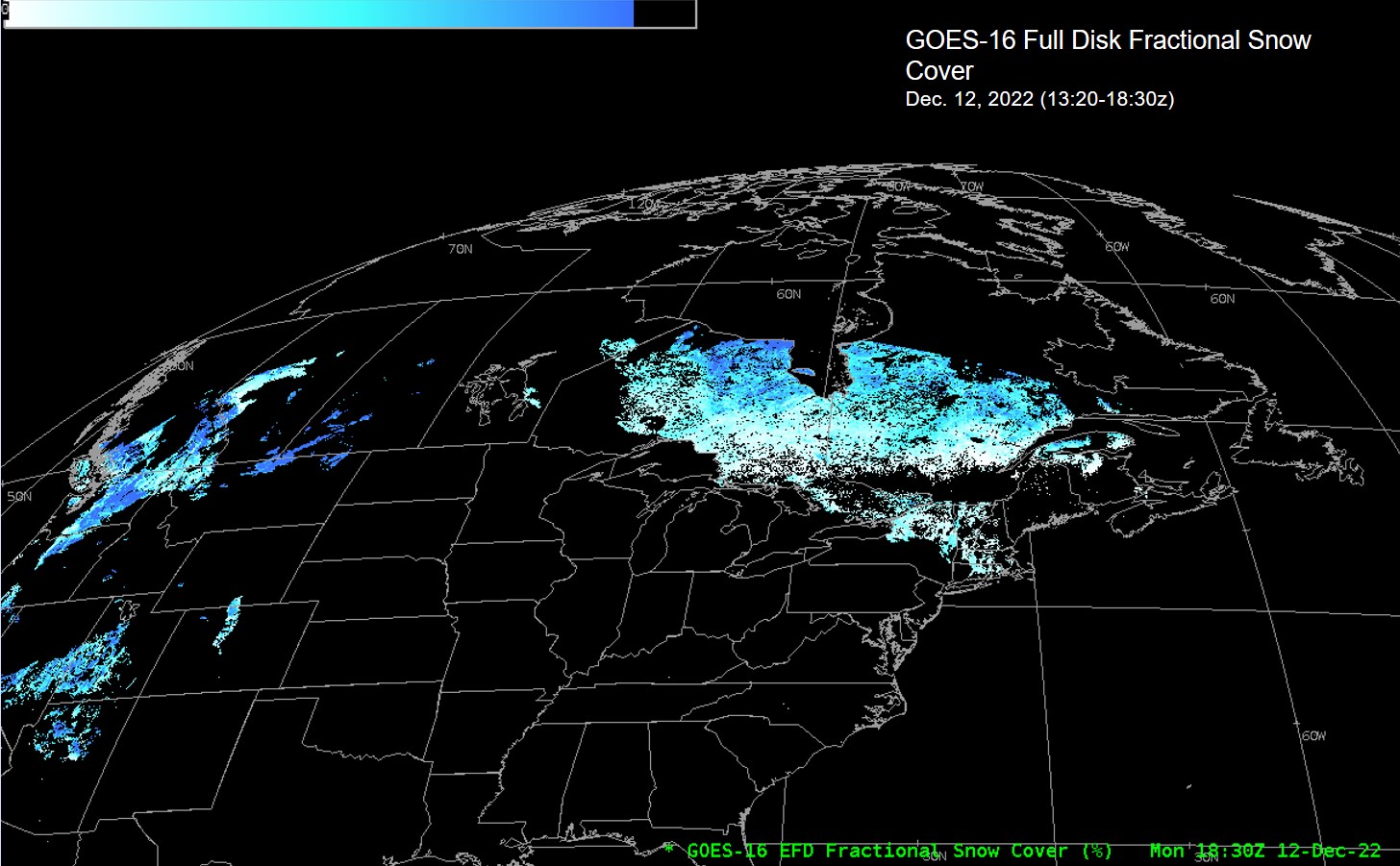
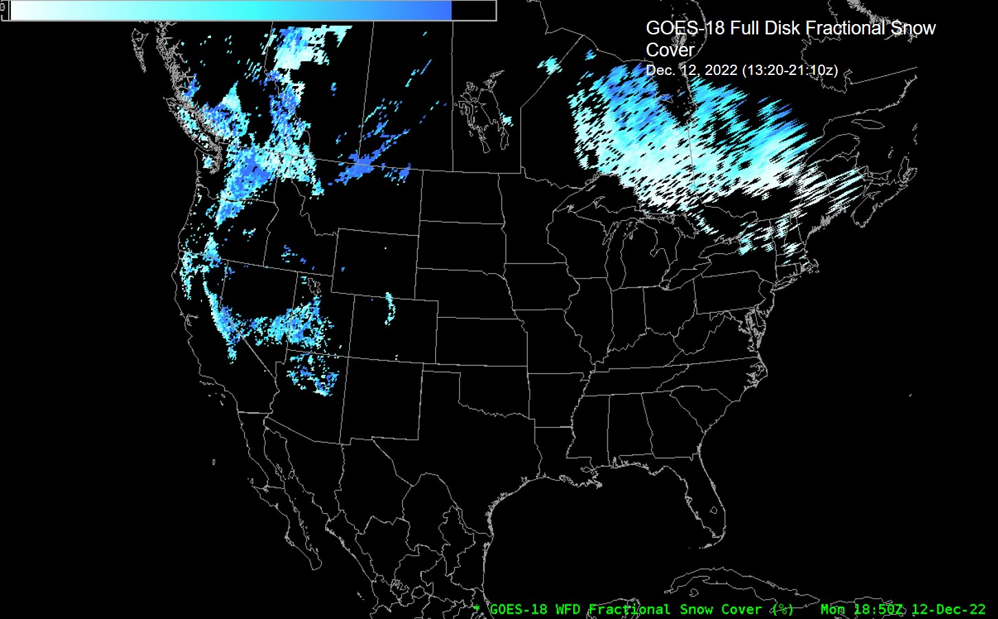
Fractional Snow Cover: 0.0-1.0

Quality Flags: DQF:flag_values = 0US, 1US, 2US, 3US; DQF:flag_meanings = "normal nonretrievable uncertain bad_data"

Technique: IC&E products are produced using ABI channels 2, 3, 5, 14, and 15. Its algorithm dependencies are cloud mask, solar zenith angle, and satellite viewing angle. Its ancillary data dependency is the land/water mask.
IA&T products are produced using a One-dimensional Thermodynamic Ice Model (OTIM), which depends on other derived products rather than ABI channels directly. See “Use Cases & More” for details.
FSC retrieval algorithm is a ratio of the reflectance difference between ABI Band 2 and the reflectance of snow-free land, over the difference between the reflectance of snow-covered land and snow-free land. Snow-covered land is determined using a two-step algorithm process. The first step - Initial Snow Identification - involves the Normalized Difference Snow Index (NDSI), ABI Bands 2, 3, 5, and 13, and spectral threshold-based decision tree algorithm. The second step - Consistency Testing - involves verifying the plausibility of identified snow against snow cover climatology, land surface temperature climatology, and surface elevation. See “Use Cases & More” for details.

AWIPS Technical Details

Sector Full Disk
Refresh Rate IC&E: 3 hours
IA&T: 3 hours
FSC: 1 hour
Size IC&E: 68 MB/day (8 files) per satellite
IA&T: 48 MB/day (8 files) per satellite
FSC: 48 MB/day (24 files) per satellite
Resolution 2 km nadir
Data Source PDA
Projection GOES-R Fixed Grid
Storage Location /data_store/goes-r
WMO Header IC&E East: IXTR99 KNES
IC&E West: IXTR89 KNES
IA&T East: IXTT99 KNES
IA&T West: IXTT89 KNES
FSC East: IXTL99 KNES
FSC West: IXTL89 KNES
Product Short Name IC&E: OR_ABI-L2-AICEF
IA&T: OR_ABI-L2-AITAF
FSC: OR_ABI-L2-FSCF
Data Path NOAAport/SBN (EXP Channel) as of June 5, 2023
AWIPS Configuration TOWR-S RPM v23
AWIPS Plugin goes-r
Edex Purge Rule 24 hours (baseline)

Use Cases & More

More information can be retrieved from SCN 23-42, PS-PVR, and ATBD (Enterprise Versions).

Point of Contact: Jeff Key

Feedback Form

Submit questions and suggestions for the TOWR-S pages using this short form.

This page was last updated on March 26, 2024.