GOES DMW - Total Operational Weather Readiness - Satellites (TOWR-S)
GOES Derived Motion Winds
About
The GOES-East and GOES-West Derived Motion Winds (DMW) product estimates wind speeds and directions from the movement of cloud and moisture seen in Advanced Baseline Imager (ABI) spectral bands. Winds are produced using ABI Channels 2 (0.64 um), 7 (3.9 um), 8 (6.2 um), 9 (7.0 um), 10 (7.4 um) and 14 (11.2 um). The product has a measurement range of 0 - 300 knots for speed and 0 to 360 degrees for direction.
When tracking clouds, the winds algorithm makes use of cloud top heights, estimated by a separate algorithm, to assign the most representative height to the feature being tracked. For clear-sky (water vapor) winds, the algorithm tracks moisture gradients, determining their height from brightness temperatures and a short term temperature forecast (the GFS model).
Limitations
Quality Consistency: The product's accuracy is 7.5 m/s (~15 knots) and degrades in quality near the edges of the GOES footprint.


AWIPS
Location: GOES-East and GOES-West By Sector → Select Sector → Derived Products → Derived Motion Winds
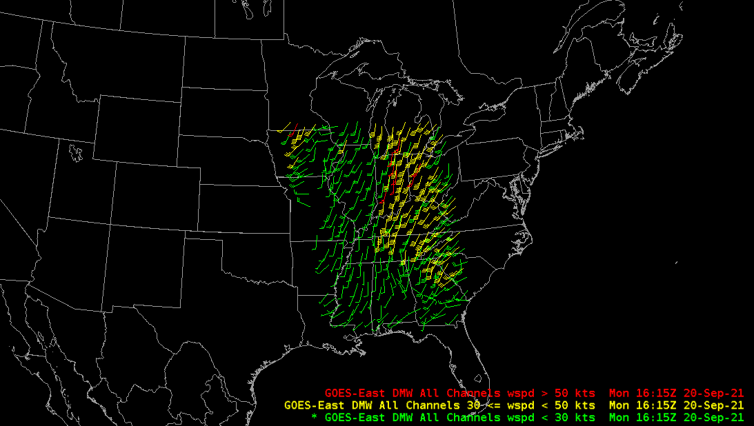
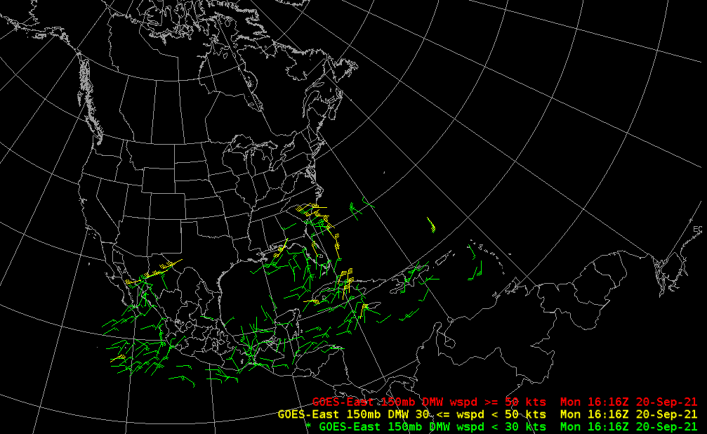
Color Maps: For By-Pressure, wind vectors are colored according to the pressure range selected. For displays "By Channel" and "By Mandatory Levels," wind barbs are colored based upon the speed being displayed – 0-30 knots: green;30-50 knots: yellow; 50+ knots: red. The size of the wind barbs can be modified by right-clicking the legend and selecting "magnification".
Sampling: Sampling returns the Wind speed in Knots and Direction from which the wind is coming in deg (ranging from 0 (North)-360).
Quality Flags: In AWIPS, a mask is used to store and display the "good quality" wind vectors as deemed by the algorithm.
Technique: The DMW product is useful for situational awareness when trying to identify the speed and direction of wind at various levels in the atmosphere. DMWs may indicate warm or cold air advection and mean wind flow. This can also help in identifying the jet stream, jet streaks, and centers of low pressure (such as mid-latitude cyclones or tropical storms).
The GOES DMW product can be used with several model fields to identify horizontal advection of moisture, vorticity, and temperature. They can also be used to compare modeled upper-level wind patterns and determine which model is best capturing the atmospheric situation at the time. The location of the jet stream and jet streaks can also be identified (and compared to models) for additional confidence as well as implications for cyclogenesis.
AWIPS Technical Details
Sector | CONUS, Mesoscale |
Refresh Rate |
Full Disk (available primarily to Centers, not on SBN): 60 min CONUS: 15 min Mesoscale sectors: 5 min |
Size |
GOES-East: 2.82 GB/day GOES-West: 2.57 GB/day |
Horizontal Resolution |
7.5 km visible band (CH 02) 30 km SWIR (CH07) and water vapor bands (CHs 08, 09, 10) 38 km longwave infrared band (CH14) |
Vertical Pressure Layers | 000-250; 250-350; 350-450; 450-600; 600-775; 775-900; 900mb-Sfc |
Data Source | PDA |
Projection | N/A Point plots |
Storage Location (raw) | /data_store/goes-r/yyyymmdd/hh |
WMO Header | IXTU99 KNES (GOES-East)
IXTU89 KNES (GOES-West) For each product time there can be 6 Channels providing wind records or 6 files per output time (all with the same WMO header) |
Product Short Name | OR_ABI-L2-DMW[F|C|M1|M2]-M6C[02|07|08|09|10|14] |
Data Path | GOES-East: SBN GRE
GOES-West: SBN GRW (Meso on EXP) |
AWIPS Configuration | TOWR-S RPM v22 |
AWIPS Plugin | GOES-R DMW |
Edex Purge Rule | 18 hours (baseline) |
Use Cases & More
GOES-R Derived Motion Winds - B. Line, Satellite Book Club #11, July 30, 2020
More information can be retrieved from NESDIS Quick Guide, GOES-East SCN, ATBD.
Point of Contact: Jaime Daniels
This page was last updated on March 26, 2024.