Experimental GOES Turbulence Product from CIMSS

About 

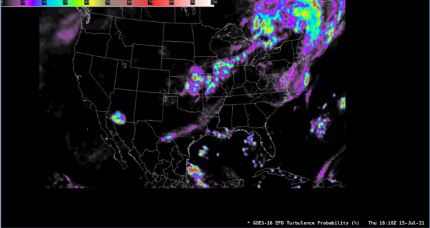
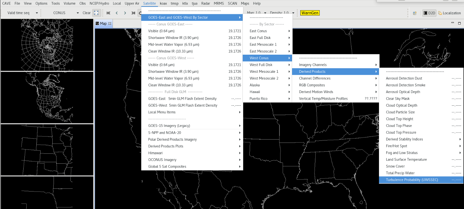
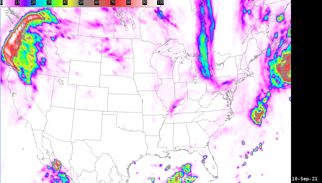
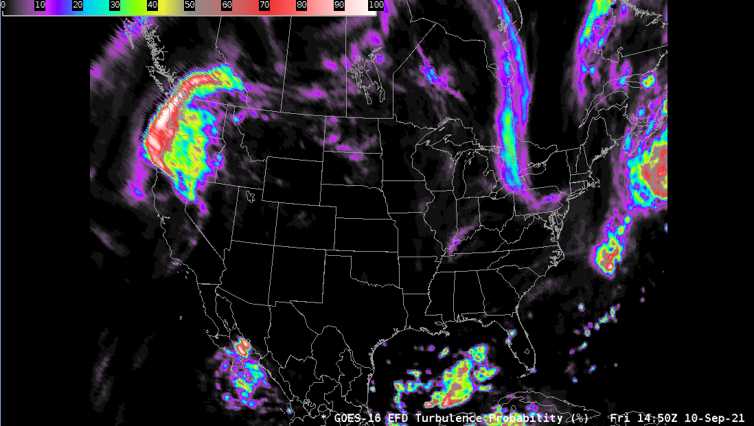
The Cooperative Institute for Meteorological Satellite Studies (CIMSS) is developing a turbulence nowcasting product by applying artificial intelligence (AI) to water vapor and infrared imagery of geostationary imagers. The product estimates the probability of moderate-or-greater turbulence at commercial aircraft cruising altitude, and has validated quite well with very little bias. The product provided to AWIPS is for the 36Kft-37Kft layer.

Limitations

Experimental: This product is still being validated, and is in the experimental phase.

Clear Skies: Clear air turbulence results are not as strong.

AWIPS Data Flow: AWIPS currently only supports a single level, whereas the base product produces multiple.

AWIPS

Location: GOES-East and GOES-West By Sector → East Conus or West Conus → Derived Products →Turbulence Probability (UWSSEC)   

Color Maps: grid/lowrange enhanced

Sampling: Probability (%) of Moderate or Greater Turbulence

Quality Flags: None in AWIPS

Technique: Use in conjunction with other atmospheric fields to determine regions where Moderate or Greater Turbulence can be identified.

AWIPS Technical Details

Sector GOES East and West CONUS (LDM)
Refresh Rate 10min
Size

LDM EConus/WConus: ~144 MB/day

CIMSS Direct Full Disk,  ~8.5 GB/day/satellite

Resolution 2 km at the Equator
Data Source UWSSEC
Projection GOES-R Fixed Grid
Storage Location (raw) data_store/goes_r/yyyymmdd/hh/uwssec_isatss_L3-TURB*
WMO Header N/A
Product Short Name N/A
Data Path LDM
AWIPS Configuration TOWR-S RPM v21.3.1 baseline
AWIPS Plugin goes-r
Edex Purge Rule 24 hours (baseline)

Use Cases & More

CIMSS GOES 16/17 Turbulence Probability Product - S. Campbell, Satellite Book Club #62, August 12, 2021

More information can be retrieved from CIMSS and CIMSS Turbulence Probability.

Point of Contact: Sean Campbell

Feedback Form

Submit questions and suggestions for the TOWR-S pages using this short form.

This page was last updated on March 26, 2024.