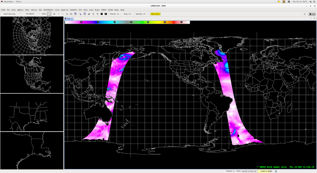
AMSR-2 Ocean Surface Winds

About 

Wind information over open waters where observations are scarce is critical for shipping concerns. Sustained strong winds can generate dangerous waves. GCOM is a polar-orbiting satellite that uses microwave data from AMSR-2 (Advanced Microwave Scanning Radiometer 2) to infer wind speeds. Microwave emissions are detected with a scanning antenna that rotates once per 1.5 seconds, measuring a swath 1450km wide. Sea-surface winds are computed using the 36.5 GHz channel. Sea foam and surface waves both influence the microwave signal used to infer wind speeds.

Limitations

Rain Blockages: Heavy convective rain, as above over the Western Atlantic, can affect the wind signal and degrade the estimate of wind speeds.

Coastal Areas: The interpretation algorithm omits areas within 50km of shorelines, because reflection from land areas wash out those from ocean surfaces.

AWIPS 

Location: Satellite Polar Derived Products Imagery  Ocean Surface Wind Speed

Color Maps: Beaufort_Winds

Sampling: AWIPS converts to knots (kts) from m/s

Quality Flags: WSPD_QC Winds over 30 m/s

Technique: GCOM AMSR-2 winds are an important ground truth in regions where ship and buoy information is scarce.

AWIPS Technical Details

Sector Full single orbit
Refresh Rate 99 min
Size 123 MB uncompressed → 45 MB gzipped
Resolution 6 km/1450 km wide swath
Data Source PDA
Projection None
Storage Location TBD/Site-specific
WMO Header N/A
Product Short Name GCOM AMSR2-OCEAN
Data Path Data Delivery
AWIPS Configuration Baseline:

distribution/pointset-satellite-amsr2.xml

styleRules/pointSetSatelliteImageryStyleRules.xml

pointset/netcdf/satellite_amsr2.xml

datadelivery/mappings/ShortNameMappings.xml

Additional menu and style configs via TOWR-S RPM v20+
AWIPS Plugin PointSet
Edex Purge Rule 1 day

Use Cases & More

Sample files found here via NESDIS.

More information can be retrieved from STARCIMSSNASA, CIRA, and GINA.

Point of Contact: Paul Chang

Feedback Form

Submit questions and suggestions for the TOWR-S pages using this short form.

This page was last updated on March 26, 2024.