About
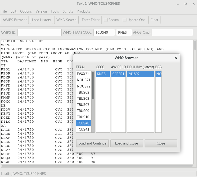
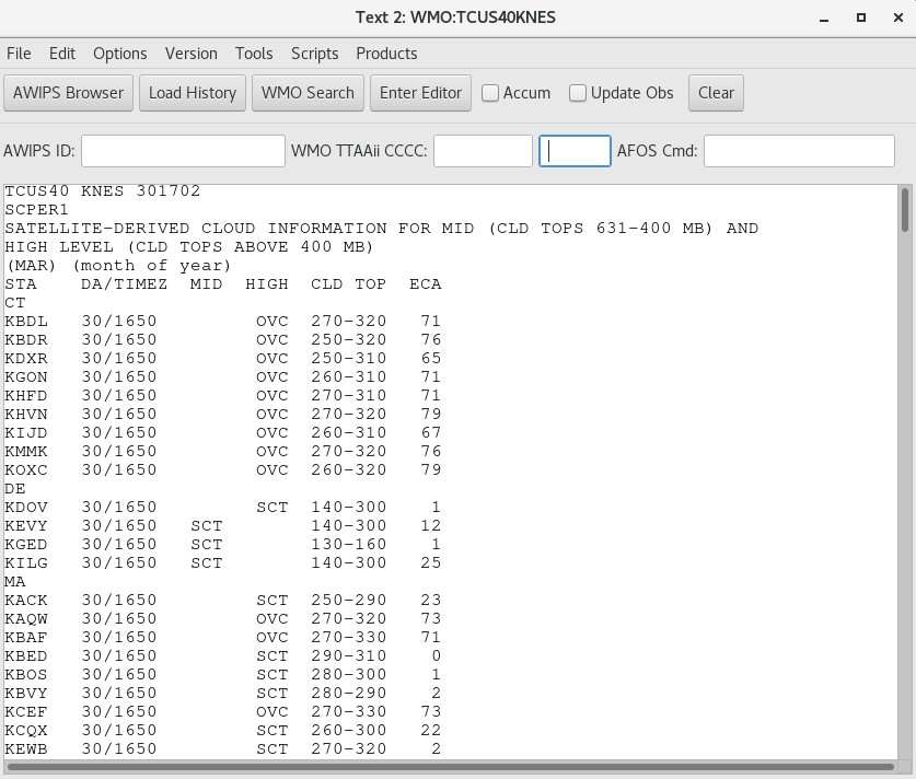
GOES ASOS Satellite Cloud Products (SCPs) are text products providing hourly satellite-based estimates of cloud cover at the middle (e.g. 631-400mb) and upper (above 400mb) levels of the atmosphere above Automated Surface Observing System (ASOS) and other ground-based weather stations. (ASOS ceilometers are limited to altitudes below 12,000 feet or ~640mb.) This cloud-cover information is included in NWS Hourly Weather Roundups and transmitted over NOAA Weather Radio. Cloud cover estimates may be CLR (clear), SCT (scattered), BKN (broken), or OVC (overcast). A percentage of Effective Cloud Amount (ECA) is provided at each location, and represents a measure of total cloud cover specified at MID or HIGH levels.
GOES ASOS SCPs supplement ground ASOS observations for Terminal Aerodrome Forecasts (TAFs) and other products, especially for aviation weather. The stations from which the readings are measured are usually airports, indicated by the four-letter International Civil Aviation Authority (ICAO) identifier . These ground stations report many weather elements in addition to cloud cover, and are limited to a maximum altitude of 12,000 feet. More on the ASOS program can be found here, with a User's Guide available here.
The ASOS SCPs are available via the Satellite Broadcast Network (SBN/NOAAPort) and viewed through the AWIPS Text Workstation. ASOS SCPs are also available from weather.gov here. The products are divided into different geographic regions, delineated by WMO headers and AWIPS IDs. The collective U.S. regions are Central, Eastern, Southern, Western and Pacific U.S; as detailed in the table below.
Notes:
1. Effective June 3, 2024, 149 obsolete station identifiers and stations no longer in operation were removed from the SCP station lists. The removed stations are listed here, with suggested alternate stations or identifiers.
a. Many suggested alternate stations are just a new or corrected identifier for the same station; especially where the distance is only a few km and the location names are similar. (Many station lon/lat positions have a precision of only 0.01 degree ≅ 1km.)
b. Some suggested alternate stations are tens of km away: especially in sparsely-settled areas, this is the current, active station closest to a station no longer in operation.
c. A few alternate stations are several hundred km away: when a defunct station's lon/lat position was inconsistent with its name or identifier, the suggested alternate station was chosen based on the location name, no matter how distant.
2. On August 11, 2023, ASOS SCPs were expanded to include over 1,200 new station identifiers. These new station identifiers are listed here.
| Region |
States/Territories |
WMO Header |
AWIPS ID |
| Central |
CO; IA; IL; IN; KS; KY; MI; MN; MO; ND; NE; SD; WI; WY |
TCUS41 KNES (GOES-East)
TCUS51 KNES (GOES-West) |
SCPCR1
SCPCR2 |
| Eastern |
CT; DE; MA; MD; ME; NC; NH; NJ; NY; OH; PA; RI; SC; VA; VT; WV |
TCUS40 KNES (GOES-East)
TCUS50 KNES (GOES-West) |
SCPER1
SCPER2 |
| Southern |
AL; AR; FL (mainland); GA; LA; MS; NM; OK; TN; TX |
TCUS42 KNES (GOES-East)
TCUS52 KNES (GOES-West) |
SCPSR1
SCPSR2 |
| Southern |
FL (Keys); Puerto Rico; U.S. Virgin Islands; Cuba |
TCUS62 KNES (GOES-East) |
SCPSR3 |
| Western |
Alberta, Canada; AZ; CA; ID; MT; NV; OR; UT; WA |
TCUS53 KNES (GOES-West)
TCUS43 KNES (GOES-East) |
SCPWR2
SCPWR1 |
| Pacific |
Alaska; Hawaii; U.S. Minor Outlying Islands; Kiribati |
TCUS54 KNES (GOES-West) |
SCPPR2 |