AMSR-2 Brightness Temperatures - Total Operational Weather Readiness - Satellites (TOWR-S)
AMSR-2 Microwave Brightness Temperatures
About
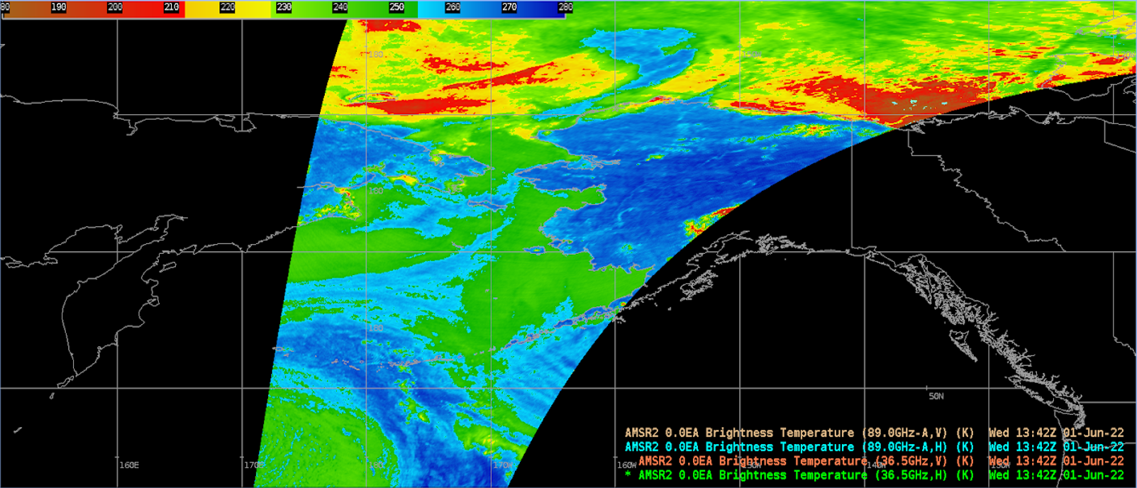
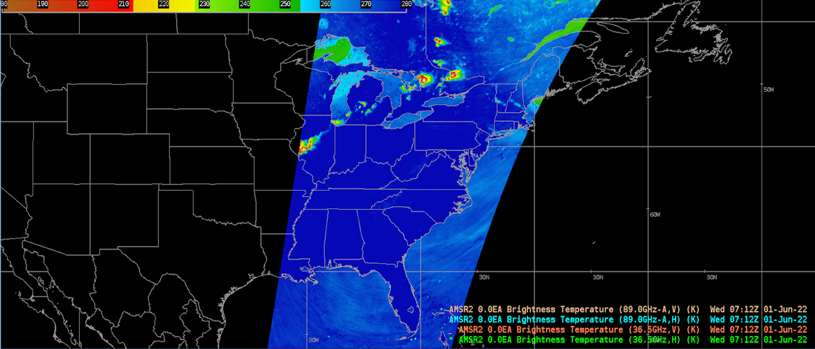
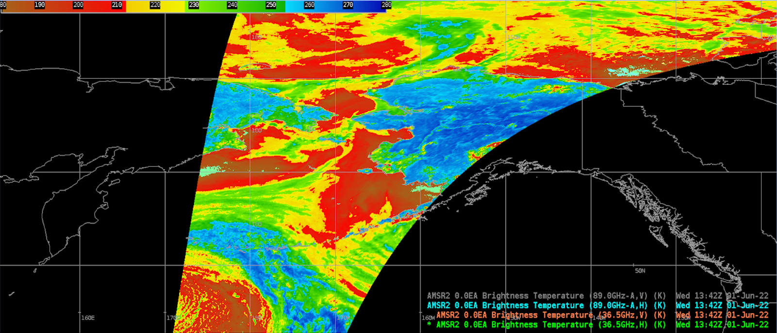
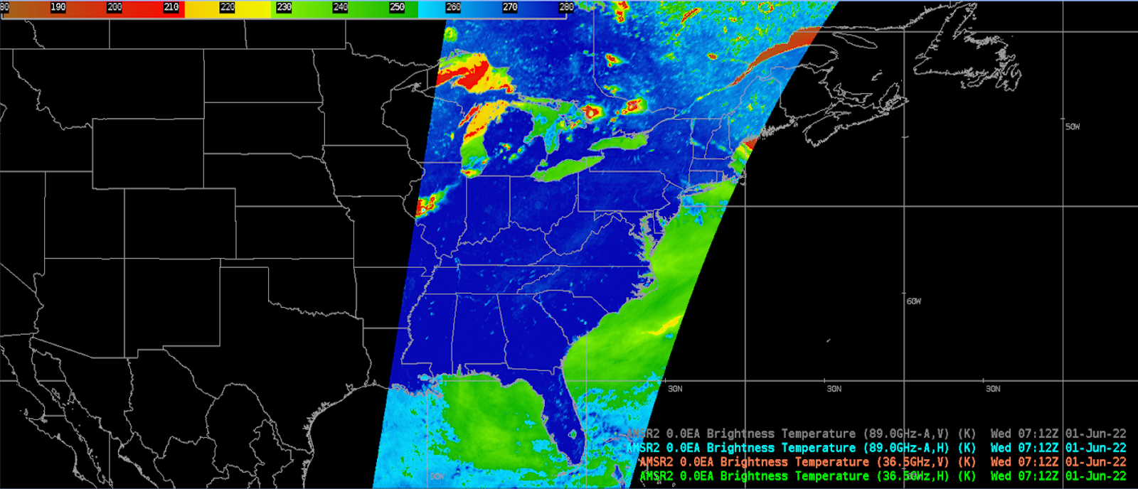
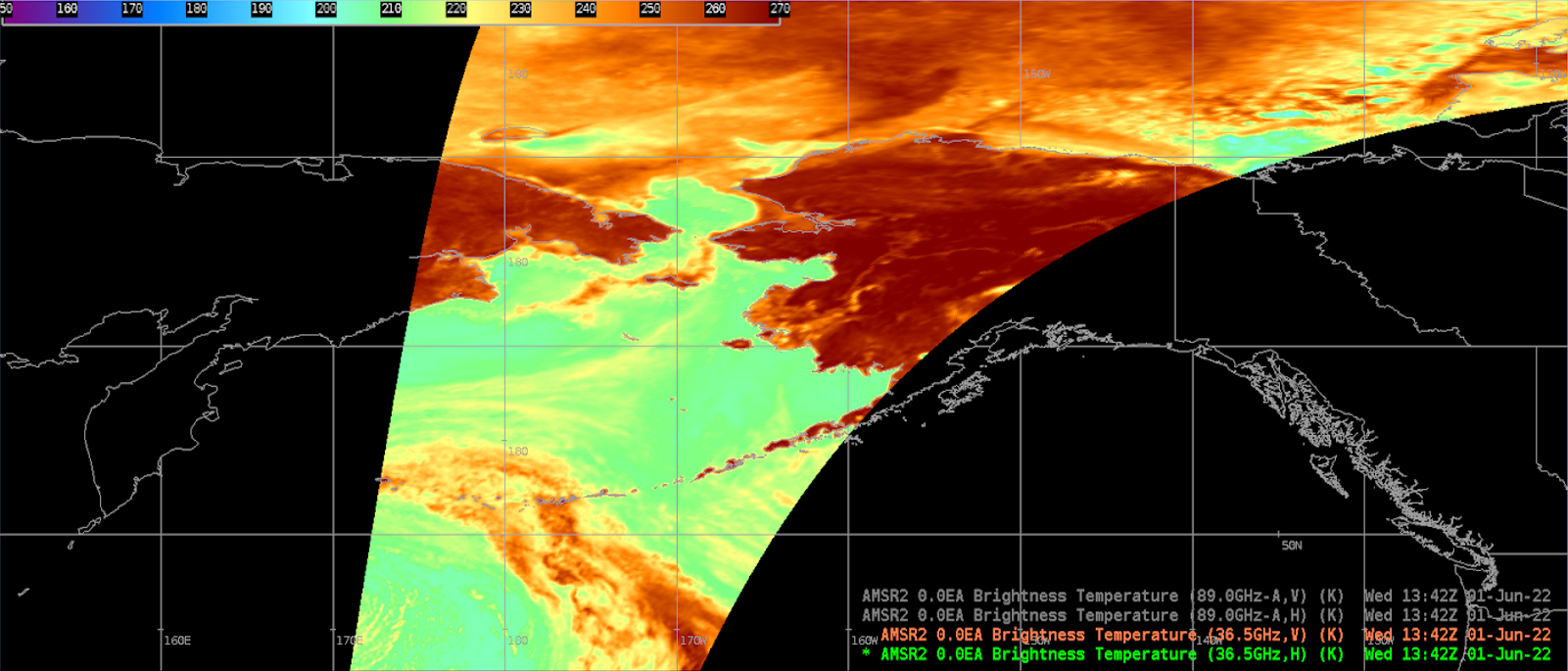
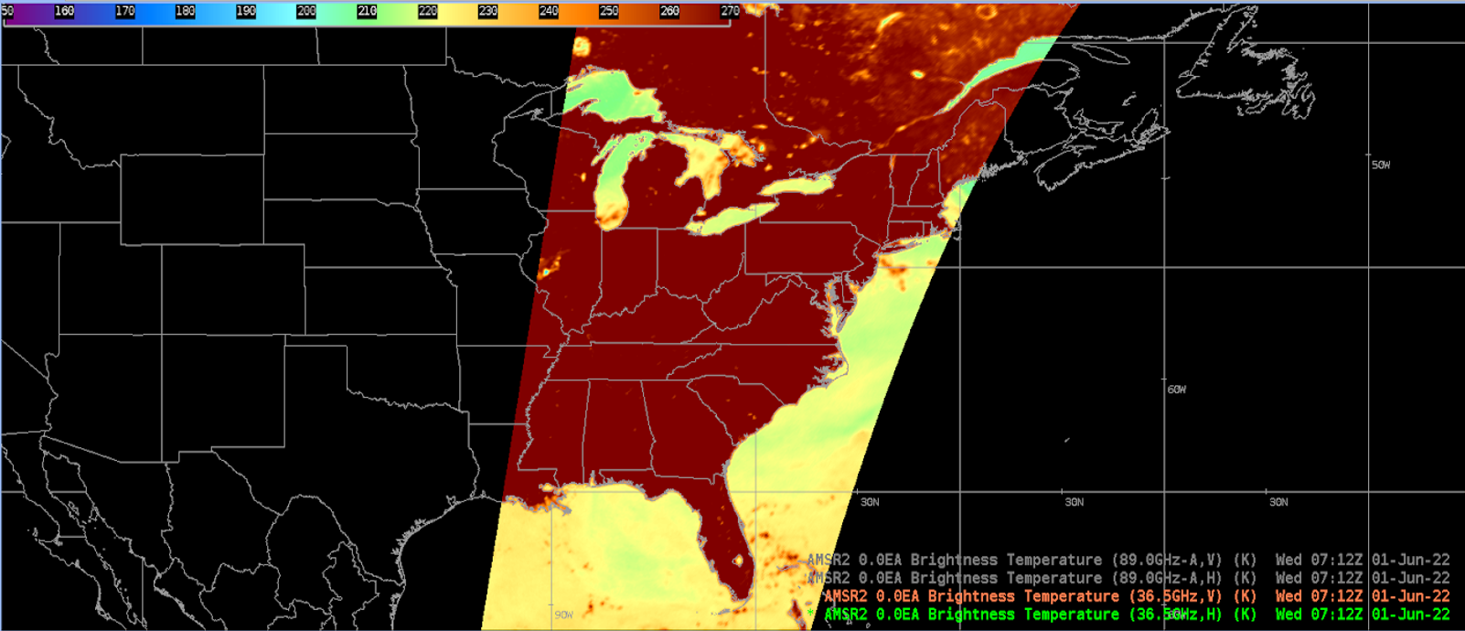
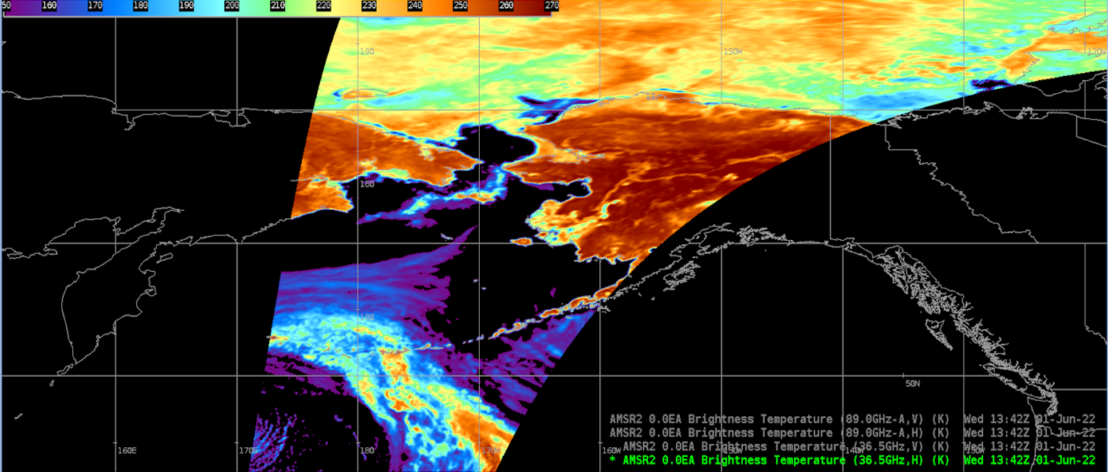
Aboard JAXA's GCOM-W1 satellite, AMSR-2 is a microwave radiometer that measures dual polarized - vertical (V) and horizontal (H) - radiances at 6.9, 7.3, 10.65, 18.7, 23.8, 36.5, and 89.0 GHz. Brightness temperature (TB) is a passive measurement of radiance from the microwave radiation emitted from the atmosphere and represented in units of temperature. Brightness temperatures observed by AMSR-2 are linearly correlated with temperatures at the Earth's surface. There is high transmittance in the microwave spectrum, so there is rarely interference due to weather, resulting in near-full coverage.
The EDRs provided by OSPO are L2 products. These are calibrated, corrected, reformatted, and flagged by the GCOM-W1 AMSR-2 Algorithm Software Processor (GAASP) from the L1B data provided by NASA. Further processing for ocean and precipitation products utilize a regression-based approach from AMSR-E, and the Goddard Profiling Algorithm (GPROF) respectively.
Limitations
AWIPS Product Availability: While there are products from 7 channels, only 36.5H, 36.5V, 89.0AH, 89.0AV are in the TOWR-S RPM v22 menu. The 6.925(H/V), 7.3(H/V), 10.65(H/V), 18.7(H/V), and 23.8(H/V) products may be viewed via OSPO.


AWIPS
Location: Satellite → Polar Derived Products Imagery → AMSR2 Imagery
Color Maps: Sat/MW/nrl_micro37ghz_swaths; Sat/MW/nrl_micro89ghz_swaths
Sampling: Kelvin
Quality Flags: RFI, Sun Glint
Technique: While brightness temperature products are useful on their own to track temperature gradients, they also contribute to the production of several ocean, land surface, and precipitation products. These include: Cloud Liquid Water, Land Cover Type, Rain Rate, Sea Ice, Sea Surface Temperature, Sea Surface Wind Speed, Snow Cover, Snow Depth, Snow Water Equivalent, Soil Moisture, and Total Precipitable Water.
AWIPS Technical Details
Sector | Full single orbit, 1450km swath width |
Refresh Rate | 99 min |
Size | ~260-290MB uncompressed → ~130-145MB gzipped |
Resolution | 36.5GHz: 7x12km, 10km sampling interval; 89.0GHz: 3x5km, 5km sampling interval |
Data Source | PDA |
Projection | None |
Storage Location | N/A |
WMO Header | N/A |
Product Short Name | AMSR2-MBT |
Data Path | Data Delivery |
AWIPS Configuration |
Some products available with TOWR-S RPM v22 distribution/pointset-satellite-amsr2.xml styleRules/pointSetSatelliteImageryStyleRules.xml pointset/netcdf/satellite_amsr2.xml datadelivery/mappings/ShortNameMappings.xml |
AWIPS Plugin | pointset |
Edex Purge Rule | 1 day |
Use Cases & More
AMSR-2 Observations of Hurricane Dorian - Jelenak, et al., 2020
More information can be retrieved from OSPO, OSPO NOGAPS, and STAR.
Point of Contact: Paul Chang
This page was last checked in March 26, 2024.