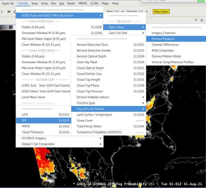
GOES Fog and Low Stratus

About 

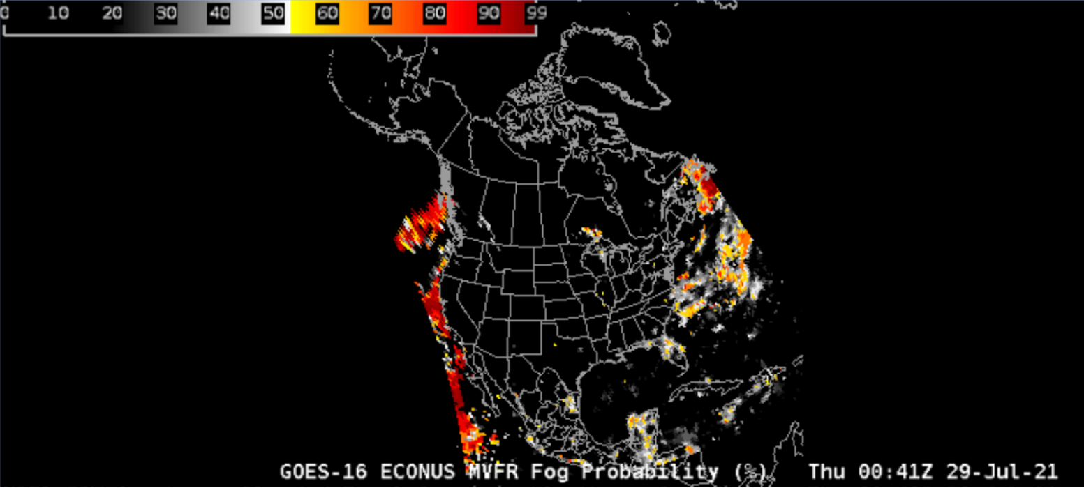
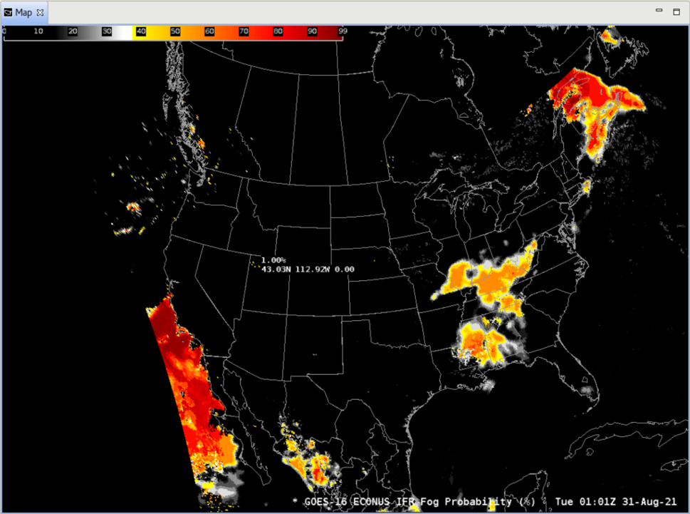
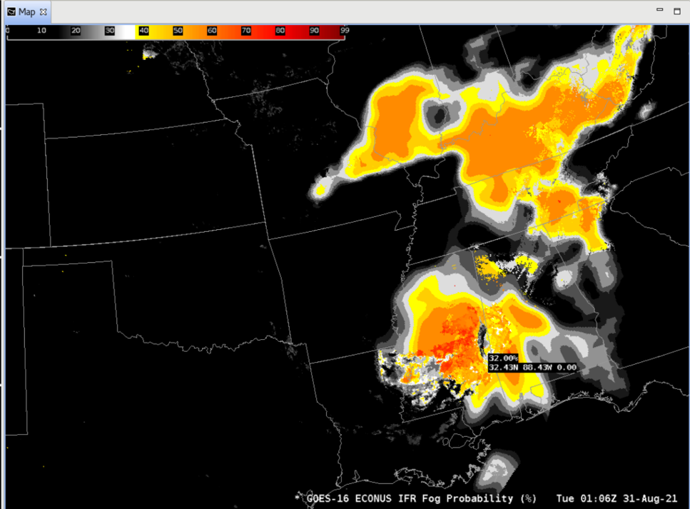
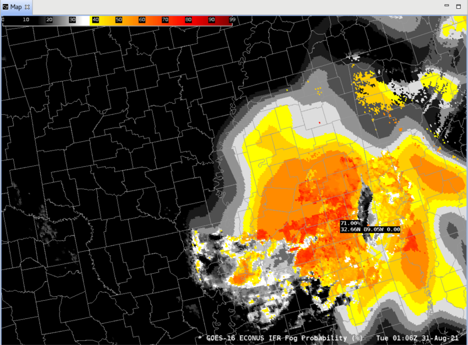
This product estimates low cloud thickness and the probability of reduced aviation visibility (Marginal Visual Flight Rules, Instrument Flight Rules, and Low Instrument Flight Rules).  

MVFR conditions = surface visibility < 5.0 statute miles and/or cloud ceiling < 3000 feet

IFR conditions = surface visibility < 3.0 statute miles and/or cloud ceiling < 1000 feet

LIFR conditions = surface visibility < 1.0 statute miles and/or cloud ceiling < 500 feet

FLS probability products provide a signal when higher clouds mask the satellite view of low clouds, and screens out regions of elevated stratus to highlight areas where the cloud ceiling likely meets the categorical thresholds.

The categorical thresholds are used to delineate different types of operational impacts to aviation. For example, in IFR conditions, visual approaches may be restricted and impact (reduce) airport arrival and departure rates.  FLS may be used to gain more information on cloud decks over data voids. It may also be used as a decision aid for terminal aerodrome forecast preparation. FLS can provide the forecaster confidence information on spatial extent, and help the forecaster convey uncertainty in the Area Forecast Discussion and to NWS core partners (e.g. FAA).1

Limitations

Day/Night Discontinuity: Different predictors are used for day and night, though probabilities are always available.

Thickness Product: This product is only valid for near-surface, single layer water clouds. Additionally, it is not available just after sunrise nor just before sunset.

AWIPS 

Location: GOES-East and GOES-West By Sector → select sector → Derived Products → Derived Motion Winds

Color Maps: GOES-R/GOESR-L2/{MVFR-PROB, LIFR-PROB, IFR-PROB}, Grid/gridded data

Sampling: {%, %, %, ft}

Quality Flags: N/A 

Technique: AWIPS 4-panel of the GOES FLS Fog Depth and Night Fog Channel difference with surface observations (panel one), the FLS ProbMVFR, ProbIFR and ProbLIFR (panels 2-4). An alternative is to overlay all 3 FLS (MVFR, IFR, LIFR) fields with the satellite imagery at the top, and the FLS products underlaid and sampled to provide a cursor readout of probabilistic information. Look for trends (in space and/or time) of probabilities of 60% or greater to provide confidence a particular category is being met.1

AWIPS Technical Details

Sector GOES-East CONUS; GOES-West CONUS/PACUS
Refresh Rate 5 min
Size ~3.2 MB/file
Resolution CONUS 2500x1500 (2km nadir)
Data Source NSOF
Projection GOES-R Fixed Grid
Storage Location (raw) data_store/goes_r
WMO Header GOES-East: IXTE99 KNES; GOES-West: IXTE89 KNES
Product Short Name ABI-L2-GFLSC_AWIPS
Data Path SBN GRE/GRW
AWIPS Configuration Baseline
AWIPS Plugin goes-r
Edex Purge Rule 1 day baseline

Use Cases & More

Use of GOES FLS to Support the Aviation Program at WFO New York, NY - D. Radell, Satellite Book Club #17, September 10, 2020

More information can be retrieved from CIMSS, VLab Quick Guide IFR Probability, VLab Quick Guide Cloud Thickness

Point of Contact: Mike Pavolonis

Feedback Form

Submit questions and suggestions for the TOWR-S pages using this short form.

This page was last updated on March 26, 2024.