Metop ASCAT - Total Operational Weather Readiness - Satellites (TOWR-S)
Metop ASCAT
About
The Advanced Scatterometer (ASCAT) winds products are produced by NOAA/NESDIS utilizing measurements from the scatterometer instrument aboard the EUMETSAT Metop-B/C satellites. The instrument uses radar to measure backscatter to determine speed and direction of winds over the surface of the oceans. ASCAT data feeds numerical weather prediction models, provides useful information on ice, snow and soil moisture, and is used to analyze areas of individual storm activity. Scatterometer winds are reported at an effective altitude of 10 meters above sea surface.
Limitations
Latency: Like any polar-orbiting satellite, data may be delayed by several hours. There may not be new data for a certain area for up to 24 hours.
Visibility: Data is corrupted when there is heavy precipitation.


AWIPS
Location: Satellite → Polar Derived Product Plots → Scatterometer Winds → ASCAT Winds 25 Km
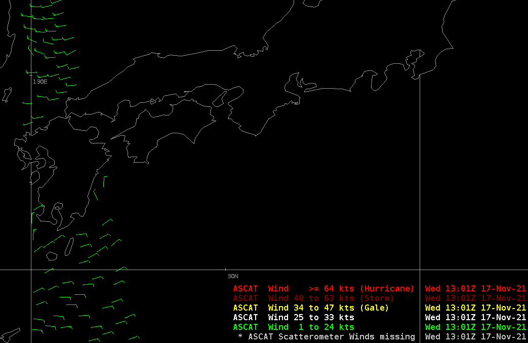
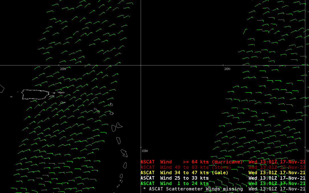
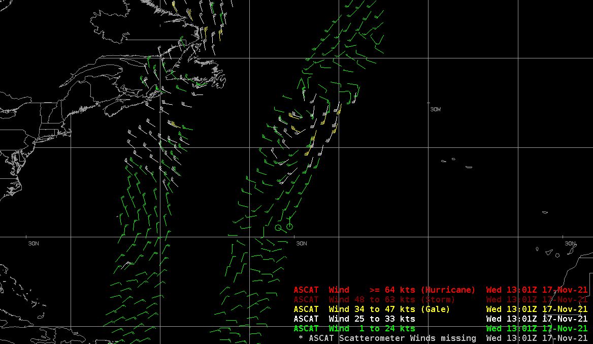
Color Maps: None. Legends are colored by wind speed as implemented by TOWR-S RPM. Ranges are 1-24 kts (Green), 25-33 kts (White, general advisory level range), 34-47 kts (Yellow, Gale), 48-68 kts (Dark Red, Storm), >= 64 kts (Red, Hurricane force)
Sampling: Observation time (Z), Wind Direction @ Speed in knots
Quality Flags: N/A
Technique: When overlayed with available surface operations and in-situ observations, scatterometer imagery assists in identifying and stating expected weather conditions within a marine forecast AOR, and identifying wind thresholds that meet Small Craft Advisory criteria.
AWIPS Technical Details
Sector | Global: 3-minute granules (33 per orbit); 1800km swath width |
Refresh Rate | 2 passes/day/satellite |
Size | ~16Mb/day |
Resolution | 25km |
Data Source | SBN |
Projection | N/A |
Storage Location | /data_store/bufrascat |
WMO Header |
Metop-B: JSYY(0[1-9]|10) KNES Metop-C: JSXX(0[1-9]|10) KNES |
Product Short Name | N/A |
Data Path | PDA → NCO → NCF |
AWIPS Configuration | Baseline. TOWR-S RPM v20+ updates the wind categories with a new wind range (25-33 kt), and descriptions of wind categories (e.g. Gale, Storm, Hurricane) |
AWIPS Plugin | bufrascat |
Edex Purge Rule | 12 versions |
Use Cases & More
Polar Satellite data products: Use cases and AWIPS implementations - J. Evans, L. Byerle, April 10, 2020
More information can be retrieved from OSPO, OSPO Imagery, and VLab Data Registry.
Point of Contact: Paul Chang
This page was last updated on March 26, 2024.