GOES Cloud Top Height

About 

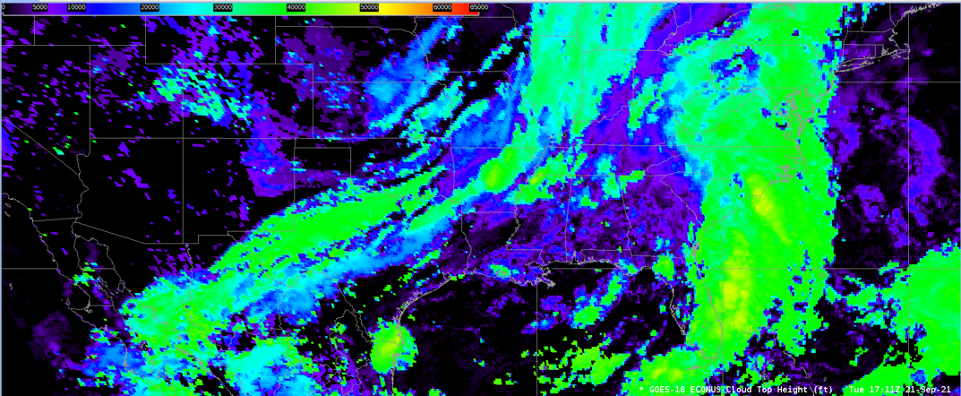
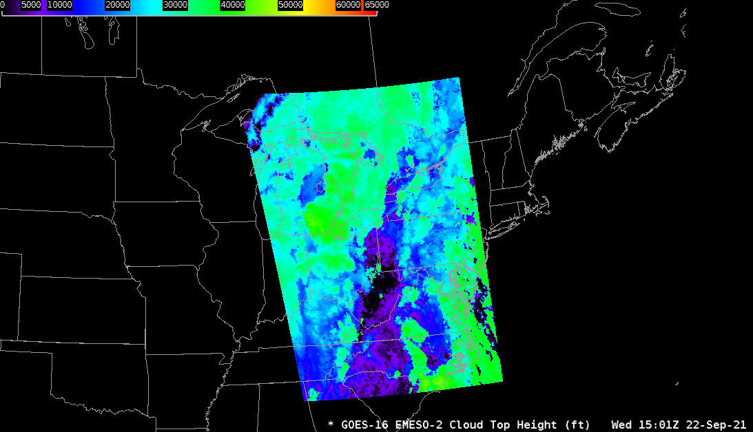
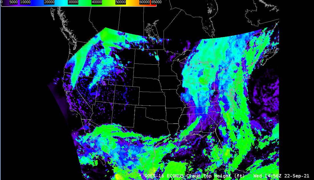
The GOES-R Cloud Top Height product produces cloud top heights in meters (which is converted to feet locally in AWIPS) for all cloudy pixels. The resolution of this product varies depending upon which image the satellite produces. For Full Disk and CONUS imagery, this product is 10km resolution. For a Mesoscale image, this product is 4km resolution. The GOES-R Cloud Top Height product is created both day and night. It is accurate to within 500 m (~1500 feet).

The GOES-R Cloud Top Height product is calculated on pixels that are determined to be either "cloudy" or "probably cloudy" by the GOES-R Cloud Mask algorithm. It utilizes GOES-R bands 11.2 um, 12.3 um, and 13.3 um. The GOES-R Cloud Top Height product relies on the infrared observations to avoid discontinuities associated with the transition from day to night.

Limitations

Sensitivity: The algorithm performance is sensitive to imagery artifacts or instrument noise.

Projection: The GOES-R Cloud Top Height product is not produced beyond 62 degrees local zenith angle.

AWIPS 

Location: GOES-East and GOES-West By Sector → Select Sector → Derived Products → Cloud Top Height

Color Maps: GOES-R/GOESR-L2/VTRSB (baseline). Units are in Feet. Dark colors imply colder clouds whereas light colors imply warmer clouds.

Sampling: Feet

Quality Flags: A “good quality” flag mask is used to retain pixels that meet good quality thresholds.

Technique: This product is useful when trying to assess the height of clouds, both convective and stratiform. For convective clouds, the Equilibrium Level of the environment can be inferred from this product which can assist with evaluating storm severity. Cloud Top Height may also be used in conjunction with visible 0.64um satellite imagery (CH 02) and 10.33 um satellite imagery (CH 13). Because of the increased cadence of these imagery channels, cloud vertical growth can be assessed and then compared to the Cloud Top Height product. The GLM Lightning Detection product can also be overlayed, as the amount of lightning will likely increase as the cloud top height increases.

AWIPS Technical Details

Sector Full Disk, CONUS, Mesoscale
Refresh Rate Full Disk: 10 min; CONUS: 10 min; Mesoscale: 1 min
Size ~30 MB/hr
Resolution 10 km at nadir
Data Source PDA
Projection GOES-R Fixed Grid
Storage Location /data_store/goes-r/
WMO Header GOES-East: IXTG99 KNES; GOES-West: IXTG89 KNES
Product Short Name OR_ABI-L2-ACHA[F|C|M1|M2|
Data Path SBN EXP
AWIPS Configuration Baseline
AWIPS Plugin goes-r
Edex Purge Rule 1 day baseline

Use Cases & More

More information can be retrieved from the Quick Guide, GOES-R, and STAR.

Point of Contact: Andrew Heidinger

Feedback Form

Submit questions and suggestions for the TOWR-S pages using this short form.

This page was last updated on March 26, 2024.