


"All-Layer" Grid - OCLO
All-Layer Grid
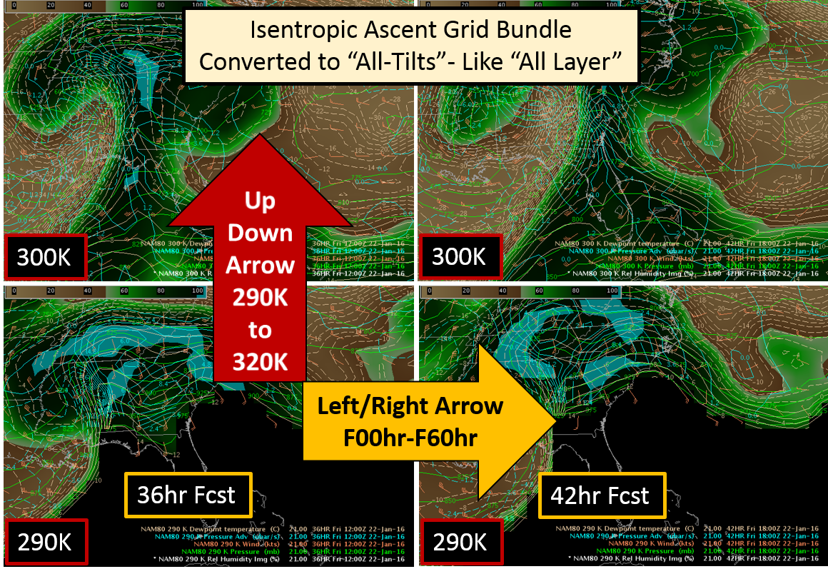
Fig. 1 "All-Tilts"-like "All-Layer" display of mesoscale ascent parameters in isentropic coordinates where up and down keyboard arrows navigate in space from 290K to 320K and left and right arrows navigate through time in a model run from 00HR to 60HR (animated gif from 290K-320K at each time step). Download the procedure at bottom of page to try it out.
AWIPS Procedure
- all-tilts ascent.xml (try me on any AWIPS build!)
- The easiest way to check it out is to download on an LX to your home folder, and load it using CAVE->Load/Save Displays->Load Displays and select the downloaded procedure with File button select tool. Once displayed, just copy in to your procedure if you want to save it.
Training Job Sheets (click on "html" for web page layout with image links or "PDF" for PDF viewing with images embedded with instruction)
- Creating an All-Layer Grid Jobsheet (html, PDF)
- All-Layer Grid described in 16.1.1 Informational Overview (LMS - Internet, speaker notes PDF)
Overview:
- If you convert your model grid bundles to all-layer displays, you can rapidly navigate through time (left/right arrows) and space (up/down arrows) similar to all tilts.
Refresher Commands:
- left and right-arrow keys – time navigation (e.g. forecast hour)
- up and down-arrow keys – layer navigation (e.g. height or theta)
- Ctrl + right-arrow keys – highest layer at largest time (i.e. forecast hour)
- Ctrl + left-arrow keys – lowest layer at smallest time (i.e. forecast hour)
- Ctrl + up-arrow keys – highest layer at time of data displayed
- Ctrl + down-arrow keys – lowest layer at time of data displayed
Usage Tips
- Convert any grid bundle in a procedure to an all-tilts bundle following the jobsheet below.
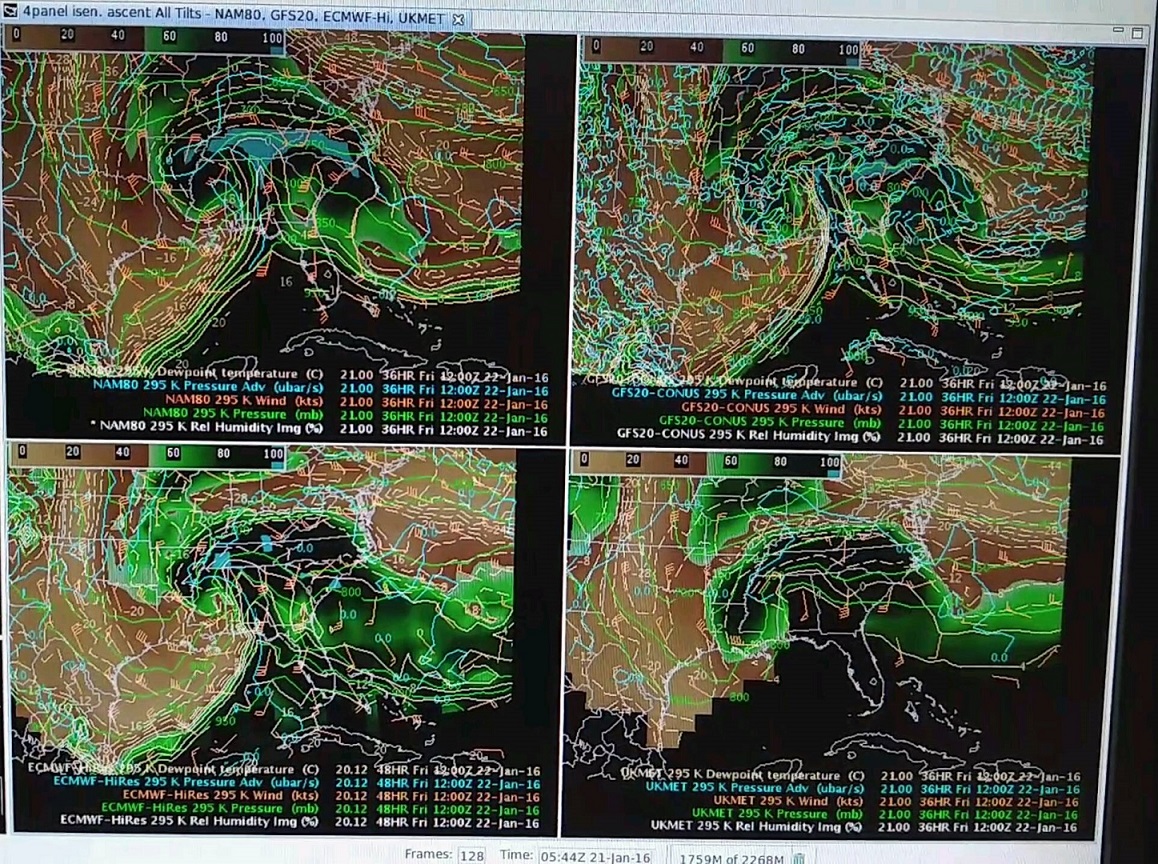
- Go for 4panel all-layer if you feel adventurous (see Fig. 2 and jobsheet below).
- Use the Alter capability to convert your all-layer bundles to use another model.
- Optimize your frame count to capture your model layers and forecast times to minimize memory usage (#_of_time_step + 1) * (number_of_layers) = frame count.
Limitations
- Requires some straightforward modification of saved bundle in the location perspective.
- Combined images in the All-Layer "spatial" mode sometimes have problems with time matching (throws lots of AlertViz time matching errors). You may need to rebuild the procedure without using paired images in order for this to work. Stacking the images and toggling them on/off appears to work fine.
Contact
- nws.wdtd.awips@noaa.gov