Development of an Updated Surge/Wave Grid to be used for NSEMs along the Atlantic Grid - OSTI Modeling
Development of Updated Surge/Wave Grid
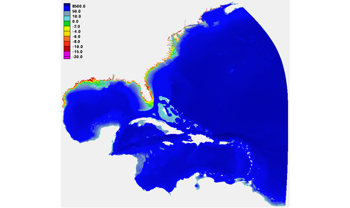
This project would develop a single grid for the Atlantic and Gulf of Mexico coastal waters of the United States, to be used in the Named Storm Event Model (NSEM) simulations. The grid would be based on modification to the existing Hurricane Surge On-demand Forecast System (HSOFS) unstructured triangular grid. The current HSOFS grid covers the entire Gulf of Mexico and extends into the Atlantic Ocean to the approximate longitude of 65W, allowing for appropriate generation of storm surge from atmospheric effects over a large region. Nearshore, the grid extends on to land up to a topographic height of 10m using an overland grid resolution of approximately 200m. This grid will be modified in the nearshore and overland areas to improve the NSEM’s ability to meet the COASTAL Act’s requirements, as determined by model testing. The grid will also be adjusted to (1) better represent features in regions vulnerable to inundation and (2) incorporate and better reflect new bathymetry and topography made available through other Bathymetry/Topography projects. The final modifications to the HSOFS grid will be tested with the ADCIRC-WaveWatch III coupled model system to ensure numerical soundness and stability.

Development of an updated Surge/Wave Grid to be used for NSEMs along the Atlantic Coast
