Meso-IDSS Blog - Operations Proving Ground
-
NE Texas/SE Oklahoma Tornadoes & Hail: 4/24/2020
A shortwave trough traversing the Central Plains set the stage for severe thunderstorms across southeast Oklahoma and northeast Texas (and the Ark-La-Tex region) on the afternoon of April 24, 2020. The SPC highlighted the threat area as an Enhanced Risk for all modes of severe weather,... Read More »
-
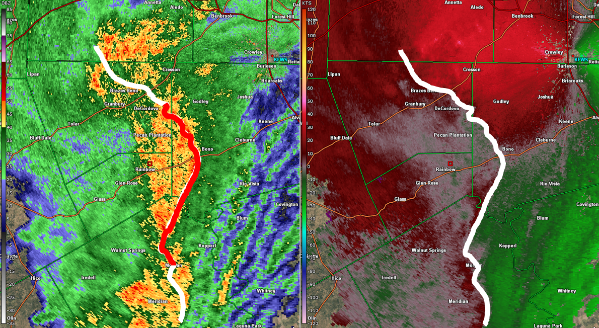
Mesoanalysis Using the Three Ingredients Method in North Texas: 2/20/2018
Would you issue a tornado warning based on the radar imagery in Figure 1? The rotational velocity (Vrot) of the circulation just northwest of Godley, TX (located about 20 minutes southwest of Fort Worth, TX) was only 15 kts; notably below what might be considered the typical “threshold” of 30... Read More »
-
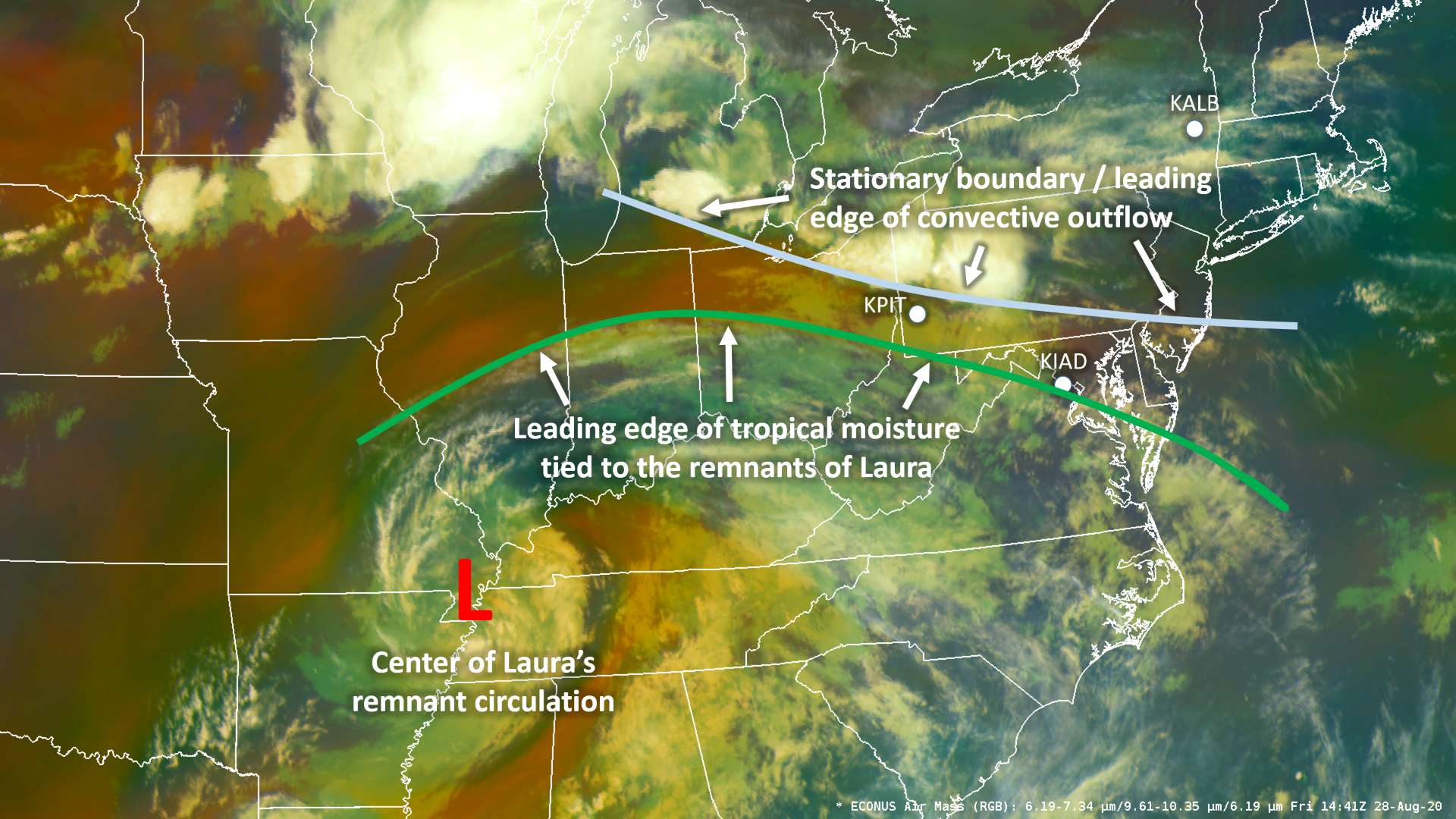
Surface Boundary & Air Mass Considerations for Storms Near Philadelphia, PA: 8/28/20
. On the evening of August 27th, decaying convection, which had produced severe wind across New York, Pennsylvania, and northern New Jersey earlier in the day ( see previous blog post ), had produced an outflow boundary which was... Read More »
-
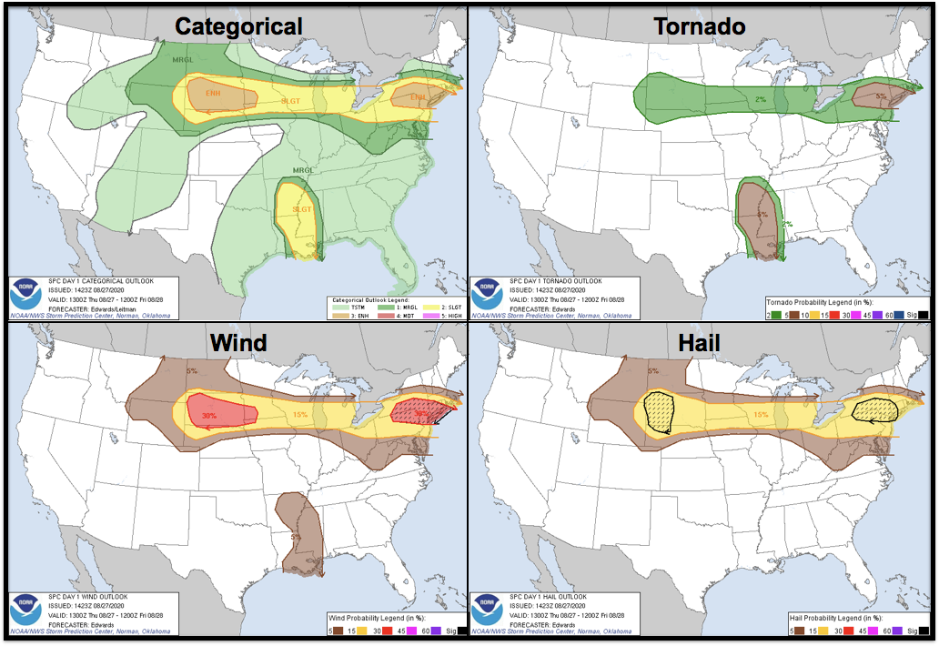
Late Summer Severe Storms in the Northeast & Mid-Atlantic States: 8/27/2020
. On August 27th, 2020, a potent closed low in the Canadian Maritimes with 500mb heights ranging 2 to 4 standard deviations below normal (Figure 1), and a ~1020mb high pressure over the Southeast U.S., resulted in a tight pressure... Read More »
-
Using Mesoanalysis to Message a Decreasing Severe Weather Threat in Nebraska: 6/21/2020
We often focus on how mesoanalysis allows for the enhancement of messaging in scenarios in which the severe weather threat is locally increasing. But mesoanalysis can certainly prove useful in providing clues that a particular severe threat may underperform original... Read More »
-
Anticipating & Communicating the Severe Threat Near La Crosse, WI: 6/2/2020
On the afternoon of June 2nd a shortwave trough was traversing the Northern Plains (Figure 1a). This feature, along with an area of 850-700mb frontogenesis, aided in sustaining elevated convection that had been slowly moving west to east across Minnesota through the day. Meanwhile,... Read More »
-
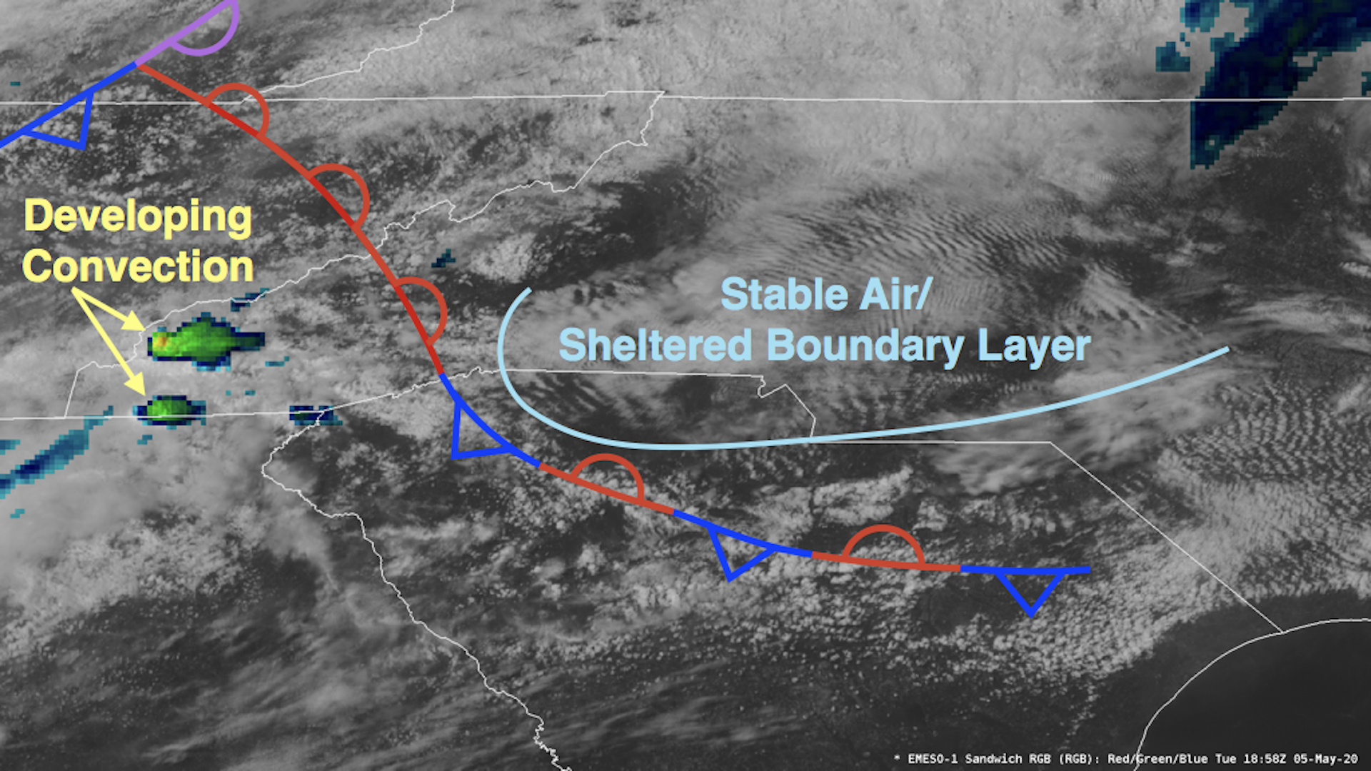
The Evolving Potential for Severe Hazards in the Carolinas: 5/5/2020
The Evolving Potential for Severe Hazards in the Carolinas: 5/5/2020 All severe hazards were possible on the afternoon and evening of May 5th in the Carolinas. The Storm Prediction Center (SPC) highlighted the area with a categorical... Read More »
