


Radar Color Tables - Snow Squalls and Snow Squall Warnings
Snow Squall Radar Color Tables
Overview
Significant snow squall events typically occur when max dBZ values exceed 30 dBZ and max radial velocities are in excess of 30 knots. Color tables have been developed to highlight these thresholds to aid in the decision warning process. Figure 1 highlights a snow squall event during the evening commute of February 8th, 2020 across the I-90 corridor east of Missoula, Montana. Trained spotters in Clinton reported snowfall accumulations of up to 2.5 inches during a one hour period. A broad area of 30-35 dBZ (seen in yellow) was observed by the KMSX radar in this case.
Download AWIPS cmap files: Reflectivity: Winter_dBZ_snow_squalls.cmap | Velocity: V_snow_squalls.cmap
Snow Squall Color Table Examples
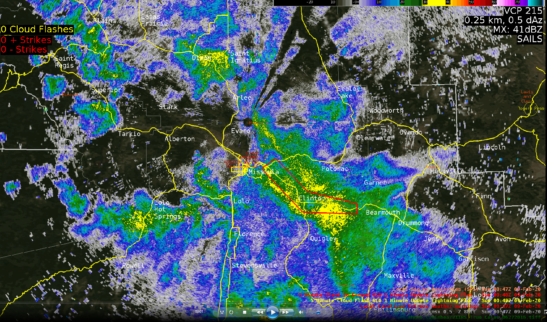
Figure 1. Winter snow squall reflectivity color table. Snow Squall event across the I-90 corridor east of Missoula, MT during the evening commute of February 8th, 2020.