Class of 2022 - The William M. Lapenta - NOAA Student Internship Program
-

Brianna Witherell
School: Southern Illinois University - Edwardsville
Major: Electrical Engineering
NOAA Affiliation: NESDIS GOES-R Office
Research Title
GLM Background Imagery in AWIPS Could Provide Critical Forecasting Data during ABI OutagesAbstract
The Geostationary Lightning Mapper (GLM) is an instrument onboard the GOES-R series satellites designed to continuously monitor and record lightning across most of the Western Hemisphere. In addition, the GLM also transmits visible-band (0.77 µm) background images that are used as calibration for the lightning detection. These images are ~8km grid spacing and are not geolocated or calibrated. However, because of the 2.5min full-disk sampling, the GLM background imagery provides a unique opportunity to fill in gaps for the main imaging instrument, the Advanced Baseline Imager (ABI). This gap filler may be considered for the case where ABI imagery may become unavailable. Supporting the availability of GLM background images to NWS forecasters in the event of an ABI outage requires the imagery to be available in the Advanced Weather Interactive Processing System (AWIPS). This presentation describes how the GLM background imagery for GOES-16 and GOES-17 has been made AWIPS-compatible through projecting the product onto the fixed grid, to the format of the ABI used routinely in AWIPS today. Upon making the GLM imagery AWIPS compatible, forecaster evaluations were performed. Feedback from demonstrations with five NWS forecast offices and the GLM working group are summarized. Initial feedback suggests the GLM background imagery would serve as a suitable backup to the ABI. In addition, a second project applied imagery bands from the GOES-R Advanced Baseline Imagery (ABI) to identify sea surface features important to NWS forecasters. In areas that are cloud free, the Gulf Stream, cold and warm eddies, the Loop Current, areas of upwelling, and additional sea surface features can be detected using the imagery, especially when they are looped over time. These ocean features have a large impact on vessel speed and their detection is critical to safe maritime operations. ABI shortwave Infrared (SWIR) band 7 and Window Infrared bands 13,14, and 15 of GOES-16 and GOES-17 were cleared of clouds blocking these features for the various ABI sectors (e.g. Full Disk, Conus, and Mesoscale) and processed efficiently in a real-time environment in AWIPS. Time averages were also performed in the real-time environment to filter shorter temporal signatures, and color enhancements were applied to accentuate the features.
-

Nadiyah Williams
School: Georgia Tech University
Major: Earth and Atmospheric Science
NOAA Affiliation: OAR/National Severe Storms Lab
Research Title
Comparative Analysis of Wind Observations from Doppler LIDAR and RadiosondesAbstract
Doppler lidar is capable of producing high-resolution, three-dimensional retrievals of the wind speed and direction. Typically, the retrieval accuracy decreases with increasing altitude and severe weather conditions; however, lidar remains a powerful tool for assessing the boundary layer. Radiosondes are capable of retrieving wind speed and direction at higher altitudes by tracking how fast it drifts, but it is common for erroneous upper-air data from particular stations to be rejected due to the balloon drifting far from the launch site and producing non-vertical profiles. This project aims to compare wind observations from lidar and sonde measurements in the boundary layer in order to evaluate their performance while observing moderate to severe weather conditions and to gain understanding about what each measurement type might represent in these varying conditions. Comparative analysis was performed to assess the relevance of wind observations collected by University of Oklahoma and National Oceanic and Atmospheric Administration. Results are expected to show that radiosondes become less representative of the conditions in which they are launched when the horizontal distance from the point they were launched is largest, which would generally occur in the strongest winds. Comparisons are underway to test this hypothesis fully, which will be shown.
-

Stephen Wegmann
School: Georgia State University
Major: Geosciences and Geography
NOAA Affiliation: OAR/Weather Program Office
Research Title
Telling the Story Behind the Social Science: Developing a Digital Storytelling Process to Translate the Findings of NOAA’s Hurricane Supplemental Social and Behavorial Science ProjectsAbstract
Story generation is the process of creating a narrative using a premise or summary—the term is commonly used within the field of artificial intelligence. However, conceptually, story generation can be applied to any writing one may do, especially when provided reference material, if the objective is to draw from the content a cohesive narrative. Effective storytelling makes a significant difference in all aspects of communication, doubly so in the domain of science where concepts can appear intangible without thorough contextualization. Adding concrete illustration and concise explanation of why and how scientific research is valuable to a broad audience increases the likelihood of engagement and action. This presentation will describe the development of an applied story generation process to translate and communicate the findings of four, NOAA-funded social and behavioral science projects that were designed to accelerate tropical cyclone risk communication and modernize the National Weather Service’s tropical cyclone product suite. To plan and execute story generation, this process used cloud-based brainstorming and storyboarding collaborative platforms, plain language writing, and ArcGIS StoryMap online tools to translate complex, scientific findings into a powerful, digital story. These components aid in organizing and crafting content and presenting scientific research findings in a compelling and engaging format that is more likely to connect with recipients from public educators to legislative officials.
-

Flora Walchenbach
School: University of Washington - Seattle
Major: Atmospheric Science
NOAA Affiliation: NWS/NCEP Environmental Modeling Center
Research Title
Evaluation of NOAA’s Operational/Experimental CMAQ in Regions Affected by WildfiresAbstract
The NOAA National Air Quality Forecast Capability (NAQFC) relies on the Community Multiscale Air Quality Modeling System (CMAQ). The CMAQ assembles meteorological, emissions, and air-chemistry transport models to simulate particulate matter, ozone, and other pollutants in the atmosphere, tracking movement of pollution plumes over time on a fixed three- dimensional grid in order to predict hourly pollutant concentrations and related processes (e.g.: deposition) for multiple vertical layers. Efforts are currently underway at NOAA to update the operational coupled offline GFS-CMAQ to a state-of-the-science online RRFS-CMAQ (Rapid Refresh Forecast System-CMAQ), providing 72-hour air quality forecasts for CONUS, AK, and HI twice a day at 06 and 12z cycles. In this project I work with the Environmental Modeling Center (EMC) to contrast the performance of operational and experimental CMAQ forecasts near and downwind of severe wildfire events. As the prevalence of wildfires increases, it is becoming only more important to accurately predict where smoke will migrate and potentially become a public health risk. By constructing a plotting tool in python to overlay EPA AirNow observations over forecasted air quality predictions for the same period, we can visualize discrepancies in real and modeled air quality and determine where each model may be succeeding or underperforming in regions affected by wildfires. Here I focus in more depth on a case study of ozone and PM2.5 in the Southwestern US from June 13-14 of 2022, during the Black Fire in NM and Haywire/Pipeline/Double Fires in AZ.
-
Jeffrey Wade
School: Syracuse University
Major: Earth and Environmental Science
NOAA Affiliation: NWS/OWP National Water Center
Research Title
Incorporating Physics-based Water Temperature Predictions into the National Water Model FrameworkAbstract
The development of a continental-scale water temperature model is a leading priority in the field of water quality prediction, given the recognized links between river thermal regimes and viability of ecosystems, in-stream habitats, and fisheries. We have developed a physics-based heat budget model to predict water temperatures using operational outputs from the National Water Model (NWM) Version 2.1, including meteorological forcings, streamflow, groundwater inflow, and channel geometry. Using several configurations of our model, including both Eulerian and reverse particle tracking semi-Lagrangian computational schemes, we explored the feasibility of incorporating sub-hourly water temperature prediction and forecasting into the framework of the NWM. Initial model results within a test basin suggest that heat budget approaches to water temperature modeling forced by NWM outputs can produce predictions with acceptable error to observed temperatures during summer baseflow periods. We found that the semi-Lagrangian scheme was better suited to generating water temperature predictions at the NWM’s desired spatial resolution and temporal frequency, as it produced convergent results with computational effort suitable to upscaling to larger spatial domains. Model performance in high-order mainstem channels exceeded that of first-order streams, likely due to the increased influence of groundwater inflow uncertainty along headwater reaches. Future model development will include application to additional test basins, the incorporation of reservoir heat and winter ice dynamics, and sensitivity analyses.
-

Wyatt Sullivan
School: Cornell University
Major: Computer Science
NOAA Affiliation: NWS/OSTI Meteorological Development Lab
Research Title
Monthly Climatologies for NBM, RTMA, NDFDAbstract
When analyzing real-time forecasts or historical weather data, it is often that context is desired. When a forecast predicts a high of 90 in an area on the 15th of May, we would also like to know what this predicted value means in context. Is this typical of May temperature in that area? Is it abnormally high? Is it a record high? Conversely, if we see a strikingly low forecasted temperature, we want to know how low it truly is. Is it in the 10th percentile of all May temperatures? Is it the record minimum? These questions can all be answered through monthly climatological data. Using 2.5km resolution historical weather data stored on Amazon Web Services (AWS) S3 within the NOAA Open Data Dissemination program, monthly climatologies have been generated for National Blend of Models (NBM), National Digital Forecast Database (NDFD), and Real-Time Mesoscale Analysis (RTMA) data. High-resolution percentile climatologies are created by aggregating element grid data from relevant grib files on S3. The percentiles of interest are 5th, 10th, 25th, 50th, 75th, 90th, 95th, max and min. Percentiles are created for continuous elements such as temperature, wind speed, wind gust, maximum temperature, minimum temperature, dewpoint, humidity, precipitation, and snowfall. The climatologies are stratified by valid time, meaning that percentile grids are produced for each valid time 00z - 23z. The results of the climatology calculations are exported to Tag Image File Format (TIFF) files (file format used to store raster graphics) so they can be easily displayed using mapping software. With these percentile distributions, we are able to provide further context to the forecast data. Climatologies are created using Python as the main programming language, aided by packages such as Geospatial Data Abstraction Library (GDAL) and NumPy. NumPy’s percentile method is used to create the percentile data. The climatology Python script is going to be run after every month in order to add new data to the climatologies and keep the percentiles up to date. The processing can be easily expanded to add new elements. The climatological data is slated to be integrated into two web pages developed by MDL. Using the percentile grids, we can compare any grid-based forecast map to the percentile values of the same month to create a map that represents the percentile that each gridpoint’s element value falls into. With this, we can objectively observe which gridpoints are experiencing typical monthly conditions, which ones are abnormally low or high, and to what magnitude. Further, if more context about a singular gridpoint is of interest, functionality has been included that allows a user to click on an individual gridpoint to display a box-and-whisker plot that shows where that gridpoint’s value falls within the distribution. This also allows the user to compare NBM, NDFD, and RTMA gridpoints and their distributions, as each of these three types are included in the box and whisker plot.
-

Kirsten Snodgrass
School: Mississippi State University
Major: Geoscience
NOAA Affiliation: NWS/NCEP Storm Prediction Center
Research Title
Verification of NOAA/NWS Storm Prediction Center Calibrated Severe Hazard GuidanceAbstract
For over a decade, the NWS Storm Prediction Center (SPC) has produced 4-hr and 24-hr calibrated probabilistic guidance for tornadoes, severe hail, and severe wind hazards within the Day 1 convective period (1200 - 1200 UTC). This guidance is produced from a combination of maximum neighborhood probabilities of 1) High Resolution Ensemble Forecast (HREF) storm-attribute variables and 2) Short-Range Ensemble Forecast (SREF) environmental variables paired with 3) the historical frequency of a hazard report occurring within 25 miles of a grid point. This guidance has been made internally available to SPC forecasters and externally available via the HREF viewer hosted on the SPC website. In May 2021 this guidance became operational in the National Weather Service (NWS), allowing it to be distributed publicly via National Center of Environmental Prediction (NCEP) web services, serve as a component to SPC timing guidance (under development), and is currently scheduled for incorporation into version 4.1 of the National Blend of Models (NBMv4.1). With recent upgrades to the HREF membership and scheduled retirement of the SREF, developmental work has focused on recalibrating the existing HREF/SREF guidance, as well as developing new calibrated guidance, that 1) utilizes environmental variables from the HREF and Global Ensemble Forecast System (GEFS, substituting for the SREF), 2) explores alternative storm-attribute and environmental variables and combinations, 3) explores alternative truth datasets (e.g., Maximum Estimated Size of Hail, MESH), and 4) extends into the Day 2 convective period. These new and existing versions of calibrated guidance were evaluated in the 2022 Hazardous Weather Testbed (HWT) Spring Forecasting Experiment and objectively verified as part of this project through The William M. Lapenta NOAA Student Internship Program. This presentation provides objective verification results that were completed utilizing the 24-hr operational HREF/SREF calibrated guidance compared to two versions of experimental HREF/GEFS calibrated guidance for the period 15 March 2022 to 15 July 2022, as well as various sets of operational and experimental calibrated guidance that were evaluated in the 2022 HWT Spring Forecasting Experiment.
-

Subhatra Sivam
School: University of Maryland – College Park
Major: Atmospheric and Oceanic Science, Theatre
NOAA Affiliation: OAR/Pacific Marine Environment Lab
Research Title
Comparing Models to Saildrone Measurements of Air-Sea Heat Flux near the Arctic OceanAbstract
Unscrewed surface vehicles, such as the wind-driven and solar-powered saildrones, are essential in collecting in situ observations of marine variables. Latent heat flux, the air-sea energy exchange that occurs when water evaporates or condenses at this level, and sensible heat flux, the air-sea energy exchange that occurs because of the temperature differences at this level, are collected and compared to model predictions of the same variables. The model values are extracted at the time and location in which the saildrone collected data from the years 2017 - 2019, and have been plotted in different ways to examine the differences. By assessing these differences, models can become more accurate to better understand Arctic environments.
-
Ashley Stagnari
School: Cornell University
Major: Environment and Sustainability
NOAA Affiliation: OAR/Weather Program Office
Research Title
Working with Stakeholders: Engaging Sectors to Influence the Future of EPIC and UFSAbstract
Amidst the challenges posed by extreme weather events and the progression of climate change, committing to the advancement of weather forecasting and prediction is pivotal to enable impactful societal outcomes. The rising frequency and challenge to predict extreme weather events calls for cross-sector partnerships. Through the Unified Forecast System (UFS), the sectors can collaborate to accelerate advances in the Nation’s operational forecast modeling systems. Moreover, integrating stakeholder feedback and engagement can help align user, developer, and operational needs to the technological aspects of the Earth Prediction Innovation Center (EPIC) and UFS. In this report, community engagement best practices generated from a literature review of previous social science research were applied to feedback collected during the 2022 Unifying Innovations in Forecasting Capabilities Workshop (UIFCW) hosted by the EPIC, the UFS, and UFS Research to Operations (R2O) Project in College Park, Maryland and online. Stakeholder feedback was collected from Slack (a collaborative messaging program), workshop events, question and answer sessions, and a post-workshop survey. By collecting and analyzing feedback, various community engagement elements were evaluated for their presence, absence, and need for improvement. This work highlighted the need to define community as it relates to a cross-sector involvement to improve weather modeling (Michaud & Eosco, 2022), elaborate on community membership, clarify governance structures, and evaluate action plans for committing to goals established at meetings such as the UIFCW. Finally, the author will share ideas for a path forward in an effort to help improve the UFS and EPIC’s goals to build a modeling community and improve operational weather prediction.
-

Rohan Shroff
School: Cornell University
Major: Atmospheric Science
NOAA Affiliation: NWS/NCEP Climate Prediction Center
Research Title
Individual versus Collective ENSO ForecastingAbstract
The El Niño-Southern Oscillation, or ENSO, is a pattern with climate anomalies that extend across the tropical Pacific Ocean, and significantly influences temperature and precipitation anomalies across the globe. The official ENSO forecast produced by the Climate Prediction Center of the National Weather Service currently uses a consensus methodology where each ENSO forecaster (varies between 7 and 12) is equally weighted to produce the final forecast. One question is whether the official collective average provides more skillful forecasts than the individual, anonymous forecasters that are used in that average. Whether or not this method improves forecast accuracy is analyzed using seven years of forecast data (2015-05-01 – 2022-05-01). Forecast verification scores, such as mean and absolute mean error, mean squared error (MSE), bias, error variance, and the MSE Skill Score (MSESS), were analyzed. We find that the consensus method of ENSO forecasting is generally more accurate than individual forecasters. The consensus forecast has the lowest mean absolute error (0.267 °C) and MSE (0.14) when compared to individual forecasters, especially those who are missing fewer than 25% of forecasts. As expected, both MSE and mean absolute error increase with longer forecast lead times. A warm bias is also evident in consensus and individual forecasts, with a mean consensus error of 0.12 degrees °C. 5 out of 18 forecasters also had a mean error above 0.2 degrees °C, with only one forecaster out of 18 having a negative mean error. The warm bias primarily shows up at longer forecast lead times, beyond 3 seasons. Regardless, this analysis demonstrates that collective forecasting for producing ENSO forecasts results in superior forecast accuracy relative to individual forecasters.
-

Liam Sheji
School: The State University of New York at Albany
Major: Atmospheric Science and Meteorology
NOAA Affiliation: OAR/Air Resources Lab
Research Title
Influence of the COVID-19 Pandemic on Black Carbon and Carbon Monoxide Emissions in the New York City Metropolitan AreaAbstract
Black carbon (BC) poses a significant public health concern and the measurement of BC comes with great uncertainties. Carbon monoxide (CO) is often emitted from similar and/or collocated sources, which makes analyzing BC emissions in urban areas more attainable. The COVID-19 pandemic restrictions resulted in a decrease in emissions of many pollutants nationwide due to stay-at-home orders, which provided a great opportunity to investigate the impacts of the pandemic on anthropogenic emissions. The University of Maryland Cessna 402B research aircraft equipped with a suite of trace gas and aerosol absorption and scattering observing instruments conducted a series of flights in 2020 to measure mass concentrations of several trace gases, including BC and CO. In combination with data from a near-road (NR) site in Queens, New York, it is possible to determine the flux of these gases from New York City (NYC) using a mass-flux balance approach. The average of 11 flights over NYC between April and September 2022 resulted in a mass flux of 2.03 and 323 Gg yr -1 for BC and CO, respectively. Higher enhancement ratios of BC/CO on weekdays versus the weekend were observed and are likely due to more diesel trucks on the road on weekdays. All NR and flight BC and CO measurements are positively correlated. The flight and NR data are compared to two “bottom-up” emission inventories from the pre-COVID National Emissions Inventory (NEI) and the Emissions Database for Global Atmospheric Research (EDGAR) models. The NEI and EDGAR show BC emission values of 2.46 and 2.78 Gg BC yr -1 (~ 21% less than the flight averaged emission value) for the flights conducted in NYC. Possible reasons for discrepancies are discussed.
-

Jackie Sepulveda
School: Valparaiso University
Major: Meteorology
NOAA Affiliation: OAR/Weather Program Office
Research Title
Evaluating the Capabilities of an Open Source Data Assimilation SystemAbstract
The Earth Prediction Innovation Center (EPIC) Program has a mission to be a catalyst for community research and modeling advances, leading to an inclusive scientific community initially focused on Numerical Weather Prediction. Developing multi-platform testing capabilities of the end-to-end applications with documentation will aid EPIC and UFS along with their stakeholders in expanding and enhancing efforts in providing community-wide open-source content. Doing so will fulfill the mission and vision of both EPIC and NOAA. In an effort to understand the utilization, accessibility, and community code development of the Joint Effort for Data assimilation Integration (JEDI)-based Data Assimilation (DA) systems, this project focuses on building data assimilation products from end-to-end on the Orion environment. The intention of this project is to utilize high-performance computing (HPC) to integrate the JEDI framework with UFS applications and find areas of accessibility, buildability, and overall success of the end-to-end open source coding applications.
To complete this work, we ran a fully cycled Next Generation-Global Ocean Data Assimilation System (NG-GODAS) marine JEDI-Sea-Ice Ocean Coupled Assimilation DA system with sea surface temperature as the forecast variable on an HPC platform – “Orion”, at Mississippi State University, for a 15-day span (April 15-30, 2021). Run time, errors, experience, and internal access limitations were analyzed. These results will demonstrate the end-to-end applications for the NG-GODAS marine JEDI systems from multiple cloud based HPC platforms. -

Victoria Scheidt
School: University of Michigan – Ann Arbor
Major: Meteorology and Climatology
NOAA Affiliation: NWS/WPC Weather Prediction Center
Research Title
Evaluating WPC’s Excessive Rainfall Outlook Using an Object-oriented ApproachAbstract
One of the most deadly and damaging weather phenomena in the United States is flash flooding, typically brought on by heavy precipitation. The Excessive Rainfall Outlook (ERO) created by the Weather Prediction Center (WPC) is one of the many products released to help predict flash floods by determining the risk of rainfall exceeding the flash flood guidance within 25 miles of a point. Our aim is to identify and display biases in the forecast using object-based verification. This project uses the Model Evaluation Tools (MET) software for the Method for Object-Based Diagnostic Evaluation (MODE) to identify objects in the ERO and Practically Perfect (PP) from 01 May 2015 to 30 April 2022. PP is a statistical tool designed to mimic the ERO if the forecasters had perfect knowledge of the verification using observations and proxies for flash flooding. EROs are issued out to three days with risk categories of marginal (MRGL), slight (SLGT), moderate (MDT), and high (HIGH). MODE matched PP and ERO objects (e.g. determined two objects in separate fields are the same object) according to all the categories above, excluding MRGL. Object-based biases and errors in regional, seasonal, and yearly ERO are analyzed using a variety of plots including; wind rose, box plot, bar graphs, heat maps, and arrow maps. Key results from these graphs show that, on average, predictions are getting better each year, centroid displacements are generally toward the east/ northeast in the SLGT category, and area mean error is the highest overall in the winter and spring months.
-

Bruno Rojas
School: Penn State University
Major: Meteorology
NOAA Affiliation: OAR/Atlantic Oceanographic and Meteorology Lab
Research Title
A Structural Analysis of Hurricane Dorian (2019) during Rapid IntensificationAbstract
Hurricane Dorian (2019) was an Atlantic hurricane that underwent rapid intensification (RI) preceding the most damaging landfall to the northern Bahamas in recent memory. Part of the difficulty in understanding and predicting RI are structural changes to the hurricane. Two structural aspects are analyzed in this study: the alignment of a tilted vortex, and an early period of secondary eyewall formation. This analysis was conducted using the Hurricane Ensemble Data Assimilation System (HEDAS), based on the Hurricane Weather Research and Forecasting model (HWRF). Depending on data availability, HEDAS is capable of assimilation of satellite derived atmospheric motion vectors, land based doppler radar winds, and data obtained from aircraft reconnaissance missions which includes flight level data, dropsonde data, and winds derived from the tail doppler radar. Our findings show that during the period of vortex alignment, the vertical wind shear through two layers was opposite in direction, indicating this configuration may be favorable for vortex alignment. At the end of the RI period, an eyewall replacement cycle (ERC) took place, and HEDAS analyses available. The analysis shows a secondary wind maximum and a mesoscale descending inflow feature in the rainband region. This demonstrates that HEDAS is capable of resolving these complex features.
-

Kaitlyn Roberts
School: West Connecticut State University
Major: Meteorology
NOAA Affiliation: NWS/OPPSD Central Processing
Research Title
Outreach Efforts Regarding AWIPS Product DevelopmentAbstract
The National Weather Service Office of Central Processing is continually working on creating and implementing advances in the AWIPS software program. Many of these efforts are long-term and behind the scenes, so field employees may not be aware of them until they are implemented. In this project, I interviewed AWIPS development project leads on several AWIPS changes currently in progress and distilled the information into presentations. These presentations will be shared with National Weather Service employees in order to broaden their knowledge and understanding of upcoming changes to the AWIPS program.
-

Christopher Picard
School: Dartmouth College
Major: Environmental Earth Sciences
NOAA Affiliation: NWS/NCEP Ocean Prediction Center
Research Title
Assessment of Arctic Sea Ice Edge Location Forecasts Using Model, Satellites, and Ice Charts to Better Inform Polar MarinersAbstract
The United States National Ice Center (USNIC) utilizes cutting edge models and satellite observations to inform polar mariners of the present location and forecasted location of sea ice in high latitude regions. Everyday, USNIC ice forecasters produce 48-hour Special Arctic Regional Oceanographic Synopsys (called SPAROS forecasts) of sea ice edge based on model outputs, temperature, pressure and wind data, and 7-day advanced scatterometer loops, among other sources. While USNIC ice forecasters engage in intensive quality control measures for SPAROS forecasts each day, there remains a need to quantify the accuracy of these forecasts and identify geographic regions that need improvement. Here we create an automated model that compares SPAROS and Global Ocean Forecast System (GOFS) 48-hour forecasts of sea ice to the USNIC analyzed daily marginal ice zone product (MIZ) to assess forecast accuracy. On average, the USNIC SPAROS forecasts overestimate and underestimate sea ice extent by approximately 2.4% and 1.4%, respectively, and the SPAROS forecasts significantly outperform the GOFS model. We find the SPAROS forecasts are especially accurate in the Laptev Sea, the East Siberian Sea, and the Chukchi Sea. Compared to the MIZ, both the forecaster-created SPAROS and the GOFS model output have their largest differences in the Gulf of Ob and the broader Kara Sea region. Overall, we find USNIC ice forecasters consistently provide the most accurate 48-hour forecasts of Arctic sea ice edge available. Importantly, this model provides USNIC ice analysts with an important tool to assess the accuracy of daily SPAROS forecasts and to better inform polar mariners through improved forecast accuracy.
-

Sarah Pappas
School: Marshall University
Major: Geography and Meteorology, Applied Mathematics
NOAA Affiliation: NWS/NCEP Weather Prediction Center
Research Title
Verification of the WPC Winter Storm Severity Index (WSSI)Abstract
The Winter Storm Severity Index is an operational tool created by the Weather Prediction Center. The purpose of the WSSI is to function as a situational awareness tool, which functions by categorizing winter storm severity into impact levels for the continental United States. The WSSI currently uses six components to determine how winter weather is causing impacts: blowing snow, flash freeze, ground blizzard, ice accumulation, snow amount, and snow load. The WSSI uses National Weather Service forecasts from the National Digital Forecast Database (NDFD) to create an impact level-based forecast using Geographic Information Systems (GIS). The five impact levels are limited, minor, moderate, major, and extreme. The WSSI uses meteorological and non-meteorological factors to determine a societal impact level from 1 to 5 for each category. This includes a two-day snowfall climatology that helps to delineate impacts from snowfall across the climatologically diverse CONUS. Verification of the WSSI each year allows necessary improvements to be made in its forecasting to better inform the public about potential impacts. Verification of the 2021-2022 winter storm season has revealed the importance of improving the mountainous forecast areas. This season’s verification involved manual counting of the highest forecasted impact level for each category. While subjective, it allows less skewed numbers due to a single stray pixel of a higher forecasted impact level being counted by an automated process. This year, the use of zonal statistics was introduced via ArcGIS to display the number of days and which impact level each National Weather Service forecast zone saw for each component and overall. This helps to home in on the impacted areas allowing for more targeted improvements to the WSSI algorithms than had been done in the past. The displaying of the zonal statistics will show why current WSSI changes are being made, along with some of the struggles in winter forecasting.
-

Marissa Osterloh
School: Iowa State University
Major: Meteorology
NOAA Affiliation: OAR/Great Lakes Environmental Research Lab
Research Title
Seasonal, Interannual and Decadal Variability and Long-Term Trend of Ice Cover in Saginaw Bay and Georgian Bay in the Great Lakes between 1973-2022Abstract
Great Lakes ice cover is a sensitive indicator of regional climate change. Although seasonal ice cover is repetitive yearly, there is high interannual variability in ice cover for each Great Lake. A driving factor in investigating variability in ice cover for the Great Lakes is that different Great Lakes may experience different spatial and temporal variability related to each lake’s orientation, depth, and turbidity. A deeper understanding of ice cover climatology for the Great Lakes is important for better ice cover forecasts for future winter seasons. The Great Lakes are important sources of drinking water, transportation, hunting, and fishing, for the UnitedStates and Canada, so having accurate projections for ice cover is important from an ecological and economical standpoint. In this study, we focused on Saginaw Bay and Georgian Bay in Lake Huron, where we evaluated the 50-year ASCII winter dataset of ice charts produced by the National Ice Center (NIC). We used the NOAA’s CoastWatch mask to subset our locations from the dataset. From here, we looked at variables such as daily averages of ice cover from December 1st to April 30th (the average winter season), average annual ice cover (AAIC), average maximum ice cover (AMIC), and duration of ice cover. Furthermore, we also evaluated differences in bathymetry and latitudinal coordinates of the two Bays to better understand which parameter may have a larger impact on ice cover and duration. We also considered other atmospheric forcings, such as the El Nino-Southern Oscillation (ENSO), in our evaluation of our findings. Results indicate that the ice cover growth during the seasonal cycle between Saginaw Bay and Georgian Bay has notable differences, primarily due to the differences in bathymetry between the Bays. It is found that both Saginaw Bay and Georgian Bay show decreasing trends in AAIC and AMIC, but Georgian Bay is highly volatile and is decreasing at a faster rate despite the Bay being located further north. This finding shows that deeper bathymetry of a Bay may result in that Bay being more susceptible to climate forcings resulting in a larger interannual variability. This report aims to show variability in ice cover for Saginaw Bay and Georgian Bay on seasonal, interannual, and decadal time scales to better understand ice climatology for theGreat Lakes and improve future ice projections for the area.
-

Maite Morales Medina
School: University of Puerto Rico
Major: Environmental Health
NOAA Affiliation: NESDIS Satellite Applications and Research
Research Title
Atmospheric Satellite Data Applications and User Engagement in the U.S.: Solar Energy Industry Assessment from June 6 to August 12, 2022Abstract
Technology and satellite products are advancing. Consequently, data can be over overwhelming for end users, including public and private sector. Therefore, the User Engagement Process is essential to help NOAA better understand what users are currently utilizing for decision making and where gaps in services lie. Our purpose in this project is to assess how atmospheric composition data can provide value to the community, since we will have an atmospheric composition instrument on our next generation geostationary satellites. Our methodology is based on Jobs-To-Be-Done Theory to understand the needs of different users better and create new or enhanced products and services to meet the evolving needs of users. This method includes tree main steps: Find users, Interview process and Analyze outcomes. In order to have a target community and find end users, we analyze the total of satellite products of atmospheric composition (15) from NESDIS data base and organize them by potential applications in the community. During this process, four main categories were deployed. However, since today is an increasing industry that depends on atmospheric data for product, we choose to work with the Solar Energy community. Five potential end users from private, public and academia sector were contacted. One form the private sector, Tesla Forecasting Company, was able to perform the interview. The Interview help us to go through the process of job mapping. This method is related to Jobs-To-Be-Done Theory and allow us to understand different tasks and goals a user is trying to accomplish. As a result, we define the company’s job, which is provide their clients with hourly weather forecast to monitor solar energy production. The needs of the company were centered on the accessibility of radiance data. However, we notice during the interview that the company do not have access and do not provide their clients with aerosols forecast, such as dust, ashes and smoke. Several studies have found that Aerosols causes a drop in the efficiency of photovoltaic panels, which translates to a decline in the amount of power produced and lost income for their operators. These information is important to NOAA in order to acknowledge these gaps in the solar energy community and better support this industry. The User Engagement Process enhances relationships and increases collaboration among partners and end users. Also, informs STAR and NESDIS on user needs to make informed decisions on prioritization of
products and services. -

Diana Montoya-Herrera
School: University of San Diego
Major: Integrated Engineering emphasis Sustainability
NOAA Affiliation: OAR/Geophysical Fluid Dynamics Lab
Research Title
Quantifying the Impact of Model Resolution on the Representation of Marine Heat WavesAbstract
Marine Heatwaves (MHWs) are periods of time when there is a high accumulation of heat in the ocean surface boundary layer. MHWs are generated through coupled phenomena, influenced by both atmospheric and ocean processes. To classify a MHW, sea surface temperatures must be warmer than the 90th percentile of the recorded climatology, last for at least five days, and the sea surface temperature must not decline under the 90th percent for more than two consecutive days. In this study, we quantify the impact of ocean model resolution on the statistics of MHWs simulated in a coupled-climate model; specifically the simulated frequency, duration, and cumulative intensity of MHWs. This work uses output from the National Oceanic and Atmospheric Administration’s (NOAA) Geophysical Fluid Dynamics Laboratory’s (GFDL) coupled climate model, CM4. CM4 is a coupled atmosphere-ocean general circulation climate model and is configured with a 50km atmosphere resolution. For this work, two configurations of the model are run with different ocean resolutions: an 1⁄8 of a degree high resolution run and a 1⁄4 degree companion run. The configurations are otherwise identical and run for 200 years with pre-industrial forcing. Here we analyze sea surface temperature output of the pre-industrial control simulations from years 21-200 at a coastal point near Western Australia and compute statistics of the MHWs duration and cumulative intensity. The analysis is repeated at locations off of Peru, Brazil, and the Pacific Northwest coast, all regions which have had significant and recent MHW activity. In all the locations, MHWs in the high resolution simulation are shorter, more frequent, and stronger compared to those identified in the companion run. Our analysis of the differences in representation of pre-industrial MHWs from simulations of varying ocean resolutions of CM4 could lead to a better understanding of present-day MHW events.
-

Jared McGlothlin
School: University of Washington - Seattle
Major: Atmospheric Science
NOAA Affiliation: OAR/Pacific Marine Environment Lab
Research Title
Using Saildrones to Assess Atmospheric Reanalysis Air-Sea Heat Fluxes in the Tropical PacificAbstract
The ocean and atmosphere interact through air-sea fluxes, or exchanges of heat and energy across the air-sea interface, that have important implications on global weather and climate patterns. To compensate for the limited availability of direct flux observations over the ocean, numerical weather prediction (NWP) reanalyses use bulk algorithms based on state variables to estimate these fluxes. However these have been shown to have large errors and biases that can affect predictions. This project aims to assess bulk flux estimates from multiple atmospheric reanalyses including NCEP Climate Forecast System Reanalysis (CFSR), ECMWF Reanalysis v5 (ERA5), NCEP/NCAR Reanalysis 1 (NCEP1), and NCEP/DOE Reanalysis 2 (NCEP2) through comparisons against new in situ observations collected by Saildrone Uncrewed Surface Vehicles (USV) in the central tropical Pacific. Preliminary results indicate that all of the reanalyses had a strong correlation between USV observations for net heat flux and net SWR, but the correlation was much weaker (0.5 to 0.7) for other flux components and very weak (~0.25) for the net longwave radiation for NCEP1 and NCEP2. The daily root mean square errors and biases for net heat flux range from 70 to 95 W/m^2 and -24 to -74 W/m^2 respectively, with CFSR doing the best and NCEP2 doing the worst for both. However, the CFSR struggles on smaller timescales with errors almost doubling . All products showed increased disagreement in net heat flux and its components near the Hawaiian Islands and in the ITCZ but increased agreement in the eastern equatorial Pacific cold tongue. Further work looking at surface winds and currents is needed to understand their impact on bulk flux estimates.
-

Ryan Martz
School: University of Nebraska - Lincoln
Major: Meteorology and Climatology
NOAA Affiliation: NWS/NCEP Weather Prediction Center
Research Title
Preliminary Verification and Overview of Weather Prediction Center's Day 3-7 Hazards ForecastsAbstract
The Weather Prediction Center (WPC) took over responsibility for the Day 3-7 Hazards forecast from the Climate Prediction Center (CPC) in early 2019. Since taking over this product, there have been no studies done to assess the quality of the product or summarize seasonal characteristics of hazard forecast areas. This study seeks to examine a climatology of the three different precipitation hazards issued in this product (Heavy Rain, Heavy Precipitation, Heavy Snow) along with a verification of their accuracy for the period of April 2019 through March 2022. We developed a climatology by looking at a spatial distribution of the different hazards in each season and for each forecast day. For these climatologies, spring was defined as April - June, summer as July - September, fall as October - December, and winter as January - March. Hazards were verified against observed precipitation (Stage IV 24-hour Quantitative Precipitation Estimation (QPE) for Heavy Rain, National Operational Hydrologic Remote Sensing Center (NOHRSC) gridded 24-hour snowfall analysis for Heavy Snow, and merged QPE and NOHRSC snowfall data for Heavy Precipitation) contours that matched the intensity requirements for hazard issuance. We used the average observed fractional aerial coverage of each hazard to work toward development of a probabilistic forecast method to improve the utility of the Day 3-7 Hazards forecast for core partners.
-

Jordan MacIsaac
School: Purdue University
Major: Planetary Science
NOAA Affiliation: OAR/Geophysical Fluid Dynamics Lab
Research Title
Investigation of Changes in Steric Sea Level Due to Antarctic MeltwaterAbstract
As global temperatures continue to warm under the influence of anthropogenic climate forcing, freshwater melt from glaciers and land ice contribute to sea level rise. While the addition of mass to the oceans causes a direct rise in sea level, there are secondary sea level effects to consider. Thermosteric (temperature-dependent) and halosteric (salinity-dependent) changes in ocean circulation contribute to a redistribution of subsurface heat and salt. Using results from idealized simulations performed with the GFDL-CM4 numerical climate model, we analyzed simulations where fresh meltwater was supplied to the ocean off the Antarctic coast at a constant rate (0.1 Sv) for 70 years with no other forcings present. We compare the results of this perturbation experiment with a long 500-year preindustrial control simulation to analyze the anomalous change in sea level associated with the secondary impacts of Antarctic meltwater. Our results indicate that the meltwater forcing leads to a robust increase in steric sea level off the coast of Antarctica, followed by a steric decrease in lower latitudes. The Antarctic meltwater also leads to a steric increase in sea level that is present throughout much of the Atlantic basin. Thus, even though the meltwater forcing is localized in the Southern Ocean, there are significant remote changes that extend into further basins. These findings can provide the basis for further investigation into the depth of these changes within the water column and highlight the importance of secondary influences of sea level rise from Antarctic ice sheet melt.
-

Kimberly Mace
School: University of Florida - Gainesville
Major: Statistics
NOAA Affiliation: OAR/Office of Ocean Exploration and Research
Research Title
Modeling the Habitat Suitability of Deep-Sea Sponges on the Blake PlateauAbstract
Deep-sea sponges are vital organisms within deep-sea ecosystems, but they are vulnerable to many impacts of anthropogenic activities including commercial fishing, oil extraction, and rising ocean temperatures. While the value of deep-sea sponges is known, little research aimed at sponge exploration or modeling exists. The goal of this study was to expand upon the available literature and analysis on the distribution of deep-sea sponges, specifically in the Blake Plateau, located offshore of the Southeastern United States. The habitat suitability of deep-sea sponges on the Blake Plateau was modeled and used to make predictions about the effect of seafloor topography on the suitability of predicting sponge habitat. Seafloor topography and bathymetry data (mean depth, slope of the seafloor, rugosity, curvature, and aspect) were generated from multibeam bathymetry collected by NOAA Ocean Exploration. Presences of sponges were mined from NOAA’s Deep Sea Coral Research and Technology Program deep-sea coral and sponge database. Data were organized and cleaned in ArcGIS Pro, and maximum entropy modeling was used to create maps and response curves that were analyzed to understand the suitability of different terrains and areas of deep-sea sponge locations. Modeling showed high habitat suitability in the western region of the modeling area, with depth and rugosity as the primary driving factors of suitability; this model had an AUC value of 0.954 with a standard error of 0.00126. In this study, depth serves a proxy for other predictors including water temperature, availability of light, and current strength. The results of this study provide a foundation of knowledge for future research and pose important questions within the field of deep-sea sponge research and conservation. While the study area is exclusive to the Blake Plateau, these results may be used to form hypotheses of sponge distribution in other regions and create foundational guidelines for management practices.
-

Madison Lytle
School: California Polytechnic State University
Major: Aerospace Engineering Mathematics
NOAA Affiliation: NESDIS Satellite Applications and Research
Research Title
Atmospheric River Identification Neural Network (ARINN) for SmallSat ObservationsAbstract
In recent years the development of small-form satellites, such as CubeSats, has reduced the cost and complexity of missions, providing new opportunities for satellite research. However, these missions in turn necessitate smaller instrumentation. In the case of microwave atmospheric sounders, this translates into fewer channels limited to higher frequencies, as is the case for the Temporal Experiment for Storms and Tropical Systems Technology Demonstration (TEMPEST-D) and its follow-on STP-H8 mission payload TEMPEST aboard the International Space Station (ISS). At the same time, the emergent technology of neural networks is becoming an increasingly useful tool for analyzing satellite data. Here, we develop and assess an Atmospheric River-Identification Neural Network (ARINN) applicable to SmallSat atmospheric sounder data. Atmospheric rivers (ARs) are dynamic atmospheric structures that transport significant quantities of water vapor, resulting in weather events that range from the critical replenishment of water resources to dangerous flooding. ARs may be identified through Total Precipitable Water (TPW) data retrieved from brightness temperature measurements from SmallSats such as TEMPEST-D, making it a beneficial case study to investigate the potential of neural networks applied to small satellite data. In this study, we train ARINN with historical TPW-based AR data from operational satellites such as SNPP/ATMS, evaluate the model accuracy, and apply it to the TEMPEST-D TPW data. Results demonstrate ARINN’s successful identification of ARs from sample data sets with high accuracy, prompting its use for data classification of TEMPEST-generated images to be released from the STP-H8 mission.
-

Nicole Luchau
School: New York University
Major: Environmental Studies
NOAA Affiliation: OAR/Atlantic Oceanographic and Meteorology Lab
Research Title
Improvements on the Subsurface Automated Sampler for eDNA (SASe)Abstract
This summer, Nicole concentrated on the revival and improvements on the Subsurface Automated Sampler for eDNA (SASe). This machine is a recently invented water sampler that is programmed to filter seawater on site at a specific time and day. After weeks of trouble shooting previously built SASe's, Nicole and her co-intern were able to get 3 fully functioning units. These units were deployed at the Coral City Camera to collect eDNA samples from the reef under restoration. Nicole was also able to build upon her microbiology lab skills by aiding one of her mentors in extracting DNA from samples, running PCR tests, and preparing DNA plates for sequencing. The future of the SASes are bright as they allow for efficient eDNA collection without the need of a researcher being present. With a batch of 20 new SASes with peristaltic pump and motor upgrades being built in the coming months, this sampler will be distributed to scientists at AOML to facilitate eDNA research.
-

Olivia Lee
School: University of Washington - Seattle
Major: Meteorology
NOAA Affiliation: OAR/ESRL Global Monitoring Laboratory
Research Title
Calibration of the SPN1 Sunshine Pyranometer against Reference Radiometric Measurements Using a Shading and Unshading MethodologyAbstract
The demand for precise and reliable solar radiation measurements while minimizing cost and maintenance has increased as the applications of solar renewable energy become more ubiquitous. Containing no moving parts and requiring no complex alignments, the Sunshine Pyranometer (SPN1) estimates Global Horizontal Irradiance (GHI) and Diffuse Horizontal Irradiance (DHI) via seven thermopiles that measure solar irradiance under a unique shading mask. Along with low power requirements and minimal maintenance, the absence of moving parts allows the measurement of solar components with the SPN1 on moving platforms like aircraft, ships, and autonomous vehicles with less maintenance and points of failure than an instrument that requires a rotating shadowband or tracking system. As opposed to a radiometer with a single sensor, the SPN1 is subject to several sources of error such as detector mismatching and the dome lensing effect. Understanding and accounting for these uncertainties is essential to data quality. Because this instrument uses seven sensors that are shaded at different times, it is more challenging to calibrate the SPN1 than a typical pyranometer. This project proposes a method to calibrate each of the seven sensors individually using a method of shading and unshading. The SPN1 rotates on a platform and a minimum and maximum irradiance are selected for each sensor per cycle. The Direct Normal Irradiance (DNI) is obtained and compared against a standard reference and a calibration factor is determined.
-

Joshua Kumm
School: Embry-Riddle Aeronautical University
Major: Meteorology Computational Math
NOAA Affiliation: NWS NCEP Environmental Modeling Center
Research Title
Validation of JEDI Software for Observational Data AssimilationAbstract
Data Assimilation (DA) is a critical component of model initialization, or providing models with a best estimate of the initial state of the atmosphere by incorporating weather observations into the numerical weather prediction (NWP) models used for weather forecasting. DA involves taking a real observation in a specific location, sampling the model state and using a forward operator to interpolate to that location, which produces a model-simulated observation, then comparing it with the real observation, and adjusting the model by the difference between the two, called the innovation. The Environmental Modeling Center (EMC) uses the Gridpoint Statistical Interpolation (GSI) system to perform data assimilation, but the Joint Effort for Data assimilation Integration (JEDI) project aims to overhaul existing software infrastructure and replace it with a new system. It is very important that the results of the JEDI data assimilation software are consistent with the existing GSI system. Here we seek to contribute to the greater JEDI project at EMC by validating the JEDI software infrastructure for use in a future version of the Global Forecast System (GFS). Validation is done primarily by examining plots of: 1) JEDI simulated observations, compared with those produced by GSI, and 2) difference between JEDI simulated values and the true observations, compared with the difference between the same observations but with GSI simulated values. These sets of plots are examined to verify that there are no significant discrepancies or errors present in the JEDI data. The end goal of this work is to ensure the JEDI software is working properly, producing results that are in line with those produced by GSI, and to report any glaring errors/discrepancies so that they may be corrected by EMC at a later date.
-

Nicole “Nikki” Kozel
School: Purdue University
Major: Electrical Engineering
NOAA Affiliation: NESDIS GOES-R Office
Research Title
AWIPS Analytics AnalysisAbstract
Forecasters across the country are using the Advanced Weather Interactive Processing System (AWIPS) every day to make informed weather predictions. Many products exist in AWIPS for forecasters to use but having so many in the program makes the interface difficult to navigate and takes up bandwidth to provide. In order to reduce the number of products that are not useful, the team working with theGeostationary Operational Environmental Satellites (GOES-R) need a way to view the usage of their products. This will also help them provide products that better fit the forecasters’ needs. Utilizing Amazon’s DynamoDB that stores AWIPS session information in ten-minute intervals, a graphical user interface (GUI) was created—named the AWIPS Analytics Atlas (AAA)—to make sorting through the data easier and more understandable. The creation of the GUI was done through the VLab User-Defined Graphical Framework (VUGraF)—the Total Operational Weather Readiness-Satellites (TOWR-S) team’soriginal software. During the creation of AAA, VUGraF also received several updates to improve the capabilities of the software to display the different data processing methods. Based on a user’s inputted time range and a selected sorting method by weather forecasting office (WFO) or product, data is queried from the database and analyzed to create multiple different displays that can be toggled. The displays include a timeline to find trends in users’ usage as well as a table and graph showing different products’ or sites’ percent usage of the total selected time. With AAA, the GOES-R team can better understand the usage of their products and determine what products do not need to be provided to AWIPS.
-

Lydia Knox
School: SUNY College of Environmental Science and Forestry
Major: Environmental Studies
NOAA Affiliation: OAR Climate Program Office
Research Title
Steps to Accelerating Community Climate Action – An Innovative Toolkit Engaging Whole Communities through Inter and Trans-disciplinary WorkAbstract
Addressing climate change with the speed and scale that science and justice demand requires a massive mobilization of individuals, institutions, businesses, organizations, and governments. Tools, resources, knowledge, and effort from disparate fields will be critical to meeting the challenge. Leaders at all levels have been and continue to implement climate action plans to address climate threats. However, many fail to encourage organic, community-driven climate action or the specific practices communities and individuals can take to work towards meeting climate goals. This session will discuss the lessons that can be learned from these plans and opportunities to accelerate just, locally-driven climate action by educating students and educators, providing training and workforce development, communicating effectively, providing public access to climate information, and engaging the public in decision making. Under the NOAA Climate Program Office, the Steps to Accelerating Community Climate Action toolkit was created to bring together reflections and address these opportunities. The goal was to create an easier way for communities to reach their climate goals and enhance community action through inter and trans-disciplinary work. This toolkit was based off of NOAA’s U.S. Climate Resilience Toolkit and through its use, community leaders and institutions can mobilize available resources across their community to engage residents, businesses, schools, and other institutions to accelerate action towards climate goals. Leaders will be able to assess resources and the potential impacts of different practices. The toolkit and supplementary guide provide best practices on how to integrate different knowledges and disciplines and engage in inter and trans-disciplinary work. Through the use of the guide and toolkit, community leaders can enhance engagement in climate action and build healthier, more equitable, more resilient and regenerative communities in an effective way.
-

Gabriela Jeliazkov
School: University of California at Berkeley
Major: Molecular Environmental Biology
NOAA Affiliation: OAR Great Lakes Environ Research Lab
Research Title
Rapid Detection of Cyanobacteria Blooms in the Great Lakes with Emerging TechnologiesAbstract
Phytoplankton play an important role in the formation of episodic harmful algal blooms (HABs), which plague the Great Lakes during the late spring to fall period. Water treatment is informed by the presence of both harmful and non-harmful algal blooms; proper differentiation between the two is essential to ensuring proper water treatment. Current monitoring of the Great Lakes is inadequate for differentiating between toxic and non-toxic phytoplankton groups, and only indicates presence or absence of HABs. A phytoplankton community composition algorithm previously only applied to Monterey Bay, CA will be applied to airborne hyperspectral imagery taken over Lake Erie in order to assess how accurately it detects and identifies phytoplankton community composition types. This algorithm, called Phytoplankton Detection with Optics (PHYDOTax), takes a spectral library based on laboratory optical measurements and uses them to decompose the signal into phytoplankton groups. Accuracy will be assessed by comparing PHYDOTax outputs to both in situ water samples for pigment analysis and Fluoroprobe data. The accurate detection and identification of phytoplankton groups informs the ecology of the Great Lakes by characterizing phytoplankton community composition, and is crucial to ensuring effective water treatment and ecosystem modeling efforts.
-

Alexander Hrabski
School: University of Michigan – Ann Arbor
Major: Naval Architecture Marine Engineering
NOAA Affiliation: NWS OSTI Meteorological Dev Lab
Research Title
A Fourier-based Post-processing Scheme for Improving NWS Extra-tropical Storm Surge GuidanceAbstract
The National Weather Service's (NWS) Extra-Tropical Storm Surge (ETSS) model provides Total Water Level (TWL) guidance in coastal areas due to storm surges and tides. TWL observations at nearly 300 stations are used by the ETSS model, and these measurements are applied to assess error in the model’s station-based guidance (i.e., anomaly). A closer look at the anomaly time series reveals that, for a subset of stations, the ETSS error is dominated by oscillations at the tidal constituent frequencies. At many of the affected stations, this type of error is always present, and these erroneous oscillations can sometimes exceed 1 foot in peak-to-trough amplitude.
To address the issue, we developed a post-processing methodology that detects and mitigates this form of error. First, we established a Fourier-based signal-to-noise indicator that determines when a station has clear oscillations in its anomaly. We then designed a filtering strategy that connects the station anomaly signal to the tidal signal using time series data from the recent past. Once generated, the filter can be used to remove the erroneous oscillations from the TWL guidance. To assess the filter's skill, we measured performance against historical data, with special attention placed on storm surge events. The result is a reduction of the root mean square error of several inches to a foot, depending on the severity of the erroneous oscillations at a given station. These improvements correspond to a reduction in the average relative error of station-based TWL guidance of approximately 5% to over 50% when compared to the operational ETSS post-processing scheme. This presentation will detail this work and will conclude with comments on the cause of the erroneous oscillations and suggestions for future work. -

Harrison Hayes
School: University of Miami
Major: Meteorology
NOAA Affiliation: NWS NCEP National Hurricane Center
Research Title
50-Knot Wind Radii Comparisons: SAR and NHCAbstract
Forecasters at the National Hurricane Center rely on radar, model consensus, and satellite references to construct the wind radii profiles of storms in real time. Synthetic Aperture Radar (SAR) from the Center for Satellite Applications & Research (STAR) measures the surface winds of tropical cyclones due to its ability to peer through the clouds down to lower levels. Incorporating more SAR observations (when applicable) may facilitate the forecasting process. Thus, the project showcases the similarities and discrepancies of 50-knot wind radii data between SAR observations and the National Hurricane Center’s HURricane DATabase 2nd Generation (HURDAT2) archive by superimposing data in the form of quadrant wedges onto SAR subplots using Python.
-

Holly Haught
School: University of Maryland – College Park
Major: Atmospheric and Ocean Science
NOAA Affiliation: NWS NCEP Environmental Modeling Center
Research Title
Towards a Global Wave Model System on Unstructured MeshesAbstract
WW3 is a third-generation spectral wave model that can be used in large-scale modeling of wave behavior and climate (WW3DG 2019). The WW3 model first began using single rectilinear grids and was later expanded to support multi-grid capabilities. However, a single unstructured grid can be utilized instead. Unstructured meshes have allowed the model to run more efficiently due to the geographical domain decomposition parallelization algorithm and its implicit numerical solver. The domain decomposition method enables us to distribute the workload to several computational nodes efficiently in parallel environments. The implicit numerical solver allows larger time step without violating CFL constraints for small element sizes. As a result, it will enable the ability to resolve nearshore physics, leading to more accurate model outputs (Abdolali et al. 2020). However, unstructured meshes are currently being used for coastal applications and it is not widely assessed for global applications. Within this study, three global unstructured meshes have been tested in stand-alone mode (forced by hourly wind and current and daily ice) for the period of Sep 24 - Oct 24 2021. In addition to contemporary physics for the global application including ST4 source term, discrete interaction approximation (DIA), bottom friction, and depth-induced breaking, obstructions are considered to incorporate the dissipative effects of unresolved islands and geometries. In this study, the Unresolved Obstacles Source Term (UOST), a term that parametrizes the dissipative effects of unresolved features in the ocean is utilized. To incorporate the UOST, meshes were post-processed with alphaBetaLab, and obstruction files were generated (Mentaschi et al. 2020). Comparison between the model outputs on different meshes (with and without the use of UOST) and satellite and buoy observations will be presented at the conference. For validation, we will utilize ww3-tools to generate statistics including RMSE, bias, relative bias, scatter index, Hanna and Heinold parameter (HH), correlation coefficient, and standard deviation for the satellite and buoy data.
-
.png)
Clara Haughey-Gramazio
School: University of Miami
Major: Marine Conservation
NOAA Affiliation: OAR Ocean Acidification Program
Research Title
Spatiotemporal Coverage of Surface Underway pCO2 Data within U.S. Large MarineAbstract
NOAA’s Ships of Opportunity program provides underway sea surface data including pCO2 , temperature, and salinity in an effort to better constrain air-sea CO 2 flux and track ocean acidification. These observations span across 6 decades helping us document and predict how oceans respond to and impact the earth’s climate system and better understand the risk ocean acidification poses to the nation’s living marine resources. They serve as a critical element to NOAA’s carbon observing and ocean acidification monitoring networks providing foundational carbonate chemistry data globally. Here we report on the findings from an analysis examining the historical coverage of these observations obtained explicitly within the U.S. coastal Large Marine Ecosystems to understand how the network has expanded over the past decade, identify persistent coverage gaps, and better understand the factors controlling coverage dynamics. In this project, spatiotemporal data coverage is examined using Surface Ocean CO2 Atlas (SOCAT) from January 2017 to December 2021. The data is collected from government research, fishing, and other recreational vessels at two minute intervals with thermosalinographs and other sensors maintained by NOAA PMEL and AOML with support from NOAA’s OAP and GOMO program offices. The analysis targets the U.S. Coastal Large Marine Ecosystems: East Bering Sea, Gulf of Alaska, California Current, Gulf of Mexico, Southeast and Northeast U.S. Continental Shelves, Beaufort Sea, Chukchi Sea, West Bering Sea, Insular Pacific- Hawaiian, and Caribbean Sea. These areas encompass river basins, estuaries and continental shelves and house the nation’s fisheries. The data was downloaded, binned and sorted using R-Studio. A .25 x .25 degree grid was created on GIS and mapped to each of the LME’s to determine how many cells contained valid SOOP retrievals in each of these areas both annually and seasonally from the overall grid count versus how many grid boxes contained a point within them. Valid revivals within the project were considered flag 2 which contains a salinity, temperature and CO2 measurement making it a complete data set. Preliminary finds show that the greatest spatial coverage over the period of analysis has been within the California Current and Northern Bering while the California Current, Gulf of Mexico and Gulf of Alaska provided the greatest seasonal resolution. Findings also demonstrate a robust expansion of coverage throughout the network as continued to grow. Major gaps remain in the coverage of the Insular-Pacific, Aleutian Island, and SE US Continental Shelf.
-

Victoria Grisson
School: University of Texas at Austin
Major: Freshwater and Marine Science
NOAA Affiliation: OAR Atlantic Ocean Meteorology Lab
Research Title
MST of Fecal Bacteria in South Florida Beaches to Investigate the Impacts of Changes to Beach Management and Bather Activity during COVID-19Abstract
Microbial Source Tracking (MST) is the technique of identifying the host animal sources that contribute to fecal contamination by measuring the relative abundance of their specific Fecal Indicator Bacteria (FIB) in the environment. It has been observed that exposure to fecal contamination in areas from different host sources can have different levels of potential pathogen exposure risk to humans who are using these waters for recreational activities. Over time, risk-based water quality thresholds for abundance of different FIB genetic markers have been derived from past quantitative microbial risk assessment (QMRA) studies to assess the relative risk of exposure during recreational beach use and to establish recommended risk-based thresholds (RBT) of exposure to particular genetic markers to guide water quality management. This study used an array of quantitative PCR assays to measure the levels of host-specific FIB genetic markers in environmental water and sand samples in an effort to identify and quantitate host sources of fecal contamination at popular beaches in South Florida that had undergone changes in beachgoer behavior and beach management due to COVID-19. Furthermore, recommended RBT were used to determine how changes in beachgoer activity and bather density due to the pandemic has impacted microbial contamination of beaches in Miami, as well as to investigate the exposure risk of these beaches by measuring the levels of FIBs for three gene markers: HF183, DogBact, and Gull2. Observed results supported the hypothesis that beaches should be cleaner of human and dog FIB markers during beach closure as a majority of the sites had low or undetectable levels of their respective markers during the shut down. However, levels exceeding the RBT of HF183 were observed on certain dates when beaches were reopened and had high bather density levels, highlighting the idea that bather shedding may be one of the major sources of contamination, especially in the near-shore water column. Additionally, elevated levels of Gull2 were found during closure times across all sites and dates,supporting the hypothesis that beaches were dominated by seagulls in the absence of humans. These findings will help the Division of Environmental Resources Management with future beach action and management decisions.
-

Alyssa Griffin
School: Plymouth State
Major: Meteorology
NOAA Affiliation: NWS NCEP Weather Prediction Center
Research Title
Analysis of the Maximum Rainfall and Timing Product Forecast Activity during the Flash Flooding and Intense Rainfall Experiment 2022Abstract
The Flash Flooding and Intense Rainfall Experiment (FFaIR) experiment is run annually through the HydroMeteorology Testbed. One of the goals of the experiment is to utilize real time experimental guidance to forecast flash flooding and intense rainfall. This is done through various forecasting activities such as the Maximum Rainfall and Timing Product (MRTP). The MRTP required participants to draw contours that represented six hour rainfall accumulation for a domain and time that was determined collaboratively by the participants. Performance diagrams were created for each of the participants as well as for the models being evaluated in FFaIR to compare in which situations does one outperform the other. For each participants’ MRTP forecast and the corresponding model forecasts, statistics such as the Critical Success Index (CSI), Probability of Detection (POD) and False Alarm Ratio (FAR) were calculated to create the performance diagram. This presentation will summarize participant and model performance for valid MRTP times, both daily and weekly, and discuss factors that influenced forecasters CSI scores. For instance, an impacting factor on forecaster performance was the spatial coverage of the rainfall event; when spatial coverage was larger, CSI scores were generally higher and vice versa for smaller spatial areas.
-
Elena Goodspeed
School: University of Colorado Boulder
Major: Atmospheric Ocean Science
NOAA Affiliation: NESDIS Satellite Applications and Research
Research Title
Hunga Tonga-Hunga Ha’apai Eruption Observed by Satellite Microwave MeasurementAbstract
On January 15, 2022, the Hunga Tonga-Hunga Ha’apai submarine volcano erupted in the south Pacific Ocean. The pressure and acoustic gravity waves produced by this powerful volcano propagated outward in concentric circles around the Earth for several days in both the troposphere and stratosphere. Using the MIRS (Microwave Integrated Retrieval System), and the satellites NOAA-20 and SNPP ATMS measurements, the retrieved atmospheric temperature fields are analyzed to determine how the Hunga Tonga-Hunga Ha’apai eruption was reflected in satellite microwave radiation and the MiRS retrieval based on the microwave observation.
-

Cristian Gonzalez Hernandez
School: University of North Carolina – Charlotte
Major: Meteorology
NOAA Affiliation: OAR ESRL Global Systems Lab
Research Title
Development of scale-aware boundary layer turbulence schemes for use in operational modelsAbstract
TBD
-

Skylar Gertonson
School: Valparaiso University
Major: Meteorology
NOAA Affiliation: NWS NCEP Storm Prediction Center
Research Title
Tornado Outbreak Predictability: How Far Can We Take It?Abstract
Many definitions of tornado outbreaks exist in scientific literature, and their definitions become more complex with improving science. Tornado outbreaks present a significant threat to life and property necessitating further analysis of their predictability. In this study, tornado outbreaks are identified from 2000-2019, using a Practically Perfect Hindcast (PPH) technique, which uses tornado reports to define probability contours that would resemble a “perfect” outlook from the Storm Prediction Center (SPC) . An outbreak day is defined as one containing a 45% PPH contour created from an analysis of all tornado reports or a 15% PPH contour created from an analysis of only EF2 and greater tornado reports. A climatology of tornado outbreak events is created to investigate their spatial distributions and seasonal frequencies. From this set of outbreak days, predictability is assessed using the Global Ensemble Forecast System (GEFS) reanalysis and reforecast data for a 16-day period leading up to each event. Predictability of these tornado outbreaks is evaluated through an analysis of 500-mb geopotential height anomaly correlations over the contiguous United States. An anomaly correlation coefficient (ACC) of 0.6 or higher is used to determine a skillful forecast, and the GEFS shows forecast skill out to 7- 8 days on average for these outbreaks . The predictability of the five largest outbreaks in our dataset is compared to that of the five smallest outbreaks. Results show that the largest outbreaks are associated with skillful forecasts at longer lead times when compared to the average of all outbreaks. This result may give forecasters greater confidence in the GEFS’ predictions, which could lead to improved forecasts in advance of dangerous outbreak events.
-

James Frech
School: University of Maryland College Park
Major: Mathematics and Statistics
NOAA Affiliation: NESDIS National Centers for Env Info (NCEI)
Research Title
NOAA/NCEI Blended Winds for Offshore Wind EnergyAbstract
Offshore wind farms are a low cost, efficient technology for green energy. They deliver significant economic benefits through manufacturing and operation, and importantly can be deployed rapidly at scale. Offshore wind also offers a route to opening up access to renewable energy for a global population, majorly clustered around coastal locations. Few studies have shown that the offshore winds at the hub height (of the wind turbines), is on an average 90% higher than over land. America’s fledgling offshore wind sector has been growing over the past few years. There are two operating projects on the East Coast and 12 projects in the development phase. According to the Wind Vision document of the Department of Energy, the contribution of offshore wind energy will be ~22 GW by 2030 and ~86 GW by 2050 in the US. The US National Oceanic and Atmospheric Administration's (NOAA’s) National Centers for Environmental Information (NCEI’s) Blended Seawinds (NBS) product is an important element in NOAA’s Blue Economy Strategic Plan, offshore renewable energy, marine transportation, marine ecosystem and fisheries, among others. The NBS version 2.0 uses multiple satellite resources, and reanalysis data to develop a blended sea surface (10m) vector winds on a global 0.25 deg regular grid for several time resolutions: (6-h, daily, monthly, and climatology) andcan resolve hurricane scale winds. A suite of wind field resources is proposed and developed over the USA coastal region, that includes wind roses, wind speed maps, wind speed frequency distribution, Wind Power Density, Effective Wind Speed Occurrence, and Rich Level Occurrence and their Trends. These wind energy resources will help stakeholders in their decision making related to renewable energy development. Results show wind speeds at ~100 m (hub height) in these offshore stations have a mean bias of ~0.62 m/s with a standard deviation of ~3.29 m/s relative to ERA5 reanalysis data. The wind speeds at several heights are also validated against the National Renewable Energy Laboratory (NREL) Wind Integration National Dataset (WIND) toolkit, that includes meteorological conditions and turbine power over major offshore locations. Comparison with NREL 100 m winds gives a mean bias of ~1.42 m/s and standard deviations of ~3.25 m/s over the currently operational wind farms off the US coast.
-

Rebecca Foody
School: Cornell University
Major: Earth and Atmospheric Sciences
NOAA Affiliation: OAR Atlantic Oceanographic Meteorology Lab
Research Title
Improving Air-Sea Surface Turbulent Heat Fluxes Using Concurrent Shipboard MeasurementsAbstract
Air-sea surface turbulent heat fluxes are crucial to forming accurate weather and climate predictions. However, there is considerable disagreement among current reanalysis products. The goal of this study is to assess biases in these products using concurrent shipboard measurements of surface air temperature (SAT), barometric pressure, relative humidity (RH), and upper ocean temperature that have been taken along two transects in the North Atlantic since 2020 as part of the eXpendable Bathy Thermograph (XBT) project. Following a quality control procedure, the hourly averaged data from shipboard measurements were compared with hourly ERA5 and 6-hourly NCEP2 reanalysis data, which were interpolated to the locations and time of the XBT profile data. Mean biases among the three products are not statistically significant for all variables except a cold bias in the NCEP2 SAT. In addition, the correlation between the shipboard measurements and the reanalyses are high (r>0.9) for all variables except for RH, which is slightly lower between shipboard and ERA5 data (r~0.78), and much smaller between NCEP2 and the other two products (r=0.44 for shipboard and r=0.41 for ERA5 data). The collocated data were then used to compute the surface latent and sensible heat fluxes in three scenarios: using 1) a combination of XBT, meteorological stations, and ERA5 data, 2) exclusively ERA5 data, and 3) exclusively NCEP2 data. Compared to the shipboard-based estimates, ERA5- and NCEP2-based fluxes show positive biases of 34 ± 41 W/m2 (ERA5) and 71 ± 61 W/m2 (NCEP2) for the latent heat flux and 5 ± 9 W/m2 (ERA5) and 22± 25 W/m2 (NCEP2) for the sensible heat flux. However, only the bias in the NCEP2 sensible heat flux is statistically significant due to cold bias in NCEP2 SAT. Overall, ERA5- based fluxes agree better with the shipboard estimates with correlations of about 0.9 for both latent and sensible fluxes, whereas the correlations of NCEP2-based fluxes with the shipboard estimates are somewhat lower at about 0.75.
-

Conor Finneran
School: University of Washington - Seattle
Major: Atmospheric Science
NOAA Affiliation: NESDIS Satellite Applications and Research (STAR)
Research Title
AI-based Voice Control Frame Development for a Web-based Integrated Calibration and Validation System Long-term Monitoring System in NOAA STARAbstract
Conor could not present at workshop due to health concerns not related to COVID. He did a great mount of work through late July and we are proud of him.
-

Rachel Fadaka
School: UMD Baltimore County
Major: Computer Science
NOAA Affiliation: NWS OPPSD Central Processing AWIPS
Research Title
Developing and Implementing Software Solutions for AWIPSAbstract
Weather forecasters at more than 130 National Weather Service (NWS) offices around the country have relied on Advanced Weather Interactive Processing System (AWIPS) software to make weather forecasts and dispense highly reliable advisories. AWIPS is a computer system that ingests and displays meteorological, hydrological, satellite, and radar data. It’s a mission-critical system, often referred to as the National Oceanic and Atmospheric Administration’s (NOAA) Cornerstone IT system, meaning recurring updates and new releases are needed as time goes on and new requirements arise. As far as architecture goes, AWIPS is primarily written in Java and consists of a frontend and a backend. Common AWIPS Visualization Environment (CAVE) is the frontend, used for rendering and analyzing data for AWIPS, and Environmental Data Exchange (EDEX) is the backend data server, the main AWIPS application for ingesting, decoding, and storing data. During my ten weeks as a Lapenta intern at the NWS’ Office of Central Processing, I learned how to develop and implement software solutions for small defects. With help from the NWS Office of Central Processing’s AWIPS Software Development Team (ASDT), I was able to work on four changes to the AWIPS software baseline. These changes were in response to Discrepancy Reports (DRs), documented describing issues found when using AWIPS. The DRs described information like the issue’s priority and impact, the required behavior of the solution, and testing instructions. I used this key information when examining multiple DRs to decide which would be best suited for my skill set. Ultimately, I was able to reduce the DR backlog, and by working on DRs that have been unresolved for up to two years, I was also able to provide long-awaited fixes. Fixes that will be put into an upcoming AWIPS release and hopefully eliminate the need for overrides put in place in sites across the country. Another significant outcome would be the reduced amount of manual editing forecasters will do moving forward, saving valuable forecaster time.
-
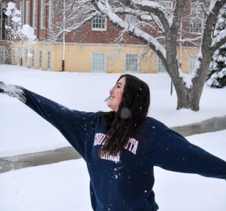
Lexy Elizalde
School: South Dakota School of Mines and Technology
Major: Atmospheric and Environmental Science
NOAA Affiliation: NWS NCEP Aviation Weather Center
Research Title
Automated Determination of Tropopause Heights for Improved Aviation Warnings and Forecasts (Recorded)Abstract
Knowing the location of the tropopause is necessary for aviation weather forecasting, although this can be a laborious task and is subject to forecaster bias. Currently, the Aviation Weather Center (AWC) is responsible for issuing Significant Meteorological Information (SIGMET) bulletins for a variety of weather hazards including turbulence, the altitude of which the tropopause level plays a key role in. AWC meteorologists can use GFS-derived determinations of the tropopause on the NAWIPS software, including the World Meteorological Association (WMO) lapse-rate, potential vorticity, and hybrid of the two to create hand-drawn depictions of the transition layer. The end-result is meant to aid pilots in averting regions of turbulence and entrance to the stratosphere, as this could allow ozone infiltrated air to enter the cabin leading to ozone scrubbers needing to be turned on. This project investigates several tropopause-level clear air turbulence SIGMET cases for verification and investigates the application of current and new tropopause definitions for use in improving the prediction of turbulence altitude.
-

Brian D’Souza
School: University of Illinois Urbana Champaign
Major: Geophysics and English
NOAA Affiliation: OAR Pacific Marine Environment Lab
Research Title
The Use of Saildrones to Investigate Hurricanes (Recorded)Abstract
Our ability to predict the direction of propagation of a fully formed hurricane is commendable but there is still work to be done when considering intensity. The recent development of uncrewed sea surface vehicles, manufactured for NOAA by Saildrone, allow researchers to gather previously inaccessible data within hurricanes. During the 2021 Atlantic hurricane season, 5 such saildrones were deployed in hurricane prone areas, and were able to infiltrate 6 tropical cyclones. This included saildrone SD1045, which was able to transmit footage and measurements from the sea surface within the eye of Hurricane Sam, a mere 34 km from its center. The recorded video brought greater attention to the saildrone program. Saildrone data is publicly available on NOAA’s ERDDAP server and satellite images of past hurricanes are available through NESDIS. However, the data in its raw format is complex and difficult to visualize for both researchers and the general public. My project this summer was to develop a program that can make a compiled animation tracking the saildrone against synchronous GOES-16 satellite images, while simultaneously presenting concurrent data readouts graphically. I was able to create data visualizations that combine visible and infrared satellite imagery, location tracking, and data plotting, which makes measurement comparisons easier across hurricanes. This aids NOAA’s saildrone team in their efforts to acquire and analyze newly available hurricane data, which will allow us to understand and predict hurricane intensity during formation with greater accuracy.
-

Charles “Hank” Dolce
School: Texas A&M University
Major: Meteorology
NOAA Affiliation: OAR Atlantic Ocean Meteorological Lab
Research Title
Examining the Response of Upper Ocean Velocity to a February 2022 Wind Event in the Tropical North Atlantic OceanAbstract
In the tropical North Atlantic Ocean, sea surface temperature patterns have significant influences on the weather and climate patterns of nearby regions. Specifically, ocean-atmosphere interactions in this region of the Atlantic have a profound influence on the development and intensification of tropical cyclones, which can bring major impacts to the Caribbean region and North America. The Prediction and Research Moored Array in the Tropical Atlantic (PIRATA) program was implemented to study these air-sea interactions. PIRATA was established as an array of 10 moorings in 1997 by France, Brazil, and the United States and has since expanded to include 8 additional moorings. Data from the PIRATA Northeast Extension (PNE) station at 20°N, 38°W was examined for this particular study. This mooring was augmented on November 24, 2021 with fifteen additional current meters as part of the ongoing TACOS (Tropical Atlantic Current Observation Study) experiment. The hourly atmospheric variables examined here include winds, air temperature, and sea level pressure. For the ocean variables, hourly currents and temperature were examined at several depths between 7 and 97 m. While no tropical cyclones passed the mooring during the TACOS deployment, several wind events peaking at 10 m/s were observed, with one notable event that persisted throughout February and March 2022. On February 7, 2022, an extratropical low pressure system passed within 500km of the mooring, which was followed by a strong ridging regime beginning 5 days later that launched a prolonged period of wind speeds around 10 m/s across the mooring lasting into the middle of March. Ocean currents responded swiftly as the winds increased, increasing in magnitude and shifting directions from westward with a weak northward component to northward with a weak eastward component consistent with an Ekman ocean current response given easterly winds. Inertial currents were triggered with a mean oscillation period of 32 hours, consistent with the theoretical inertial period of 35 hours, and amplitudes of 10 cm/sec increased due to the onset of this wind event. The passage of ocean eddies had some influence on the evolution of these currents, though the primary forcing was from the wind event itself.
-

Alex Alvin Cheung
School: University of Maryland College Park
Major: Meteorology
NOAA Affiliation: NESDIS Satellite Applications and Research (STAR)
Research Title
Documenting the Progressions of Secondary Eyewall FormationsAbstract
Intense tropical cyclones (TCs) can form secondary eyewalls (SE). Some SEs partake in an eyewall replacement cycle (ERC), which is when a SE replaces the inner eyewall. An example of a commonly known ERC pathway involves three phases: (1) the initial identification of a SE, (2) when the SE equals in strength to the inner eyewall, and (3) the disappearance of the inner eyewall caused by the replacement from a SE. We refer to this as the classic pathway. However, we found that secondary eyewall formations (SEF) are not a singular process and can result in multiple possibilities beyond an ERC. Anecdotally, we know that there are multiple entrances and exits (pathways) into and out of a SEF with significant deviations from the classic ERC paradigm. Hence, this study supplements this gap in understanding by documenting the various SE progressions and identifying certain environmental conditions and storm metrics that may provide others insights into the evolution of a SEF in real-time. Here, we use 89–92 GHz passive microwave imagery (PMI) from the NOAA Cooperative Institute for Research in the Atmosphere’s Tropical Cyclone Precipitation, Infrared, Microwave, and Environmental Dataset (TC PRIMED) to subjectively identify SE patterns related to deep convection. In the SE identification, we include an estimated satellite analyst’s confidence ranging from low confidence (1) to high confidence (5). Next, using our developed dataset of SE labels, we tracked the progression of 115 SE appearances in TCs with at least one high confidence (4+) SEF (42 storms), noting various patterns in entrances, SEs, and exits in the PMI. With the SEF progressions identified, we test environmental variables (e.g., wind shear, sea- surface temperature) and storm metrics (e.g., intensity, storm motion) for statistical significance between various SE evolutions. We found that two common pathways exist: (1) no replacement of the inner eyewall by the outer eyewall and (2) the replacement of the inner eyewall by the SE. Interestingly, we found that the environmental conditions in the classic path are typically in environments that are highly conducive to TC intensification (weak vertical wind shear, greater mid-level RH, and greater SSTs), indicating that a certain set of conditions must occur for an ERC to occur. In summary, this study captures the diverse scenarios for SEF pathways beyond the classic ERC paradigm. The details of this work will be presented along with improvements to the study on the secondary eyewall labels and environmental variables made between now and the conference.
-
McKenzie Brannon
School: Syracuse University
Major: Earth and Env Science
NOAA Affiliation: NWS NCEP Environmental Modeling Center
Research Title
Utilizing JEDI Software to Observe Lake Erie Eutrophication and Seasonal Algal BloomsAbstract
The Joint Effort for Data assimilation Integration (JEDI) framework is a system aimed at improving the versatility and efficiency of data assimilation. This project utilizes the Regional Ocean Modeling System (ROMS) and JEDI’s Sea-Ice Ocean and Coupled Assimilation (SOCA) project to test and learn the compilation of 3D and 4D models on a high-performance computing system. One use of these models is exploring the relationship of harmful algal blooms with different parameters such as water depth, surface temperatures, and nutrient loading. Another use is to assimilate chlorophyll concentration data in these models and assess their impact on forecasting harmful algal blooms. While a forecast impact study requires a long- term continuous effort on model compilation, marine observations, especially chlorophyll concentration are currently written into the JEDI observation system, i.e., IODA (Interface for Observational Data Access). In this system, eutrophication and harmful algal blooms are tracked using ocean color data collected by NASA’s Moderate Resolution Imaging Spectroradiometer (MODIS) aboard the Aqua satellite. This project uses this MODIS ocean color data in JEDI/IODAformat to observe harmful algal blooms and eutrophication in Lake Erie, the southernmost great lake. Lake Erie is impacted by these blooms that release toxins and pose a health risk for humans and the lake’s ecosystem. Understanding bloom patterns in the lake is paramount for future prediction and mitigation. Preliminary results demonstrated through SOCA-diagnostics (marine JEDI visualization tool box) reveal blooms in the western basin of Lake Erie peaking in late summer.
-

Ricardo Bourdon
School: Cornell University
Major: Earth and Atmospheric Science
NOAA Affiliation: NESDIS National Centers for Env Information
Research Title
Examining the Importance of Physical Processes on the Termination of Harmful Algal Blooms on the West Florida ShelfAbstract
On the West Shelf of Florida (WSF), there are seasonal blooms of the dinoflagellate Karenia brevis, known as red tide events. These seasonal blooms often become Harmful Algal Blooms when the cell counts of the K. brevis reach numbers greater than 104 cells per liter (McCulloch, 2013). The blooms of K. brevis are seasonal, typically occurring within the fall and winter, and lasting 2 to 4 months, although a duration of 8-12 months is not uncommon (Vargo, 2009). The initiation of the bloom is thought to begin about 18 to 74 km offshore at depth. These waters are oligotrophic waters, meaning that they are generally low in nutrients. However, the time period of the blooms coincides with the changing of the wind and current conditions on the WSF. During the late fall months, the winds become more upwelling favorable (Maze 2015). The upwelling allows for K. brevis to get nutrients from the deep water, meaning upwelling is important for the bloom initiation (Wesiberg et al, 2014). The offshore blooms make their way onto the WSF through the process of Eckman transport and upwelling that advects them on-shore (Wesiberg et al., 2014). Once advected on-shore, the blooms are maintained by upwelling that brings more of the offshore K. brevis to the onshore bloom, and also river discharges that dump out into the coastal waters, bringing more nutrients to the bloom (Maze 2015). There is a lack of knowledge on how these blooms get terminated. Macrozooplankton grazing does not appear to be a major factor for Karenia brevis bloom termination (Vargo 2009). Nutrient limitation, normal cell death rates, and grazing may not play a significant role in bloom termination due to the length that some blooms have been known to last (Vargo 2009). It is hypothesized that physical processes may be the primary mechanism for the termination of red tides. The point of this project is to investigate the role of physical processes in the termination of these blooms. After exploring the available NCEI HABSOS data, a spike in the cell count of K. brevis was identified from September 2019 to December 2019. In order to better understand the conditions which can facilitate the termination of the red tide blooms, I examined the physical and biological conditions before the bloom, during the bloom and after the bloom (early 2020) in order to assess possible factors that lead to the termination of red tides. Physical conditions include surface water temperature, salinity, wind speed and direction, and currents. I utilized data from two buoys from the National Data Buoy Center (NDBC) to gain in situ wind data and I took geostrophic current data from the NOAA CoastWatch data portal. I used this data to understand the wind and current strength, creating images in Python. In order to better understand the conditions that are important for the termination of the red tides, I conducted a Primary Component Analysis to determine the factors that are most important. For this PCA, I used the cell count data collected from HABSOS, buoy data from locations surrounding the location where most of the cell counts were taken. From this PCA and the images of the current and wind conditions, I identified that the V component (north south direction of the wind) and the wind speed were highly correlated with the first principal component and also correlated with cell counts of K. brevis. Therefore, for the HAB of 2019, winds and currents played an important role in the termination of the bloom.
-

Esha Bharadwaj
School: Clark University
Major: Geography
NOAA Affiliation: OAR Climate Program Office
Research Title
Climate Smart Actions: A Database of Flood Resilience Strategies for the United StatesAbstract
Flooding is one of the leading causes of damage to property, natural areas, and people, and due to climate change, it is increasing in both frequency and intensity in many parts of the country. Even without climate change, one would expect more damage from floods simply due to people moving infrastructure, housing, and other resources near coastlines and water bodies. This project laid the foundation for a searchable database containing strategies to address flooding – and ultimately other hazards – that have been used by state governments. We extracted strategies related to flooding from state climate action plans and state agency plans downloaded from the Georgetown Climate Center State Adaptation Progress Tracker. California is not within the scope of this study because another NOAA-funded team is focusing on efforts there. Also, local plans were not considered; the emphasis here is on plans made at the state level. More than 1/3 of the nation’s states do not have a state level climate adaptation plan, and very few states (around 1/4) have a state agency-led plan published within the last four years. Climate adaptation appears to be a low priority at the state level in many parts of the country. However, plans have been put in place in most regions where FEMA has documented a high risk of impacts from flooding. I extracted 400 strategies from those plans that address the impacts of flooding. The bulk of the flood protection solutions address natural areas where watershed and floodplain management are essential to protecting assets downstream. A large number of strategies focus on directly protecting property since people value assets that are exposed to flooding. Examples of strategies include managing floodplains, encouraging water infiltration through watershed protection, and limiting property construction within a certain distance from the coastline or a water body. Protecting lives is perhaps the highest priority for addressing the impacts of flooding. Most of those strategies fall within three categories: coastal ecosystem protection; education, outreach, and engagement; and flood insurance. As part of its mission to support a Climate Ready Nation by 2030, NOAA has a responsibility to interpret climate information and assist communities and tribes as they address climate-related hazards. It is critical to plan now to reduce the dramatic impacts of climate change and protect current and future generations. To scale up and accelerate climate adaptation practice, NOAA hopes to train climate practitioners to carry out this mission. Building a database with strategies to address flooding and other climate- related hazards will help those practitioners serve communities through planning and by tracking progress toward protecting lives, property, and resources.
-

Jacklynn Beck
School: Ohio State University
Major: Atmospheric Science
NOAA Affiliation: OAR Climate Program Office
Research Title
Inventory of Federal Climate Engagement and Capacity-building ProgramsAbstract
Engaging the public in climate action is vital to ensure that equitable climate actions are taken to combat the impacts of climate change. To ensure that the public is prepared for the scale of the climate crisis, the U.S. Federal government must support national initiatives to educate, train and engage citizens. Since the introduction of Executive Order 14008: Tackling the Climate Crisis at Home and Abroad in 2021, federal departments and agencies have been tasked with addressing climate solutions and justice, leading to an explosion of society-focused climate programs. This session will present the results of the 2023 inventory of 520 U.S. federal climate education, training, communication, access to information, engagement, and coordination programs across 12 federal departments and 9 agencies, covering both existing and proposed programs in the 2023 budget. The inventory covers all aspects of climate work, from K-12 education to applied science, workforce development to Tribal adaptation. Additionally, the inventory includes programs funded through the Build Back America bipartisan infrastructure budget. The foundation laid by this research will encourage coordination of resources, knowledge, and best practices amongst the Biden administration, federal agencies, and non-federal partners. This ecosystem of federal action-focused climate policy will ensure that society is receiving necessary resources to take action and build a climate ready nation.
-

Evan Belkin
School: State University of New York at Albany
Major: Atmospheric Science
NOAA Affiliation: NWS NCEP Storm Prediction Center
Research Title
2021 NOAA/NWS SPC Day 1 Fire Weather Outlook VerificationAbstract
The NOAA/NWS Storm Prediction Center (SPC) is responsible for forecasting meteorological conditions that, when combined with antecedent dry fuels, result in a significant threat for the rapid growth and spread of wildfires across the contiguous United States (CONUS). The SPC issues three categorical risk areas in the Day 1 and 2 (defined as 12-12 UTC) Fire Weather Outlook Products: “elevated”, “critical”, or “extremely critical” for dry and windy conditions. The risk category depends on both the severity of the forecast weather and the fuel conditions relative to a given geographic region. A “critical” outlook will be issued when, in the judgment of the forecaster, sustained winds of 20 mph or greater (15 mph in Florida) are forecast, the minimum relative humidity is at or below the regional threshold, temperatures are above 50- 60oF (depending on the season), and the fuels are dry, all for a duration of at least three consecutive hours. This study aims to quantify and document the performance characteristics of the SPC Day 1 Fire Weather Outlook during the entirety of 2021. Using surface data from the SPC’s operational surface objective analysis system (sfcOA) archive and Energy Release Component (ERC) climatological percentile data from the Gridded Surface Meteorological (gridMET) dataset, the SPC “critical” fire definition was evaluatedacross the CONUS. Since “extremely critical” delineations are reserved for significant deviations from climatological normal, this study did not verify “extremely critical” conditions any differently from “critical” conditions. The Probability of Detection (POD), False Alarm Rate (FAR), and Critical Success Index (CSI) were calculated for each individual day in 2021 as well as the year as a whole. Performance diagrams were then created using these data and these results will be shown and discussed.
