Class of 2021 - The William M. Lapenta - NOAA Student Internship Program
Class of 2021

Alanna Goodell
Alanna is a senior studying environmental engineering at Northern Arizona University. Her degree choice and future goals are a result of her passion for the environment.
School: Northern Arizona University
Major: Environmental Engineering
NOAA Affiliation: OAR Air Resources Lab
Research Title
Abstract
With New York City’s goal to reach carbon neutrality by 2050, there needs to be an understanding of the emissions within the metropolitan area. To determine how the emissions of some greenhouse gases and short-lived air pollutants changed in 2020, aircraft and surface observations of greenhouse gases (including carbon dioxide and methane) and short-lived air pollutants that were collected in New York City in 2020 will be analyzed. Enhancement ratios will be examined among these chemicals and compared to the ratios in a global emission inventory called Emission Database for Global Atmospheric Research (EDGAR). Ratios of some chemicals, such as methane, carbon monoxide, total reactive nitrogen, and black carbon, against carbon dioxide will be used with the well-known carbon dioxide emissions to calculate emissions of these chemicals from the urban area. The impact of COVID-19 on these emissions will also be analyzed

Alex Hewett
Alex is pursuing a BS in Atmospheric Sciences with a meteorology concentration at the University of Washington. He is a proud Navy veteran, where he served as an airborne search and rescue swimmer. In his spare time he enjoys camping, hiking, and spending time with his cats Zeus and Athena.
School: University of Washington - Seattle
Major: Atmospheric Science
NOAA Affiliation: OAR Pacific Marine Environmental Lab
Research Title
Abstract
The Indian Ocean is home to many interesting weather and climate phenomena. The seasonal monsoon and associated rainfall variability is of great importance to cultures in the region. On year to year time scales, the Indian Ocean Dipole (IOD) plays a significant role in influencing the ocean-atmosphere system of the region. Moreover, the IOD and monsoon interact with other phenomena such as the Madden-Julian Oscillation (MJO) and the El Niño Southern Oscillation (ENSO), which in turn influence weather and climate over North America and globally. Here we explore the ocean-atmosphere coupling in the Indian Ocean basin over the period 1979-2019, with emphasis on 2016-2019 when there was a strong negative IOD in boreal Fall of 2016 and a strong positive IOD in boreal Fall of 2019. We use the ERA5 monthly averaged data to present visualizations of the seasonal variations in monsoon winds, sea surface temperature (SST), and precipitation; and compare anomalies in these quantities for positive and negative phases of the IOD
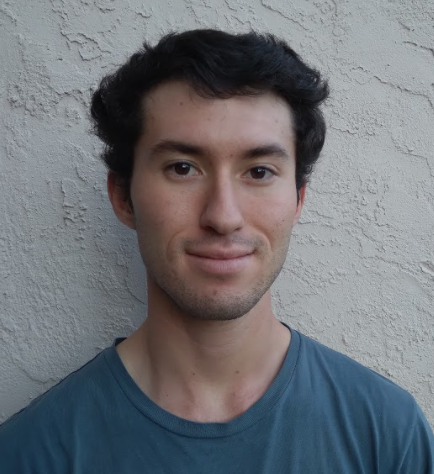
Alex Penunuri
Alex is going to be a fourth year student at the University of Colorado Boulder, majoring in Atmospheric and Oceanic Sciences and minoring in Applied Mathematics. He was born and raised in San Jose, CA, and enjoys the outdoors and watching hockey and basketball (go Sharks and Nuggets!).
School: University of Colorado - Boulder
Major: Atmospheric and Oceanic Sciences
NOAA Affiliation: OAR/ESRL Physical Sciences Lab
Research Title
Abstract
From August-October 2018, the Propagation of Intra-Seasonal Tropical OscillatioNs (PISTON) campaign collected meteorological data from ship by taking atmospheric soundings, and oceanic data by ship-towed vertical profilers. The data collection occurred onboard the R/V Thomas G. Thompson in the Philippine Sea, with more meteorological soundings taken from nearby islands. The objective of this study was to analyze temporal and land vs. ocean variations in the atmospheric and oceanic boundary layers. The minimum, maximum, and median values of the atmospheric mixed layer height sampled over ocean by the ship were 120, 969, and 729 meters. The maximum island-based atmospheric boundary layer height was much higher at 1583 m, which is attributed to greater surface temperatures on land. The oceanic mixed layer sampled by the ship had min, max, and median values of 15, 114, and 48 meters, respectively. The oceanic mixed layer depth reached its maximum between October 5-9 when the ship was located furthest north. During this time the ocean depth was consistently greater than 80 meters, at least double the median ocean mixed layer depth of the campaign. For all time periods, vertical salinity stratification determined the base of the ocean mixed layer (pycnocline), and a fresh isothermal barrier layer persisted below.

Alexander Moxon
School: University of Wisconsin - Milwaukee
Major: Atmospheric Science
NOAA Affiliation: NWS/NCEP Weather Prediction Center
Research Title
Abstract
Given the substantial risk to life and property that heavy precipitation events pose to the public, heavy rainfall events, particularly those that lead to flash flooding, are of great importance to atmospheric scientists. Accurate forecasting allows for emergency managers and the public to prepare for such dangers. Substantial improvements have been made to the short-term forecasting of such events through the implementation of the MetWatch Desk within the Weather Prediction Center (WPC). However, despite advances over the past several years in numerical weather prediction forecasting models, improvements can still be made to forecasting during the nowcast (0-6 hours) period. Meteorologists staffing the MetWatch Desk have identified limitations in forecasting models that include inaccurate determinations of sub-hourly rainfall rates as well as delayed convection initiation within Convective-Allowing Models (CAMs).
This project aims to utilize machine learning techniques to better predict heavy precipitation events. Initially, the machine learning techniques being used in this project are being developed using the multi-model ensemble that drives the Probabilistic Quantitative Precipitation Forecast (PQPF) guidance issued by the Weather Prediction Center (WPC). Additional work will expand the project to use Multi-Radar/Multi-Sensor (MRMS) System data. This research project aims to develop a tool that can better predict the location and magnitude of high-QPF events that may lead to flash flooding. This tool can then be used by meteorologists, namely at the WPC MetWatch Desk, to assist in forecasting during the nowcast period and in issuing products such as Mesoscale Precipitation Discussions.

Alexandra Pate
Alex Pate is a rising senior at Colorado School of Mines, where she is pursuing a B.S. in applied math and statistics with a minor in data science. During her time as a William M. Lapenta intern at the Physical Sciences Laboratory, she will help analyze datasets of clouds and air-sea fluxes in the tropical Atlantic Ocean. In her spare time, Alex enjoys playing the French horn, reading, and hiking.
School: Colorado School of Mines and Technology
Major: Computational and Applied Math
NOAA Affiliation: OAR/ESRL Physical Sciences Lab
Research Title
Abstract
Cloudiness is an essential metric of the climate system yet it has previously been difficult to measure from autonomous ocean vehicles. To add more capability to the uncrewed surface vehicle (USV) Saildrone, we develop a cloud fraction algorithm that processes upward-looking visible sky camera images taken atop the Saildrone. Images were collected and tested during the 2020 Atlantic Tradewind Ocean–Atmosphere Mesoscale Interaction Campaign (ATOMIC) in the Northwest tropical Atlantic. The USV Saildrones were operating in the same region as the NOAA research ship Ronald H. Brown. Cloud fraction estimates were similar from the ship-basd ceilometer and processed sky camera images taken from the same region. Relationships between cloud fraction and surface radiation are similar between the ship and Saildrone. Therefore, the cloud fraction sky camera image processing technique appears robust for further application and analysis of Saildrone data during ATOMIC and other field campaigns focused on weather, climate, and cloudiness.
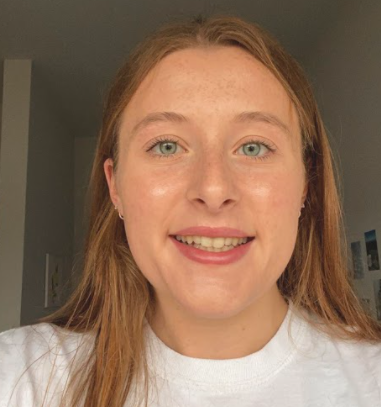
Anna Dennis
Anna is a rising senior at the University of Illinois Urbana-Champaign and pursuing a degree in Meteorology. She has a lot of computing experience under her belt, having helped with Illinois Univ IT with code to handle analysis of observations and she has been the webmaster for the Illinois Chapter of the AMS. Anna first heard of NOAA in high school and is amazed at the diversity of operations and research within the agency. She wants to help NOAA expand outreach to customers via new web processing and page restructure. She is from Louisville, KY and enjoys playing tennis, going hiking, and drinking coffee!
School: University of Illinois – Urbana Champaign
Major: Meteorology
NOAA Affiliation: NWS/OPPSD Central Processing AWIPS Office
Research Title
Abstract

Anna Hall
Anna is a rising senior at Washington College in Chestertown MD, double majoring in Physics and Mathematics. In addition to her busy schedule as a student, Anna tutors classmates in Calculus to the tune of 6-10 hours per week and has even served as a lifeguard; she is also proficient in Spanish and many computer languages. Anna plans on pursuing different research opportunities that help understand climate change and the different physical processes that occur in the atmosphere. With her strong background in physics, she hopes to focus on different thermodynamic principles that lead to global warming, and work on a team to understand extreme weather patterns occurring as a result of the climate crisis. She likes to swim, do embroidery and hike in the beautiful areas of Maryland.
School: Washington College
Major: Physics and Mathematics
NOAA Affiliation: NESDIS STAR
Research Title
Abstract
An atmospheric duct is a band of stratified air found in the lower atmosphere that has a strong temperature inversion, deviating from the usual decrease in temperature with altitude. In this Lapenta summer intern project, we performed validation and analysis of tropospheric ducting by comparing independent ducting predictions with respect to satellite, European Centre for Medium-Range Weather Forecast (ECMWF) model, and in situ data over a selected site near the Baja coast over ocean, considered to have frequent ducting. In particular, using temperature profile data from the second Constellation Observing System for Meteorology, Ionosphere, and Climatology (COSMIC-2) satellite mission, the ECMWF model output, and La Paz, Mexico radiosondes, our study attempted to corroborate the existence of Tropospheric ducts off the West Coast of Baja California. Ducts occurring in the lower Troposphere at this site, especially during the summer months of June, July, and August, are predicted to be associated with strong temperature inversions with altitude. Utilizing three different sounding sources gives us insight into the nature of temperature profiles of the region, and the ability to characterize the performance of each of these sounding sources relative to each other. Implementing Python programming techniques allows us to plot a temperature versus mean-sea-level altitude figures from multiple days to visualize temperature inversions and provide evidence to support the presence of ducts.
Through analyses and comparisons of the different soundings, we were able to show a strong temperature inversion below two kilometers. The COSMIC-2 radio occultation data and the ECMWF data produce almost identical temperature profiles. However, there are cases where the profiles from COSMIC-2 may disagree with the model near the surface. The radiosonde data shows a strong temperature inversion near the surface. The findings of this study will not only contribute to a better understanding of the tropospheric ducting weather phenomena, but also identify potentially reliable thermally stable validation sites for comparison. These findings can be used for an algorithm validation for satellite retrieval of temperature profiles, as well as, facilitating the assimilation of satellite measurements in numerical weather prediction models.
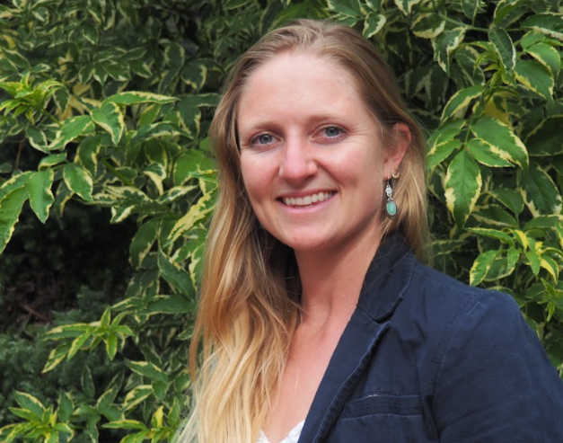
Anna Jensen
Anna is a graduate student at Oregon State University, majoring in Geographic Information Systems and also working on a graduate certificate in Fisheries Management. She obtained her undergraduate degree at California State University of Sacramento. Anna has been very busy over her last 10 years, teaching various classes in marine biology and ecology as well as rock climbing techniques. She intends to research the hydrologic cycle of coastal regions where mountain snowpack acts as a primary source of freshwater. Anna wants to investigate marine-influenced meteorological patterns and the way these affect the timing and location of snowmelt runoff. Her goal is to advance the methods and technologies used for computing, visualizing, modeling, and delivering environmental geospatial information. By combining satellite imagery with ancillary geophysical data, she believes NOAA can generate increasingly accurate and predictive models that will allow for more effective water resource management. Her passion lies in better understanding the fluid dynamics of our planet, as one of the greatest challenges facing society is the inevitable shift in spatial and temporal patterns of weather and climate. She enjoys climbing, surfing, playing the guitar, singing, running, and helping others find holistic healing processes.
School: Oregon State University
Major: Geographic Information Systems
NOAA Affiliation: NWS/NCEP Ocean Prediction Center
Research Title
Abstract
The United States National Ice Center (USNIC) hosts the Interactive Multisensor Snow and Ice Mapping System (IMS), an operational software package used to demarcate the presence of snow and ice across the entire northern hemisphere. The data is produced primarily for use in daily operational weather model initializations, but a demand has arisen to use this record for both climatological analysis and as a means to visualize meteorological events. Since 2005, daily, gridded, hemispheric snow and ice charts have been generated at 4km resolution, and cataloged by the USNIC. Until now, no products had been developed to analyze this data. This project transitions data records spanning 15 years from 2006 to 2020 into a working snow climatology. Two climatology products resulted; A collection of 24 bimonthly files depicting cumulative number of days with snow on the ground over the duration of the climatology, and 24 bimonthly files depicting average number of days with snow on the ground per period. Both of these are made publicly available on the USNIC website. Instructional documents are created detailing the methodology analysts will follow to perform annual updates of the cumulative and average snow climatology records, as well as instructions and templates for how to create bimonthly difference charts depicting present anomalous snow conditions. The bimonthly snow on the ground products can be used by the research and technical community as a data source for study while the operational departure from normal charts can be used by the operational community for quickly understanding snowpack characteristics. The detailed instructional documents allow the USNIC to carry this project forward, expanding the record into a more robust climatology with each subsequent year.

Anna Sitzman
Anna is a senior at Loyola University New Orleans in Louisiana studying Environmental Studies with a concentration in Social Sciences, but is originally from Omaha, Nebraska. At school, she is a student-athlete on the swim team and in Gamma Phi Beta sorority. She loves to bike, dance, watch and talk about Marvel and Star Wars, and eat desserts and oatmeal! She is passionate about meteorology, the relationship between the environment, water, and humans, and working for NOAA has always been her dream job.
School: Loyola University of New Orleans
Major: Environmental Studies and Social Science
NOAA Affiliation: OAR Climate Program Office
Research Title
Abstract
Understanding the stormwater management issues of the Great Lakes region brings to light pressing issues brought on by climate change and its impact on equity, public health, and the future of the Great Lakes environment. To manage their water, 1900-era engineers crafted an easy and efficient way to collect rainwater runoff, domestic sewage, and industrial wastewater into one pipe for transport and disposal; this method is still being used in approximately 772 cities in the U.S today. In the Great Lakes region, combined sewer systems transport wastewater to a sewage treatment plant for treatment, then discharge it into one of the lakes. Today, the combined sewer systems are long past their prime. The 100+-year old transport pipes are falling apart, cannot keep up with growing populations, and are expected to deteriorate further with increasing impacts of climate change. As the climate continues to change, cities in this region are faced with new challenges to adapt and protect their citizens and environment as more intense storms are expected. The increases in extreme rain events and fluctuation of lake levels bring to light the age and limited capacity of the original sewer systems that were built before thoughts of increases in intensity, duration, and frequency of precipitation events were even considered. . In addition, neighborhoods continually suffer public health dangers and property destruction from extreme rainstorms and increased flooding. Inequity is revealed by analyzing flood-vulnerable communities and the state of their water infrastructure. To accommodate this discrepancy, cities are becoming more aware of issues with the system and specifically vulnerable communities. Through analysis of city programs and plans and data on changes in precipitation and lake levels, the disproportionate impacts of flooding in the Great Lakes region can be explored. The expectation of the results of my project will be to help educate citizens on the importance of considering the future impacts of a changing climate, lake levels, and their impacts on updating stormwater infrastructure in their neighborhoods.

Austin Jerke
Austin recently graduated from South Dakota School of Mines & Technology in Rapid City, South Dakota with a bachelor's degree in atmospheric and environmental sciences. He will continue to work on my master's degree in meteorology at South Dakota School of Mines & Technology studying distinguishing factors in accumulating hailstorms. Ever since he witnessed a tornado severely damage my grandparents' farm when he was a kid, Austin knew he wanted to study the weather and improve weather forecasting. Weather forecasting directly impacts the well-being of many people which is why he has made it his life mission to understand and predict weather phenomena.
School: South Dakota School of Mines and Technology
Major: Atmospheric Science
NOAA Affiliation: NWS/NCEP Weather Prediction Center
Research Title
Abstract
The Excessive Rainfall Outlook (ERO) is a probabilistic forecast of rainfall exceeding flash flood guidance within 40 km of a point. It is issued for days 1 through 3 with four categorical risks: marginal (5-10%), slight (10%-20%), moderate (20%-50%), and high (>50%).
Atmospheric models inherently possess biases or errors that influence forecasts made by meteorologists every day. The ERO product produced by the Weather Prediction Center (WPC) relies on these atmospheric models and is therefore subject to similar biases and errors. Since flash flooding is one of the deadliest weather phenomena on Earth, exploring the object-based ERO biases could provide forecasters with increased situational awareness. This presentation will feature the progress made exploring object-based biases during the William M. Lapenta Internship program of 2021. This study compares the ERO to an analysis called Practically Perfect (PP), which consists of a variety of flash flood observations and proxies. PP represents a best-case forecast given perfect knowledge of prior events. Comparisons between PP and the ERO are made using the Model Evaluation Tools (MET) Method for Object-based Diagnostic Evaluation (MODE) developed by the Developmental Testbed Center (DTC) at the University Corporation for Atmospheric Research (UCAR). In addition to exploring the contiguous United States, the day 1, day 2, and day 3 EROs are alsosub set by region and season. The ERO was found to present displacement biases towards the east northeast especially for the central United States for slight day 1 when compared to PP. Results will be shown to highlight discrepancies in ERO and PP centroid frequencies, ERO and PPobject areas, and ERO and PP displacements. Additionally, modifications made to the previous MODE configuration settings will also be discussed.

Brittany Whitlam
Brittany just finished her 3rd year at the University of Utah working towards a Bachelors degree in Atmospheric Sciences on the Professional Meteorology track. She is currently working as an undergraduate research assistant in wildfire modeling, and hopes to use this research experience to become an IMET with the NWS someday. This connects her to the NOAA mission through sharing knowledge with others in order to create a weather ready nation!
School: University of Utah
Major: Atmospheric Science
NOAA Affiliation: NWS/OSTI Meteorological Development Lab
Research Title
Abstract
This project evaluates two datasets that are commonly used for aviation decision support. Accurate ceiling and visibility forecast guidance is critical to the aviation industry in Alaska. Therefore, the first topic includes a verification of Alaska ceiling height and visibility forecast guidance from the Localized Aviation Model Output Statistics Program (LAMP) Meld compared to the National Blend of Models (NBM). Unlike products for the contiguous United States, NBM Alaska products do not currently include LAMP Meld data as an input, but may in the future. Using archived ceiling height and visibility observations at LAMP stations in Alaska, the threat score and bias of forecast guidance from both LAMP Meld and NBM were calculated and plotted. The findings from this verification will allow the Meteorological Development Laboratory to measure how the NBM ceiling height and visibility forecast guidance could improve if the LAMP Meld data is incorporated as an input to the NBM’s products in Alaska.
The second topic includes a comparison of Vaisala and Earth Networks Inc. (ENI) ground-based lightning detection systems within CONUS. LAMP uses lightning data for short-term forecast guidance for aviation. This evaluation uses archived data of individual cloud-to-ground (CG) strokes, in-cloud (IC) pulses, and total lightning (TL) strokes/pulses. These strokes and pulses were mapped in order to visualize the different characteristics of Vaisala and ENI ground-based lightning detection networks.

Carina Rodriguez
Carina Rodriguez is a twenty year old Salvadorian and Mexican woman from Los Angeles, California. She is currently attending California State University Long Beach as an Environmental Science & Policy major with a minor in Sociology. During her free time she enjoys singing, reading, exercising, and spending time with her loved ones.
School: California State University – Long Beach
Major: Environmental Science and Policy
NOAA Affiliation: OAR Climate Program Office
Research Title
Abstract
This project follows the flow of data from thousands of land- and space-based observations in North America, to higher-order analyses, to their eventual societal application. Many different kinds of observations are essential to monitor climate change, such as increasing averages in global temperatures, or long-term changes in extreme weather and cross-disciplinary studies are needed to connect these observed changes to societal impacts and solutions. Extreme weather events, including heat waves and cold waves, have detrimental impacts on human thermal comfort and biological systems at large. Compiling thousands and thousands of these observations from 1979-2016, the North American Regional Reanalysis (NARR) is a consistent, high quality atmospheric and land surface hydrology dataset and a valuable resource used in multiple NOAA-funded studies to classify extreme temperature events (e.g. heat, cold, humidity, dryness). Cross-disciplinary studies build on NARR analyses and elucidate drivers of mortality during extreme temperature events, growing evidence-based literature available to policy makers to protect communities from dangerous extreme temperature events. Following the flow of information from observations through the environmental science and public health literature demonstrates observations and analyses are critical for understanding climate impacts and advancing climate solutions, such as improving the health of communities.

Charlotte Merchant
Charlotte is pursuing a BSE in Computer Science with concentrations in Applied Mathematics, Statistics, and Environmental Engineering at Princeton. She hopes to harness computational tools to mitigate environmental issues through climate and earth system modeling. Charlotte grew up in Memphis, Tennessee, and enjoys backpacking, tennis, and taking 12 minute naps.
School: Princeton University
Major: Computer Science
NOAA Affiliation: NWS/OPPSD Central Processing
Research Title
Abstract
The Advanced Weather Interactive Processing System (AWIPS) is a meteorological processing, display, and analysis system that ingests and integrates meteorological, satellite, and radar data for distribution to 135 Weather Forecast Offices and River Forecast Centers across the United States and was originally developed by the National Weather Service in partnership with Raytheon. Founded in 2015, the AWIPS Software Development Team (ASDT) acts as the in-house programming expertise for NOAA’s Office of Central Processing AWIPS Program Office. The Software Recommendation and Evaluation Committee (SREC) ranks and assigns Development Change Specifications (DCSs) and Discrepancy Reports (DRs) to ASDT which, consequently, performs level of effort (LOE) estimates for each DCS and larger DRs. Software engineers for AWIPS develop using Agile methods, and the codebase is primarily written in JAVA and Python. My contributions through the Lapenta internship include work on two DCSs: tracking duplicate process events for the AWIPS statistical display and integrating Observed Weather into the Weather Wire Service Daily Climate product. AWIPS users can load external products into the Common AWIPS Visualization Environment (CAVE), used for rendering and analyzing AWIPS data. Within the CAVE AWIPS statistical display, the user can graphically represent the processing time, processing latency, and, now, duplicates of processing events for a given time range. Using this tracking, the user can optimize their data ingest events and prevent repeated processing of the same product. Additionally, the integration of observed weather in the Weather Wire Service Daily Climate product allows for the automated and accurate report of counts for weather events (such as rain or hail) for the Climatological Report. Future AWIPS developments will include an update to the Red Hat Linux 8 operating system and transitioning to more cloud-based services. Subsequent ASDT work could involve implementation of Spanish text products and further enhancements to the Post-Tropical Storm report (PSH) software.

Emily Speciale
Emily Speciale is a rising junior from Annapolis, Maryland, who attends the University of Miami (Florida). She is pursuing a double major in Marine Science and Biochemistry & Molecular Biology. Outside of school, she is president of her university’s club volleyball team and loves to foster and volunteer with stray cats.
School: University of Miami
Major: Marine Science and Biochemistry
NOAA Affiliation: OAR Office of Ocean Exploration and Research
Research Title
Abstract
Mesopelagic fish play a key role in ocean ecosystems, serving as predators for zooplankton, prey for larger commercial species, and a source of carbon transfer for holistic ecosystems. Active acoustics are used to collect data on mesopelagic fish since returning echoes can be quantified into echometrics that describe the fishes' distribution in the water column. These echometrics include density (Sv), center of mass, inertia, proportion occupied, index of aggregation, and equivalent area. It is important to understand what factors could affect these echometrics. Satellite-derived oceanic data is widely accessible and can be used to recognize how epipelagic factors affect mesopelagic dynamics. Thus, we created an open-source and cloud-based workflow that processed active acoustic backscatter data into echometrics and correlated these values to satellite-derived data measurements. The workflow centered on analyzing data from NOAA Ocean Exploration’s Okeanos Explorer cruises, specifically the Windows to the Deep 2019 Expedition (EX1903), which surveyed the Exclusive Economic Zone of the southeastern United States. The ship’s Simrad EK60 18 kHz active acoustic data was processed and interpreted into echometrics by using Python to combine PyEchoLab and Echometrics repositories. R was then used to find relationships between the echometrics and satellite-derived data. Overall trends in the data showed the density of organism backscatter increasing with chlorophyll-a concentrations and decreasing with sea surface temperature (SST). General additive models found high significance levels between satellite-derived chlorophyll-a concentrations and all echometrics, with 74.2% of deviance explained. Significant correlations between SST and all echometrics except aggregation were also present. Through this analysis, we gain more understanding on the trends and patterns of mesopelagic fish distribution, and we can use this information to better inform fisheries management decisions.

Emma Estburg
Emma studies applied math and manufacturing and design engineering at Northwestern University. In her free time, she loves to knit and work on her graphic design skills.
School: Northwestern University
Major: Manufacturing and Design Engineering, Applied Math
NOAA Affiliation: OAR Pacific Marine Environmental Lab
Research Title
Abstract
With more Arctic in situ observations available due to growing technology, along with the need for the observations to increase understanding of the weather and climate, evaluations of forecasts and models need to be made. This study uses in situ observations from uncrewed surface vehicles (USVs), saildrones, to evaluate the Modern-Era Retrospective Analysis for Research and Applications version 2 (MERRA-2) surface heat fluxes in the Arctic. MERRA-2 is the global atmospheric reanalysis of the satellite era produced by NASA’s Global Modeling and Assimilation Office. The observations were taken in the Bering, Chukchi, and Beaufort Seas by three saildrones during July – September 2017, four saildrones during July – October 2018, and six saildrones during May – October 2019. Sensible and latent heat fluxes were calculated using the saildrone observations. The heat fluxes were compared with regional and bilinear interpolated data from MERRA-2. The findings show that MERRA-2 surface heat fluxes are good estimations in the Arctic and errors do not vary greatly year to year or month to month. With the increasing loss of sea ice during the summer months, accurate models and forecasts in the Arctic are needed to fully understand the effects of climate change. Since MERRA-2 has good estimations for sensible and latent heat fluxes, this product can be used to estimate changes in the surface energy budget in the Arctic during a time of increasing sea ice loss.

Eric Robinson
Eric is a rising junior at the University of Maryland College Park, double majoring in computer science and GIS systems. An Eagle Scout, Eric also had a busy internship with NASA in 2018 reorganizing large project files and databases. He is mainly interested in investigating Climate Change and using his knowledge of GIS and Remote Sensing to gather insight and inform decision making. Eric has developed a passion for environmental science, ocean acidification research and how to improve climate modeling within NOAA. In his spare time Eric likes to do bodybuilding/powerlifting, go backpacking, photograph nature, play the piano, and just hang out and plan trips with friends.
School: University of Maryland – College Park
Major: Geographic Information Systems/Computer Science
NOAA Affiliation: NWS/NCEP Environmental Modeling Center
Research Title
Abstract
This project will be hosted by EMC’s Model Evaluation Group (MEG) and will focus on evaluating convection-allowing models (CAMs) that are currently being developed at EMC. In particular, this project will largely focus on the FV3-CAM development effort. The student will evaluate FV3-CAM forecasts to 1) assess the FV3 model’s ability to provide useful guidance during severe convective events and 2) help inform decisions related to the ongoing development of regional configurations of the FV3.
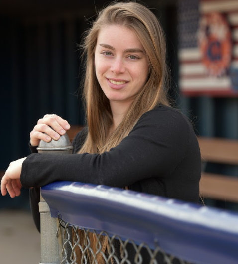
Erica Bower
Erica Bower is a PhD student at Stony Brook University working with Dr. Kevin Reed, where her research focuses on extreme precipitation related to tropical cyclones and extratropical transitioning cyclones. Outside of work, she enjoys playing sports, running, hiking, and playing various musical instruments.
School: Stony Brook University
Major: Atmospheric Science
NOAA Affiliation: OAR Atlantic Oceanographic and Meteorology Lab
Research Title
Abstract
Hurricanes Marco and Laura traversed the Gulf of Mexico within 3 days of each other in late August of 2020, influencing the upper ocean in this region significantly. To quantify the impact of the storms' wind and precipitation fields on the upper ocean, this study analyzes the ocean salinity and temperature fields from various data sources, including the Navy Coupled Ocean Data Analysis (NCODA), global HYCOM Real-Time Ocean Forecast System (RTOFS), and the Princeton Ocean Model (POM) forecast products from the 2020 operational coupled Hurricane Weather and Research Forecast (HWRF) system. The Integrated Multi-satellitE Retrievals for GPM (IMERG) final run precipitation product is used to identify the effects of precipitation on upper ocean processes such as barrier layer fluctuations. Total accumulated precipitation from Hurricane Marco reached 497.64 mm in the Northern Gulf, while maximum accumulated precipitation resulting from Hurricane Laura totaled 499.45 mm over the Central Gulf. This excessive precipitation must be accounted for when studying the oceanic barrier layer. The precipitation due to both storms was correlated to the barrier layer depth (BLD), ocean heat content (OHC), and upper ocean salinity in the following 6-12 hours, with correlation values as high as 0.94 when NCODA analysis was paired with IMERG precipitation. The wind field of each storm caused BLD changes occurring between 6 and 24 hours after the passage of the strongest winds. An anticyclonic low salinity eddy driven by the Mississippi River freshwater discharge (Eley et al. 2021) is identified in the Central Gulf in the path of Hurricane Laura. After the passage of the hurricane, mixing induced by the strong wind field dissipates the feature, making the salinity field more uniform in the wake of the storm. Finally, the HYCOM and POM models are assessed for accuracy as compared to the NCODA analysis. HYCOM does not represent the low salinity anticyclonic eddy in the central Gulf of Mexico but represents the BLD similarly to that in the NCODA data in all areas of the Gulf except the Loop Current. POM tends to more accurately represent the anticyclonic eddy but still underestimates BLD in the Loop Current. The representation of salinity and BLD in HYCOM and POM may be explained by the forcing of the simulations without precipitation and freshwater river discharge. To improve salinity and BLD simulations, more accurate initial conditions are needed through data assimilation and the inclusion of freshwater input.
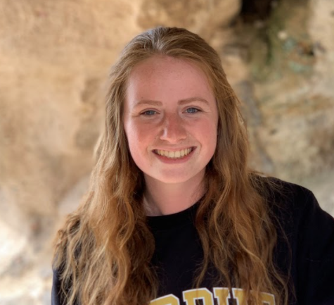
Erika Maneke
Erika Maneke attends Purdue University where she is majoring in Applied Meteorology and Climatology and minoring in Forensic Sciences. She has assisted with research addressing nitrous oxide emissions from soil for the past two years. In her free time she loves to travel, and she has been to all 50 states and visited over 300 national park sites.
School: Purdue University
Major: Applied Meteorology and Climatology
NOAA Affiliation: OAR Great Lakes Environmental Research Lab
Research Title
Abstract
Ice cover on the Great Lakes affects the ecology, biology, and economy of the Great Lakes area, and it also serves as an indication of the regional climate. Ice cover data from the National Ice Center was used to analyze Green Bay and Western Lake Erie for the 1973-2021 time period. Green Bay exhibited a higher average ice concentration than Western Lake Erie. The standard deviation calculated for Western Lake Erie’s average daily ice cover concentration is larger than Green Bay’s, indicating that Western Lake Erie’s ice cover is more variable and therefore harder to predict. The annual average ice cover (AAIC) of both regions shows a large interannual variability over time, in responses to the atmospheric teleconnection pattern forcings such as ENSO. The AAIC and the annual maximum ice cover in Green Bay and Western Lake Erie exhibited negative trends, meaning less ice cover occurs in the present compared to the past. The first and last ice cover dates in both regions have demonstrated a negative trend indicating an earlier start and end to the ice cycle. The duration of ice cover, which plays a crucial role in ecological processes, has become shorter for Western Lake Erie but slightly longer for Green Bay. Overall, lake ice cover has shown a long-term declining trend from 1973-2021.
An update of the climatology of the Great Lakes was completed for the years 2018-2021. Shallower, nearshore regions of the lakes show the earliest dates of ice cover while the middle of the lakes freeze later, if ever, in the season. Lake ice melts first in the middle regions of the lakes and persists longer in nearshore locations. The 2020 winter season displayed a significant decrease in ice cover on the lakes, due to a strong El Nino event.

Gabbie Christo
Gabbie is an undergraduate student at the University of Illinois Urbana Champaign working on his bachelors in Atmospheric Science and a minor in Business. She loves being a teaching assistant helping others to understand course material and likes to tutor others. She has used python and GIS to investigate data sets from different campaigns like CAMP2EX. Gabbie has been improving her communication skills and learning what it takes to be a leader. As a meteorologist at NOAA, she will use her forecasting skills and knowledge of meteorology to effectively develop, plan, and track projects. Gabbie likes hiking, traveling, swimming/going to a beach, and shopping.
School: University of Illinois – Urbana Champaign
Major: Atmospheric Science
NOAA Affiliation: NWS/NCEP Environmental Modeling Center
Research Title
Abstract
This project evaluates data from the global ensemble forecasting system- aerosol during two case studies from the 2019 CAMP2EX field campaign. The purpose of this project is to examine how well the model performed when compared to field observations. The GEFS-aerosol model provides 6-hourly global aerosol optical depth and mixing ratios of aerosol species at 64 model levels. The aerosol model is embedded in the GFSv15 and uses inline aerosol representation from GOCART to examine the forecasts of aerosols such as dust, organic and black carbon (wildfire smoke), sea-salt, and sulfate. The Cloud and Aerosol Monsoonal Processes- Philippines Experiment’s (CAMP2EX) goal was to characterize roles of anthropogenic and natural aerosol particles effects in frequency and amount of warm and mixed phase precipitation in the vicinity of the Philippines during the Southwest Monsoonal period. This location was chosen due to the diversity of aerosols and the significant period of biomass burning originating from Borneo. Focusing on the Single Particle Soot Photometer (SP2) from Orion P3 aircraft that measures black carbon concentrations, comparisons were able to be made from the model black carbon concentrations to aircraft observations. Model forecasts of total aerosol optical thickness were able to be compared to satellite maps from MODIS. Vertical profiles were created from model outputs, graphed along the latitude and longitude of the aircraft flight track, to examine how high the black carbon was extending into the atmosphere and compared to vertical motion as a possible reason why.
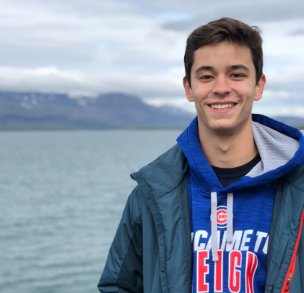
George Campe
George Campe is a rising senior studying Atmospheric and Oceanic Science at the University of Maryland, College Park. He enjoys anything related to the ocean, but also enjoys staying active through sports or running.
School: University of Maryland – College Park
Major: Atmospheric and Oceanic Sciences
NOAA Affiliation: OAR Ocean Acidification Program
Research Title
Abstract
This presentation seeks to determine the effectiveness of informational 2-page documents in educating a congressional audience (with varying degrees of knowledge on the subject) on ocean acidification and its effects on 3 major geographical regions. The mentioned 2 page documents were first presented to Congress on July 14th and 15th before being opened to the public. Their main purpose was to describe how ocean acidification in the Pacific Northwest, Pacific Islands, and the Gulf of Alaska has been harming the local indigenous populations. The 2-pagers were sent out to large groups of people along with one survey to be taken before the documents were read, and one for after. The responses to these surveys were recorded, analyzed, and then visualized to determine the difference in the general public’s knowledge on the subject. Low response rates to the surveys made some regions more difficult to analyze than others, but ultimately the data demonstrated an increased understanding of the effects of ocean acidification, as well as an increased awareness of what NOAA’s Ocean Acidification Program is doing to help prepare local communities for this problem.
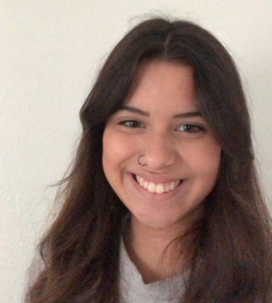
Hailey Santa Ana
Hailey is a rising senior at the Texas A&M Corpus Christi majoring in Atmospheric Science. Meteorology has fascinated her since her adolescent years after experiencing a tornadic weather event in her hometown. Tropical meteorology is her main focus, observing and tracking tropical systems. In her spare time Hailey enjoys dancing, hiking, crochet, and baking.
School: Texas A&M – Corpus Christi
Major: Atmospheric Science
NOAA Affiliation: NWS/NCEP National Hurricane Center
Research Title
Abstract
The National Hurricane Center (NHC) began issuing Potential Tropical Cyclone (PTC) advisories in 2017. A potential tropical cyclone is classified as a disturbance that is not yet a tropical depression or storm and poses a threat of tropical storm or hurricane conditions to land areas within 48 hours. The purpose for these advisories is to allow for forecasters to issue tropical storm/ hurricane watches and warnings more in advance than if the disturbance were to be labeled as an invest until it can be categorized as a tropical depression or storm. There have been 56 forecast advisories issued from 2017-20 for PTCs. Although NHC completes an annual verification of their forecasts for tropical cyclones, no comprehensive verification has been conducted for PTCs. The purpose of this study is to evaluate the accuracy of the PTC forecasts and assess which models have been performing best for this sample. In addition, comparisons of the predictions between PTCs and tropical cyclones will be shown to document the challenge of making PTC forecasts. The results are visually represented as plots created in MATLAB from the forecast track and intensity error found.

Harrison Tran
Harrison will be a senior pursuing a Bachelor of Science in Atmospheric and Science and a minor in Computer Science at Cornell University this fall. Born and raised in Austin, Texas, Harrison has been fascinated by atmospheric science ever since he was 4 years old. The active 2004 and 2005 Atlantic hurricane seasons and the captivating wall-to-wall coverage of local springtime severe weather helped solidify his interest in meteorology. At the heart of this interest is a vocation to foster a more weather-ready public and share an appreciation for atmospheric science. He occasionally writes articles on Wikipedia documenting historical tropical cyclones and has been featured on the site's main page. In the future, Harrison hopes to serve a career in operational forecasting, though his options are still open. In addition to meteorology, Harrison is also interested in astronomy and data visualization and closely follows college football. He enjoys listening to a large variety of music spanning anything from Roy Orbison to modern EDM.
School: Cornell University
Major: Atmospheric Science
NOAA Affiliation: NWS/NCEP Weather Prediction Center
Research Title
Abstract
CLIQR is a storm analog identification system that finds historical storms with parameters similar to currently active storms, prioritizing parameters most relevant to rainfall. Analogs are paired with rainfall accumulation graphics, allowing for quick assessment of rainfall produced by storms with similar sizes, motions, and intensities. CLIQR's outputs are offered in a GUI for WPC users or on a website where users can view currently active systems and the analogs identified by CLIQR. Initially developed in 2008 in Perl, CLIQR lost functionality in 2017 following the discontinuation of the NHC's Tropical Cyclone Objective Guidance product. CLIQR has now been rewritten in Python and modified to update every three hours using data from the NHC's new Tropical Cyclone JSON product and the ATCF. Additionally, CLIQR now incorporates the entire NHC forecast track to identify and rank analogs, allowing CLIQR to capture a greater breadth of possible matches and tailoring the best matches to more relevant systems. To supplement CLIQR, over 50 new rainfall graphics have been created for historical CONUS-impacting systems extending back to 1900 to augment the WPC's Tropical Cyclone Rainfall Project. A large database of CONUS tropical cyclone rainfall observations has also been created to help power future GIS applications.

Jake Campbell
Jake Campbell is a graduate student attending George Mason University in Fairfax, VA, working on his Climate Science master's degree with 1 year completed. Jake has spent almost 9 years working as a mechanical engineer but has decided to pursue his true passion as he is easily considered a weather nerd. He hails from San Antonio, Texas, and the large storms that rolled into that area each spring and the hurricanes that affected the Gulf coast fascinated him and jump started his desire to make his main passion his career. He has tuned into the livestreams of the hurricane chasers that hunker down in the strike path of the worst of the worst hurricanes that make landfall in the US as I am amazed at the sheer power and destruction that occurs. Some of his favorite hobbies are playing soccer and cornhole and he likes working on his own cars.
School: George Mason University
Major: Climate Science
NOAA Affiliation: NWS/NCEP Environmental Modeling Center
Research Title
Abstract
WAVEWATCH III (WW3) is a community wave modeling framework that includes the latest scientific advancements in the field of wind-wave modeling and dynamics. When given a specific application, the WW3 model’s physical parameters require adjustments dependent on the specific application’s need. It is due to simplification of the model physics, or incomplete parametrization of certain observed processes that cannot be fully modeled. As an actively open source and evolving model, its significant performance improvements over the past few years, and its ever-growing list of applications, the need for model optimization becomes increasingly important. Due to differing grid shapes and resolutions along with differing temporal scales, a set of optimization tools are needed that can be accommodating to adjust interconnected model parameters that are central to a specific application. Employing an optimization algorithm and statistical analysis of model outputs compared to observations (buoy station and satellite altimeter observations) can accurately be used to fine tune the model performance to improve model accuracy. The work done this summer consisted of creating validation scripts in the Python programming language, which is also open source, in parallel to the existing MATLAB validation scripts, which will expand the portability of optimization to platforms that do not have access to MATLAB. The created python scripts over the past ten weeks accomplished the following: 1) Pull buoy station datasets in NetCDF format by year from NOAA’s National Data Buoy Center database and save them by station name for easy integration later, 2) Merge all buoy station datasets into one file, process WW3 model output to matched merged observations, and interpolate both to a user requested time frame and frequency and save as two new NetCDF files. 3) Interpolate WW3 satellite wave height output data to satellite along-track altimeter data. This enables straightforward statistical analysis as it provides a predicted wave height value for every satellite measurement which is of finer spatiotemporal resolution than WW3, 4) Two statistical analysis scripts provide the root mean squared error calculations for all variables available for both buoy point and satellite data. Finally, time series plots were created for all variables to illustrate the success of the Python scripts. All Python scripts are now currently uploaded to the WW3_Optimization GitHub repository for easy user access.

Jetson Ku
Jetson is a rising junior at the University of Maryland at College Park double majoring in Computer Science and Data Science. In addition to being a Lapenta intern, he has also been working with NOAA's Coral Reef Conservation Program and project manager helping to organize data and identify trends from the coral reefs off of the coast of Florida. In addition to his studies at UMD, he also plays division II hockey and is a member of a student investment group. Jetson wants to expand his knowledge of NOAA beyond coral reefs and ecosystems and feels he can add help process data with his expertise in computer science. Jetson likes making music, playing hockey, simulation games, watching soccer, football, basketball, or movies.
School: University of Maryland – College Park
Major: Computer and Data Science
NOAA Affiliation: NWS/OSTI Meteorological Development Lab
Research Title
Abstract
Forecast verification statistics are graphically displayed on an internal NOAA website by interactively querying a relational database. This presentation will talk about the development of a Python script that automatically produces summary reports of these statistics to ensure data integrity and completeness. It will also discuss how the reports can be used to provide verification data to the field in a reliable and consistent manner.
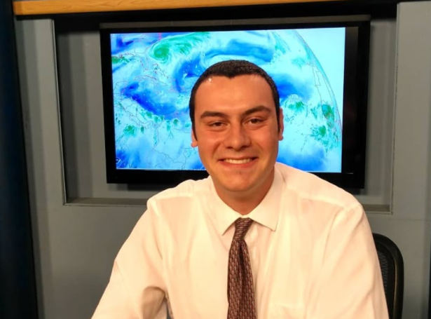
Justin Bettenhauser
Justin attends Plymouth State University and is pursuing an M.S. in Applied Meteorology. In his spare time, he likes to play video games and follow sports. He is a fan of the New York Mets, New York Islanders, New York Giants, and Boston Celtics.
School: Plymouth State University
Major: Applied Meteorology
NOAA Affiliation: OAR Air Resources Lab
Research Title
Abstract
For decades, the aviation industry has sought for ways to have commercial aircraft avoid ash plumes after a volcanic eruption. The Eyjafjallajökull eruption of 2010 shutdown the European airspace for about a month, which caused significant financial losses for commercial aviation companies. The International Civil Aviation Organization will be setting new requirements for probabilistic forecasts of volcanic ash will be implemented in the next 5 years and the Air Resources Laboratory (ARL) is currently creating model simulations that will meet these requirements. The HYSPLIT group within the ARL is responsible for the development of these ensemble model forecasts as well as researching other HYSPLIT transport and dispersion model applications. One eruption that is currently being studied is the October 2020 Bezymianny eruption. The HYSPLIT ensemble output was created by driving HYSPLIT with 31 members of the global ensemble forecast system (GEFS). Using python and Image Magick, images and animations were created to qualitatively compare forecasts from each ensemble member. Satellite retrievals of ash mass loading of the ash cloud were made by the volcanic cloud analysis toolkit (VolCAT) from NOAA and NESDIS and were used in several ways. The forecast images were compared side-by-side for a qualitative comparison. It was observed that capturing the exact location and pattern of the observed ash was difficult. Finally, the receiver operating characteristic (ROC) curve was utilized for a quantitative evaluation of the probabilistic forecast. For many ensembles and time periods, there turned out to be a huge contrast between the forecasted ash plume with the observed one.
Katherine Parise
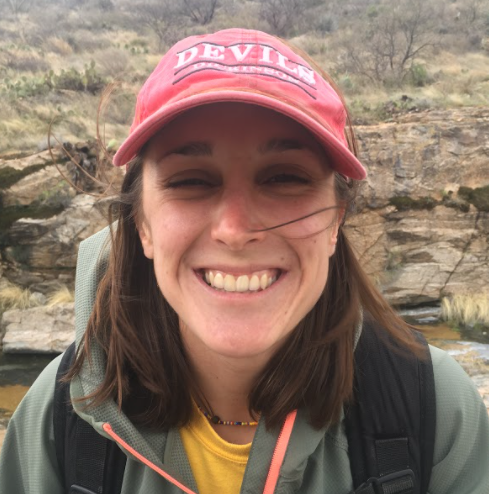
Kat recently graduated from Dickinson College with a degree in Biology and is currently a graduate student at American University in the Environmental Science program. After spending a semester studying marine science in the Caribbean, she wanted to look more closely at environmental issues involving the ocean. She loves spending time outside, and is an avid hiker, biker, and swimmer.
School: American University
Major: Environmental Science
NOAA Affiliation: OAR Ocean Acidification Program
Research Title
Abstract
This project will involve in depth analysis of co-located biological and chemical oceanographic data sets, from OA funded cruises, to determine potential OA impacts. These data sets exist for all US coasts so the student can choose the region they know most about or prefer.

Kayla Hudson
Kayla is an undergraduate student at Jackson State University working on her Bachelor’s of Science degree in Atmospheric Science and Meteorology. One of her earliest memories of weather is Hurricane Katrina and watching it ravage the Deep South. Though she was very young in 2005, Katrina not only heavily destroyed communities in New Orleans but in Mississippi as well. Seeing everyone help each other rebuild after the storm really gave Kayla the urge of wanting to someday provide my heart of service to help others when catastrophic storms like Katrina happen, by alerting the public to a pending storm and helping them to remain calm. From that point in her life, she has had a significant interest in meteorology and helping NOAA.
School: Jackson State University
Major: Meteorology
NOAA Affiliation: NESDIS STAR
Research Title
Abstract
According to McLaughlin et al., 2005 data assimilation is defined as, “A way to integrate the data from a variety of sources with different resolutions and accuracies, with model prediction, to improve deterministic model accuracy.” Data assimilation is known to be helpful in observational data usage and global analyses while at the same time being a key necessity in weather prediction and simulations systems. Although satellite observations are critical for numerical weather prediction, they remain under-utilized in terms of volume of data assimilated, and information content extracted. A machine learning model was developed to optimize observation errors in Numerical Weather Prediction. This research will improve the way satellite observations are used in forecast models. The case study used to execute this is the 2020 Easter Tornado Outbreak and we observed the way the forecast system behaves as it evolves through all the cycles. To effectively execute this process, we analyzed the Easter tornado outbreak for the period around April 12th 14th to base research around this case study. Next, we trained a machine learning model that can predict the way that observations are currently weighted, focus on a single satellite sensor, and evaluate current observation errors assigned. Then we developed the machine learning model to predict the way the current system assigns observation errors; this work led to testing a machine learning model and assessing impact on forecast. The machine learning model was optimized to improve the assignment of observation errors and tests. It would improve it by lowering the errors, getting more information out of them. Ultimately, this project aims to improve the utilization of satellite data in Numerical Weather Prediction’s data assimilation, as well as cater to the improvement of satellite data’s impact through forecast accuracy and weather preparedness for future extreme weather events.

Kendrick Lolange
Kendrick is currently a senior at the University of Massachusetts Boston studying electrical engineering. I love to spend my free time outside and enjoying the fresh air playing sports.
School: University of Massachusetts - Boston
Major: Electrical Engineering
NOAA Affiliation: OAR Pacific Marine Environmental Lab
Research Title
Abstract
The main purpose of this Multipurpose Integrated Diagnostic Acquisition System (MIDAS) is to log data from a quatersized microcontroller called an Openlog Artimus to measure parameters such as pressure via Bluetooth communication for ocean instrumentation. The serial port terminal application (Cool term) was used as a serial communication link between the PC and the microcontroller. Coolterm was simply used to transfer the data from the microcontroller to the PC. The data recorded from the MIDAS is then plotted in real time as a time series graph for observation by engineers and technicians.

Kyle James
Kyle James finished his sophomore year of college at the University of Oklahoma. He is currently majoring in data science and meteorology, and he hopes to go into forecasting or research after my collegiate studies. In his spare time, he likes to travel across the states and internationally, try different cuisines, and hang out with friends.
School: University of Oklahoma - Norman
Major: Meteorology
NOAA Affiliation: OAR Earth Systems Research Lab GSL
Research Title
Abstract
The High-Resolution Rapid Refresh (HRRR) Version 3 and National Blend of Models (NBM) convective forecasts are used by the aviation community to plan and route air traffic within the National Airspace System (NAS). Additionally, they are used as inputs to the Traffic Flow Management Convective Forecast used by the Federal Aviation Administration. This work compares the calibrated HRRR, the uncalibrated HRRR, and uncalibrated NBM quantifying the impact to the NAS owing to differences in convective performance. HRRR and NBM data was provided for March-August 2020 and were compared against the Corridor Integrated Weather System, which was used as the truth data set. Performance was evaluated from an impact-based perspective, using the Flow Constraint Index, which combines weather (Vertically Integrated Liquid and echo top fields) and air traffic data to derive constraint information using a geometry consistent with airspace operations. This method of assessment allows the model performance to be measured as it impacts aviation decision making. Categorical statistics showed that the calibrated HRRR performed better than the uncalibrated HRRR, which performed better than the uncalibrated NBM. This result held true when stratifying by either echo top height or magnitude of constraint. In addition, two case studies (a severe weather event over Michigan and pop-up thunderstorms over Atlanta) were examined to further prove the validity of categorical statistics. Variability in performance is also examined geographically over the US.

Laura Cabrera
Laura T. Cabrera-Rivera is currently a first year doctoral student pursuing a degree in Environmental Health at the University of Puerto Rico, Medical Sciences Campus. During the weekend, she likes to go to the beach with her dog Carmela or stay at home skipping through Netflix shows.
School: University of Puerto Rico
Major: Environmental Health
NOAA Affiliation: OAR Climate Program Office
Research Title
Abstract
Puerto Rico and the U.S. Virgin Islands (USVI) are rich in biodiversity, cultural heritage, and natural resources. More than 3.5 million inhabitants depend on the region’s natural resources and environmental services for their well-being, livelihoods, local economies, and cultural identities. Changing climate and weather patterns interacting with human activities affects land use, air quality, and resource management and poses growing risks to food security, the economy, culture, and ecosystems services (NCA, 2018). On September 2017, Puerto Rico and USVI were struck by two (2) major hurricanes in less than two (2) weeks. There were 2,975 excess deaths related to Hurricane María due to the loss of essential resources and lack of understanding and knowledge. Therefore, the U.S. Caribbean region, including Puerto Rico and the U.S. Virgin Islands (USVI), is a high priority for investment by the Regional Integrated Sciences and Assessments (RISA) Program from the National Oceanic and Atmospheric Administrator (NOAA). NOAA-RISA Program has expanded regional capacity to adapt to climate change by investing in transdisciplinary climate science teams over five-year periods. These regional teams’ main goal is to build sustained relationships between decision makers and researchers that support collaborative and equitable adaptation to climate risks. While the RISA Program has evolved since its inception in the 1990s, it still lacks national coverage across the United States. For that reason, RISA Program partnered with a 2021 William M. Lapenta NOAA Student Intern to conduct a review of the region’s climate impacts, federal investments, partner networks, and research gaps. The findings of the review indicate availability of resources for agriculture, forestry, coastal zone management, and atmospheric science, however there are few federal grant projects related to climate health and few collaborations between Puerto Rico and USVI, two islands that experience the same climate challenges. For that reason, we recommend more institutional support for partnerships between Puerto Rico and USVI and the promotion and encouragement of projects about Climate Health.
Lauren Crane
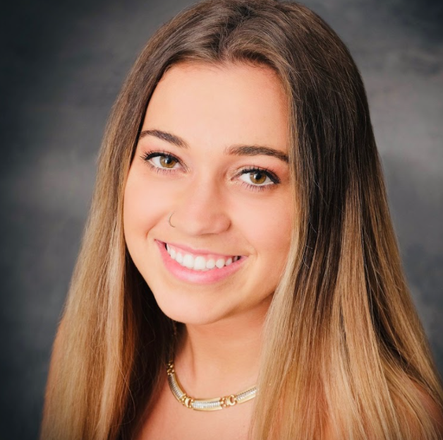
Lauren is a rising senior in Climate and Space Engineering at the University of Michigan with a concentration in Climate Science and a minor in Public Policy. She hopes to combine her aspirations in climate and policy to both research and influence climate policy in order to mitigate carbon emissions and climate change globally. In her free time, Lauren enjoys hiking, camping, and playing tennis.
School: University of Michigan – Ann Arbor
Major: Climate and Space Engineering
NOAA Affiliation: OAR Climate Program Office
Research Title
Abstract
Climate Justice Through the Lens of ACE will present an introduction to Climate Justice and an in-depth analysis of the distribution of climate justice programs across the federal government, as researched and recorded through an Action for Climate Empowerment (ACE) stocktake conducted by myself and two other Lapenta interns from June 2021-August 2021. The stocktake was completed through desktop research of federal budget documents and extensive peer reviewing in order to gain a general, widespread understanding of which existing federal programs were supporting the United Nations Framework Convention on Climate Change (UNFCCC) ACE strategy, with a focus on Climate Justice, a specific initiative of the United States. The presentation aims to break down the dispersion of climate justice and equity programs in terms of which departments they fall under and the balance, or lack thereof, in the underserved audiences and focal points they are addressing. This will be accomplished through statistical charts and visuals that demonstrate not only the stronger areas for climate justice in the federal government, notably racial equity and justice in both the Environmental Protection Agency (EPA) and the Department of Energy, but also the gaps in certain departments and audiences that have yet to be addressed sufficiently, with the lack of gender-sensitive programs and intergenerational programs being a significant gap according to the stocktake findings.
Lauren Vocke
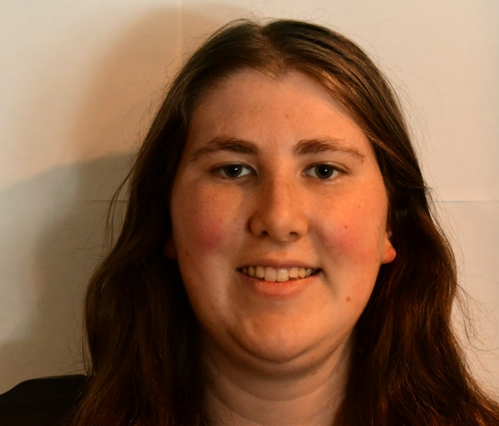
Lauren is currently a graduate student at the University of North Dakota pursuing a master’s degree in Atmospheric Sciences. Originally from New York, she loves to travel, meet new people, and experience the new and exciting weather that different places have to offer. She has had a passion for the weather since she was five, and is especially interested in deploying observations into operations to help with model and forecast accuracy as well as to increase communication and outreach programs to improve forecast perception and understanding among the public.
School: University of North Dakota
Major: Atmospheric Science
NOAA Affiliation: NESDIS STAR
Research Title
Abstract

Leah Barkai
Leah was born in Oahu, Hawaii and started college at the University of Portland then in her second semester sophomore year she studied abroad in Perth, Australia and after the study abroad she transferred to University of San Diego where she is graduating from in May with a BA in Environmental and Ocean Sciences. Leah connects to the NOAA mission most by wanting to share scientific knowledge and information with others so they understand what is happening in the world around us. Also we need to understand and predict changes in the climate, weather, oceans and coasts so we can prepare for those changes and if there is anything we can do to help cope with these changes. She loves being outdoors, especially the ocean either surfing, snorkeling or swimming. She hopes to gain research experience from this internship and is very excited about this opportunity!
School: University of San Diego
Major: Environmental and Ocean Sciences
NOAA Affiliation: OAR/ESRL Global Monitoring Laboratory
Research Title
Abstract
The Ozone and Water Vapor group of NOAA’s Global Monitoring Laboratory makes long-term continuous measurements of the Earth’s ozone layer at key locations around the world. A key tool for making these measurements is the Dobson spectrophotometer. It was first designed by Dr. Gordon Miller BourneDobson in 1931, and has been used for gathering Total Column Ozone (TCO) measurements ever since. Dobson Spectrophotometers were designed to be self-calibrating by the Langley technique, but the environments in which they’re operated are often unsuitable for conducting calibrations. Therefore, the World Meteorological Organization devised a calibration scheme in which a single standard instrument is calibrated at a pristine environment, and all other instruments are assigned calibrations by comparison to that standard. NOAA GML is the custodian of the world standard and checks its calibration every two years at their observatory in Mauna Loa, Hawaii by taking measurements with Dobson spectrophotometer 083. The Dobson returns total column ozone values in Dobson Units (DU) where one DU equals 0.01 millimeters of pure ozone at standard temperature and pressure. The total column ozone is the amount of ozone contained in a hypothetical column of air between the Dobson and the outer edge of the atmosphere. The Dobson method evaluates the amount of ozone by comparing the relative change of the Solar ultraviolet light measured by the instrument to what the instrument would measure outside of the atmosphere (so-called calibration constant). The Langley technique graphs the relative intensity measured by the instrument with respect to the path length through the ozone layer, and then extrapolates data to a path length of zero, which is called the calibration constant. The project was important for three reasons: 1) collecting continuous measurements of the ozone layer at MLO, 2) verification of historic, ongoing and new satellite ozone records and 3) applying the network calibration technique called Langley to verify the World Dobson Standard calibration. The results will be compiled and plotted against previous years starting in 1972.

Macy Chang
Macy is a Master’s student in the Environmental Engineering program at UC Berkeley, with emphasis in Environmental Fluid Mechanics and Hydrology. She plans to conduct graduate research on ocean-atmospheric interactions and is educated in environmental science, fluids, molecular biology, and GIS. In her free time, she enjoys outdoor recreation including camping, volleyball, and scuba diving.
School: University of California at Berkeley
Major: Environmental Engineering
NOAA Affiliation: OAR Geophysical Fluid Dynamics Lab
Research Title
Abstract
Ocean currents in the Solomon Sea, a semi-enclosed sea in the southwestern tropical Pacific, feed into the Equatorial Undercurrent (EUC) through three northern exit straits, providing dissolved iron (dFe) to the iron-limited eastern equatorial Pacific waters. As iron is a significant and limiting nutritional component of oceanic primary productivity, it is important to understand projected future change of the Solomon Sea’s outbound dFe transport. This study compares model projections of ocean volume and dFe transport out of the Solomon Sea under the high-emissions future scenario Shared Socioeconomic Pathway 5-8.5 (SSP5-8.5). Volume and dFe transport calculations are derived from a series of simulations performed using two state-of-the-art coupled GFDL models, GFDL-CM4 and GFDL-ESM4. Observations of transport and iron concentrations in the Solomon Sea are first used to assess the mean-state performance of the two models. The simulated vertical flow structure and distribution of transport between the straits differs from that observed; however, both models have net volume transports which are consistent with observed estimates (18.5 Sv annual mean). Net volume transport exiting the Solomon Sea is projected to increase in magnitude and interannual variability under the SSP5-8.5 scenario in both models. The vertical structure of dFe concentrations is more consistent with observations in ESM4 compared to CM4, likely due to its more sophisticated treatment of iron cycling. This suggests a higher level of confidence in projected changes in Solomon Sea dFe concentrations in ESM4 compared to CM4. ESM4 projects dFe transport out of the Solomon Sea to decrease by 3.0 x 10¹⁰ mmol/year (-9.6%) under SSP5-8.5 conditions. The results suggest that anthropogenically-forced climate change may lead to a decreased delivery (and increased interannual variability) of iron-rich waters from the Solomon Sea region into the equatorial Pacific, which may influence oceanic primary productivity. This study underscores the importance of conducting model validation in understudied regions to reduce regional biases in model development and reduce uncertainty in future climate projections.

Madeline Statkewicz
Maddie Statkewicz is a rising fourth-year Ph.D. candidate in atmospheric science at the University of Houston and earned a B.S. in applied mathematics at the University of South Alabama. Her research concerns the impact of changing precipitation patterns on flooding in Houston, TX, a rapidly growing urban area. She is passionate about teaching as well as science communication and policy, and she hopes to one day become a professor.
School: University of Houston
Major: Atmospheric Science
NOAA Affiliation: OAR Climate Program Office
Research Title
Abstract
New York City is a petri dish of atmospheric chemistry due to its unique combination of natural and anthropogenic emissions. Subsequently, there are many current and planned campaigns to measure and characterize the City's atmospheric composition in both the short- and long-term. This project will categorize, describe, and connect seven scientific measurement campaigns: two ground-based studies (LISTOS and NYC-METS), three aircraft campaigns (CUPiDS, AEROMMA, and GOTHAMM), and two satellite missions (TEMPO and GeoXO). All of these activities will be presented cohesively in a single infographic to inform stakeholders, policymakers, and citizens alike of the exciting atmospheric campaigns in New York City.

Maggie Bruckner
Maggie Bruckner is an atmospheric science PhD student at the University of Wisconsin working with Dr. Brad Pierce. She earned her bachelor’s degree in environmental science from the University of Portland. In her spare time she enjoys a variety of activities including playing ultimate frisbee, hiking, and reading novels.
School: University of Wisconsin - Madison
Major: Atmospheric Science
NOAA Affiliation: OAR/ESRL Global Systems Lab
Research Title
Abstract
During August and September of 2020 air quality and visibility in the western US was greatly degraded as a result of wildfire smoke. The 2020 fire season was one of the worst on record, and resulted in hazardous air quality across Washington, Oregon, and California. The High-Resolution Rapid Refresh-Smoke (HRRR-Smoke) model forecasts 3D smoke concentrations on an hourly refresh cycle, with wildfire emissions estimated from VIIRS and MODIS fire radiative power (FRP) data. Previous evaluations of HRRR-Smoke forecasts have focused mostly on surface particulate matter and satellite derived smoke aerosol optical depth (AOD). In this study we evaluate HRRR-Smoke forecasts with hourly aerosol optical depth (AOD) observations from the Aerosol Robotic Network (AERONET).

Michael Michaud
Mike Michaud is a PhD student at the University of Delaware studying Disaster Science and Management. Trained first as an atmospheric scientist, and now as a social scientist, he enjoys bridging the gap to better incorporate social science into the physical sciences. When not working, Mike is an avid kayaker and boater, enjoys cooking and baking, and is usually providing attention to his very adorable dog.
School: University of Delaware
Major: Disaster Science and Management
NOAA Affiliation: OAR Weather Program Office
Research Title
Abstract
Following Hurricane Sandy in 2012, more attention turned to the need for improving Numerical Weather Prediction capabilities within the United States as it became evident they were outperformed by models developed internationally. This led to the creation of the Unified Forecast System (UFS) to simplify the operational suite of models and capitalize on “community modeling”. While the idea of community modeling is not new, it can take different forms and meanings. It is important to have a common definition and understand what it means to be part of a community before being able to strengthen one. This project examines perceptions of “community modeling” from key stakeholders involved with the UFS and the Earth Prediction Innovation Center (EPIC). As a center designed to build partnerships, EPIC must be aware of perceptions and understanding of what it means to be part of the community. Through data from interviews with key stakeholders across different sectors of earth prediction, and utilizing theoretical and practical frameworks, this project makes recommendations on how EPIC can cultivate a Community of Practice and continuously engage members to develop a sense of community.
Michelle Spencer
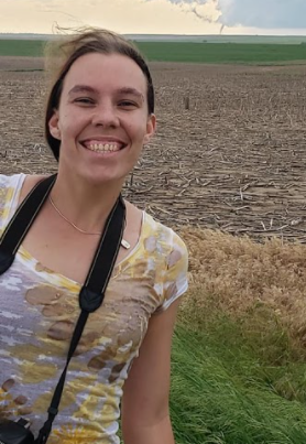
Michelle Spencer is a Metropolitan State University of Denver alumni who graduated with her Bachelors of Science degree in Meteorology in December of 2019. She is now pursuing her Masters degree in Atmospheric Sciences at the University of Wisconsin-Milwaukee where she is studying the influence of SST uncertainty on severe weather forecasts in the southeast US. She strives to understand the mechanisms driving different weather phenomena. She enjoys camping, the Colorado mountains, and anything outdoors during her spare time.
School: University of Wisconsin - Milwaukee
Major: Atmospheric Science
NOAA Affiliation: OAR Atlantic Oceanographic and Meteorology Lab
Research Title
Abstract
The strong winds, rainfall, and surface heat fluxes from tropical cyclones (TCs) can force pronounced changes in sea surface temperature (SST) as well as subsurface temperature, salinity, and upper ocean velocity. This study characterizes the effects of TCs on the ocean by determining the primary storm factor(s) controlling surface and subsurface temperature, salinity, and velocity before and after the storm passes. We use direct observations of the ocean and near-surface atmosphere from the Prediction and Research Moored Array in the Tropical Atlantic (PIRATA) to investigate the effects of TCs on the upper ocean. Between 1998 and 2020, nine TCs were identified with wind speeds in excess of 15 m/sec, as measured by one of the PIRATA moorings, and for which hourly mooring data was available. These storms passed within two degrees of the moorings located at 20N, 38W; 15N, 38W; or 12N, 23W in the tropical North Atlantic Ocean. Along 38W, where ocean temperature stratification is weak, it is found that TC-induced SST cooling is linked primarily to storm intensity (maximum near-surface wind speed). In contrast, ocean temperature stratification is likely the primary driver for SST cooling at the 12N, 23W site, where stratification is strong and weaker storms are able to produce large SST decreases. Interestingly, the upper-ocean velocity response to TCs does not show a strong relationship with the pre-storm ocean state and instead depends mainly on TC intensity. Potential implications of these results for understanding the ocean’s response to TCs and predicting the ocean’s feedback to TC intensity will be discussed.

Milton Stookey
Milton is a rising senior at the University of California at Berkeley, majoring in Physics. He has been very aggressive about improving his knowledge of how the biosphere interacts with the atmosphere and machine-learning itself. He has been a paid research assistant investigating soil samples and how non-till cropping can be established in cities. His research interests include applications of quantum computing to weather prediction and ecosystem processes, remote sensing for drought and flood mitigation, remote sensing for increasing agricultural efficiency and sustainability, fungal networks as holistic ecosystem health indicators, and harnessing fungal translocation to warn ecosystems of imminent pest, disease or environmental threats.
School: University of California - Berkeley
Major: Physics
NOAA Affiliation: NWS/NCEP Environmental Modeling Center
Research Title
Abstract
NOAA’s Unified Forecast System (UFS) is a global coupled Earth modelling environment with considerable spatial and temporal flexibility. The UFS environment is being used for development of the next generation of the operational Global Forecast System, GFS v.17. Progress is made incrementally using UFS Prototypes, each one bringing in new features or physics. This work documents recent steps taken to configure the Land Verification Toolkit (LVT) from NASA’s Land Information System Framework (LISF) for UFS model evaluation. LVT is a formal system for land surface model evaluation, providing numerous evaluation capabilities for insitu observations, as well as gridded, remotely sensed, and reanalysis products in their native formats. LVT offers accuracy-based metrics, uncertainty and ensemble diagnostics, information theory, spatial similarity and scale decomposition metrics, as well as external masking and stratification options, lending it considerable evaluation breadth and flexibility. In order to allow LVT to work with native data formats, a custom reader must be developed for each datastream. A reader was created for UFS Prototype single-month outputs, and was extended to allow for multi-year evaluations. Initial accuracy-based evaluations were performed on output against International Soil Moisture Network CONUS stations from July 2012. Results were found to be consistent with previously performed evaluations. Subsequently, 8 years of Prototype 6 soil moisture outputs (2011-2018) were evaluated using the ESA CCI SM Combined (active scatterometer and passive radiometer) product (0.25º daily), with a focus on land type classifications. Finally, albedo evaluations were performed using the MODIS GLASS albedo product (0.05º 8-daily). This initial work aims to incentivize the use of LVT by non-LIS groups. Future work would seek to increase interfacing between UFS outputs and LVT, so as to take full advantage of the framework’s evaluation capabilities.

Miranda Bitting
Miranda is from Catonsville, MD and she just graduated from the University of Delaware this spring, earning an honors B.S. in meteorology and climatology with a minor in geography. Next fall she will be starting a master's program in meteorology at Penn State University, where she will study the evolution of coastal storms. Some of her primary interests are forecasting, coastal storms, hail, and weather communication. She has worked with NWS at the Office of Observations, the State College Weather Forecast Office, and now the Weather Prediction Center. Miranda has loved her experiences at NOAA and plans to pursue a career in forecasting for the National Weather Service.
School: Pennsylvania State University
Major: Meteorology
NOAA Affiliation: NWS/NCEP Weather Prediction Center
Research Title
Abstract
The Flash Flood and Intense Rainfall (FFaIR) experiment is a Hydrometeorological Testbed experiment that evaluates the utility of certain operational and experimental models in the context of forecasting extreme precipitation events. Last year in FFaIR, participants noted that “popcorn” convection simulated by FV3 convective-allowing models (CAMs) had a large wet bias in both the hourly and 24-hour QPF from these storms and had the appearance of grid-cell storms. In order to investigate this trend and to try and identify a possible cause for these grid-cell storms, instantaneous precipitation rates (hereafter p-rate) from the models were compared to p-rates from the Multi-Radar Multi-Sensor (MRMS) QPE. The FV3-CAM models evaluated in the study were the EMC FV3-LAM and FV3-LAMDAX as well as the GSL RRFS1. First, a time series analysis was done on the four data sources using the maximum p-rate for each model each hour. This showed a clear trend: all three experimental models consistently overestimated the maximum p-rate, with the RRFS1 demonstrating the highest overestimation on the majority of dates studied. Additionally, heat maps were created to illustrate the amount of grid points showing certain p-rates for each forecast hour. According to the daily heat maps, it is clear that all three experimental models have significantly more p-rate grid point values above 10 in/hr than the MRMS data.
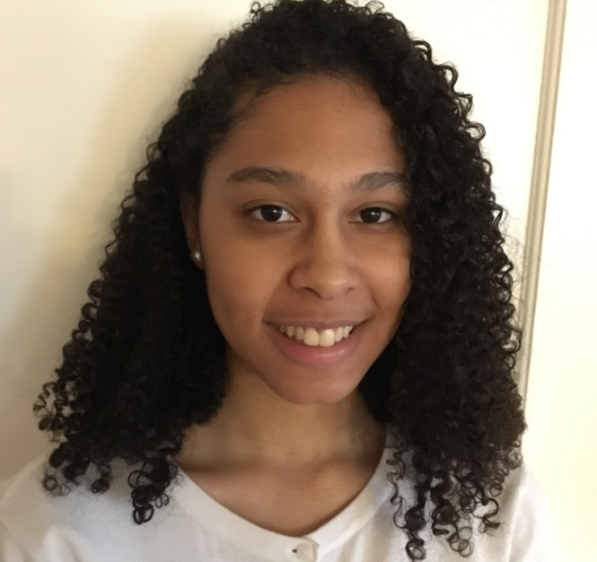
Naylah Perodin
Naylah Perodin is a rising senior at Loyola University Maryland. She is working on her B.A. in Computer Science with a minor in Information Systems. Her connection to the NOAA mission is her desire to help improve the analysis and prediction of climate change through the use of AI. NOAA’s focus on scientific research and involvement with satellite data acquisition and observation align with her interests. NOAA’s mission of sharing knowledge and awareness about atmospheric and oceanic changes resonates with Naylah and she looks forward to using her software development skills to support that mission. Her hobbies are solving puzzles and baking desserts.
School: Loyola University of Maryland
Major: Computer Science
NOAA Affiliation: NESDIS STAR
Research Title
Abstract
After reviewing the vegetation indices from the NOAA-20 and S-NPP satellites, it has been determined that there are locations and intervals of time when high quality vegetation index values cannot be obtained. In order to improve the VIIRS vegetation indices, we need to complete a correlation validation study between the PhenoCam Green Chromatic Coordinate (GCC) and satellite Green Vegetation Fraction (GVF) values, as the GVF values are derived from vegetation indices. The study will provide insight on where and how improvements to the vegetation products can be implemented. We have created a correlation tool that calculates and validates the annual and seasonal correlation between the GCC and GVF values. After reviewing the results of the study, we have determined that there is a stronger correlation on average between the GCC and NPP and NOAA-20 GVF values than between GCC and existing AVHRR GVF climatology. This indicates that improvements to the GVF climatology should be possible by using NPP or NOAA-20 data. In future work, a monthly NPP GVF climatology will be computed and that improvement will fill in the missing gaps to produce a more precise product.
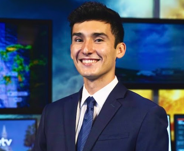
Nicholas Mesa
School: University of Florida - Gainesville
Major: Civil Engineering
NOAA Affiliation: OAR Atlantic Oceanographic and Meteorology Lab
Research Title
Abstract
By using frequent and near-coincident NOAA aircraft and satellite observations, we can provide greater detail and context to the dynamics of an intensifying tropical cyclone, fostering a better understanding of intensification to improve forecasts. We sought to use these observations to investigate the spatiotemporal evolution of precipitation and relative humidity in an intensifying tropical cyclone with respect to vertical wind shear. Our hypothesis proposed an increase in the mean relative humidity in the upshear portion of a tropical cyclone as it intensified, indicating a more symmetric moisture distribution which is conducive to sustained convection. This project focused on Hurricane Edouard in 2014 to look into this evolution while also establishing the framework for analyzing the forthcoming abundance of near-coincident observations from the NASA TROPICS constellation. By determining the frequency of near-coincident observations in Edouard and “matching” the data, a unique and comprehensive dataset was created that combined data from satellite microwave retrievals, tail-Doppler radar, and dropsondes.
Preliminary diagnostic products were created to investigate how the mean relative humidity in the mid-troposphere changed over time in the upshear and downshear quadrants of the storm. One challenge was the presence of “contaminated” pixels in the microwave soundings. These pixels were mainly associated with areas that were likely to have precipitation or convection. While Edouard provided an intriguing initial case, other tropical cyclones should be investigated in a composite analysis. Overall, this tool could be valuable for future use by incorporating additional datasets and creating other derived diagnostic products. Thus, this project enables a streamlined and thorough analysis of past and future tropical cyclones that spans time, space, and different observational platforms.

Nicole Hilton
Nicole Hilton is an Army veteran and an expected December 2021 graduate of the Master of Arts in Geography program at the University of North Carolina at Charlotte, with a Bachelor of Science in Communication from the University of North Florida. She shares NOAA's desire to understand the impacts of dynamic natural and human-facilitated environmental conditions on economic activity, population health and wellbeing, and decision-making, and to produce related informational products that enlighten and encourage sustainable action based on sound science. Her other interests include pursuing additional knowledge and self-development, reading and writing fantasy, and engaging in philosophical and intellectual discussions.
School: University of North Carolina – Charlotte
Major: Geography
NOAA Affiliation: OAR Climate Program Office
Research Title
Abstract
The global resource landscape, including labor and the environment, faces significant risks due to climate change, which has equally significant implications for our civilizations. This dynamic is influenced heavily by policy and action, with endeavors such as the United Nations Framework Convention on Climate Change (UNFCCC)’s Action for Climate Empowerment (ACE) strategy crafted to provide guidance for sustainable and equitable progress towards the Paris Climate Agreement goals, while honoring the unique context of each country and leveraging the power of the local people. Despite the United States not yet adopting an ACE national strategy of its own, this project discovered the implementation of ACE-related elements in over 200 federal programs. Through the examination of fiscal year 2022 budget documents and other sources of publicly available information with refined ACE element definitions adapted for the U.S. context, an initial inventory of federal programs was generated, internally reviewed, and analyzed between June 2021-August 2021. Of the six elements within the framework that these programs may have incorporated, however, the demands for skills emerging from the impacts of climate change and potential transitions lend to the imperative nature of the ACE-element ‘Training’, which focuses in large part on capacity building and workforce development, in particular. This presentation synthesizes the findings of this element-specific analysis, determining the scope of programmatic inclusion and identifying opportunities for future integration

Patricia Razafindrambinina
Patricia is a Lapenta intern who will be working with the GML group. She earned her B.S. in Biochemistry from California State University – Fullerton, and now is a graduate student in chemistry at the University of Maryland at College Park studying the effects of aerosol particles on the climate. Outside of research, Patricia leads UMD’s Graduate Science Policy Group and is an active science advocate with the American Geophysical Union who enjoys writing policy memos and op-eds. In her free time, Patricia loves to cook, social dance, and hang out with her cat, dog, parrot, and bunnies.
School: University of Maryland – College Park
Major: Chemistry
NOAA Affiliation: OAR/ESRL Global Monitoring Lab
Research Title
Abstract

Quinn Bustos
Quinn Bustos is working towards her Bachelor of Science in Technical Communication at the New Mexico Institute of Mining and Technology. Her primary career goal is to help better the Earth by increasing environmental awareness and conservation through her work. In her free time, Quinn enjoys playing the cello and swimming.
School: New Mexico Institute of Mining and Technology
Major: Technical Communication
NOAA Affiliation: OAR Climate Program Office
Research Title
Abstract
Public awareness of climate is essential to fighting against climate disruption. The United Nations Framework Convention on Climate Change (UNFCCC) recognized the importance of climate awareness among the public, and included it in Article 12: Action for Climate Empowerment (ACE). As the United States moves toward implementing an ACE national strategy, it was necessary to take a preliminary inventory of federal programs in the U.S. to discover what ACE-related work is currently being done or is planning to be done in the future. The inventory was conducted by two other interns and I who researched many federal programs to see what ACE elements they included. This presentation uses data from that inventory to determine where the most climate public awareness programs are in the government, what audience is most served by these programs, and which other ACE elements the climate public awareness programs typically address. I found that the Department of Commerce had the most climate public awareness programs in our inventory. The audience most served was the community, and the other ACE element most commonly addressed in climate public awareness programs was education.

Rachel Han
Rachel is a rising fourth-year at UCLA majoring in Environmental Science with a concentration in Atmospheric and Oceanic Science. She is really excited to start her summer at NOAA because since Rachel was younger she has wanted to help improve our Earth. Rachel has traveled to different countries and seen the vast biodiversity that exists around the world and she wants to keep it that way. Some of her favorite hobbies include hiking and playing softball! She also has two Bernese Mountains Dogs that she loves to death.
School: University of California – Los Angeles
Major: Environmental Science
NOAA Affiliation: NWS/NCEP Ocean Prediction Center
Research Title
Abstract
Due to a period of intense extratropical cyclones this past winter, this project studied the different ocean and atmosphere behaviors that potentially contributed to this extreme storminess in the North Pacific. In late November, the ultra-large container vessel ONE Apus lost over 1,800 containers when it encountered swell generated from a very intense cyclone, resulting in $90 million in cargo loss alone. In late December the crew from FV NNE of Midway Island was reported missing, presumed to have abandoned the ship, and never found. The COVID-19 pandemic has highlighted the dependency of the world’s population on transoceanic shipping as a key component of global supply chains and the reliance on accurate marine weather forecasts to prevent the loss of cargo and lives. This project highlights two different storm periods during the fall and winter of 2020- 21, November 29th to December 4th and December 30th to January 8th, and examines the evolution of large-scale atmospheric circulation patterns of the Northern Hemisphere during and leading up to these two periods of frequent extreme extratropical cyclone activity. We analyzed sea level pressure, 500-hPa geopotential height, and wind speed to see where these storms were developing. We then compared the anomalous fields during the two periods of cyclone activity with those associated with several teleconnections, focusing primarily on the Pacific-North American (PNA) and the North-Pacific Oscillation patterns. This year, we were in a La Niña year, but the PNA (which is typically negative during a La Niña) did not exhibit the expected behavior. The pattern of z500 anomalies for each storm period are consistent with the dominant teleconnections during those days. However, during both date ranges there were more than one strong teleconnection observed, meaning these stormy periods may be reflections of the constructive interference of multiple modes of large-scale climate variability. Assumptions made within the project and potential future projects will also be discussed.

Sam Coakley
Sam Coakley is a Ph.D. candidate in Physical Oceanography at Rutgers University. He is fascinated by the coupling of tropical cyclones and the upper ocean. As a true oceanographer, if Sam isn't at work, you can find him at the beach.
School: Rutgers University
Major: Physical Oceanography
NOAA Affiliation: OAR Global Ocean Monitoring and Observation
Research Title
Abstract
The 2020 Atlantic hurricane season holds the record for the most billion-dollar tropical cyclones (TCs) with 7 landfalling on the U.S. coast. TC track forecasting has seen great improvement while intensity forecasting lags behind. The limited improvement in intensity forecasting can be partially attributed to an incomplete understanding of ocean-TC interactions. Ocean observations have been increasingly acknowledged by the scientific and operational forecast communities as critical to improving Earth system prediction.
This work presents a coordinated, multi-institutional, and multi-platform approach to capture the ocean features that affect TC intensity. This effort will focus on the essential ocean features (EOFs) of the Gulf of Mexico and the Caribbean Sea and provide recommendations for how to best observe these features for the ultimate goal of improving TC intensity forecasts.
Sustained surface ocean observations during hurricane season help to improve the initial conditions in data assimilative coupled models, which has been shown to improve intensity forecasts. We will use autonomous platforms, such as underwater gliders and saildrones, to monitor EOFs throughout a hurricane season. Colocated ocean and atmospheric observations targeted at a TC would help develop air-sea interaction theory by capturing the evolution of both the ocean and atmosphere throughout the passage of the TC. Air-deployed instruments allow us to study the small-scale, nonlinear interactions of the ocean and TCs.
Closing gaps in NOAA’s ocean observations by capturing sustained and targeted ocean observations and coordinating colocated ocean-atmosphere observations is essential to accurately representing the ocean in Earth system models and improving forecasts.

Samuel Ephraim
Sam Ephraim is a senior at the University of Michigan majoring in meteorology and computer science. He is from the Chicago area and has loved to observe the weather since a young age. He is excited to learn new skills in addition to applying his prior knowledge while at NCEP. Outside of his studies, he loves to sail and is on the University of Michigan Sailing Team.
School: University of Michigan – Ann Arbor
Major: Meteorology and Computer Science
NOAA Affiliation: OAR Weather Program Office
Research Title
Abstract
The goal of the Earth Prediction Innovation Center (EPIC) is to enable the most accurate and reliable operational numerical forecast model in the world. EPIC will achieve this goal through community engagement where students, researchers, professors, and other community members can collaborate to develop open-source code for the Unified Forecast System (UFS). One way to spark the interest of new community members is through Graduate Student Tests (GST), which are usability tests that entail running, modifying, rerunning, and comparing outputs of the UFS code and its applications.
In order to increase accessibility of the UFS GSTs, cloud versions were developed as part of a William M. Lapenta internship project at NOAA. The cloud-based GSTs include documentation with instructions to run containerized versions of the UFS usability tests on the Amazon Web Services (AWS) platform that utilize new plotting scripts to visualize results, as well as a FAQ document. Running the GSTs on the cloud is important for increasing accessibility because people without access to HPCs will now be able to run the GST quickly and cheaply using any device that can connect to the internet. Cloud-based GSTs are expected to increase the number of people running the UFS. This will in turn increase the pool of people contributing to the UFS, which will help NOAA develop the most accurate and reliable operational numerical forecast model in the world.
This talk will discuss the GSTs in depth and explain some of the challenges of deploying the GSTs in the AWS cloud. Performance metrics from running the GSTs in the cloud along with opportunities of future engagement with

Sean Parker
Sean is currently a graduate student at Rutgers University majoring in Atmospheric Science. He got his BS in Meteorology at Rutgers Univ in the last year. He has also been a project lead for WxPrediction LLC, concentrating on S2S, and also serves the New Jersey Army National Guard. Sean wants to utilize this internship to improve his knowledge and understanding of earth system models, to effectively prepare for a future career in accurately forecasting seasonal impacts and risks associated with a warming climate. He strives to combine that knowledge with his education to effectively communicate climate research with people outside of the science community.
School: Rutgers University
Major: Meteorology and Atmospheric Science
NOAA Affiliation: NWS/NCEP Climate Prediction Center
Research Title
Abstract
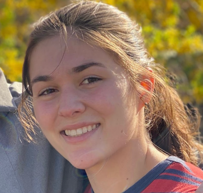
Sophie Grimsley
Sophie is a rising senior at the University of South Carolina’s Honors College. She is majoring in Environmental Science and hopes to one day forecast hurricanes for the National Hurricane Center. She grew up dealing with hurricanes in Jacksonville, Florida, and she enjoys hiking, soccer, and trying new kinds of tea in her free time.
School: University of South Carolina
Major: Environmental Science
NOAA Affiliation: OAR Atlantic Oceanographic and Meteorology Lab
Research Title
Abstract
Accurately forecasting hurricane intensity change is important for timely hurricane preparedness and impact-based forecasts. Previous studies have shown that air-sea interactions and boundary-layer processes play a key role in regulating hurricane intensity change. Despite its importance, the hurricane boundary layer has been the least observed part of a storm, and how the boundary layer structure evolves during intensity change is not well understood. The purpose of this study is to identify key boundary layer structure in relation to intensity change by analyzing aircraft observations in Hurricane Irene (2011). A total of ~80 dropsondes, and Tail Doppler Radar (TDR) and lower-fuselage radar data from 4 continuous reconnaissance flights into Hurricane Irene at different intensity stages are analyzed. Structural metrics including boundary layer height, inflow strength, and moist entropy are evaluated. Both symmetric and asymmetric distribution of the boundary layer structure are presented. Results show that a) there is no apparent correlation between the axisymmetric boundary layer height and intensity; b) both the height of maximum wind speed and mixed layer depth increase with radius; c) the mixed layer depth downshear is shallower than upshear before intensification; d) near-surface equivalent potential temperature shows a shear-relative wavenumber-1 asymmetry that is tied to the asymmetry of convection; and e) surface enthalpy fluxes are enough to recover downdraft induced low-entropy air before the intensification period of Irene.
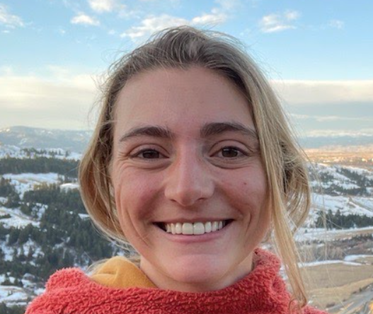
Sylvie Alexander
Sylvie is a junior at Scripps College pursuing her B.A in Environmental Analysis. She is concentrating in Psychology and minoring in Geology. Sylvie is passionate about climate change and the role the ocean plays in climate regulation. In her free time she enjoys hiking, mountain biking and exploring fiber arts! She will be studying abroad in Iceland from middle of August to around Thanksgiving.
School: Scripps College
Major: Environmental Analysis
NOAA Affiliation: OAR
Research Title
Abstract
Sylvie will serve on the NOAA Carbon Dioxide Removal (CDR) Task Force and lead NOAA's cross line office portfolio analysis for the NOAA
CDR Science Strategy white paper and the development of a summary document for senior leadership. They will also engage with other
federal agencies through the USGCRP Carbon Cycle Interagency Working Group as part of their interagency CDR efforts. This internship will
require engagement with scientists and program managers throughout NOAA and academic partners.
