
Unpredictable: The President’s Day Storm of 1979 - National Weather Service Heritage
Unpredictable: The President’s Day Storm of 1979
By Emily Senesac (emily.senesac@noaa.gov)On an ordinary winter day in early 1979, rather unremarkable other than the fact that it was “bitterly cold”, the Mid-Atlantic states braced for an incoming weekend snowstorm. Forecasts called for around four to six inches of snow to fall across the region over President’s Day weekend. However, that was not to be. Widely regarded as the worst storm to strike the Mid-Atlantic in almost 60 years, the President’s Day Storm paralyzed the region for days.
A high pressure system over the US-Canada border pushed the cold air needed for snow. As a classic “Nor’easter” developed, the cold air mass spread south and east, meeting the warm ocean air in the Gulf and creating a “breeding ground” for storms.
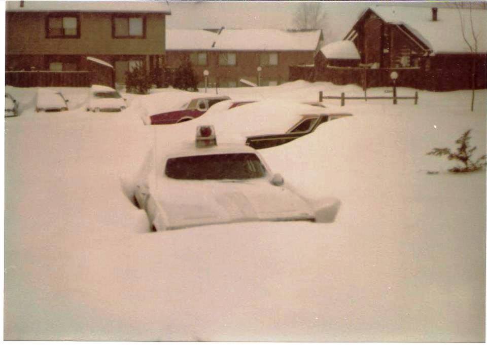
Though the storm was anticipated to some degree, the weather forecasting models of the day drastically under-predicted the severity of the storm and were unable to account for the rapid cyclogenesis, or strengthening of the cyclone circulation around a low-pressure area, that occurred. By Monday, February 19, snow was falling at an unprecedented rate of almost five inches per hour, accumulating to over 20 inches across northern Virginia and Maryland, nearly 25 inches in Delaware, and over a foot in North Carolina. Roads were blocked, impassable even to snowplows. Fortunately, the “Tractorcade” movement had just come to the nation’s capital. Farmers from across the Midwest had driven their tractors to the National Mall to protest the agricultural policy of the Carter administration just before the storm hit. In the aftermath, some of the farmers generously attached blades to their tractors to help clear roads and assist stranded motorists.
Though few fatalities and injuries occurred, NWS meteorologists and the larger research community began to investigate the failure of the forecast models and search for a way to improve it. As temperatures warmed and snow began to melt, operational and research communities came together under a common understanding: enough was enough.
In the years since the President’s Day Storm of 1979, forecasting model technology has undergone monumental improvements; in fact, many of today’s research and operational model suites exist as a result of the response to this record-shattering snowstorm. Additionally, The Extratropical Cyclone Workshop, an annual gathering of experts in the field who work to develop and improve model capabilities, was launched in May of that same year.
While the 1979 storm was undoubtedly historic, it wasn’t the only storm with that name: the “second” President’s Day Storm struck the same region in 2003. However, due to improved computer forecasting and model advancements, cities up and down the coast were much better prepared.
Additional Reading
-
Mid-Atlantic Winters: Snow, Wind, Ice and Cold: https://www.weather.gov/lwx/winter_DC-Winters
-
Scientific Review of the President’s Day Storm by NWS Director Dr. Louis W. Uccellini (2014): https://ocean.weather.gov/2-PresidentsDayStormColloquium_Uccellini.pdf