Tragedy at Joplin-The EF-5 of May 22, 2011 - National Weather Service Heritage

Tragedy at Joplin-The EF-5 of May 22, 2011
By Emily Senesac (emily.senesac@noaa.gov)In the aftermath of the historic and deadly April 2011 Super Outbreak of tornadoes across the Southeastern US, it had become increasingly evident to the NWS that forecasts and warnings for severe weather threats needed an added element to make their messaging reach the “last mile” of effectiveness in modern-day society. As communities across the Southeastern US were still reeling from a busy and tragic April, an unthinkable tragedy struck again in a different part of the country about one month later.
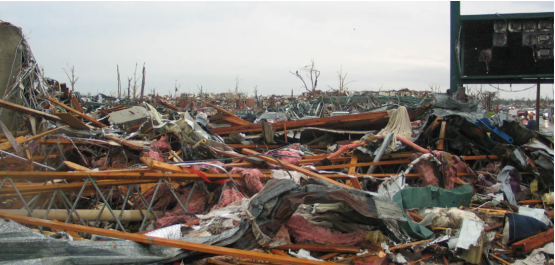
Sunday, May 22, 2011 started out as a hot, humid day in the southern United States. By late afternoon, a large supercell thunderstorm had developed just east of Joplin, Missouri, producing a massive wedge tornado on the southwestern edge of the city and continued to grow in size and track directly through the heart of Joplin. This storm generated additional tornadoes, caused extreme wind damage and flash flooding, and resulted in incredible devastation and tragic loss of life.
With wind speeds exceeding 200 miles per hour, almost 160 fatalities and more than 1000 injuries occurred in Joplin alone, making it the 7th deadliest tornado on record. Numerous well-built houses and buildings were torn from their foundations, and vehicles of all sizes were thrown more than 200 yards and destroyed beyond recognition. Due to the sheer wind power, trees were stripped of bark and asphalt was ripped from roads and parking lots. In its wake, the EF5 strength tornado left much of Joplin in a state of complete devastation.
Meteorologists, structural and wind engineers, and numerous others continue to study this catastrophe even now, nearly a decade later, with the intention of creating safer communities. In response to the tragedy at Joplin and the other devastating and powerful tornadoes of 2011, the NWS explored and eventually implemented a number of enhancements to improve severe weather warning and response. The most important enhancement was the reformatting of Severe Thunderstorm and Tornado Warnings into the “Impact-Based Warning” product structure. This paradigm restructures key information in the warning, such as the level of threat (i.e. “large and damaging tornado”) and source of the information (i.e. trained spotter) into quick and easy to visualize bullets and sections, as well as an “Impacts” section that quickly describes what that threat is capable of producing in terms of life and property threats. This impact-based information allows community decision makers to make quick and appropriate decisions regarding their local area in dangerous situations, one of the primary hallmarks of the Weather-Ready Nation (WRN) effort.
For almost a decade, the NWS has led the WRN effort, dedicated to education, outreach, and collaborative efforts to help improve resilience and preparedness in communities across the country. As decision makers nationwide continue to make life-saving decisions in the face of dangerous weather, the NWS moves forward in its mission of creating a Weather-Ready Nation.
Additional Reading:
- Winds of Change: the 2011 Tornado Outbreak and the Birth of a Weather-Ready Nation. https://vlab.noaa.gov/web/nws-heritage/-/winds-of-change-the-2011-tornado-outbreak-and-the-birth-of-a-weather-ready-nation
- Overview of Joplin Tornado-May 22nd, 2011 https://www.weather.gov/sgf/news_events_2011may22
