
Then and Now: Decades of Hurricane Preparedness - National Weather Service Heritage
Then and Now: Decades of Hurricane Preparedness
By Emily Senesac (emily.senesac@noaa.gov)One crucial part of the National Weather Service’s effort to build a Weather-Ready Nation is the element of preparedness -- knowing what’s coming, where to go, and what to do. Although some important national preparedness efforts, such as National Hurricane Preparedness Week, have only been around for the last few decades, the NWS has been dedicated to forecasting hurricanes, as well as warning and preparing the public, since its founding. The story below, which first appeared in the September, 1961 issue of Weather Bureau Topics, highlights what hurricane warning and preparedness looked like almost 60 years ago.
 Carla: Biography of a Hurricane
The Weather Bureau has been widely praised by the press and by officials of government and private disaster relief agencies for its warnings of Hurricane Carla. On September 12, the day after the storm hit the Texas coast, Vice President Lyndon Johnson stated that government leaders were “highly pleased” with the fine performance of the Weather Bureau in warning Texas and Louisiana residents of the hurricane’s approach.
Carla was one of the most destructive hurricanes that ever hit the coast. This storm provided a classic demonstration of the effectiveness of each element of the hurricane detection and warning program. Without the cooperation of many
agencies, the storm might have taken thousands of lives in the coastal area. As it was, fewer than 40 deaths occurred, many of them caused by the tornadoes associated with the hurricane.
Navy hurricane hunters and Weather Bureau research aircraft tracked the storm from its inception, keeping close watch on its location and intensity. The automatic weather station, anchored in the Gulf of Mexico, was near the eye of the hurricane. As Carla moved through the Gulf, the automatic station transmitted valuable information on the storm.
The powerful new weather surveillance radars at Galveston and Lake Charles obtained excellent fixes on the hurricane from the time that it moved within range. TIROS III passed overhead, photographing the storm from 450 miles in space.
The Weather Bureau’s timely warnings indicated that tides would reach 15 feet as the hurricane crossed the coastline and that winds near the center were as high as 150 mph. Evacuation of low-lying areas was urged. Radio and television stations along the coast did an outstanding job of warning distribution. With the aid of the Red Cross and Civil Defense organizations, nearly half a million people were able to leave the coastal area and find shelter in safer locations. The press has called this the greatest mass exodus in the history of the United States. The wholesale evacuation undoubtedly prevented a catastrophe of the proportions of Hurricane Audrey, which took nearly 400 lives in 1957.
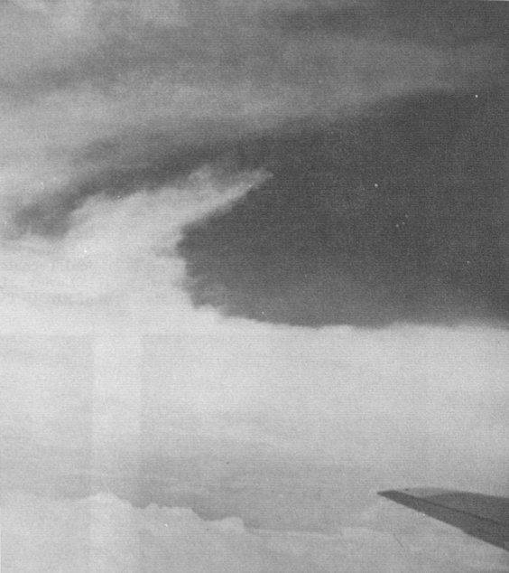
The aircraft of the Research Flight Facility flew into Hurricane Carla on September 4, 6, 8, 9, 10, and 11, providing the most extensive research coverage of any tropical storm in history. They investigated the storm from its incipient stages until it was breaking up over land, flying missions from Jamaica, New Orleans, San Antonio, and Dallas.
The Bureau planes penetrated the hurricane at elevations from a few thousand feet up to 45,000 feet. On one occasion, an Air Force U-2 gathered data at 70,000 feet.
First indications of the storm came on September 4, when ships reported a weak tropical disturbance in the Western Caribbean. Navy hurricane hunters were dispatched to the area on the same day and confirmed the ship reports. Also on September 4, the Weather Bureau’s research aircraft began studying the storm for the National Hurricane Research Project.
The tropical storm moved northwestward, gathering strength, and passed between the rawinsonde stations on Grand Cayman and Swan Islands. The station at Grand Cayman suffered considerable damage. By the time it approached Yucutan Channel on September 6, Carla had reached hurricane force. Already, the northern Gulf coast had been alerted by the Weather Bureau to watch for future advisories and bulletins.
The storm entered the Gulf of Mexico and moved erratically toward the northwest, still growing in size and intensity. A hurricane watch, from Morgan City, Louisiana to Apalachicola, Florida, was first ordered on September 8 and on the same day was extended to include the entire Texas coast. When Carla reached the center of the Gulf on September 9, hurricane emergency warnings were issued for the coastal area from Freeport, Texas, to Grand Island, Louisiana. On the following day, the warnings were extended southward to Aransas Pass, Texas.
While the huge storm was in the center of the Gulf of Mexico, its effects were felt around the entire perimeter of the Gulf. The new WSR-57 radar sets at Galveston and Lake Charles first observed the hurricane’s eye on September 10, when it was 220 nautical miles from Galveston. Hurricane warnings were extended to Corpus Christi. On the same day, TIROS III made excellent photographs of Carla, showing the tremendous extent of the storm.
The hurricane struck the Texas coast near Matagorda Bay on the afternoon of September 11. Its winds were as high as 150 mph, whipping the tides to 15 feet above normal in some places. After moving inland, the storm veered to the north and gradually weakened. In some areas of northeast Texas, 15 inches of rain fell as the dying storm moved northwards. The rain from Carla, added to the previous heavy rains, caused flooding throughout South Central states.
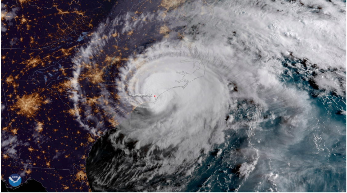
In the many years since this destructive storm, hurricane warning and preparedness have advanced significantly. As a result of the development of new technologies like improved radar and satellite systems, a heightened understanding of hurricanes due to daring feats of the Hurricane Hunters, a stronger ability to communicate on both national and local scales, and more, the NWS is in the position to forecast and warn more accurately than ever before.
Though forecasting and warning capabilities have come a long way, the NWS still remains relentlessly focused on improving preparedness.
Additional Reading:
-
Link to hurricane hunters story
-
Link to radar developments story