
Out of Thin Air: The History and Evolution of Upper-Air Observations - National Weather Service Heritage
Out of Thin Air: The History and Evolution of Upper-Air Observations
By Emily Senesac (emily.senesac@noaa.gov)Modern weather forecasting relies on a wide variety of observations, including those gathered from recent advancements like radar and satellites. Nevertheless, an essential element of contemporary meteorology has its roots in the distant past. With origins that can be traced back to 18th-century Europe, the practice of gathering upper air observations began when scientists attached thermometers to kites, flying them through the sky in order to get an accurate atmospheric reading. Around the same time, a similar practice was occurring in the American colonies, but with a unique twist: Benjamin Franklin flew a kite during a thunderstorm to demonstrate the electrical nature of lightning.
In France, the 1780s brought about the invention of the hot air balloon, a development that was quickly adapted for meteorological use. Equipped with barometers, thermometers, and other instrumentation, scientists piled into balloon baskets in order to investigate the structure and chemistry of the upper atmosphere. These manned ascents continued through the end of the century, and even occurred (with less frequency) up until the mid-1900s; however, these early flights were incredibly dangerous. Extreme cold, lack of oxygen, and inadequate breathing equipment resulted in serious injury and, in some cases, death.
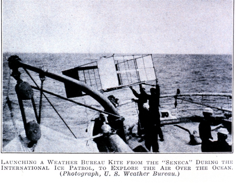
Meanwhile, the use of kites to record upper air conditions continued. By 1900, the Weather Bureau had established several kite observation stations across the country. A bit more advanced than the earlier models, these kites carried instrumentation or meteorographs that could record pressure, temperature, and humidity. Although kites were far safer than hot air balloons, there were many disadvantages to their widespread use. In addition to requiring almost perfect conditions in order to have a successful flight, the kites could only reach an average altitude of 3 kilometers (9800 feet). More importantly, the data that a kite collected couldn’t be accessed until the kite was reeled in, and it was possible that the kite could break loose and get damaged.
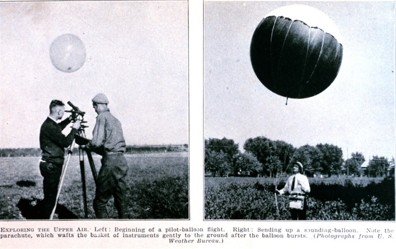
By 1900, meteorographs had been developed that could be carried aloft by free, unmanned balloons. With this advancement, it was possible to reach the stratosphere, a height that was previously unattainable with kites or manned balloons. The balloon carrying the meteograph would eventually burst upon reaching a certain altitude, and the meteorograph would return gently to earth, preserving the data until it was recovered. However, in addition to not being readily available for forecasting, the data could be lost forever if the meteorograph wasn’t found.
Starting in 1925, meteorologists began using newly developed aircraft to carry meteorographs, spelling the end for kite observations. From 1925 until 1943, the Weather Bureau and Army Air Corps operated a network of 30 aircraft stations nationwide to collect upper air observations. While the new technology was certainly exciting, it too had its shortcomings: the aircraft couldn’t be flown in poor weather and the data couldn’t be analyzed until the plane landed. Despite Weather Bureau efforts to supplement the aircraft data collected with small pilot balloons, there was still no failsafe method for observing and assessing the upper atmosphere. Not yet, anyway.
Luckily, they didn’t have to wait long: the invention of the radio led to the development of radio transmitters for upper-air data. By the early 1930s, the first radio-meteorographs or “radiosondes” were being flown into the stratosphere. Small, expendable instrument packages suspended beneath large balloons, the radiosonde could record pressure, temperature, humidity, and GPS data, as well as wind speed and direction information. In 1937, the Weather Bureau established a nationwide radiosonde network that is still operational today. As World War II proved the necessity of upper-air data and accelerated radiosonde development, the radiosonde continued to undergo improvements. One of the most significant advances to radiosonde technology allowed the radiosonde to be tracked in flight and obtain specific wind data -- these observations became known as rawinsondes. While this information was crucial to forecasting, the early rawinsonde stations lacked computer processing systems that could analyze the data. As a result, significant manual labor and time was required to process and disseminate the gathered data. In other words, this was not an efficient process.
As the years went by, newly-developed computing technology began to infiltrate every field and industry. By 1980, technological advancements in telemetry and computers made rawinsonde observations almost entirely automated. Thanks to computers, upper-air observations could finally be performed with minimal human involvement.
Today, the National Weather Service Upper-Air Observations Program oversees the operation of 92 radiosonde stations across North America and the Pacific Islands. After centuries of evolution and development, modern radiosondes provide upper air data that are essential for weather forecasts and research.
Additional Reading