
Key Advances in Weather History: Dual-Pol Radar - National Weather Service Heritage
Key Advances in Weather History: Dual-Pol Radar
By Emily Senesac (emily.senesac@noaa.gov)NEXRAD Radar is one of the National Weather Service’s observation staples. The technology’s honorable beginnings to help identify enemy aircraft during World War II helped propel Allied countries to a victory, and led to its use in weather forecasting. It’s come a long way in the decades since, especially since the installation of the network of NEXRAD Doppler radars in the 1990s. One of the more recent innovations for this stalwart system was the addition of dual polarization or dual-pol.
Paul Schlatter, Science and Operations Officer at the National Weather Service Weather Forecast Office in Boulder, Colorado, is one of the agency’s leading experts on dual polarization; so much so that he has earned the moniker “Dual Paul.” Schlatter sat down recently with the NWS Heritage Projects Team to explain the technology and its history.
The Genesis of Dual-Pol
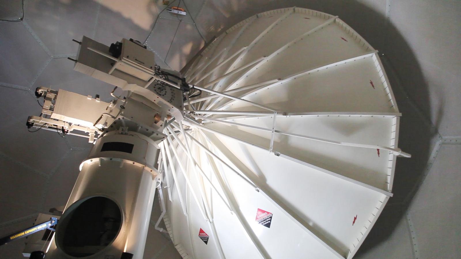
Prior to the development of dual polarization radar, the field took a massive step in technological development with the creation of Next-Generation Radars (NEXRADs). Referred to as WSR-88Ds in the technical world, these systems offered storm detection and evolution in never-before-seen detail, providing the ability for improved severe weather warnings. The NEXRAD radar systems, comprising a network of 159 units across the country, were deployed beginning in 1992, with the last installation occurring in the mid-1990s. Although this exciting technology proved to be a huge improvement upon old models, the work was far from over. As the 88Ds became the national standard, the National Severe Storms Laboratory (NSSL), the National Center for Atmospheric Research (NCAR), and several universities across the country continued researching and working with dual polarization radar technology, in attempts to test the full extent of its capabilities.
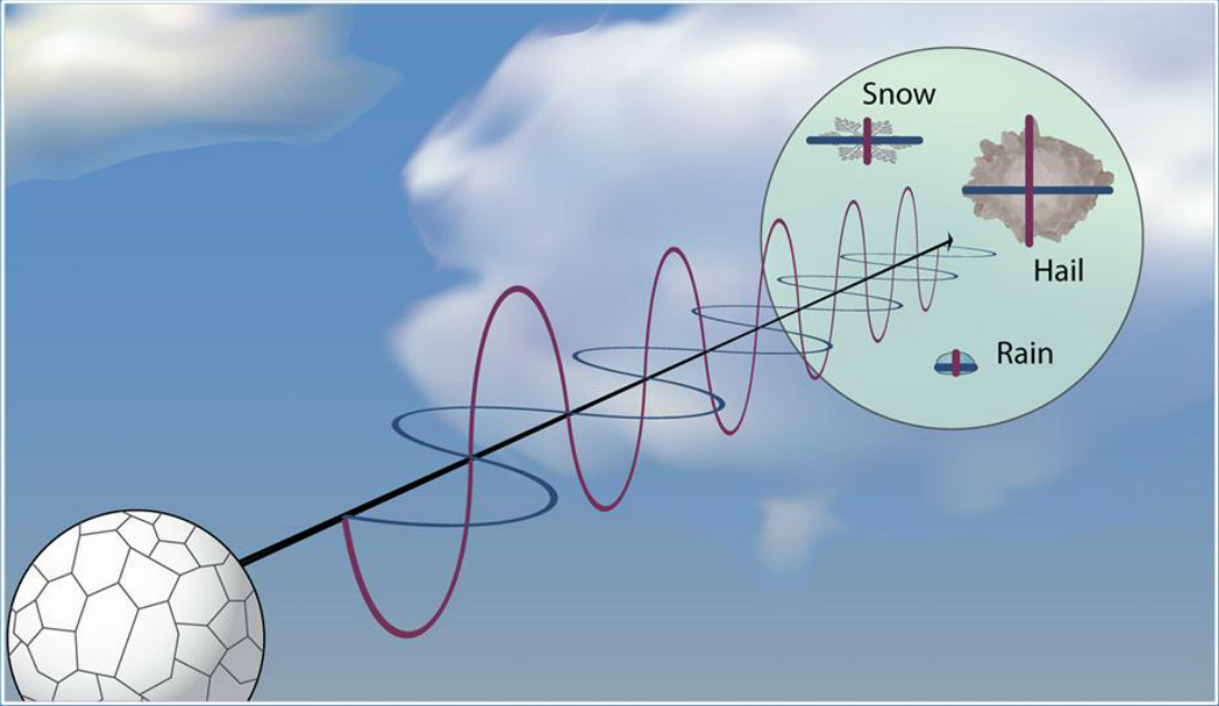
One key difference between NEXRAD systems and dual-polarization radar systems is the transmitter. Dual-polarization radar actually sends and receives pulses in both horizontal and vertical orientation (polarization), while NEXRADs only utilized horizontal polarized pulses. As a result, returned energy on the dual-polarization systems provide more in-depth information, supplying forecasters with better estimates of size, shape, total water content, precipitation type, and overall severity of incoming weather. This remarkable technology proved to have many advantages over the NEXRAD models: improved accuracy of precipitation estimates, leading to better flash flood detection; the ability to fully discern between rain, snow, sleet, and hail; the improved detection of non-weather echoes like birds and lofted tornado debris; and the identification of the melting layer, the atmospheric level at which snow melts into rain. On the whole, the addition of the vertically polarized channel on a dual-pol radar offered meteorologists more in-depth depictions of atmospheric conditions.
In testing the dual polarization technology repeatedly, the NSSL, NCAR, and multiple universities perfected the technology enough to start studying it with a more focused purpose: rainfall estimates. Ideally, meteorologists thought these improved systems could be used to determine the average size of raindrops, thus aiding in the estimation of precipitation rates.
The Benefits of Dual-Pol
In 1999, Schlatter was working with a dual-pol radar system at Colorado State University (CSU). In this position, he compared the radar data with images taken of precipitation by aircraft to verify dual-pol radar signatures of rain, graupel, and hail. As a result, Schlatter was able to further research regarding specific sizes of raindrops and hail, something that couldn’t be done using a NEXRAD system. Years later, in 2003, he was hired by the Warning Decision Training Branch (now Division), in part for his expertise interpreting dual-pol radar data.
“They saw the writing on the wall,” Schlatter said. “We were pretty sure, even then, that dual-pol was going to be a thing nationwide, even though it was still eight years away.”
Around the same time, the Oklahoma Mesonet and the Agricultural Research Service’s (ARS) Micronet, both prominent environmental monitoring networks, began comparing high density rainfall observations to a dual-pol research radar in central Oklahoma.. After observing a wide variety of weather activity for over a year -- tropical rain distributions, supercells, and winter precipitation -- it became clear that dual-pol would significantly improve rainfall estimation. According to Schlatter, this study helped build the business case for upgrading 88Ds to incorporate dual polarization technology.
“It could pay for itself in accuracy,” he said.
Using the momentum from these early successes, the Joint Polarization Experiment (JPOL) in 2002-03, with the intention of pushing dual polarization technology to the highest possible performance level. Forecasters from across the country were brought in.
“They said, ‘Here’s the data. Here’s what it can do. Here’s what it can help you detect,’” Schlatter said.
In the process of testing and exploring the full capabilities of the technology, the operational need for this type of radar system, even beyond just that of rainfall estimation, was realized. In other words, it became abundantly clear that the adoption of this technology on a national scale would have countless benefits for the meteorological community.
Just in time for the 2010 budget cycle, the Office of Science and Technology (OST) and the Office of Operational Systems (OOS) put in a joint bid to Congress for the dual-polarization project -- and were allocated an estimated $60 million to make it happen. Upgrades of the 88Ds to the dual-pol technology began the following year, in 2011, and all systems were updated by 2013. Though the dish, dome, and pedestal were the same as the old models, the transmitter receiver had to be upgraded to accommodate the new horizontal/vertical polarization capabilities, a change which required new software.
The NSSL radar in Norman, Oklahoma was the first to be updated, and there was about a two-year period where that was the only radar available to collect data for training and data quality evaluation. Fortunately, it was a very active period -- and the flurry of activity showed just how powerful this technology really was. Once the NSSL dual-pol radar was up and running, it was Schlatter’s job to analyze how operational forecasters and meteorologists should use the new data and concepts, and lead the team at WDTD to develop the training to over 2000 NWS forecasters. Armed with this insight of dual polarization’s success, Schlatter was charged with briefing NOAA and the mainstream media on the importance and benefits of dual-pol, a task which led to his clever nickname “Dual Paul”. When asked about the ease with which the dual-polarization system could recognize weather events, Schlatter laughed and said, “My six-year-old can point out where the tornado is...because it’s a clear thing on dual-pol.”
A mere month after the dual-polarization radar was installed in Springfield, Missouri, an EF2 tornado touched down in the hilly countryside. Even worse -- it was the middle of the night. “No one was going to see that tornado at night in that terrain,” Schlatter remarked, remembering the incident. Fortunately, warning forecasters were able to recognize tornado debris on the newly operational dual-pol, keeping partners and the media informed of the impending storm and potential disaster. This early success of dual-polarization radar is just one of many to occur since its installation.
Though the innovations of dual-polarization radar have proven to be at the forefront of meteorology, the evolution of radar doesn’t stop here. Dual polarization procedures are still being tested. Nevertheless, Schlatter notes meteorologists “haven’t unleashed all the capability yet.”
Additional Reading: