
Flying the Aleutians - National Weather Service Heritage
Flying the Aleutians
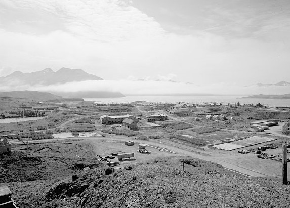
By NWS Heritage Projects Team (nws.heritageprojects.team@noaa.gov)Above: Naval operating base at Dutch Harbor in Unalaska, Alaska. Library of Congress photo.
Editor's Note: The following appeared in the February 1956 edition of Weather Bureau Topics. For many years, the Weather Bureau and the NWS had a program called "familiarization flights," in which meteorologists would occasionally ride in the cockpit of aircraft to discuss how weather impacts flight crews. This program was discontinued after security increases following the 9/11 attacks.
Although flying has been the chief means of transportation in Alaska for many years, it is still marked with ruggedness and a bit of pioneering. Early in December, Miss Jessie M. Lippincott of WBAS (Weather Bureau Airport Station) Anchorage accompanied a flight along the Aleutian Chain. Her report of the flight tells of landing strips sliced out of the sides of mountains, an aerial mail drop, a ground-controlled approach (GCA), and a 24-hour delay due to strong surface winds with gusts as high as 76 knots.
On December 8 I departed with Reeve Aleutian Airways (RAA) Flight 3, to Adak, with intermediate stops, DC-3 type equipment was used.
On take off from Merrill Field conditions were 2,500 feet scattered and 4,000 feet broken. We climbed to cruise on top, breaking out of the clouds at 6,000 feet, as forecast. We were cleared to cruise at 8,000 until let down at Cold Bay, our first stop. Several good examples of lenticular altocumulus type clouds were noted at about cruising level over the Alaska-Aleutian Range, near King Salmon.
At Cold Bay, I talked with Mr. Tom McDonald, in charge of the local Weather Bureau, as he met the plane. After take off from Cold Bay we then cruised at approximately 1,000 feet, below all clouds. The route then took us along the north side of the Aleutian Chain, over the Bristol Bay and Bering Sea. Our first landing after Cold Bay was at Cape Sarichef, which is a single runway airport on the southwest end of Unumak Island. Enroute to Dutch Harbor our next stop, we flew through some light snow showers and a little freezing drizzle. The airport at Dutch Harbor is situated so that a northerly wind of over 10 knots can cause very tricky wind conditions at the runway. The airport was sliced out of the side of one of the mountains that rise sharply to heights of 25-27 hundred feet. These mountains form an unusually well protected harbor, open to the north. However, with strong winds from any direction, very turbulent conditions will prevail at the airport.
After Dutch Harbor we flew on to Umnak, where the airport is located on the southeast end of the island. It is completely unprotected from any winds or flow from the southeast through southwest. After leaving the airport we flew to the southwest end of the island where we made a mail drop to the village of Nikolski. This is a village of sheep herders, that tend about 5,000 head of sheep. After the mail drop was completed we climbed to 8,000 feet to cruise to Adak. We were again flying above an overcast, the top of which was 6,000 feet. While in the cockpit the crew pointed out some of the volcanoes, which were identified by the bulges they made in the clouds and the turbulent conditions of the clouds to the lee of these bulges. There are several active volcanoes along the route but they were all obscured by the clouds during the flight.
At Adak a GCA let down was made. An extra headset was plugged in for me and I was able to listen to the GCA and pilots conversation.
The morning of December 10th Capt. Baker and I checked with the Navy Aerology office to get a weather briefing. Winds at that time were south-southeast at 45 knots with gusts to 60, with conditions forecast to hold like that most of the day, Capt. Baker was doubtful about take off because of extreme turbulence and the probability that several scheduled landings enroute would be inadvisable with such winds. There was a deep low centered about 300 miles west-southwest of Adak at this time with indications of a continued east-northeast movement. Capt. Baker canceled the flight after a Navy plane on take off reported extreme turbulence from the surface to 6,000 feet, and the Navy ordered no more Navy aircraft to depart until conditions improved, The wind shifted to the southwest at 1700 (5 pm local time). At this time the aircraft was further secured and spoilers were put on the wings, Gusts to 76 knots were recorded after the wind shift.
The next morning winds had diminished to 20-25 knots, ceilings were 20-22 hundred with breaks, the visibility 2 miles with snow pellets. RAA Flight 4 departed at 0900 (9 am local time). After take-off we climbed to 1,500 feet and flew to Atka, which is located on Nazan Bay which is somewhat sheltered by low hills from the southwest winds. Showers of snow and snow pellets were observed in the area, After takeoff from Atka we climbed to 9,000 feet to cruise to Umnak. Several cumulus and a few cumulonimbus build ups were observed and photographed. From the air at Umnak the crew pointed out the airport used during the summer. It is on the north shore of the island and is used to avoid the fogs that frequently blow in off the Pacific. Landings were made at Dutch Harbor and Cold Bay. At Cold Bay the wind given to the aircraft for landing was southeast at 10 knots, while at the ramp it was obvious winds were at least 20-25 knots. This was discussed with Mr. McDonald, meteorologist-in-charge at Cold Bay, and he told me that steps were being taken to have the anemometer raised to correct this.
On the flight from Cold Bay to Kodiak, the crew pointed out several airports and passes they often used. Landing was accomplished at Kodiak, then on to Anchorage. It was dark by this time but some patches of low stratus or fog could be seen below us. Just out of Kenai we ran into a cloud deck at 3,500 feet. We picked up quite a bit of propeller and windshield ice, but de-icing equipment took care of it nicely. We broke out of the cloud layer at 2,800 feet while over Turnigan Arm, and landed at Merrill Field at 2015 (8:15 pm local time). After landing I briefed the duty forecaster on conditions enroute, especially between Kenai and Anchorage.
To me the trip was very worthwhile and I feel I have a much better picture of the terrain and type operation along the Aleutian Chain. The crew seemed pleased to have a forecaster along and said they would like to take more on such flights.