
Expanding Services Across the Pacific - National Weather Service Heritage
Expanding Services Across the Pacific
By Chris Geelhart (chris.geelhart@noaa.gov)While the Weather Bureau had an office in Hawaii early in the 20th century, most of its expansion into the Pacific took place after World War II. Many stations had been previously operated by the U.S. military during the war effort, and continued to be needed as trans-Pacific flights became more common. In addition, Congress assigned the Bureau the duty of helping to rebuild the Philippines weather service following the war. Due to the remote nature of some of these locations, it was sometimes difficult to get enough staff in place.
Setting Up in Hawaii
1992
The first Weather Bureau presence in the Hawaiian Islands was in September 1904, when the Bureau took over the Honolulu station from the territorial government. Discussions of an office in Hilo occurred as early as 1917, but one was not established until 1950. Standard Weather Bureau offices were added in Lihue in 1950, and Kahului in 1962. While this latter station closed in 1999, Hilo and Lihue remain in operation as Data Collection Offices, in the present NWS office alignment; Honolulu serves as the main Weather Forecast Office for the state.
The Bureau branched into a brief period in volcanology, when it assumed operations of the Hawaii Volcano Observatory on the Big Island in 1919. During a government reorganization in 1924, the Observatory was transferred to the U.S. Geological Survey.
As a result of the devastating tsunami that struck Hilo in 1946, the Weather Bureau also established a tsunami warning service in Eva Beach.
Near the Hawaiian Islands, the Air Force ceded its weather station at Johnston Island to the Weather Bureau in 1958. Operation of that station ended in 1984.
Rebuilding the Philippines Weather Network
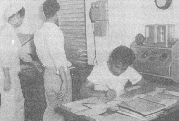
Following World War II, a number of Federal agencies were directed to participate in the rebuilding of the Philippines, which was severely impacted by the war. Congress assigned the Weather Bureau to bring the country's weather service back into operation, a critical need as Pacific air routes increased between the U.S. and Asia. The remaining stations had not been inspected for a number of years, and in some cases, had been established haphazardly as observers had been forced to flee the previous location, and set up a new site as best as was possible given the circumstances.
Upon arrival in the country, Weather Bureau personnel found their work cut out for them. The January 1948 issue of Weather Bureau Topics and Personnel provided some of the stories:
Dominic D. Conte and R.R. Waldman left Surigao, Mindanao, for Butuan at 5 a.m. one morning, The area between the towns is untouched forest, reeking with malaria, and populated with crocodiles "as big as houses." After crossing 28 rickety bridges (including a bamboo pontoon bridge), fording 6 streams, and ferrying across another, they dragged into Butuan some hours later, bedeviled by insects, tired, dirty, and worn. There was no water in Butuan that white men could drink, so after completing their inspection they had to return to Surigao or figure on spending a thirsty night. Considerable rain had fallen during the day, swelling the streams and flooding the roads, so the return trip was even more hazardous than the first, and they arrived late that night.
Between Lucena and Dact on Luzon Island, John A. Brown and C. L. Heffington found that all bridges were washed out. The only course open was to load their jeep onto a flat car and ship it by rail to Sipocot, the nearest railroad station to Daet. Since only third class passenger coaches, with wooden benches for seats, were available, they elected to sit in the jeep during the ride. At Sipocot the train left their flatcar on the siding and it was necessary to hire a group of natives to push them to the unloading ramp. An employee of the Philippine Weather Bureau, accompanying them, carried on negotiations through an uncertain conversation in Tagolog and Bicol, two of the native languages.
With not enough local personnel to staff the planned 50 station network, the Weather Bureau established an observers' school in Manila to obtain enough trained personnel. Within that program, a selected subset of personnel were sent to the U.S. mainland to receive more extensive meteorological training, in order to serve as forecasters. The Rehabilitation Act authorized 50 such trainees in the first year, and up to 25 each subsequent year until July 1950. As these people returned and the local personnel became more active in the operations of the Philippine weather service. Forecasting work at the Manila forecast center was transferred back to the Philippine Weather Bureau on April 1, 1949, with the remaining U.S. Weather Bureau only serving in an advisory capacity.
Expanding to the West Pacific
A number of weather stations in the Pacific previously were operated by the Air Force or the Navy, but were transferred to the Weather Bureau in the late 1940's through the 1960's.
The Trust Territory of the Pacific Islands was administered by the U.S. Four stations in this area of Micronesia were transferred to the Weather Bureau in 1951: Pohnpei, Koror, Truk (now known as Chuuk), and Yap. A fifth station, Majuro, was added in 1955.
The Weather Bureau began a training program in 1954 to transition the staff to local personnel. A training school was set up at Truk, in the Caroline Islands. Three training classes were established; the first one ran 10 months, the second 7 months, and the third 5 months. By the time the third class was completed in early 1957, only the Officials in Charge were American. These 5 stations remain in operation today, as Weather Service Offices.
An office was established in Guam in 1956; it was upgraded to a Weather Forecast Office in the 1990's.
The Wake Island office was a Navy operation until 1948; the Weather Bureau also operated offices on Enewetak Atoll and in Kwajalein, in support of military missile ranges. While the Enewetak station was closed in 1967, the Kwajalein station lasted into the 1970's and Wake Island into the 1990's.
South of the Equator
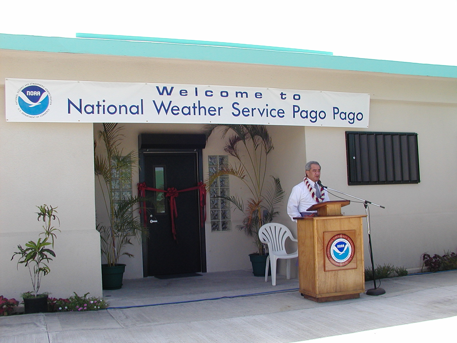
of the new Pago Pago NWS office, Nov. 2003.
Two Weather Bureau offices were even established in the Southern Hemisphere. The Air Force transferred its weather station on Canton Island, in the Phoenix Islands of the South Pacific, in January 1947. Canton Island had an airfield built in 1938 as a stopover point for Pan American Airways on their Hawaii to New Zealand route. The Army Air Forces used it as a military airfield in 1942 and 1943, and it was eventually returned to civil control. The Weather Bureau took surface and upper-air observations at this station, eventually increasing to 24-hour coverage in July 1956 as a number of airlines used the airport as a refueling point. The advent of long range jet aircraft in the 1960's negated the need for this airport, and the station was closed in 1967.
A station was also established in American Samoa, at Pago Pago, in 1956. By 1966, it operated 24 hours a day. It remains in operation today, as the NWS's only office in the Southern Hemisphere. While considered a "Weather Service Office" (as opposed to a "Weather Forecast Office"), it has forecast and warning functions assigned.