QPE - Radar Only - Warning Decision Training Division (WDTD)
Navigation Links
- 2D Reflectivity Mosaics
- 3D Derived Reflectivity Mosaics
- 3D Reflectivity Mosaics
- FLASH Products
- Lightning
- Most Useful Products
- Operational MRMS Hydro Products
- Precipitation Quality Control
- Severe Weather
- Reflectivity At Lowest Altitude (RALA)
- Reflectivity at x°C
- Probability of Severe Hail (POSH)
- Severe Hail Index (SHI)
- Vertically Integrated Liquid (VIL)
- VIL Density
- xx dBZ Echo Top (ET)
- MESH Tracks
- Rotation Tracks
- Maximum Estimated Size of Hail (MESH)
- Vertically Integrated Ice (VII)
- Height of xx dBZ Echo Above x°C
- Azimuthal Shear
- ProbSevere
- Supplementary MRMS Hydro Products (not on AWIPS)
- Useful Products for Aviation
- Composite Reflectivity Track 60min
- Layer Composite Reflectivity
- Composite Reflectivity
- Composite Reflectivity Height
- Lightning Probability
- Lightning Density
- MESH Tracks
- Maximum Estimated Size of Hail (MESH)
- Rotation Tracks
- Azimuthal Shear
- VIL Density
- xx dBZ Echo Top (ET)
- Vertically Integrated Ice (VII)
- Vertically Integrated Liquid (VIL)
Products Guide
QPE - Radar Only
Short Description
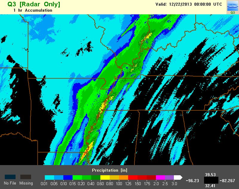
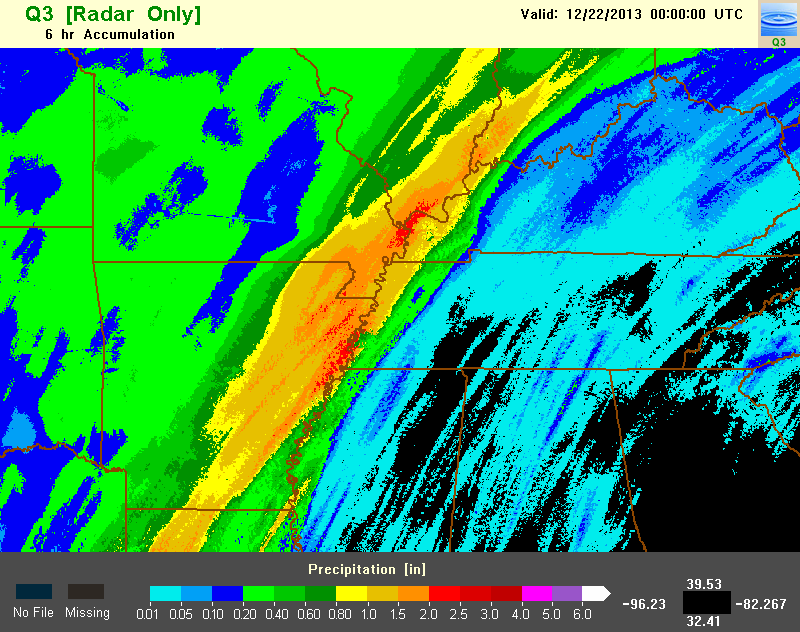
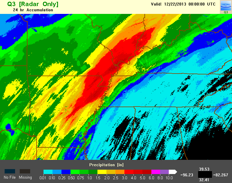
Precipitation accumulations derived from the summation of the Surface Precipitation Rate (SPR) product over a specified time interval.
Subproducts
- 1-, 3-, 6-, 12-, 24-, 48-, and 72-hour accumulations
Primary Users
NWS: WFO, RFC
Input Sources
Resolution
Spatial resolution: 1km x 1km
Temporal resolution: The 1-hour accumulation field is updated every 2 minutes. The 3-, 6-, 12-, 24-, 48-, and 72-hourly accumulations are updated hourly at the top of the hour. All products end at the indicated time.
Product Creation
The one-hour QPE – Radar Only product is an aggregation of the Surface Precipitation Rate (SPR) field, which is updated every 2 minutes. The SPR fields from the previous 60 minutes are summed to create the QPE – Radar Only field, with the product ending at the indicated time. For instance, a QPE – Radar Only field that is valid at 15:04Z is a summation of SPR fields from 14:04Z, 14:06Z, 14:08Z …to 15:04Z. Values at or below 0.01 inches are removed to reduce the areal coverage of what is most likely false light precipitation.
Longer accumulations (3-, 6-, 12-, 24-hourly) are summations of the one-hour fields, updated at the top of the hour. The 48- and 72-hour accumulations are summations of the 24-hour fields, updated daily at 12Z (on the SBN, but updated hourly online).
Technical Details
Latest update: MRMS Version 12.2
References
Zhang, J., K. Howard, S. Vasiloff, C. Langston, B. Kaney, Y. Qi, L. Tang, H. Grams, D. Kitzmiller, J. Levit, 2014: Initial Operating Capabilities of Quantitative Precipitation Estimation in the Multi-Radar Multi-Sensor System. 28th Conf. on Hydrology, Amer. Meteor. Soc.
Other MRMS product documentation: Surface Precipitation Rate
Strengths
The QPE – Radar Only field provides the best spatial and temporal coverage for precipitation estimation. The one-hour accumulation is useful for flash flood warning decision making, since it is updated every 2 minutes. Longer accumulations are good for riverine flood warning decision making and as proxies for "storm total" products.
Limitations
One of the biggest limitations of this product is that the longer duration accumulations (longer than one-hour) are only created at the top of the hour. Therefore, you cannot get running totals or storm totals, which makes it less applicable for flash flood forecasting (but more for flood forecasting).
Radar-based precipitation accumulations are not truly surface-based truth, since they are subject to the radar coverage (which is always sampling above the surface). Precipitation that is falling from a cloud at a certain height may not always reach the ground due to evaporation or wind shear effects. Especially at distances far from radars, where beam broadening is a concern, the volume being sampled may “average out” a lot of the precipitation features, and therefore, lose fine-scale details needed for accurate accumulation estimates. These instances of potentially false light precipitation explain some of the reasoning behind the 0.01 inch precipitation removal threshold.
Additionally, the QPE – Radar Only field is subject to the biases related to the SPR field. This includes biases with respect to beam blockage, as well as Z-R relationships and their ability to wholly capture drop size distributions (DSDs). The QPE – Radar w/ Gauge Bias Correction product is more accurate over non-mountainous terrain.
Quality Control
None.
Applications
The applications are numerous, but the most obvious being precipitation estimates that can be used to: 1) force hydrological models, 2) provide timely information for warning operations, and 3) verify quantitative precipitation forecasts to improve numerical weather prediction.