


MESH Tracks - Warning Decision Training Division (WDTD)
Navigation Links
Products Guide
MESH Tracks
Short Description
The maximum Maximum Estimated Size of Hail (MESH) value during a specified time period.
Subproducts
MESH Tracks
- 30 minute
- 60 minute
- 120 minute
- 240 minute
- 360 minute
- 1440 minute
Primary Users
NWS: WFO, CWSU, AWC, SPC
Other: EM
Input Sources
Maximum Estimated Size of Hail (MESH)
Resolution
Spatial Resolution: 0.01o Latitude (~1.11 km) x 0.01o Longitude (~1.01 km at 25oN and 0.73 km at 49oN)
Temporal Resolution: 2 minutes
Product Creation
MESH Tracks are computed by taking the maximum value of MESH over the specified time period.
Technical Details
Latest Update: MRMS Version 10
References
Witt, A., M. D. Eilts, G. J. Stumpf, J. T. Johnson, E. D. Mitchell, and K. W. Thomas, 1998: An enhanced hail detection algorithm for the WSR-88D. Wea. Forecasting, 13, 286-303.
Applications
Can be used to assess storm intensity trends and deviations in storm motion.
Useful to determine locations of the largest hail fall for NWS warning verification and emergency response.
Can be image combined with instantaneous MESH to create a MESH “Meteor Trails” bundle (Fig. 3) which is very useful for orientation of NWS WFO Severe Thunderstorm Warning polygons, CWSU Center Weather Advisories (CWAs), and other storm forecast track products.
Example Images
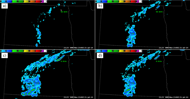
Fig. 1: Maximum Estimated Size of HA (MESH) products associated with a MCS over North Dakota and
Minnesota at 2300Z on 21 July 2014. Shown here are (a) instantaneous MESH, (b) 30-minute MESH
Tracks, (c) 120-minute MESH Tracks, and (d) 60-minute MESH Tracks.
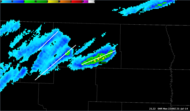
Fig. 2: 120-minute Maximum Estimated Size of Hail (MESH) Track associated with a MCS over North
Dakota and Minnesota at 2200Z on 21 July 2014. The white lines are shown to illustrate how MESH
Tracks can be used to analyze the motion of the hail core.
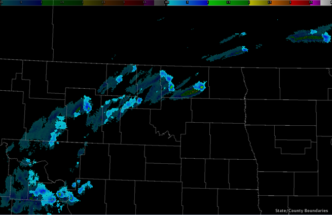
Fig. 3: Image combination of instantaneous MESH and 60-minute MESH tracks (i.e., MESH “Meteor
Trails”) associated with a MCS over North Dakota and Minnesota at 2210Z on 21 July 2014.