Height of SHSR - Warning Decision Training Division (WDTD)
Navigation Links
Products Guide
Height of SHSR
Short Description
The height associated with the SHSR field
Subproducts
None.
Primary Users
NWS: WFO, RFC
Input Sources
Radar location (lat/lon, antenna horn height above mean sea level), radar data bin coordinates (range, azimuth, elevation angle), Seamless Hybrid Scan Reflectivity (SHSR) product
Resolution
Spatial resolution: 1km x 1km
Temporal resolution: 2 minutes
Product Creation
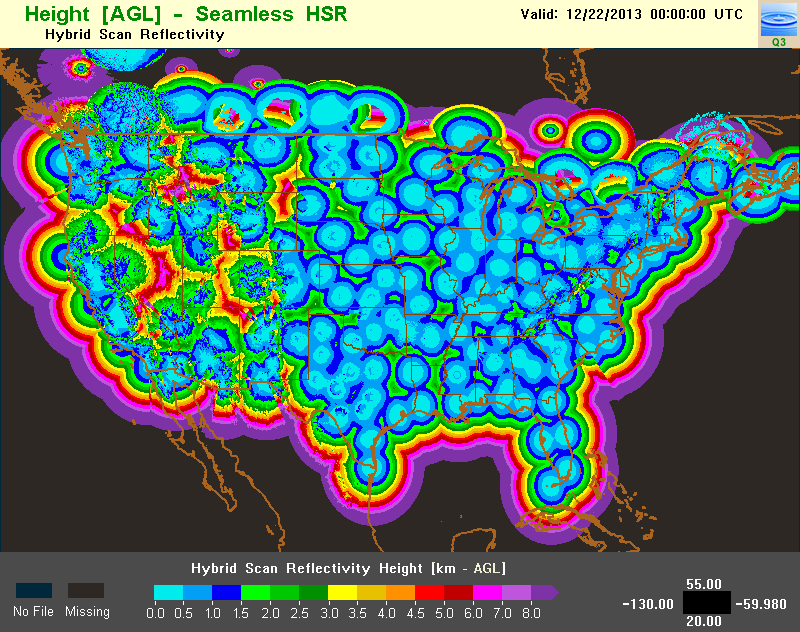
The bottom height of each SHSR data bin is defined as the height associated with the SHSR (H-SHSR). The H-SHSR is mosaicked using the same process as the SHSR (see QPE Mosaic Process). An example of this mosaicked product is shown in Figure 1.
Technical Details
Latest Update: MRMS Version 10
Accessible on: MRMS Development site
References
Other MRMS product documentation: Seamless Hybrid Scan Reflectivity
Applications
At this time, the H-SHSR is only used as a diagnostic tool. It is used for interpreting SHSR and QPE biases, as well as visualizing beam blockages. At this time, this is the best Q3 product for diagnosing distance from radar, since there is no product or method to check range from radar.
Example Images