


Continental Constant Altitude Reflectivity Mosaic - Warning Decision Training Division (WDTD)
Navigation Links
Products Guide
Continental Constant Altitude Reflectivity Mosaic
Short Description
NOTE: This product has been discontinued in MRMS Version 12
The reflectivity at a constant altitude above mean sea level (MSL).
Subproducts
Continental Constant Altitude Reflectivity Mosiac (MSL)
- 0.50 km, 00.75 km
- 1.00 km, 1.25 km, 1.50 km, 1.75 km
- 2.00 km, 2.25 km, 2.50 km, 2.75 km
- 3.00 km, 3.25 km, 3.50 km, 3.75 km
- 4.00 km, 4.50 km
- 5.00 km, 5.50 km
- 6.00 km, 6.50 km
- 7.00 km, 7.50 km
- 8.00 km, 8.5 km
- 9.00 km
- 10.00 km
- 11.00 km
- 12.00 km
- 13.00 km
- 14.00 km
- 15.00 km
- 16.00 km
- 17.00 km
- 18.00 km
- 19.00 km
Primary Users
NWS WFO
Input Sources
3D Reflectivity Cube, with reflectivity data WSR-88D network and Canadian radars
Resolution
Spatial Resolution: 0.01o Latitude (~1.11 km) x 0.01o Longitude (~1.01 km at 25oN and 0.73 km at 49oN)
Temporal Resolution: 2 minutes
Product Creation
At each horizontal 2D grid point, the reflectivity at the specified altitude is determined.
Technical Details
Latest Update: MRMS Version 10
References
Lakshmanan, V., and T. W. Humphrey, 2014: A MapReduce technique to mosaic continental-scale weather radar data in real-time. IEEE J. of Select Topics in Appl. Earth Obs. and Remote Sensing, 7.
Lakshmanan, V., T. Smith, K. Hondl, G. J. Stumpf, and A. Witt, 2006: A real-time, three dimensional, rapidly updating, heterogeneous radar merger technique for reflectivity, velocity and derived products. Wea. Forecasting, 21, 802-823.
Applications
Allows forecaster to quickly interrogate storms at particular altitudes (e.g., hail growth zone, dendritic growth zone, etc.).
Example Images
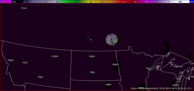
Fig. 1: Continental Constant Altitude Reflectivity Mosaic at 0.5 km over the Northern Plains at 0500 UTC
on 10 August 2014. Note the poor radar coverage at this altitude.
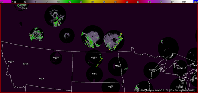
Fig. 2: Continental Constant Altitude Reflectivity Mosaic at 1 km over Northern Plains at 0500 UTC on
10 August 2014. Note the continued poor radar coverage at this altitude.
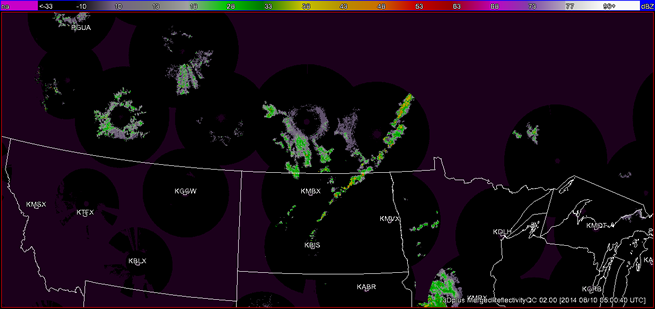
Fig. 3: Continental Constant Altitude Reflectivity Mosaic at 2 km over Northern Plains at 0500 UTC on
10 August 2014. Note the continued poor radar coverage in the Intermountain West at this altitude.
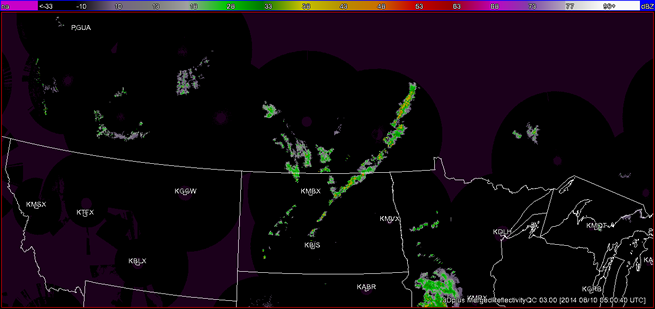
Fig. 4: Continental Constant Altitude Reflectivity Mosaic at 3 km over Northern Plains at 0500 UTC on
10 August 2014. Note the continued poor radar coverage in the Intermountain West at this altitude.
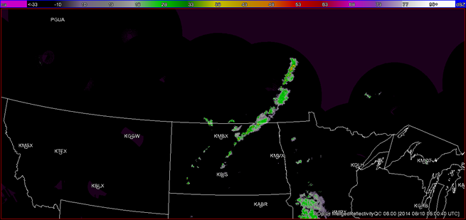
Fig. 5: Continental Constant Altitude Reflectivity Mosaic at 6 km over Northern Plains at 0500 UTC on
10 August 2014. Note the improvement in radar coverage at this altitude.