


Composite Reflectivity - Warning Decision Training Division (WDTD)
Navigation Links
Products Guide
Composite Reflectivity
Short Description
The maximum reflectivity in a vertical column using the 3D Reflectivity Cube.
Subproducts
Low-Resolution (5 km) Composite Reflectivity
Composite Reflectivity (0–4 km)
Primary Users
NWS: WFO, CWSU, RFC, SPC, AWC
FAA: TRACON, ARTCC, ATCSCC
Other: EM
Input Sources
3D Reflectivity Cube
Resolution
Spatial Resolution: 0.01o Latitude (~1.11 km) x 0.01o Longitude (~1.01 km at 25oN and 0.73 km at 49oN)
Temporal Resolution: 2 minutes
Product Creation
At each horizontal 2D grid point, the reflectivity value is checked in the vertical grid from the bottom up. Once an “available” data value is found, that reflectivity value is assigned to the composite reflectivity value. As successively-higher altitude grid points are checked, if the reflectivity value is greater than the assigned composite reflectivity value, then the assigned value is replaced with the higher value of reflectivity. This process continues until the highest-altitude grid point is reached.
Technical Details
Latest Update for Low-Resolution (5 km) Composite Reflectivity: MRMS Version 11
Latest Update for Composite Reflectivity (0–4 km): MRMS Version 11.5
References
Lakshmanan, V., T. Smith, K. Hondl, G. J. Stumpf, and A. Witt, 2006: A real-time, three dimensional, rapidly updating, heterogeneous radar merger technique for reflectivity, velocity and derived products. Wea. Forecasting, 21, 802-823.
Lakshmanan, V., A. Fritz, T. Smith, K. Hondl, and G. J. Stumpf, 2007: An automated technique to quality control radar reflectivity data. J. Appl. Meteor., 46, 288-305.
Lakshmanan, V., C. Karstens, J. Krause, and L. Tang, 2014: Quality control of weather radar data using polarimetric variables. J. Atmos. Oceanic Tech., 31, 1234-1249.
Applications
As with single-radar composite reflectivity, this product is a good situational awareness tool to determine the first convective echo, as well as the overall extent of mature thunderstorm echoes (especially in the echo overhang region).
Example Images
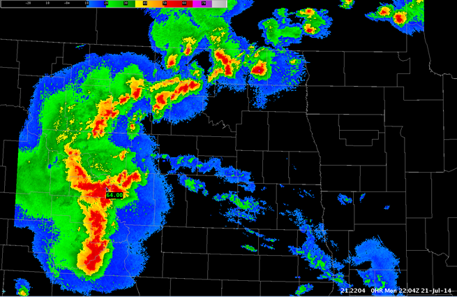
Fig. 1: Composite Reflectivity for a MCS over North Dakota and Minnesota at 2204Z on 21 July 2014.