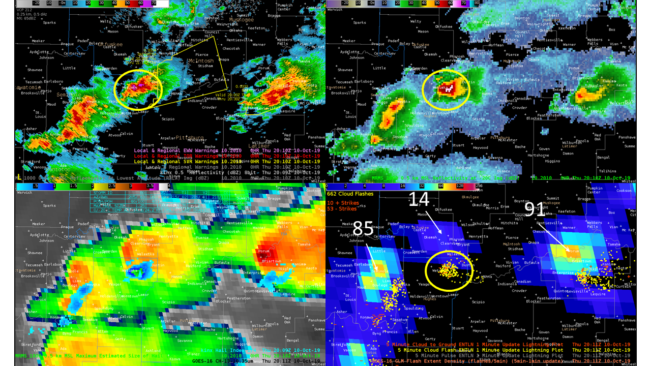
There appeared to be a good case of optical extinction with a severe warned storm near the Hughes/McIntosh county line in southeast Oklahoma on 10 October, 2019. ENI data showed a tight cluster of cloud flashes (~170) and over a dozen CGs with the cell (circled) but GLM had relatively small FED (14 flashes/5-min) when compared to neighboring storms (80-90 flashes/5-min) of lesser intensity. This minimum in flash rate in GLM continued for ~15 min while the storm was at maximum intensity. The four-panel shows MRMS reflectivity at the lowest altitude (UL), MRMS reflectivity at -20C (UR), MRMS maximum hail size/KINX hail index/GOES-16 clean-IR (LL), GLM FED 5 min-1 min update/ENI 5 min-1 min update (LR) at 20:11 UTC. Ten minutes prior to this image the flash rates were as high as 41 and returned to that value by 20:23 then grew to 100 flashes/5-min within 30 min of this image. As charges were advected downstream into the anvil, the flash rates gradually picked up but really increased as the reflectivities aloft began to come down.