As part of our impact weather responsibilities, NWS Huntsville issues Airport Weather Warnings (AWWs) for Huntsville International Airport (KHSV) and Northwest Alabama Regional Airport (Muscle Shoals; KMSL). AWWs are issued for the threat to personnel working outside at the terminal and neighboring operations, not for the threat to aviation as a whole. One of our criteria for AWW issuance is the threat of cloud-to-ground lightning within 5 miles.
On May 30, a relatively small line of thunderstorms developed over northeast Mississippi and tracked to the east, producing a few pockets of straight-line wind damage along the way. The line approached the 10-nm range of KHSV at 2320 UTC (seen below). At this point, GLM Flash Extent Density (FED) data wasn’t the most helpful data set for deciding to issue an AWW; the National Lightning Detection Network (NLDN) was already detecting a great deal of cloud-to-ground lightning with the storms.
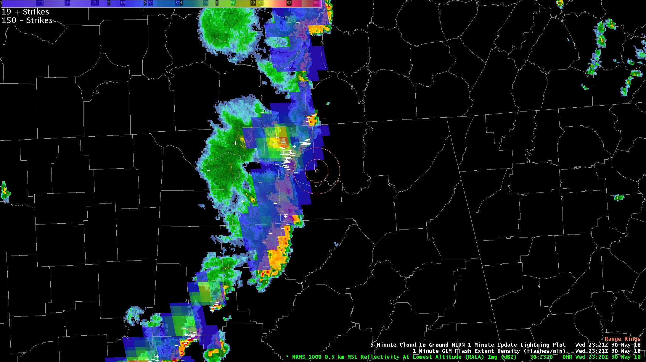
Multi-Radar/Multi-Sensor (MRMS) Reflectivity At Lowest Altitude (RALA) valid 2320 UTC 30 May; 5-minute NLDN flashes valid 2321 UTC; and GLM Flash Extent Density valid 2321 UTC. The 5 and 10-nautical mile range rings around KHSV are illustrated in coral near the center of the image.
The GLM FED data were far more useful later on in the event, after the line passed well east of KHSV and the Huntsville metro area. With nightfall, the convective updrafts weakened and lightning along the line generally decreased–but flashes within the trailing stratiform region of the quasi-linear convective system (QLCS) did not. One of the more spectacular examples occurred around 0059 UTC (seen below). The FED product really illustrated the spatial threat simply and effectively, especially when combined with the NLDN data. (This example uses a slightly different color curve from the GLM baseline to enhance lower flash rates.)
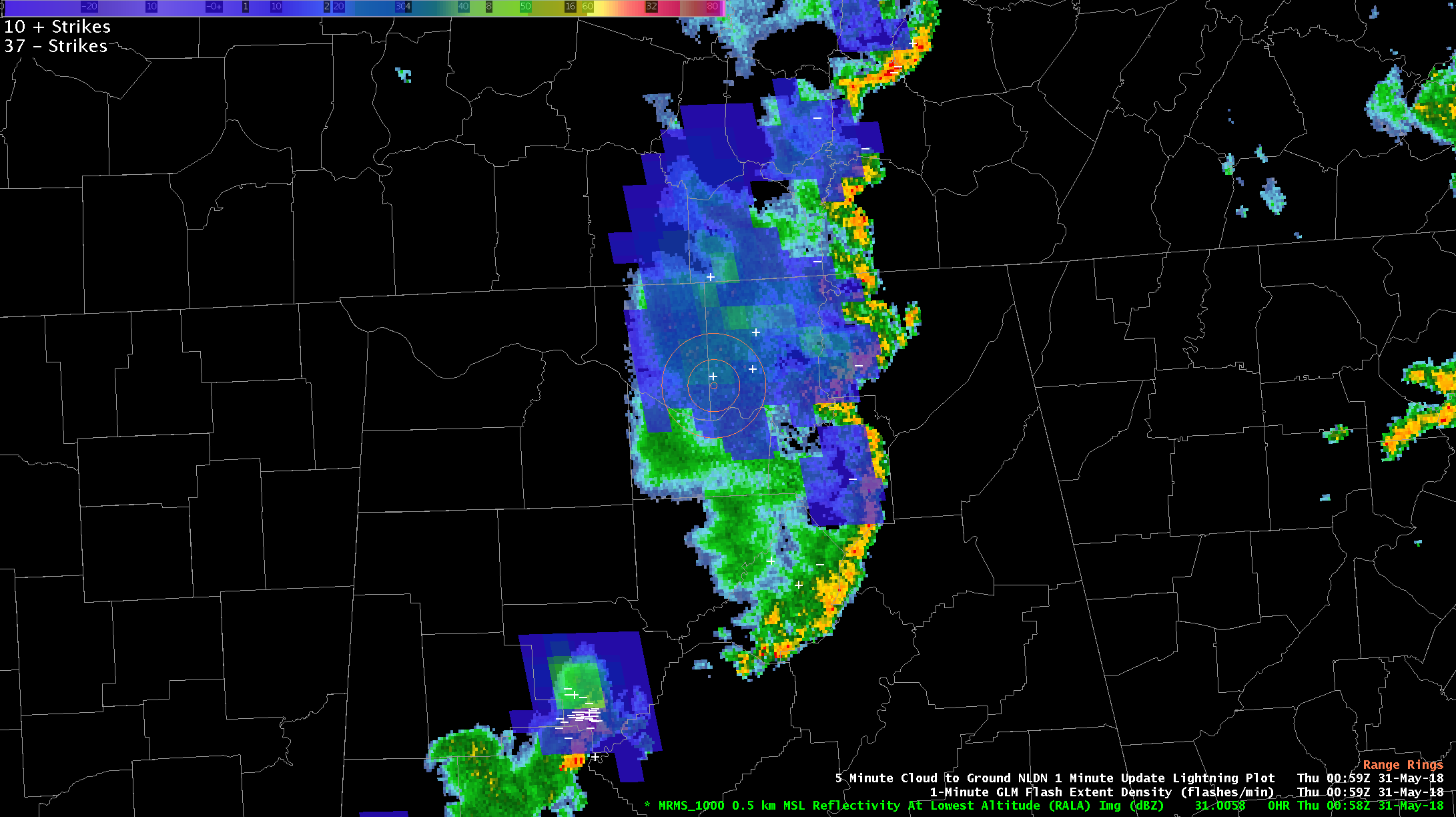
MRMS RALA valid 0058 UTC 31 May; 5-minute NLDN valid 0059 UTC; and GLM FED valid 0059 UTC. 5 and 10-nm range rings around KHSV are also noted.
GLM helped forecasters acquire and retain situational awareness of these trailing stratiform “long flashes”, which helped with AWW extension/reissuance. As a result, the airport weather warning for Huntsville was re-issued until the trailing stratiform region cleared the airport and the threat subsided.
Re-posted from: https://nasasport.wordpress.com/2018/06/15/using-glm-for-airport-weather-warnings/


