On 19 July 2018 a lone, left-moving supercell was observed with GLM moving from eastern Kansas into western Missouri. The loop below has 1-min GLM Flash Extent Density with IR (UL), 1-min Average Flash Area with Visible (UR), 1-min Total Optical Energy (LL) and regional radar reflectivity (LR) at 5-min intervals.
This event was captured to document observed lightning activity from GLM with a dominant left-moving supercell in northwest flow aloft and to analyze any obvious peculiarities with lightning behavior. A SEVERE THUNDERSTORM WARNING was issued for this storm during a later point in the lifecycle but no reports of severe weather were received. Radar hail size estimates were consistently in the 1-2" range during the peak intensity of the storm.
Conclusion: No obvious differences in lightning behavior as observed by GLM were noted with this storm when compared to other similar intensity supercells earlier in the season. At the beginning of the loop, prior to the left-mover developing a single, long flash (~2900 km2) occurred within the down-shear anvil region of the small cluster of cells. Once the left-mover developed and became the sole storm, minimum average flash sizes remained small (100-200 km2) and confined to the main updraft region. Flash rates pulsed with storm intensity and reached a maximum of 13 flashes/min at 02:32 UTC and again at 12 flashes/min at 03:06 after crossing I-49. Aside from a single bright flash (60 fJ) at the end of the multi-cell stage, Total Optical Energy remained unspectacular, generally in the15-25 fJ range through the left-moving storm's lifecycle.

4-panel loop showing flash extent density (UL), average flash area (UR), total optical energy (LL) and reflectivity (LR).
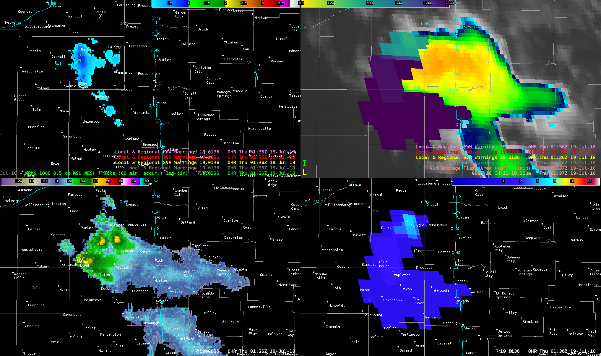
4-panel at 01:36 UTC showing a single, long flash extending downshear from storm cluster. MRMS MESH (UL), average flash area (UR), MRMS reflectivity at -20C (LL) and flash extent density (LR).
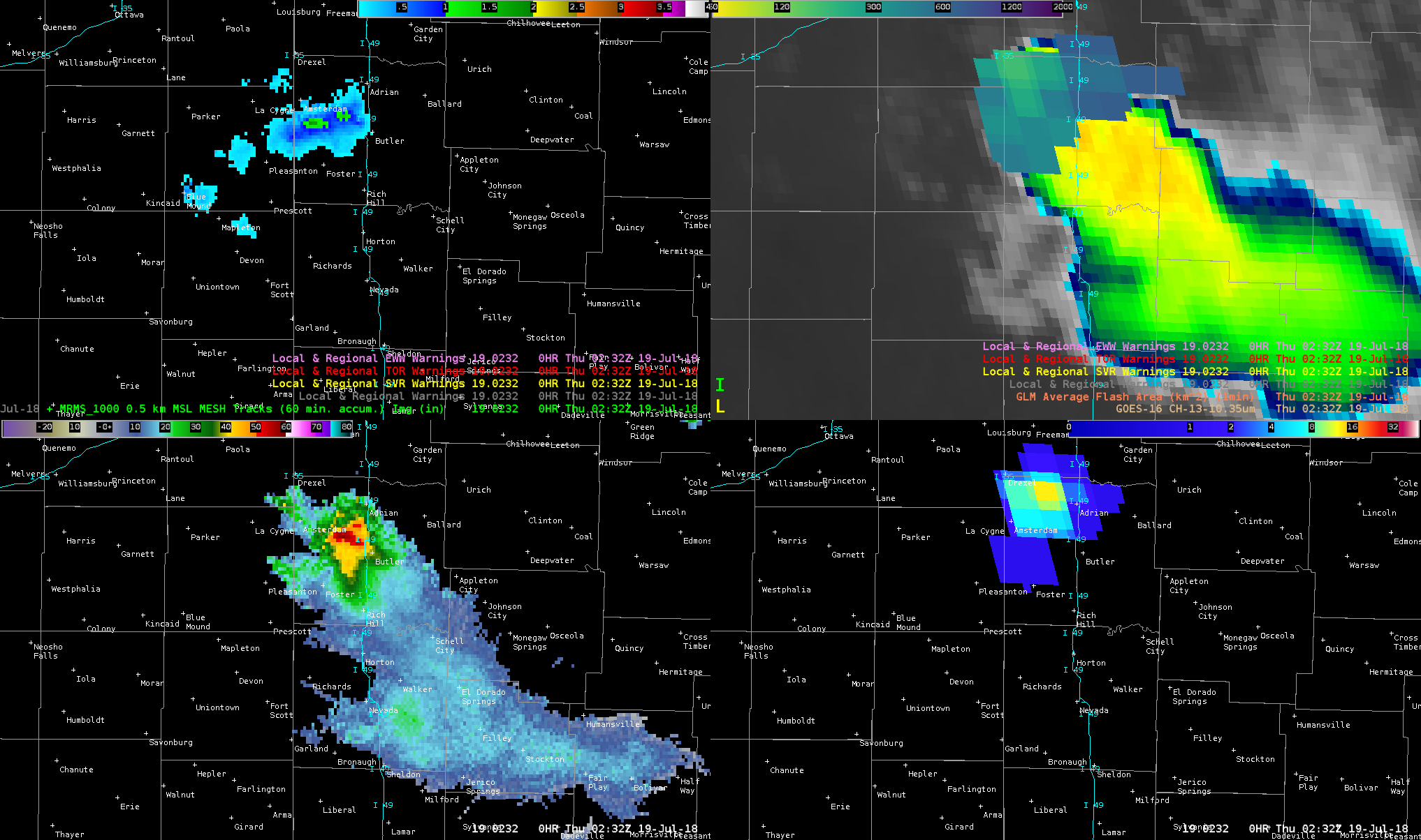
4-panel at 02:32 UTC showing peak flash rate of 13 flashes/min prior to storm crossing I-49. MRMS MESH (UL), average flash area (UR), MRMS reflectivity at -20C (LL) and flash extent density (LR).
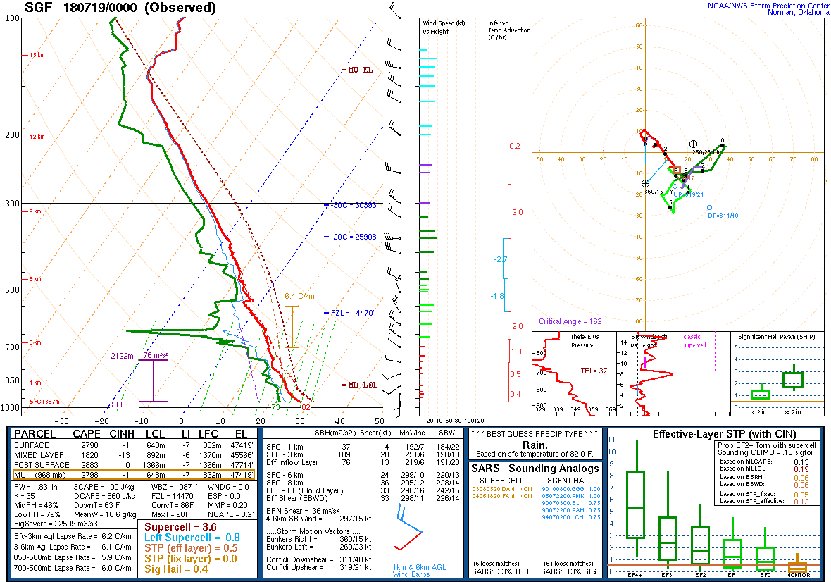
0000 UTC 19 July 2018 observed sounding from Springfield, MO. Note the LM storm motion 260/23 kt.


