Forecasters who participated in the Hazardous Weather Testbed (HWT) Spring 2018 Experiment provided useful feedback on GLM gridded products as they tracked numerous convective systems over the four-week period. Alongside imagery of the data, they provided use cases of the GLM in several forecasting situations, suggested interesting trends, and provided potential applications of the gridded products. The following imagery and quotes taken from their blog posts on the HWT page illustrate their situation-based findings.
Please note that given the experimental nature of the data, some imagery may contain GLM products that will not be included in AWIPS. Additionally, data visualization (e.g. colormaps and scales) was (and still is) undergoing changes, so variability in imagery throughout the posts and in final NWS implementation is inevitable.
While it is a rather specific application, one forecaster at the HWT noticed enhanced lightning activity in both merging and splitting convective cells. This trend is important for forecasters to be aware of, especially when tracking the evolution of discrete storms and issuing timely warnings.
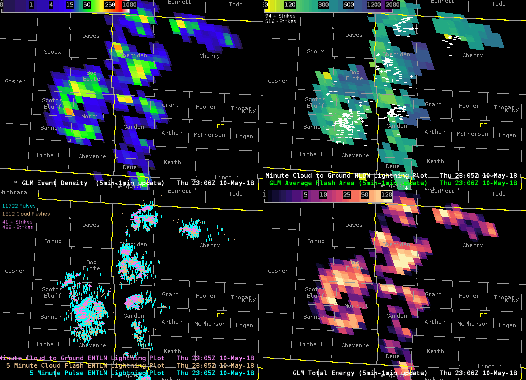
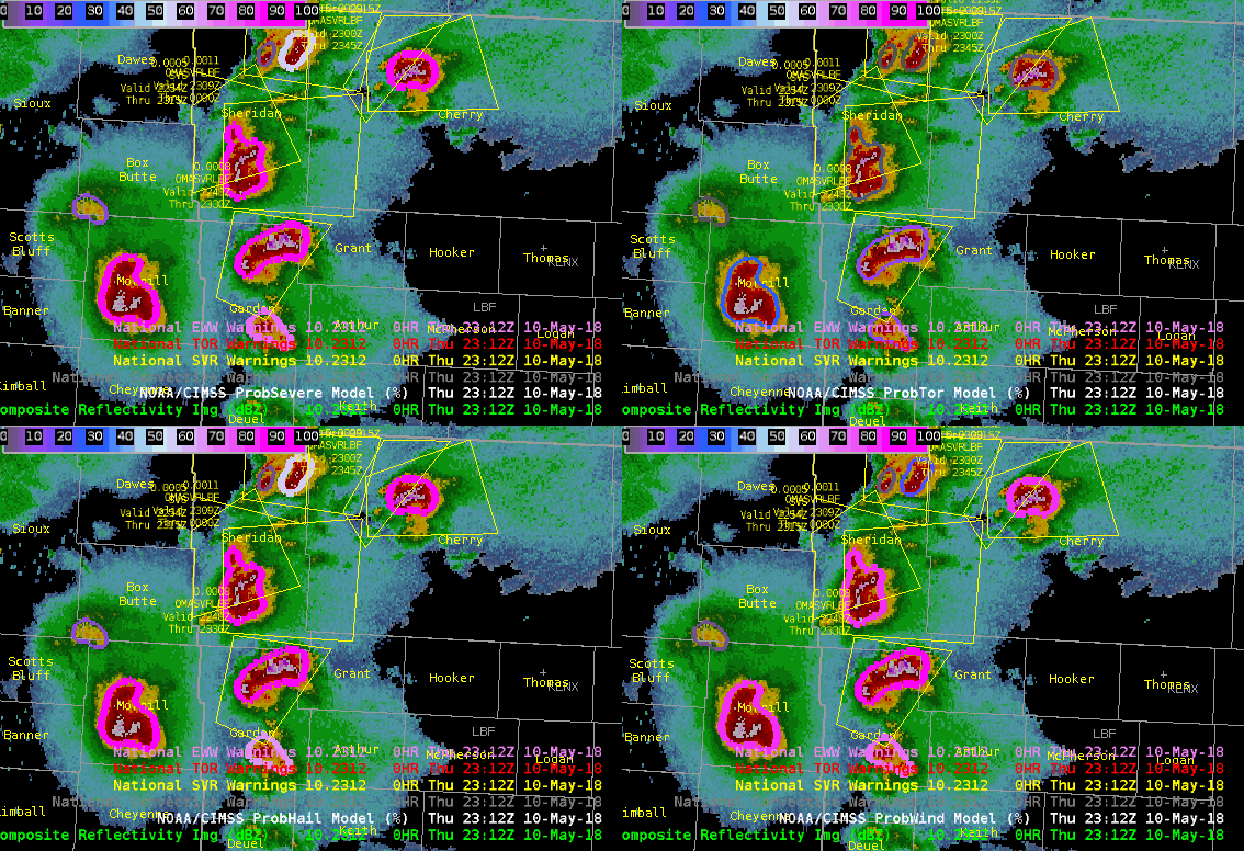
Here, the forecaster noted the spike in lightning activity after a supercell split (scroll down for radar loop):
“Noticed that GLM flash density and total energy spiked after the supercells split over Garden County Nebraska.... Also take a look at the storm over Morrill County where flash density and Total Energy spiked in values. Average flash area is also increasing in between all of these cells showing large flashes.” – “Supercell”
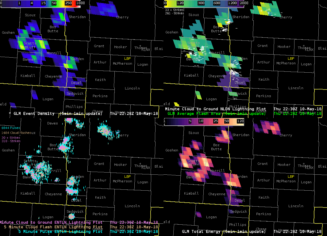
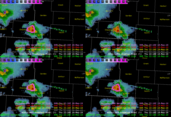
In a separate case, the same forecaster again observed enhanced lightning--this time, the rapid increase took place as two supercells merged (scroll down for associated radar loop):
“Also, noticed that the GLM Flash Density and Total Energy increased markedly as the merger took place. With all of these updrafts so close together, am also seeing a marked increase in Average Flash Area-especially over Grant/Cherry counties.” – “Supercell”