Forecasters who participated in the Hazardous Weather Testbed (HWT) Spring 2018 Experiment provided useful feedback on GLM gridded products as they tracked numerous convective systems over the four-week period. Alongside imagery of the data, they provided use cases for the GLM in several forecasting situations, suggested interesting trends, and provided potential applications of the gridded products. The following imagery and quotes taken from their blog posts on the HWT page illustrate their situation-based findings.
Please note that given the experimental nature of the data, some imagery may contain GLM products that will not be included in AWIPS. Additionally, data visualization (e.g. colormaps and scales) was (and still is) undergoing changes, so variability in imagery throughout the posts and in final NWS implementation is inevitable.
During the experiment, several forecasters noted that the GLM showed pre-convective flashes, often times prior to both ground-based lightning network signatures and cloud top cooling features on the IR channel.
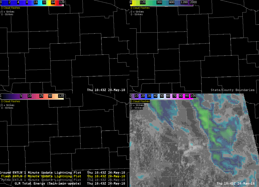
Initial convective development in this 4-panel image over Wisconsin demonstrates the unique capabilities of each of the GLM gridded products. Notice the small AFA in the top right panel (indicated by yellow on the colormap) during initial development:
“I noticed an area of increasing GLM fields in central WI shortly before 1900Z where otherwise no other convection was ongoing…the IR values really didn't begin to pique my interest until 1910-1915Z. Also, a noticeable increasing lightning trend with ENTLN data wasn't really noticed until 1905-1910Z as well so GLM was able to capture the initial electrification of this storm with few minutes extra lead time.” –Peter Sunday
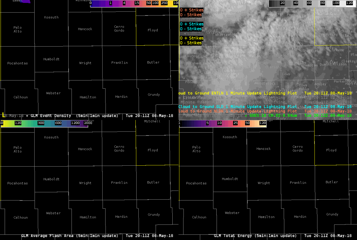
Another example of convective initiation from Iowa-- again, note the distinct small flash size on AFA, as well as the bright, convective flashes on TOE:
"Convection beginning to fire off along remnant outflow boundary from earlier storms across northern Iowa. Monitoring the GLM lightning data and the cloud to ground sensor networks to see we there would be an appreciable time difference between the first cloud flashes observed versus the first cloud to ground strikes. GLM first picked up cloud flashes around 2019Z in Hancock County while the first appreciable CG strikes occurred around 2040Z. GLM shows to be beneficial in highlighting areas of convective initiation before cloud to ground sensors.” –Jack Swigert
Lastly, another example from Wisconsin, showing small AFA (bottom left panel) and increasing TOE (bottom right panel) associated with initial supercell development:
“Possible trend I noticed is that in building updrafts you can see a small lightning flash area (yellow to light green areas in bottom left window) followed by an uptick in total lightning energy and lightning event density in new and/or intensifying updraft. Could... be used (especially small flash areas) to better determine storm motion and intensification over regular ground lightning detection networks ” – Jack Swigert


