Here is something completely different. For Fire Weather in the
Intermountain West, it is often very subtle model differences that are
VERY important.
When Fabio was decaying off the Pacific Coast last Friday (July 6th),
there was a stream of moisture getting sucked up into the Pacific
Northwest. It is exceedingly dry up here at this time of year.
Moisture streaming off of Hurricanes like this is typically very
"high level", and yields only mid and high clouds - with
maybe a sprinkle at low levels. Especially, since hurricane moisture
is typically also accompanied by relatively warm air aloft - which
keeps instability at bay. But, sometimes, if there is enough existing
moisture in the low levels, it can generate some precip. That has
HUGE implications for fire weather. Most surface fuels, especially
the grasslands at the lower elevations, are starting to "cure
out", and are now, or will soon be, "ready to burn". A
little bit of moisture the generates some high-based thunderstorms
with lightning, but no precipitation, would be very bad. That is
unlikely, but possible, in this scenario - if the warming aloft is not
quite enough to offset the instability increase from increased
moisture at mid levels. But, at the same time - even if there is no
convection, a rain event of 0.10" or 0.25" would be HUGE as
well (I know, the rest of you, with your 2" rainfall events are
laughing at us now...). That would set back the curing time for light
fuels like grasses - and would reduce the chance of fires for the next
couple of weeks.
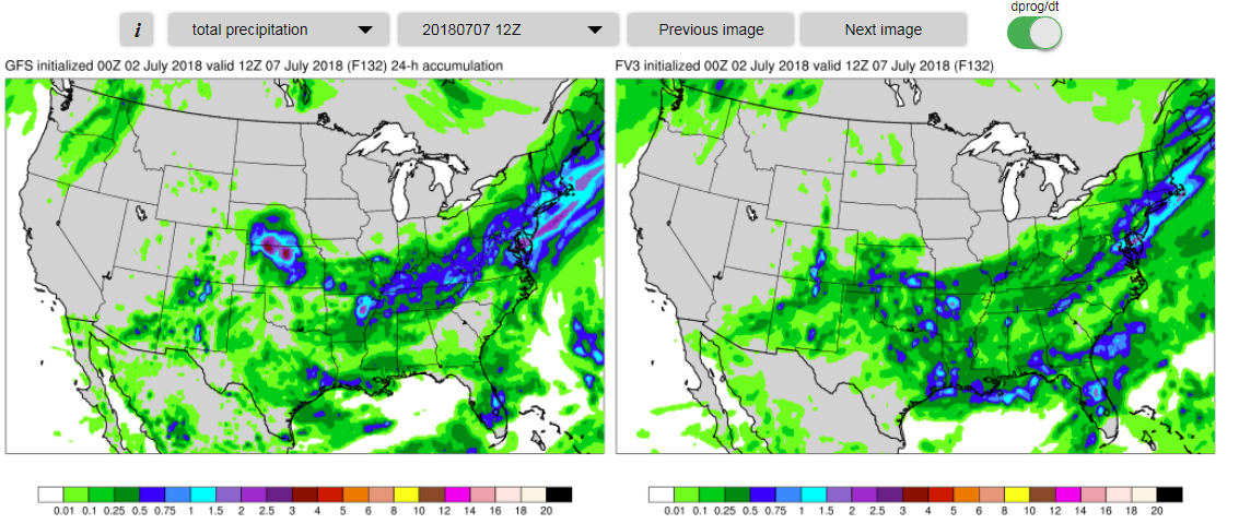
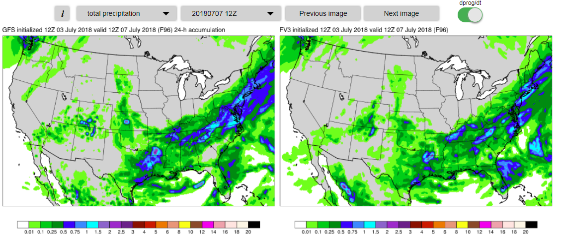
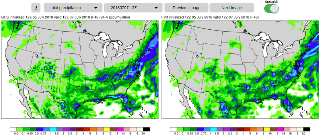
Here is a comparison of the 132-hour forecasts of 24-hr precip ending
at 12Z July 7th from GFS/FV3. Note how the GFS is generate a large
area of 0.10" of precip across Eastern Oregon - with some small
areas of even 0.25". While, at the same time, the FV3 barely
generates any area with 0.01" of precip:
Here is the Precipitable Water forecast at the same time - so that
you can see the plume of moisture coming off of Fabio in the Pacific
and into the Northwest:
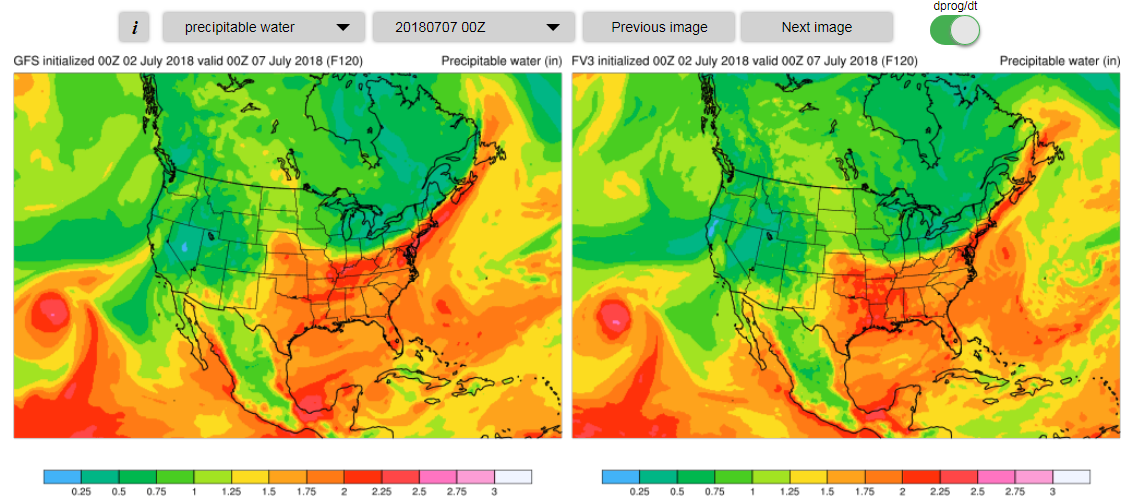
An interesting thing to note here is that, at least in this crude
look at Preciptable Water values, GFS/FV3 are pretty comparable with
the AMOUNT of moisture available aloft - though the FV3 has the plume
slightly further to the East.
This is often something we have seen in the past with the GFS, that
it can generate too much threat of precip from high-level moisture,
especially when low-levels start out relatively dry. In this case, it
appears to me that the FV3 is handling it better.
So, here are the same 24-hr precip forecasts for each of the
comparable runs as the potential event got closer:
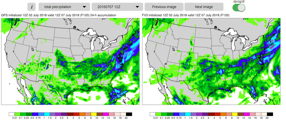
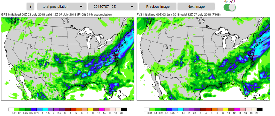
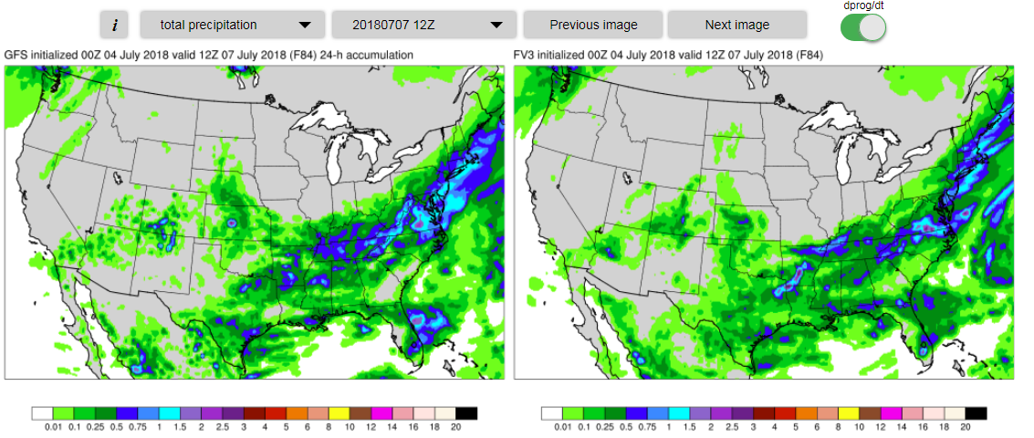
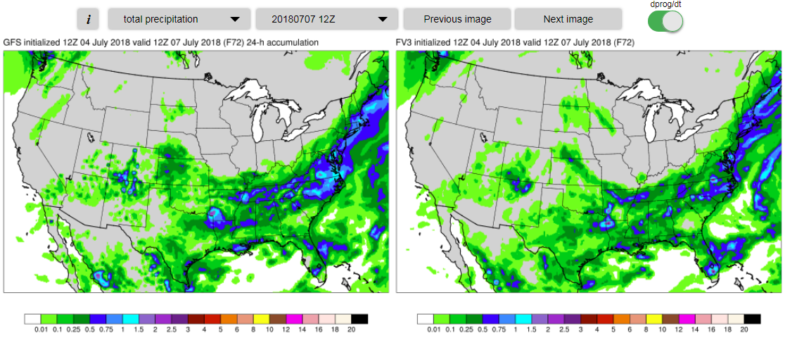
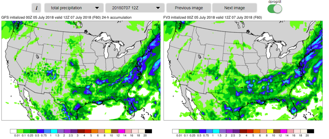
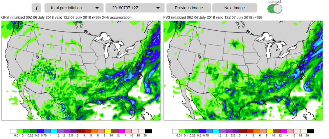
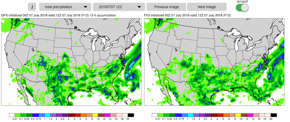
Now, in most of these, the GFS precip amounts were less than in that
132-hour forecast, which is good. But, what stood out to me was that
in virtually every case, the FV3 had less precip than the GFS (with
the possible exception of the 60 hour forecast made from 00Z July 5).
In my mind, this is a really good "win" for the FV3.
I looked at surface dewpoint differences between the GFS/FV3 in this
case (but I won't show them) - and the surprising thing was that the
FV3 was actually slightly WETTER than the GFS in most runs. But, to
me, that shows how irrelevant the surface moisture can be in such as
case. The real story is the handling of the dry layers between, say,
about 850-500mb - and any sub-cloud evaporation of precip. Is there a
difference in sub-cloud evaporation between the models? If so - it
seems to have worked out well in this case.
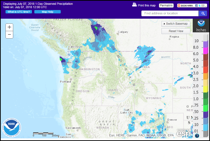
As far as verification, there was virtually no precipitation at the
surface in this case. Here is the RFC analysis at 12Z on the 7th:
And, just to show that the models were correct that the plume of
upper-level moisture was there, here is a satellite loop from Friday
the 6th:
Maybe it is silly, but this is a good case of the FV3 performing
better in a "subtle", "marginal", and
"seemingly unimportant" case.
Tim Barker - SOO - Boise, ID


