And, from today's 12Z runs.
Started.....
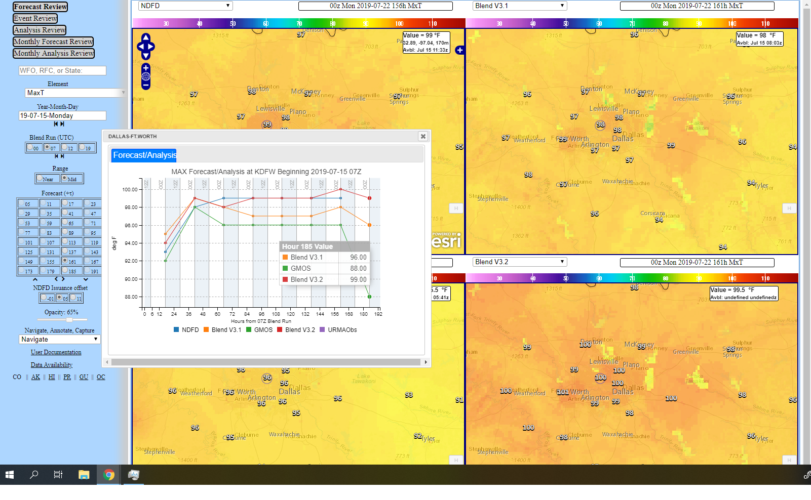
I've got ONE interesting find already, and it has nothing to
do with the forecast, but how the text bulletin referred to from
NBM shows 100 at proj=185, whereas graph from NBM display of
same shows 99. The graph shows the GMOS MaxT as 88, which
equals MEXMOS forecast that was questioned.
Now, I need to move a forecast or two into the future.
---------- Forwarded message
---------
Date: Mon, Jul 15, 2019 at 8:05 AM
Seems right to me.
========================================================
How about just forecasting 5% or less POPs thru
Sunday, a max T of 99 and a min T of 79!
#persistence
Yeah...I disagree. This is where the blends
excel in the extended and the forecaster doesn't
understand what models are going into the blend
and how they are made. If you would like to see
the input models, take a look at this
spreadsheet
and choose the appropriate version tab at the
bottom.
NBM has 100 F next Monday (v3.1 has 98) and
while this forecaster has gone away from the
cooler GFS solution, the blends should not have
been discounted or strayed away from.
....notice where the forecaster tossed
out the "extended blends" for this
upcoming weekend, based on the GFS being a
major outlier with an Alberta Clipper type
northwest flow event. Seems reasonable to
me. Check out the latest ECMWF MEXMOS for DFW
for next Monday. 100 vs. 88.
The GFS is anomalously strong with an Alberta Clipper this weekend
and an associated frontal surge into the Southern Plains with the
resulting northwest flow. While this would be a delight during the
dog days, this solution is both an outlier among extended
operational guidance and within the minority of GFS ensemble
members (a plurality of which favor seasonal ridging). This has
corrupted the extended blends, from which we removed the frontal
wind shift and associated precip chances.
--
Jack Settelmaier
(NRAP) Technical Lead, NOAA Big Data Project
Digital Techniques Meteorologist
NOAA/NWS, Southern Region HQ
Fort Worth, TX
Work: 682 703 3685
--
Jack Settelmaier Forecast Performance Blog Virtual
Lab Forum http://vlab.noaa.gov/web/forecast-performance-blog/discussions-forums-/-/message_boards/view_message/7128447VLab.Notifications@noaa.gov
--
Jack Settelmaier
(NRAP) Technical Lead, NOAA Big Data Project
Digital Techniques Meteorologist
NOAA/NWS, Southern Region HQ
Fort Worth, TX
Work: 682 703 3685


