Last Friday (May 11), a colleague was questioning the models
forecasting near 100 MaxTs in the vicinity of Austin to close out this
week (~May 17/18). In taking a look at the Temperature forecast from
the May11th run of the FV3 valid for 00Z, May 18th, I came across this
image, and joked with my colleague, actually the model is forecasting
sunset time along Lake Travis in the mid 70s! :)
 Now, at first glance, that looked odd, but then it occurred to me, the
model thinks it's going to convect there, and hence the temps will
drop to such pleasant temps. Below you can see the time-matched
precip forecast.
Now, at first glance, that looked odd, but then it occurred to me, the
model thinks it's going to convect there, and hence the temps will
drop to such pleasant temps. Below you can see the time-matched
precip forecast.
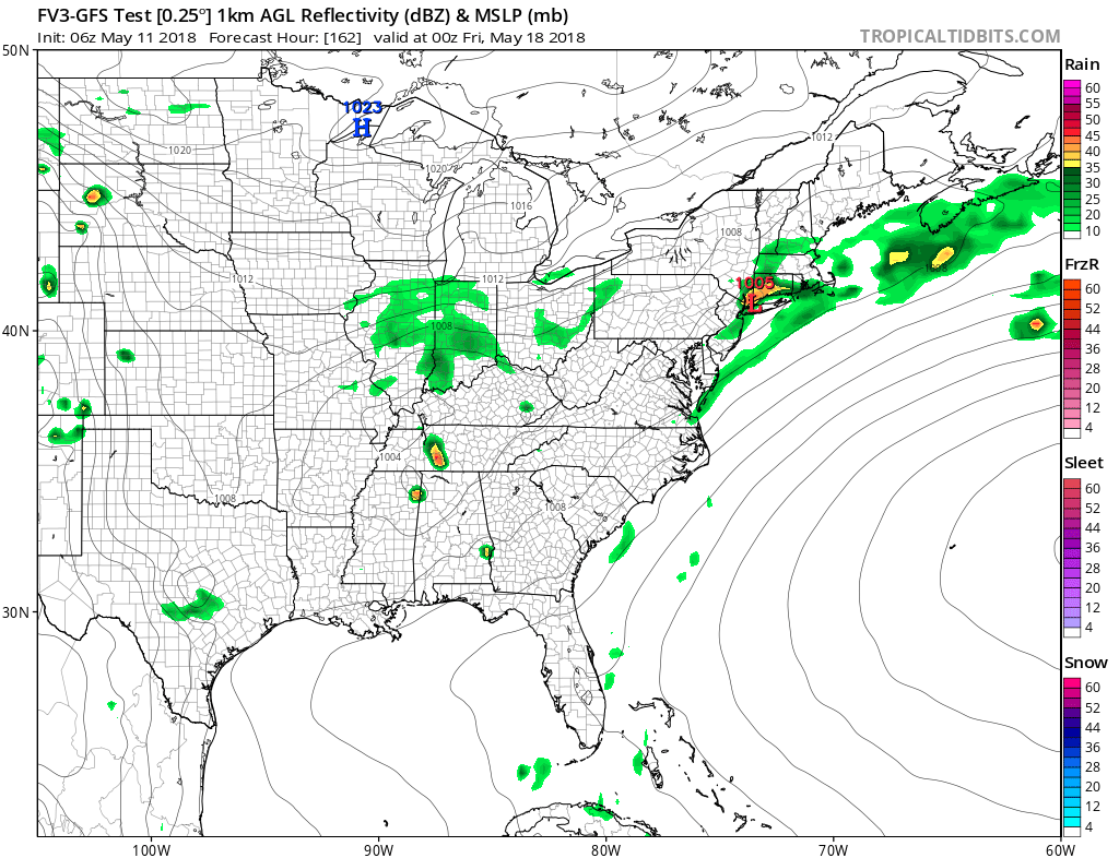
So, while I applaud the FV3 in being confident enough in its 162-hr
forecast of convective over Austin, versus, say, the dry line (where
it is NOW forecast, now that we are closer to present) over west TX,
might we want to tamp down (smooth) the model output a bit to not
allow such precision due to the low chances that it actually will
convect in that exact spot?
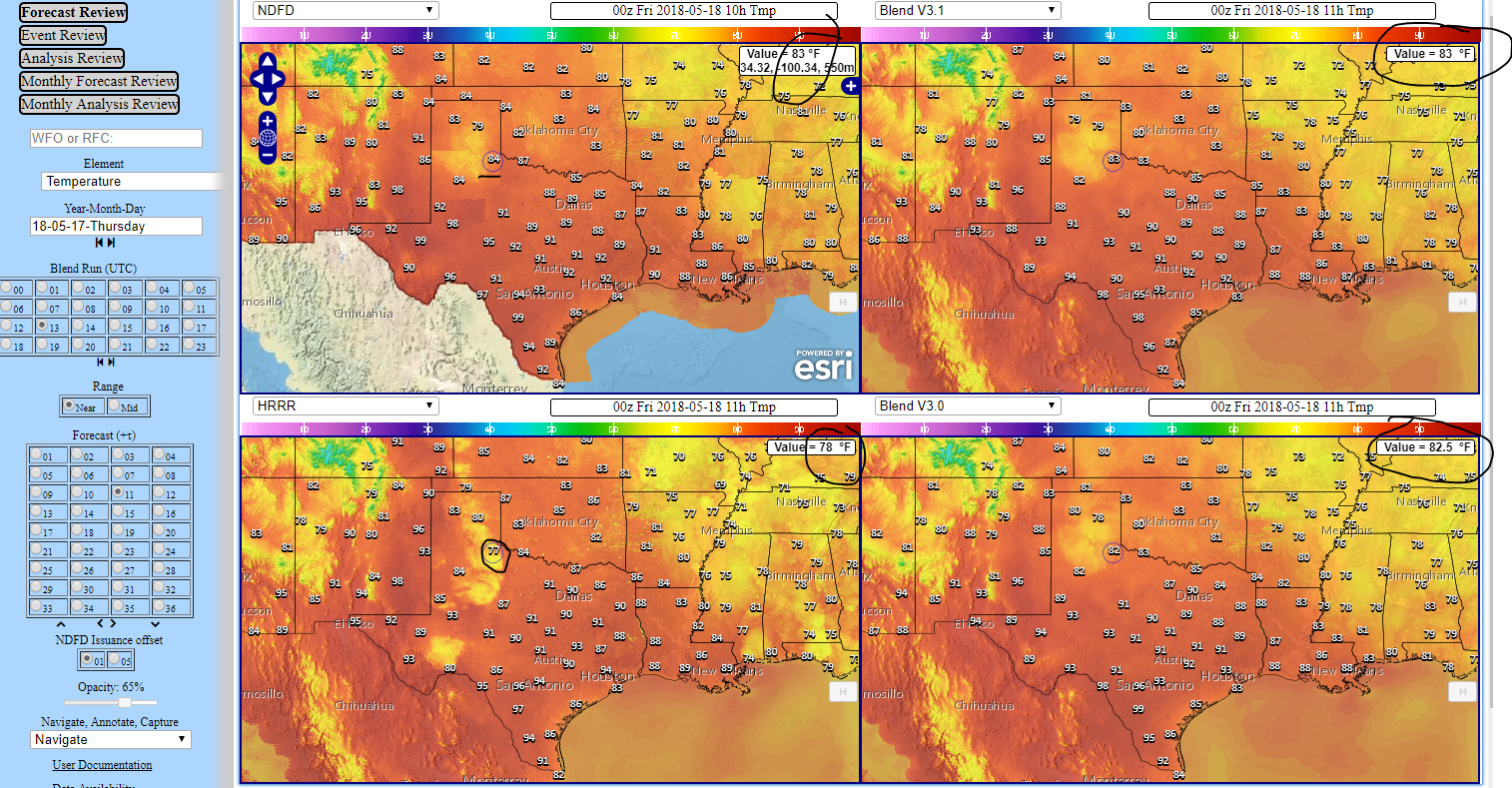
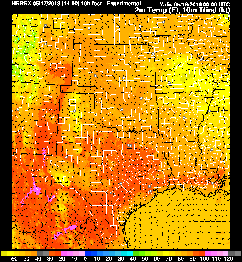
Below I've attached images from the National Blend of Models, and
from the HRRR, to see how both those systems also insert such
convection-induced cooling, but not to such a great degree, unless, in
the case of the HRRR, it's VERY likely at 6-hr forecast projections to
have confidence enough in the location of convection to cool the temps
underneath, as can be seen near and just east of Amarillo, TX, where
they most certainly want rain to lessen the drought AND to help put
out a large fire in the area (perhaps the largest in TX so far this year).